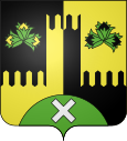
Placey
| Placey | ||
|---|---|---|

|
|
|
| region | Bourgogne-Franche-Comté | |
| Department | Doubs | |
| Arrondissement | Besançon | |
| Canton | Saint Vit | |
| Community association | Val Marnaysia | |
| Coordinates | 47 ° 16 ' N , 5 ° 51' E | |
| height | 215-281 m | |
| surface | 2.57 km 2 | |
| Residents | 198 (January 1, 2017) | |
| Population density | 77 inhabitants / km 2 | |
| Post Code | 25170 | |
| INSEE code | 25455 | |
Placey is a French municipality with 198 inhabitants (as of January 1 2017) in Doubs in the region Bourgogne Franche-Comté .
geography
Placey is located at an altitude of 247 m above sea level, about 14 kilometers west of the city of Besançon (as the crow flies). The village extends in the gently undulating landscape between the rivers of Doubs in the south and Ognon in the north, on a slope slightly to the east.
The area of the 2.57 km² large municipality covers a section south of the Ognon. The area is slightly undulating and consists mainly of arable and meadow land, there are also some smaller forest areas (Bois Saint-Paul and Bois de la Combe du Remay). The northern part is drained through the village stream in an open valley basin to the Ruisseau de Noironte. To the south, the community area extends over the plateau ( 260 m ) into the headwaters of the Ruisseau de Pommeau (tributary of the Ruisseau de Recologne). At 281 m, the highest point of Placey is reached on the hill east of the village.
Neighboring municipalities of Placey are Recologne and Noironte in the north, Audeux in the east, Mazerolles-le-Salin and Lavernay in the south and Franey in the west.
history
Various traces indicate that the municipality of Placey was already settled during the Gallo-Roman period. In the Middle Ages, Placey belonged to the Audeux reign. Together with Franche-Comté , the village finally came to France with the Peace of Nijmegen in 1678. Today Placey is a member of the Val Marnaysien municipal association .
Attractions
The Notre-Dame de la Nativité chapel was built in the 16th century in Gothic style and redesigned in 1716.
Lavoir , fountain and cattle trough
population
| Population development | |
|---|---|
| year | Residents |
| 1962 | 71 |
| 1968 | 70 |
| 1975 | 107 |
| 1982 | 151 |
| 1990 | 164 |
| 1999 | 165 |
| 2004 | 165 |
| 2016 | 198 |
With 198 inhabitants (as of January 1, 2017), Placey is one of the small communities in the Doubs department. After the population in the first half of the 20th century had always been in the range between 60 and 85 people, there has been significant population growth since the early 1970s. By the beginning of the 1990s the population had more than doubled and has remained at this level ever since.
Economy and Infrastructure
Until well into the 20th century, Placey was primarily a village characterized by agriculture (arable farming, fruit growing and cattle breeding) and forestry. Even today, the residents live mainly from their work in the first sector. Outside the primary sector there are few jobs in the village. Some workers are also commuters who work in the surrounding larger towns and especially in the Besançon agglomeration.
The village is well developed in terms of traffic. It is located near the main D67 road from Besançon to Gray . The closest connection to the A36 motorway is around nine kilometers away. There are other road connections with Noironte and Lavernay.


