
District of Dithmarschen
| coat of arms | Germany map |
|---|---|

|

Coordinates: 54 ° 8 ' N , 9 ° 7' E |
| Basic data | |
| State : | Schleswig-Holstein |
| Administrative headquarters : | pagan |
| Area : | 1,428.13 km 2 |
| Residents: | 133,193 (Dec. 31, 2019) |
| Population density : | 93 inhabitants per km 2 |
| License plate : | HEI, MED |
| Circle key : | 01 0 51 |
| NUTS : | DEF05 |
| Circle structure: | 116 parishes |
| Address of the district administration: |
Stettiner Strasse 30 25746 Heide |
| Website : | |
| District Administrator : | Stefan Mohrdieck (independent) |
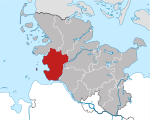
| Location of the Dithmarschen district in Schleswig-Holstein | |
  |
|
The district of Dithmarschen [ ˈdɪtmaʁʃən ; Low German : ˈdɪtmaːʃn̩ ] (in older documents: Dithmarsen or Latinized Dithmarsia; Danish : Ditmarsken; obsolete / English : Ditmarsh ) is a district , i.e. a territorial body of local self-government, in the west of Schleswig-Holstein between Steinburg and North Friesland . The district area is bounded by the North Sea , Eider and Elbe and - roughly speaking - the Kiel Canal . It is largely identical to the historical Dithmarschen region , which was at times a quasi-independent peasant republic in the Middle Ages . The Dithmarschen district is part of the Hamburg metropolitan region .
In the past, Dithmarschen was mainly characterized by agriculture and the cultivation of cabbage ; in the last 100 years, oil production , tourism and wind turbines have been added. There is an important industrial area at the Elbe port of Brunsbüttel .
geography
location
The district is located in the Holstein region on the North Sea . In the north it borders on the districts of North Friesland and Schleswig-Flensburg , in the east on Rendsburg-Eckernförde and in the southeast on Steinburg . The district boundary roughly follows the Kiel Canal in the southeast and east. Some parts of the Dithmarsch area lie to the south-east and some parts of the Steinburg and Rendsburg area to the north-west of the canal, as the district boundary is still identical to the boundary from the time of Charlemagne.
Larger cities in the vicinity are Hamburg and Itzehoe in the southeast, Husum in the north and Kiel and Rendsburg in the east. Since the traffic infrastructure in Schleswig-Holstein is much better developed in the north-south direction than in the east-west direction, the district is mainly oriented towards Hamburg. Its southern part - the Brunsbüttel economic area - belongs to the Hamburg metropolitan region .
The district is 54 kilometers wide in its largest north-south extension and 41 kilometers in an east-west direction. On the Geest, in the municipality of Schrum , is 78.81 m above sea level. NN in the parcel "Karghöde" the highest elevation in the district. Highest point at over 200 m above sea level. NN is the tip of the transmitter " Heide " ( DVB-T transmission mast) for the west coast (to Helgoland ) in Welmbüttel . The REpower 5M wind turbine in Brunsbüttel, with a tower height of 120 meters and a rotor blade length of 61.5 meters, adds up to a fraction of a second to 181.5 meters plus standing height, but not the tallest structure in Dithmarschen.
The lowest point, at half a meter below sea level, is in the Burger Au lowland.
The center of Dithmarschen is in the municipality of Epenwöhrden at N54 ° 7 '37.92 ", E9 ° 6' 45.54". At the center of Dithmarschen, a climate tree ( pedunculate oak ) was planted on May 4th 2011 by the Climate Forest Foundation and the citizens of Epenwöhrden.
Until September 30, 1922, Helgoland belonged to Dithmarschen (to what was then the district of Süderdithmarschen).
Origin and structure
Emergence

The district area is from west to east from the Wadden Sea , marshlands , peat and from Geest . The district owes its natural landscape to its location on the North Sea coast. 6500 years ago the North Sea was considerably higher than it is today. The coastline ran along the Geestkerne. A compensation coast has been developing for around 4500 years . The geest cores were connected by spits made of sand and gravel. Behind lying valleys and flat plains were no longer covered by the sea, moors, lakes and reed swamps formed. The marshes began to form around 3500 years ago. The first plants ( samphire ) settled on tidal deposits , the land turned into salt marshes and later marshes. Dithmarschen is currently benefiting from the current conditions in the North Sea. Two sediment-carrying currents meet here: one that carries sediments from an area east of the Strait of Dover via the Netherlands and East Frisia to Dithmarschen, and another that has its origin in the sea area north of southern Denmark. While the neighboring North Frisia is losing land, Dithmarschen is growing through sedimentation and embankment.
The marshes formed here later than in neighboring North Friesland and are somewhat higher. They are therefore better suited for arable farming. The intensive vegetable cultivation achieves highest yields nationwide. Planned land reclamation has been carried out by man for around 500 years , which has expanded the land area considerably. There has been systematic dyke construction on the coast since the 12th century . Before, people lived on raised mounds - artificial mounds of manure or later Klei , which were covered with gravel Soden. In older marsh settlements such as Wesselburen or Wöhrden , these Wurten can still be recognized in the local area. Others such as Tiebensee or Süderbusenwurth were soon abandoned and are visible in the landscape.
Watt, foreland, coastal protection

The Wadden Sea off Dithmarschen is characterized by comparatively high tide differences of over 3.2 meters. Unlike in North Friesland, a stable chain of barriers of islands and high sands could not form off the coast, but a much more dynamic system was created. The high sand Blauort and the island of Trischen move more than 30 meters per year towards the coast due to erosion and rewashing, and are losing considerably in size in the process; it can be assumed that new sands and islands will form at their starting point. The dominant tidal creek system off the Dithmarsch coast is the Piep , which begins at the tidal border and continues to the Speichererkoog .
According to research carried out by the West Coast Research Center in 2000, 42,000 people in Dithmarschen live in storm flood-prone areas up to a height of 10 m above sea level. NN , including 38,000 in highly endangered areas up to 5 m above sea level. NN . In this area of almost 800 square kilometers, there are assets at risk of around 4 billion euros. They concentrate on the coastal settlement centers such as Büsum , Brunsbüttel or Meldorf .
In the first line of the dyke, 82 kilometers of sea dikes and 40 kilometers of Elbe dykes serve to protect the coast . The dike line was shortened significantly with the construction of the Eider Barrage . Based on the experience with the storm surge of 1962 , this should facilitate the maintenance of the dykes and reduce the risk of the dike breaking. The second line of the dyke consists mainly of former coastal dykes, which are no longer located directly in the endangered areas but in the hinterland due to land reclamation or shortening of the coastline. They also serve as additional protection in the event of a dike breach, as well as transport or escape routes.

In the circle there are 92 kilometers of lake and 29 kilometers of eider dykes in the second line of the dike. They are also known as sleeping dikes . In contrast to the neighboring district of North Friesland, there are no islands off the Dithmarsch coast that could protect you against the violence of the sea. On the other hand, the Dithmarscher Marsch is on average a few meters above zero - after a dike breach there would be no danger from a normal high tide. It turns out that a natural siltation has taken place in Dithmarschen in the last few decades .
march

Almost half of the district area was won by land reclamation from the North Sea. On the one hand, new land was created from the Wadden Sea. On the other hand, former islands like Busen (today: Büsum ) or Helmsand were connected to the land. Of the 57,000 hectares of marshland in the district, 42,000 hectares were only gained in the last five hundred years. The old coastline roughly followed a line between Marne and Wesselburen . The last diked land was the Speichererkoog near Meldorf, the dike was completed in 1979.
Mounds , dykes and drainage canals shape the landscape. The marshland consists mainly of younger marshland , which is very fertile ( 50-70 arable land ). In the landscape there are numerous smaller and larger water systems that direct the fresh water of the inland and, at low tide, the accumulated sea water and the backed up fresh water of the Geest into the North Sea. The drainage takes place naturally in almost the entire marshland.
Geest
The Geest formed the coastline 4000 years ago. In some places like the Barlter Kleve ("Kliff") near Gudendorf with a drop of 20 meters, at the Klev von Sankt Michaelisdonn (40 meters drop) as well as between Kuden and Burg, the original cliffs can still be seen that were formed by the surf. Partial long been spits torn in the sea, the so-called in Dithmarschen Donns that provide Geest peaks in the march today.
The Geest area is divided into natural areas: The largest part belongs to the Heide-Itzehoer Geest , the Geest areas in the far northeast of the district border on the Eider-Treene lowland . Thanks to several terminal moraines , it is so hilly in the east that the area around Welmbüttel bears the name Dithmarscher Switzerland .
Originally the Geest area consisted of large oak forests , mixed oak and beech forests or coniferous forests. Of these, the Riesewohld and the Aukrug have largely been preserved. Most of the forests fell victim to agriculture, were transformed into heather areas and were only reforested in the 19th century (area around Burg, Weddingstedt, Welmbüttel and Albersdorf). Due to the large proportion of marshland and moorland, the Dithmarschen district is one of the least forested districts in Germany with only 3 percent forest area. Most of the remaining moors, like most of the moors, were converted into grassland. Moors, heaths and coppice forests are almost only found in nature reserves.
Administrative structure
From 1867 to 1919, Dithmarschen consisted of two districts, Süderdithmarschen and Norderdithmarschen . In 1919 the two districts were merged, which lasted until 1932. In the early 1930s, the state of Prussia intended to divide the district again. In 1932 this was carried out against a large protest in the population. The Nazis sided with the opponents of the amalgamation and thus collected votes for the election campaign against the Weimar Republic. After the seizure of power, the Prussian Prime Minister Hermann Göring nullified the division in October. After the end of National Socialism , two circles were set up again. As part of an administrative reform in Schleswig-Holstein, both districts were merged again in 1970.
climate

The climate of Dithmarschen is characterized by its location directly on the North Sea. There is an Atlantic climate with mild winters and summers. The amount of rain is greatest in August and October (around 80 mm per month) and lowest in February through June (around 40 mm). The marshland differs from the Geest in that the first frost usually does not occur before the end of October and the last frost not after mid-April.
On a long-term average, wind forces over four prevail in Dithmarschen on 273 days a year, and storms with gusts of wind on eight days . Due to the wind, the weather often changes rapidly, with westerly weather conditions coming directly from the North Sea predominating.
fauna and Flora

While the Geest areas are forested, there are trees in the marshland only as wind protection near houses or fortified towns, as road or fruit trees.
There are various moors in Dithmarschen. The White Moor near Heide occupies a special position ; it is the only relatively well-preserved high moor in the Schleswig-Holstein marshland.

The Schleswig-Holstein Wadden Sea National Park is partially located in Dithmarschen. In this region it is almost exclusively sand floodplain. Ecologically, the mudflats are the district's most important living space. Many mussels, snails, worms and crustaceans live here, which are the food source of other animals. It serves as a “nursery” for numerous fish species that raise their offspring here in the protected area. It is also home to a species-rich bird world, which is supplemented by numerous migratory birds in autumn and winter. Sometimes they winter here, sometimes they use it as a food-rich resting place. Typical bird species include Alpine beach runner , red knot , godwits , lapwings , plovers , oystercatchers and numerous ducks - and gulls , terns , sandwich terns , avocets , barnacles and barnacle geese (barnacle geese). About 200,000 specimens of the shelduck come in August alone . The birds drop their feathers here and are therefore unable to fly for about 3 weeks. It is almost the entire population of the species in northwest Europe. The largest salt marshes are in front of Friedrichskoog and in the Neufelder Bay.

The island of Trischen , the sandbank Tertius (a former high sand) and the high sand Blauort are located in the mudflats . These are among the only largely natural habitats on the coast and are of great importance for sea birds and seals. The flat areas are exposed to the ocean currents and constantly change their shape; generally they move east towards the coast. In the 1930s there was an attempt to dike Trischen and make it usable for agriculture, but the dike in the sea and the currents did not withstand. Today the sands belong to the national park and are prohibited from human use by law.
The Eider-Treene lowland, which is partly part of the district, houses one of the largest inland collections of meadow birds.
Nature reserves
In addition to the Wadden Sea National Park, 13 areas in Dithmarschen have been designated as nature reserves (as of February 2017). These are four (meanwhile) inland tidal flats and marshlands ( Speichererkoog / Kronenloch, Speichererkoog / Wöhrdener Loch, Dithmarscher Eiderwatt and Delver Koog ), three lakes or silted up lakes ( Kudensee , Former Fieler See , Former Fuhlensee ), four moors ( Fieler Moor , Weißes Moor , Dellstedter Birkwildmoor , Wittmoor) and the Geestkliff Kleve near Sankt Michaelisdonn .
history

Dithmarschen is first mentioned in the 9th century. Thiatmaresgaho was one of the three Saxon districts north of the Elbe, which Charlemagne had incorporated into the Frankish Empire . After the Battle of Bornhöved in 1227, Dithmarschen fell to the Archdiocese of Bremen , but its influence on the country remained small. The Counts of Holstein and Dukes of Schleswig tried several times to conquer the rich farming country, but suffered several military defeats. There were significant victories for the Dithmarscher in 1319, 1403/04 and 1500 ( Battle of Hemmingstedt ). It was not until the last feud in 1559 that the army was defeated by a united force under Johann Rantzau . The land was divided among the victors, Duke Adolf I of Schleswig-Holstein-Gottorf , the Danish King Friedrich II and Duke Johann II of Schleswig-Holstein-Hadersleben .
Dithmarschen was the only republic besides Switzerland in German-speaking Europe until early modern times. The parishes acted here similarly to the Swiss cantons . A research project at Kiel University puts it this way:
- [...] To be from Dithmarschen, however, stands for a certain peculiarity of the residents, a special independence, perhaps also an assumed stubbornness and certainly for a particularly pronounced self-confidence. A self-confidence that is rooted in the Dithmarschen story, which is truly formative in Dithmarschen.
The historian Robert Heinrich Chalybäus formulated in the 19th century: “Ditmarsen, dat schölen Boers sin? Et may well be Heren. "
The Reformation only reached Dithmarschen after the violent death of Heinrich von Zütphens on December 10, 1524 (murder in Heide). The Reformation teachings were first preached in the Meldorfer Cathedral. From 1532 the council of the 48ers forbade the adherence to the old faith as punishment for life and limb.
After it had finally lost its independence in 1559, Dithmarschen was divided into three parts ( Neocorus , vol. II, page 268). After the death of Prince Johann in 1581, the middle part around Heide was assigned to the parts Norderdithmarschen and Süderdithmarschen . In 1773 both Dithmarschen were under Danish leadership.
The region retained a high degree of independence and relative independence. The Dithmarsch land law , reformed in 1567, remained in force for over 300 years. In the following times the area experienced an economic boom. Much land was gained. So in 1585 the island of Busen , today's municipality of Büsum , was connected to the mainland.
After the devastation caused by storm surges and internal disputes at the beginning of the 18th century, the region then recovered. The Danish king reformed the landscape, which had been destroyed by frequent wars, by dividing the Meente (general property), linking the individual farms and the construction of Knicks, and restructured the rural network of paths. Numerous buildings from that time testify to the relative prosperity of the region. It was not until the Napoleonic Wars and in particular the Cossack winter of 1813/1814 that Dithmarschen suffered.
With the incorporation of the province of Schleswig-Holstein and Dithmarschen into Prussia in 1867, the state lost its special rights. The construction of the Kiel Canal and the beginning of cabbage cultivation in the region ensured a prosperity that continues to this day.
Dithmarschen was an early stronghold of National Socialism . An anti-republican and anti-modern mood led to the fact that the blood-and-soil ideology of the National Socialists fell on fertile ground in Dithmarschen and the NSDAP achieved 18 percent in the 1928 Reichstag election . In the 1930 Reichstag election it was already 50 percent, and in 1932/33 the NSDAP won over 60 percent of the vote.
| choice | Norderdithmarschen | Süderdithmarschen | Schleswig-Holstein | German Empire |
|---|---|---|---|---|
| 1928 | 18.1% | 17.8% | 4.0% | 2.6% |
| 1930 | 50.3% | 36.3% | 27.0% | 18.3% |
| 1932 (I) | 68.4% | 59.8% | 51.0% | 37.4% |
| 1932 (II) | 65.3% | 57.5% | 46.7% | 33.1% |
| 1933 | 68.6% | 63.7% | 53.3% | 43.9% |
While the German national mayor Willy Schmedtje in Meldorf and Hermann Hadenfeldt in Heide to 1938 and 1937 remained in office, Büsum Mayor Otto Johannsen was on 13 March 1933 by a group of SA and SS men led by Karl Herwig defrocked .
In the Reichspogromnacht on 9/10 November 1938, the National Socialists attacked the business owner Franz Samter in Brunsbüttel. Samter and his son were taken into " protective custody ". The Heider SA Standard 85 was significantly involved in the destruction of the synagogue in Friedrichstadt during the Reichspogromnacht .
In Gudendorf there was a camp for prisoners of war that became a death camp in April 1944. More than 3,000 Soviet prisoners of war died there.
Even in the 1990s, coming to terms with the Nazi era was difficult in Dithmarschen. The victims of National Socialism have been commemorated with stumbling blocks since 2005 . In 2005 and 2006 Gunter Demnig laid a total of seven stumbling blocks in Heide. Two more stumbling blocks were installed in Meldorf and in Burg (Dithmarschen) in 2008 and 2009.
During the Second World War , Dithmarschen was largely spared from fighting except for air raids on the port of Brunsbüttel and the oil refineries in Ostermoor and Hemmingstedt. After liberation from National Socialism, Dithmarschen and Eiderstedt (together under 120,000 inhabitants at the time) became the Allied internment area for up to 400,000 soldiers. In addition, numerous displaced persons were settled in the sparsely populated and largely undestroyed Schleswig-Holstein and thus also Dithmarschen. Around 40 percent of the inhabitants of Dithmarschen came from the former German eastern regions in 1950 .
On October 1, 1932, the Norder- and Süderdithmarschen districts were merged. On October 1, 1933, this regional reform was reversed. During the time of National Socialism , the old parishes were divided into individual independent communities. Since April 26, 1970, the merger of the Norderdithmarschen and Süderdithmarschen districts has once again created a unified Dithmarschen.
In the last few decades it was the economy in particular that determined the political picture. This included extensive infrastructure and industrialization measures ( Eider Barrage , subsidized industrial settlement in Brunsbüttel) in the 1960s and 1970s. Since the 1980s, the region has been trying to adapt to the structural change that is taking place: While the industry, which has largely just been established, is moving again, wind energy , which is highly controversial in the district, is booming . Tourism is becoming more important; at the same time, however, Dithmarschen is struggling with the changing travel habits of Germans, for whom the range of options in the region is often insufficient.
Population statistics
The population figures up to 1970 refer to the area on May 27, 1970.
|
|
Denomination statistics
According to the 2011 census , in 2011 64.6% of the 133,900 inhabitants were Protestant , 4.5% Roman Catholic and 31.0% were non-denominational , belonged to another religious community or did not provide any information. The number of Protestants has fallen since then. As of April 30, 2019, 57.4% (76,957) of the residents were Protestant. In the previous year (as of April 30, 2018), 58.1% (78,505) of the 135,234 inhabitants were Protestant.
Culture
languages

In Dithmarschen, High German and Low German ( Lower Saxony ) are spoken in everyday life . Until the 1950s / 1960s, Low German was the everyday language, almost all Dithmarschers born and raised during this period consider Low German to be their mother tongue. It is still widespread today: in more rural areas than in urban areas, among old people rather than young people.
It is often used not only in personal communication or social gatherings, but also for more formal occasions such as gatherings or club meetings. Sometimes the meetings of the municipal council are held on Platt in smaller villages, but mostly in High German out of consideration for the recorder. A living Dithmarscher Plattsprecher known through television and radio is Wilhelm Wieben , who was born in Hennstedt - the former daily announcer is now particularly popular with Low German readings and audio books. One of two crime scenes , each with subtitles, played in Dithmarschen - the portion of Platt in the dialogues was seen as too high for the High German audience.
Klaus Groth , born in Heide, was one of the first to write serious literature in Low German. Although Low German is more widespread as a written language than in most regions, a very clear dominance of High German can be seen here.
Maintenance of tradition

While the Dithmarschers have always been very proud of their history, numerous traditions have been revived or revived in recent decades. It is hardly possible to make a clear distinction between idealistically guided homeland care and the idea of promoting tourism. The result is largely genuine continuation of tradition, a newly created patchwork of different lines of tradition and new facilities, as well as entirely new inventions without a historical basis, such as the medieval market in Heide.
In rural areas, well-kept traditions Roland riding , ring riding , children's bird shooting and Boßeln . In Heide there is the Hohnbeer Festival once a year , in Nordhastedt the Frunsbeer Festival . In the last few decades, the Dithmarscher Kohltage has been promoted as a nationally interesting festival, with cutter regattas taking place once a year in Friedrichskoog and Büsum.

Traditional dishes are Mehlbüdel and Swattsuer , buttermilk soup with Klüten , kale soup or bread pudding and crab ( brown shrimp ), since the late 19th century coal . On the other hand, fish and lamb are mainly eaten by non-residents and are not part of traditional local cuisine. The name Dithmarschen is known nationally in culinary terms, primarily due to the Dithmarscher Pilsener from the Karl Hintz brewery in Marne .
Museums

The Dithmarschen district has numerous museums. The Dithmarscher Landesmuseum in Meldorf has a collection on the sea / coast / dyke construction as well as on the peasant republic. The most impressive exhibit here is the courtroom from the Lunden residential and administrative building of the first Norderdithmarsch bailiff Markus Swin. On the other hand, it has specialized in everyday history and offers, for example, reconstructions of a classroom, a dentist's room, a cinema, etc. from the beginning and the middle of the 20th century. The Hebbel Museum in Wesselburen has primarily a research library for poets.

The Büsum Museum Harbor and the Museum by the Sea in the same place focus primarily on fishing and the history of tourism in the region. The Klaus Groth Museum in Heide has been restored to the same standard as the house in which the poet lived. The poet's extensive library, a large musical collection, manuscripts and documents are kept in the museum. The Groth House also houses a Low German library that is currently being built. The Frenssen house in Barlt is a reminder of the poet. Other smaller museums are, for example, the Masonic Museum in Sankt Michaelisdonn or various smaller local museums.
Several museums focus particularly on nature. The Museum of Archeology in Albersdorf and the Stone Age Park (formerly Archaeological-Ecological Center Albersdorf ( AÖZA ) ) try to visualize prehistory in a circle. On an area of around 40 hectares, an attempt is being made to create a prehistoric cultural landscape over 5,000 years old with all its characteristics such as different types of landscape, settlement and grave.
There are various smaller museums here: the NaTour Center and Museum Lunden - it is particularly dedicated to the Eider-Treene-Sorge region - or the Forest Museum in Burg. The Kohlosseum in Wesselburen is dedicated to the history of cabbage cultivation. The Multimar Wattforum with a comprehensive exhibition on the Wadden Sea is located directly behind the district boundary on Eiderstedt . The seal station in Friedrichskoog is used both for the rearing of seals and for tourism.
A well-known memorial from the late Middle Ages is the sex cemetery in Lunden . In Gudendorf there is a memorial for the Soviet prisoners of war who were interned there and who died in captivity.
architecture
Sacred buildings

The cultural landscape shaped the churches for a long time. Manor houses and castles were never built in the peasant republic. The few castles played only a minor role even when they were built and have long since fallen to the earth walls. The churches, however, dominated the landscape. The peasant republic organized itself in largely autonomous parishes . Secular and spiritual powers were not separated here. Thus the churches were not only signs of spiritual but also worldly power. There was no space in Dithmarschen for state or public secular buildings , which, as in other parts of Germany, could have attacked the urban dominance of the churches. It was only through integration into the Kingdom of Prussia in 1867 that the spheres of influence were separated from the ecclesiastical and secular community.
In the flat marshland, the church spiers are often visible over 10 kilometers. There the churches are located in the middle of the village on high Wurten, as in Wesselburen , Marne or Wöhrden . The streets run towards them, the townscape takes on a medieval character. In these marsh villages, houses on the highest Wurt probably had to be cleared in order to build the church. In the Geest, on the other hand, the places of worship are mostly on the edge of the village or in a row with the courtyards. These villages existed for a long time before the construction of the first church, the village center was already established.
The most important church was the so-called Meldorfer Cathedral because of its importance . Dithmarschen's only church stood in Meldorf between the 9th and 11th centuries. The church, around which a medieval town had formed, remained the most important negotiating center of the Dithmarschers. Even after this function was passed on to Heide, Meldorf remained the only city with outstanding regional importance. The Reformation in the district also started from this church in 1524. Today's cathedral was built in the 13th century. Inside you can still find Gothic architecture from the years 1250 to 1300. The vault paintings from that time are among the most magnificent in Schleswig-Holstein and give an insight into the former wealth of the peasant republic.
St. Jürgen in Heide was built in the 15th century. Due to disputes within Dithmarsch Meldorf lost its place as a central meeting place. The Norderdithmarschen met on the heath from 1447 , later the council of 48 regents from all of Dithmarschen met here. The core of the elongated hall church dates from the 15th century. The church was given its present form primarily in 1724 by the three-storey late Renaissance tower by the Heid master builder Johann Georg Schott.
The Bartholomäuskirche in Wesselburen was also built by Johann Georg Schott in 1737/38 from the remains of older burned down churches (12th and 15th centuries). Its onion dome, which is quite unique in Schleswig-Holstein, is characteristic . What is striking about the baroque building are the closed gallery under the organ and the ducal blue chair opposite the pulpit.
Also noteworthy are the field stone church in Tellingstedt from the 12th century and the churches in Hemme and Büsum with their characteristic coat of arms in the church.
Industrial architecture

In the rural and rural Dithmarschen, industrialization began relatively late. The most important reason for this was the connection to the railway network in the late 19th century. The Hochdonn railway bridge , built in 1920 , still bears witness to this time. A sign of this early modernization is the former sugar and later sauerkraut factory in Wesselburen , which also dates from the late 19th century. Not used as a factory since 1995, it now houses a supermarket, a fitness studio and the cabbage workshop , where sauerkraut and the like are made from white cabbage on a small scale. In 2008 the special museum Kohlosseum was opened there.
The use of wind energy has been an option for a long time. Various Dutch mills from the 19th century are still preserved, for example in Meldorf , Westerdeichstrich or the Bergholländer Anna from 1803 in Süderhastedt . Wind turbines in their current form came here early. Long before the general boom in wind energy, the Köster company from Lohe-Rickelshof manufactured such systems. For decades they were part of the image of many marching farms. An Adler steel wind turbine from 1926 can still be found at the original location in Süderwisch .
It was only in the last few decades that industrial buildings began to play a decisive role in shaping the landscape. In addition to the now ubiquitous wind turbines, these are above all the highly visible refinery in Hemmingstedt and the industrial settlements in Brunsbüttel .
Literature and music
Significant writers who were associated with Dithmarschen all their lives show a strong focus on the subject of home in their work . The most important of them are Klaus Groth and Gustav Frenssen . The respected Low German poet Klaus Groth comes from Heide. Gustav Frenssen from Barlt may have been forgotten today, but was one of Germany's most famous local poets in his time, whose novels reached a circulation of three million. He was traded as a candidate for the Nobel Prize for Literature , but Gerhart Hauptmann received it in 1912 . While Frenssen, in addition to his support for National Socialism and his work, which later had a strong völkisch tinge, achieved an independent aesthetic achievement as a writer, Adolf Bartels from Wesselburen became known as a völkisch and anti-Semitic literary historian who was showered with awards during the Nazi era .
The Germanist Karl Victor Müllenhoff , born in Marne, was an important collector of legends and fairy tales in Schleswig-Holstein and published the legends, fairy tales and songs of the duchies of Schleswig, Holstein and Lauenburg in 1845 .
The playwright Friedrich Hebbel had an unhappy youth in Wesselburen, fled the area at the age of 19 and refused to re-enter it all his life. However, it plays an important role in tourism advertising. The Hebbelstadt Wesselburen houses the Hebbelmuseum as well as the Hebbelgesellschaft, the local event center is the Hebbelhaus, and various shops are also named after the playwright.
As a quiet holiday and recreation area, however, the area is popular with writers: the most famous of the regular guests was probably Arno Schmidt . The multiple award-winning writer Sarah Kirsch lived in the old schoolhouse Tielenhemme an der Eider until her death in 2013 and described the attraction of the region: The spirit of the peasant republic is still haunted, everyone is emperor on his tractor, and me with the haybag on the The milk driver pays homage to the shoulder when he breaks the silence . According to her, the Dithmarsch landscape consists of 97% sky .
There are several local amateur theaters, often they play in Low German. Professional guest appearances take place in the Elbeforum Brunsbüttel. Classical concerts mainly take place in the Meldorfer Dom and Sankt-Bartholomäuskirche Wesselburen, occasional pop concerts by performers from the top 10 of the German charts in the Eiderlandhalle Pahlen . Since 2006 an association has been organizing the international Frequenzen Festival in Meldorf, which is dedicated to world music.
Others were drawn into the distance: Rudolph Dirks , creator of the oldest still running comic strip in the world - The Katzenjammer Kids - was born in Heide, but emigrated with his parents to the USA when he was seven. The Johannes Brahms family , whom the Dithmarschers like to confiscate, came from Heide, but it is uncertain whether he himself has ever entered the district.
Film, television and radio

Numerous German evening TV series and some German films are playing in the Dithmarschen district. For example, the Friedrichskoog seal station serves as the backdrop for the ZDF series Hallo Robbie! . In addition, parts of the series Gezeiten der Liebe (ZDF) and North Sea Clinic (ZDF) were filmed in Dithmarschen . The only crime scene with subtitles also takes place in Dithmarschen (episode 136: Wat right is, mutt right bliewen ). In 1973 part of the ARD television film Bauern, Bonzen und Bomben based on the novel by Hans Fallada was shot in Barlt . Several television films based on scripts by Helga Feddersen were partly shot in Brunsbüttel and Marne. As part of the arts project , a film festival, the so-called “Kunstgriff-Rolle”, takes place every year. At the open-air cinema days in Meldorf , the organizers show classic films in front of a historical backdrop on the first weekend in September. Filmmaker Lars Jessen ( on the day Bobby Ewing died ) learned his trade at the Meldorfer School of Academics . In the district town of Heide, the North German Broadcasting Corporation ( NDR ) has an outdoor studio for the Schleswig-Holstein Landfunkhaus (radio and television). The citizen broadcaster Offener Kanal West Coast (OKWK) has its headquarters and three radio studios in the media center in Heide. The most successful national film from Dithmarschen was the film Potato Salad - Don't Ask! of the Youtube star Freshtorge . He lives and works in Wesselburen and shot the film mainly at his place of work, the Eider-Nordsee-Schule in Wesselburen.
Sports

Football is the most popular sport in the district after organized sportspeople and spectators. The strongest clubs are Heider SV and TuRa Meldorf, which currently play in the Schleswig-Holstein League, the fifth highest German division. Once a player from a Dithmarsch club was appointed to the German national football team: On May 22, 1957, the then 28-year-old defender Willi Gerdau from Heider SV played in the 3-1 defeat against Scotland in Stuttgart.
Boßeln is very popular in the marshland; In many small villages, a Boßel club is the only sports club. The landscape is ideal for cycling, inline skating, jogging, Nordic walking, etc.; both locals and tourists like to take advantage of the opportunity in the summer months. There are various smaller sailing and sport boat harbors on the coast. However, compared to the Baltic Sea coast, there are hardly any sailors here, as the area is much more difficult to sail. In some places it is possible to surf.
population
In contrast to most of the German North Sea coast, Dithmarschen was never influenced by Frisian , but was inhabited by Saxony . Isolated Frisians only moved into the area when the land reclamation kept growing. At the end of the 19th and beginning of the 20th centuries, numerous Poles came to work in the newly built factories in the district. The most significant change in the population structure took place after 1945, when numerous displaced persons, mostly from Pomerania, were settled in the two districts of Norder- and Süderdithmarschen.
The population due to births and deaths is declining in Dithmarschen as in all of Schleswig-Holstein. In 2008 and 2010, the district recorded migration gains, which particularly affected the Büsum-Wesselburen office. Despite the increase in migration, Dithmarschen lost population in 2008 and 2010. The population density is only about half as high as in the whole of Schleswig-Holstein. The forecast of the State Statistical Office from 2009 for 2025 expects a population decline of 7 percent in Dithmarschen. This would make Dithmarschen, after Steinburg, the district of Schleswig-Holstein with the greatest decline in population.
The proportion of foreigners in the 2011 census was 2.4 percent and thus far below the average in Schleswig-Holstein (4.8 percent) and in Germany (8.7 percent).
religion
The population is predominantly Evangelical Lutheran . Historically, the region consisted of the two church districts Norderdithmarschen, based in Heide, and Süderdithmarschen, based in Meldorf. Since the internal church reform in 2009, both church districts have been combined in the new church district Dithmarschen within the Schleswig and Holstein district. The church district comprises 32 parishes with a total of 92,400 members. The church district also includes the North Frisian island of Helgoland , which is politically part of the Pinneberg district .
In addition, there are two Roman Catholic parishes in the Dithmarscher Diaspora . The parish of St. Josef in Heide with the branch churches in Meldorf and Büsum has around 3,500 members. The Catholic churches in Brunsbüttel and Marne have belonged to the parish of St. Ansgar in Itzehoe since 2005. Both parishes belong to the Archdiocese of Hamburg . Most of the Catholics are descendants of Polish workers who immigrated to Dithmarschen at the beginning of the 20th century, as well as expellees from the former German eastern regions.
Free churches are also represented in Dithmarschen with their own congregations. There are two Baptist congregations in Heide and Sankt Michaelisdonn . In Heide there is also a congregation of the Seventh-day Adventists and the old confessional independent Evangelical Lutheran Church .
At least 500 Muslims live in the district. There is a mosque in Heide.
politics
The CDU (22 seats), SPD (11 seats), Bündnis 90 / Die Grünen (5 seats), FDP (5 seats), Independent Voting Association Dithmarschen (UWD) (4 seats), AfD (3 seats) and the Voting Association have seats in the district assembly Network Dithmarschen (WND) (2 seats) and DIE LINKE. (2 seat). The last election took place on May 6, 2018.
Dithmarschen sends two directly elected MPs to the German Bundestag : in constituency 3 ( Steinburg -Dithmarschen Süd) Rolf Koschorrek (CDU) and in constituency 2 ( Nordfriesland -Dithmarschen Nord) the former Sylt-Oster mayor Ingbert Liebing ( CDU ). Jörn Thießen (SPD) and Jürgen Koppelin (FDP) received their mandate in constituency 3 via the state list .
In the 2012 state election , the CDU in Dithmarschen received 36.7 percent. the second votes. The SPD came to 28.7 percent, the FDP to 9.5 percent, the Greens to 8.5 percent. The Pirate Party received 9.0 percent, the SSW received 2.9 percent and the Left received 2.0 percent. The conditions were shifted in the direction of black and yellow compared to the rest of Schleswig-Holstein . The smaller parties in Dithmarschen tended to do worse than in Schleswig-Holstein, only the Pirate Party received 0.8 percentage points more than the national average. The only reliable stronghold of the SPD is Brunsbüttel .
| Parties and individual applicants |
Voices 2018 |
Share 2018 |
Seats 2018 |
Voices 2013 |
Share 2013 |
Seats 2013 |
Voices 2008 |
Share 2008 |
Seats 2008 |
Voices 2003 |
Share 2003 |
Seats 2003 |
|
| CDU | Christian Democratic Union of Germany | 21,642 | 39.9% | 22nd | 23,846 | 43.3% | 21st | 25.161 | 43.4% | 25th | 32,419 | 52.9% | 27 |
| SPD | Social Democratic Party of Germany | 10,976 | 20.2% | 11 | 15,078 | 27.4% | 13 | 13,290 | 22.9% | 13 | 16,027 | 26.1% | 13 |
| GREEN | Alliance 90 / The Greens | 4,956 | 9.1% | 5 | 4,556 | 8.3% | 4th | 2,558 | 4.4% | 2 | 2,298 | 3.7% | 0 |
| FDP | Free Democratic Party | 4,914 | 9.1% | 5 | 3,659 | 6.6% | 3 | 5,636 | 9.7% | 5 | 3,160 | 5.2% | 2 |
| UWD | Independent voter community Dithmarschen | 4,469 | 8.2% | 4th | 5,423 | 9.9% | 5 | 6,673 | 11.5% | 6th | 7,305 | 11.9% | 6th |
| AfD | Alternative for Germany | 3,011 | 5.5% | 3 | - | - | - | - | - | - | - | - | - |
| WND | Voting community network Dithmarschen | 2,241 | 4.1% | 2 | - | - | - | - | - | - | - | - | - |
| THE LEFT. | THE LEFT. | 1,899 | 3.5% | 2 | 1,238 | 2.2% | 1 | 4,058 | 7.0% | 4th | 85 | 0.1% | 0 |
| WGP | Voters' initiative Graue Panther Dithmarschen | 156 | 0.3% | - | - | - | - | - | - | - | - | - | - |
| PIRATES | Pirate Party Germany | - | - | - | 861 | 1.6% | 1 | - | - | - | - | - | - |
| KWV Burg | Municipal voter association Burg | - | - | - | 390 | 0.7% | 0 | 632 | 1.1% | 0 | - | - | - |
| total | 54.264 | 100 | 54 | 56,272 | 100 | 48 | 58.008 | 100 | 55 | 61,306 | 100 | 48 | |
| Voter turnout in% | 49.1 | 50.2 | 53.0 | 56.2 | |||||||||
District administrators
- October 1, 1932 to September 30, 1933: Ernst Kracht ( NSDAP )
- May 29, 1970 to May 31, 1986: Karl-Heinrich Buhse, lawyer ( CDU )
- October 31, 1986 to January 31, 1996: Hans-Jakob Tiessen ( independent ), lawyer
- February 1, 1996 to May 31, 1996: 1st District Councilor Manfred Trube (CDU)
- June 1, 1996 to May 31, 2018: Jörn Klimant (independent), doctor of law (Dr. jur.)
- since June 1, 2018: Stefan Mohrdieck (independent), graduate in administration
District Presidents
- May 11, 1970 to September 25, 1981: Hermann Glüsing , ( CDU ), farmer
- January 20, 1982 to April 20, 1998: Rolf Gosau, (CDU), innkeeper
- April 21, 1998 to June 19, 2013: Karsten Peters (CDU), Headmaster (Rector / Director)
- June 20, 2013 to June 27, 2018: Hans-Harald Böttger (CDU), farmer
- since June 28, 2018: Ute Borwieck-Dethlefs (CDU), social worker
education
Schleswig-Holstein's youngest university of applied sciences, the West Coast University of Applied Sciences, has existed in Heide since 1993 . Over 1,500 students are enrolled in eight bachelor's and five master's degree programs in the fields of business and technology, who are supervised by 34 professors.
In Büsum there is a branch of the Christian-Albrechts-Universität in Kiel , the Research and Technology Center West Coast , which researches primarily on questions of coastal geology and geography (including coastal protection ) as well as environmental issues.
There are six grammar schools and eleven community schools, one free Waldorf school and 10 support centers in the district. There are two vocational training centers. The Dithmarschen vocational training center has locations in Brunsbüttel, Heide and Meldorf. The vocational training center for health professions is located at the West Coast Clinic and in turn consists of several schools. There are 30 primary schools. Overall, however, the level of education in the district is below average. This is particularly evident among the unemployed, of whom in 2009 over 10 percent did not have a master's degree and over half had no vocational training.
economy
Dithmarschen's economy is dominated by tourism , agriculture and wind energy . Tourism is concentrated in the north on Büsum and in the south on Friedrichskoog . In addition to the classic beach holiday with the family, cycling is particularly popular with tourists. The approximately 2 million tourists annually come almost exclusively from within the country.
The unemployment rate in August 2015 was 7.3 percent and thus above the Schleswig-Holstein average of 6.5 percent. The largest employers in the district are the Westküstenklinikum (2,300 employees), Evers printing works in Meldorf (750 employees), Covestro (formerly Bayer Material Science) in Brunsbüttel (680 employees), the Sparkasse Westholstein (600), the Sparkasse Westholstein with 740 employees in Steinburg and Dithmarschen, the Heide refinery in Hemmingstedt and Brunsbüttel (540), the Sasol chemical plant in Brunsbüttel (570). Most of the employees work in small and medium-sized craft businesses, retail, administration, in the west of the district in the hotel and restaurant industry and in agriculture.
In recent years, the proportion of commuters who work in Hamburg or in the Hamburg area has increased . In 2013, a total of 11,300 people commuted out of the district.
Agriculture

In 2009, 2.6 percent of the Dithmarscher employees (901 people) were employed in agriculture. The district was thus well above the national average of 0.8 percent. Including the number of self-employed, the rate of those working in agriculture was 6.6 percent. The most important crop in agriculture is wheat , which is grown on almost 40 percent of the area. The cultivation of silage maize and winter rapeseed, which are mainly used for the production of biogas , has risen sharply in recent years . The cultivation of cabbage is of national importance . Europe's largest closed growing area is about 2,800 hectares and produces around 80 million heads of cabbage annually. That is about a third of the total German production. Above all, the Dithmarschers plant white cabbage , but also red cabbage and savoy cabbage . Cultivation is of great cultural importance. The Dithmarscher Kohltage are one of the district's nationally highly regarded events. In contrast to other parts of Germany that choose a wine queen, there are two cabbage regents in Dithmarschen . In addition to cabbage, sugar beets , cereals , rapeseed and vegetables are grown; Furthermore, extensive livestock farming is predominantly carried out.
The cabbage cultivation began suddenly in Dithmarschen. The gardener Eduard Laß from Wesselburen began experiments in 1889 with the cultivation of different types of vegetables, with cabbage proving to be the most suitable. Other farmers quickly discovered the recipe for success. Within the ten years from 1893 to 1902, the area under cultivation for cabbage grew from three to 283 hectares in the parish of Wesselburen alone. In 1894, 863 tons of cabbage were loaded at Dithmarsch train stations, in 1913 it was 97,000 tons.
The Dithmarsch marshland is particularly suitable for growing cabbage. The soils are fertile so that even in bad years a good yield can be achieved. Due to the constant sea breeze, there are far fewer pests in the area than the small cabbage white butterfly .

In addition to the advantages of the marshland, there were favorable conditions in the infrastructure. The growing cities made it impossible for more and more people to grow their own vegetables. With the construction of the railway to Heide (1878) and branch lines into the marshes (in the 1880s) it also became possible to import large quantities of fertilizer cheaply and to export the cabbage produced. In the great time of cabbage cultivation, several sauerkraut factories were established , which mainly worked for the foreign market, as sauerkraut is not part of the traditional Dithmarsch cuisine.

However, over the past few decades, business has become increasingly difficult. The eating habits of the Germans changed so that far less cabbage is eaten. In addition, prices have been falling since the fall of the Iron Curtain, which makes it difficult to work economically. The Dithmarsch farmers are trying to adapt to this by planting more specialized and complex breeds, such as ready-to-eat red cabbage . Direct farm sales, especially to tourists, are also increasing.
In total there are over 100,000 animals on the pastures in Dithmarschen, and these are used in particular for meat production ( lamb ). The most common breeds are Texelaar (52 percent), Suffolk and Weißkopf (each 13 percent), Heidschnucken (7 percent), Schwarzkopf and Vlaamen (each 6 percent).
Energy industry

Wind energy in particular shapes the economy and meanwhile the landscape too. The GROWIAN was located in Kaiser-Wilhelm-Koog near Marne , Germany's first wind farm was also opened in this municipality in 1987. With the construction of a prototype of the REpower 5M in Brunsbüttel in 2004, what was then the largest wind turbine in the world at the time.
At the beginning of 2018, Dithmarschen had 825 wind turbines with a cumulative nominal output of 1761 MW . In March 2015, 326 percent of Dithmarschen's energy requirements were generated from renewable energies. The district was thus a clear electricity exporter. A further expansion of the use of wind energy is likely, as the politicians in Schleswig-Holstein are striving to strengthen renewable energies as a result of the energy transition. In September 2003 there were still 740 wind turbines with an installed capacity of 388 MW, almost all of them in the marshland. At this point in time this was around 5 percent of all German wind turbines on 0.15 percent of the German area. In 2003 they generated 651 million kilowatt hours of electricity, which was around half of Dithmarsch's total energy requirement. According to E.ON Hanse AG, around 59 million euros were paid to the owners in the same year, of which around 3 to 5 million euros went to the farmers as land leases. The Greens estimated the trade tax income from all plants to be up to 4 million euros.

Since the commercial use of wind energy in Germany began here, many wind turbines are comparatively old and only have a low nominal output, often only in the three-digit kW range. For this reason, older systems are being replaced by so-called repowering with larger and significantly more powerful systems. Modern wind turbines can have total heights of 150 to over 200 meters, the nominal output of conventional systems is 3–4 MW, the most powerful systems reach 7.5 MW. Due to their height, which requires nighttime lighting, they can be seen from a great distance in the flat landscape, but they run much quieter than systems with small, rapidly rotating rotors. Due to improved technology, greater hub heights and often more rotor area per kW of installed power, their utilization is usually significantly higher than with older systems. Therefore, the yield of electrical energy can usually be increased with a reduced number of larger systems. The rule of thumb is “halve the number of systems, double the output, triple the yield”. However, since additional wind farms are being built in addition to the repowering of old turbines, the number of turbines has remained largely stable since 2003, with the output of the turbines almost doubling.
In particular, due to the protection of the landscape, wind power plants and the additional power lines required for their expansion are viewed critically by parts of the population. Resistance among the population to the conversion of the natural landscape into an industrial park is correspondingly high in some cases, especially since it is feared that it will have an impact on tourism. For example, the expansion of wind energy is being fought on-site through citizens' initiatives .

The Mittelplate oil field off the coast, with around two million tons annually, accounts for around 54 percent of total German oil production. The oil refinery in Hemmingstedt processes around four million tons of crude oil a year. Some of the oil comes from Mittelplate and some is imported via the oil port in Brunsbüttel. Another oil field between Heide and Hemmingstedt has not been exploited since 1991.
The decommissioned Brunsbüttel nuclear power plant produced 770 megawatts (MW). It was the nuclear power plant in Germany with the most incidents and the highest downtimes. After it was taken off the grid in 2007, the federal and state environmental ministers decided to shut it down permanently in May 2011.
Industry
The industry is concentrated in Brunsbüttel. Since the Kiel Canal was built, there have been several small industrial companies that have made use of the good traffic situation. An ambitious infrastructure program took place there in the 1960s / 1970s, initiated by the state and district. Since the 1960s, the Elbe town has been increasingly industrialized, analogous to other areas of the North Sea coast ( Emden / Dollarthafen ; Wilhelmshaven ). An ambitious infrastructure program led to the construction of the oil port (1960), the Elbe port (1967), the nuclear power plant (1976) and another Elbe port (1979), as well as the establishment of industries, especially those that process raw materials. The first mineral oil processing company CONDEA (now part of Sasol ) was established in 1963, followed by a Bayer plant in 1977 , Schelde-Chemie (1980), VEBA -chemie (1981), a fertilizer factory of the Norwegian group Norsk Hydro (today: YARA) , a bitumen plant owned by Elf Aquitaine (now part of TOTAL SA ) and, since 1994, a hazardous waste incineration plant. Also holds DEA and now Shell bunker and storage before, via a pipeline to the refinery Heide connected in Hemmingstedt. In recent years the former vision of “sustainable industrialization” has lost its luster. Works were closed, or sold and / or downsized.
Chamber of Commerce and Industry
The Chamber of Commerce and Industry responsible for companies in the district is the Chamber of Commerce and Industry in Flensburg .
tourism

The most important pillar of tourism in Dithmarschen are beach holidaymakers on the North Sea and in the Schleswig-Holstein Wadden Sea National Park . The district has a total of about 10 kilometers of green beaches with a mudflat in front; Büsum has a small artificial sand beach and is by far the most important municipality for tourism. In 2003 there were 756,630 overnight stays, in Friedrichskoog 75,654 and in Büsumer Deichhausen 33,811. A total of 205,382 vacationers spent 1,173,205 nights in the district. Although the number of tourists has decreased slightly in recent years, the North Sea coast is less subject to competitive pressure from Mecklenburg-Western Pomerania than the Schleswig-Holstein Baltic Sea coast, as the landscapes are less similar and many holidaymakers are committed to the typical North Sea landscape and do not switch to the Baltic Sea.
In addition to the beach, the district and the hospitality industry have increasingly tried to develop other sources of income in recent years. On the one hand, this includes the booming wellness tourism. On the other hand, the hinterland and the region should become more attractive, for example by expanding the cycle path (and inliner) network. The North Sea Cycle Path leads through Dithmarschen . Local committees emphasize the attractiveness for nature lovers, canoe and kayak tourists as well as sport boaters. They should be lured into the river landscape of the Eider-Treene-Sorge . In addition, the historical and cultural-historical tradition of the Dithmarschers is more strongly emphasized and made accessible to tourists.
traffic

Shipping
Dithmarschen is surrounded by water. The North Sea , Eider , Elbe , Gieselau and Kiel Canal delimit the district, so that a body of water must be crossed to enter or leave Dithmarschen. Until the Kiel Canal was built, there was an extensive swamp area in its current position, which posed similar problems.
Ships and bridges were therefore of particular importance in traffic from the start. The most important port is the Elbe port in Brunsbüttel with its economic importance. Excursion boats and fishing cutters leave the port in Büsum. The port on the Speicherkoog Dithmarschen , which is 17 km west of Meldorf, serves primarily as a small marina . Important bridges are the railway bridge in Hochdonn and the highway bridge Grünental over the channel, the eider bridge at Tönning and since 1973 the eider crossing through the Eidersperrwerk therethrough. Since summer 2015, for the first time since 2001, there has been a regular ferry connection across the Elbe from Brunsbüttel to Cuxhaven. The ships run continuously every hour and a half and are expected to carry up to 265,000 passengers a year.

Road traffic
The federal motorway 23 was extended from Itzehoe to Heide in 1986 and is now the most important traffic connection to the outside world. Federal road 5 leads to the south-western district area and to the north ( Husum , North Frisian Islands ) . After Kiel and Rendsburg leading SS203 road .
Rail transport
The most important train connection is the Marschbahn between Hamburg and Westerland , which stops in Heide. From the Elbe port of Brunsbüttel there is a connection for freight trains to this main line. A route operated by the nordbahn railway company runs from Büsum via Heide to Neumünster .
air traffic
By Heide-Büsum Airport and the airfield St. Michaelisdonn Dithmarschen has two airfields .
Communities

The communities in Dithmarschen developed from the parishes of the peasant republic. Only Meldorf was able to develop an urban structure in the Middle Ages, while the other parishes remained rural. In modern times, Heide developed into a competitor to Meldorf, while Wesselburen and Wöhrden were also important centers of the Nordermarsch. As a result of the annexation of Schleswig-Holstein by Prussia, the more important places received town charter in the late 19th century and thus left the parishes: Meldorf 1869, Heide 1870, Marne 1891 and Wesselburen 1899. The old village of Brunsbüttel and the one created in the course of the canal construction City of Brunsbüttelkoog were merged into the city of Brunsbüttel in 1970.
During the time of National Socialism , the parishes were finally dissolved, and the individual communities were legally independent. As everywhere in Schleswig-Holstein, the municipalities are grouped into offices to ensure that administrative tasks are carried out more effectively . In Dithmarschen, for historical reasons, these were called " parish land municipality ". During the administrative reform of 1970, not only were the two Dithmarsch sub-districts merged again, but numerous offices were also re-cut. However, all offices continued to use the designation "parish district" until the administrative structural reform in 2007 in their names. Since then, only two offices have used this designation.
The largest city in terms of population is Heath. Büsum occupies a special position; Although it is an official municipality, it is the largest city in the district in the summer months due to the number of tourists in terms of the number of people living there.
From a socio-geographical point of view, the distinction between (historically rich) marshland and (historically poor) geest areas is important. Just like the historical separation in Norder- and Süderdithmarschen, this still plays a role in everyday life today. The two most important cities are located directly on the border between Marsch and Geest (Heide) or on a Geest tongue in the middle of the marshland (Meldorf).

(Residents on December 31, 2019)
| Municipalities not in office | |
|---|---|
|
|
Offices with official municipalities (* = seat of the official administration)
Former parishes
The following list contains all the municipalities in the Dithmarschen district that have been incorporated into other municipalities since it was founded on April 26, 1970:
coat of arms
|
|
Blazon : "In red on a silver galloping horse with a golden saddle, golden bridle and blue saddlecloth, a rider with golden armor, swinging a silver sword over his head with a silver plume." |
| Reasons for the coat of arms: The coat of arms, the Dithmarscher Reiter , was introduced after the conquest of the country by the Danish King Friedrich II , but originally appeared only in the Prince's seal. Since it shows a knight, it was heavily contested in Dithmarschen, proud of its time as a peasant republic, until after 1945. Only in the last few years has there been general acceptance, which is manifested in numerous Dithmarschen flags raised on flagpoles. It is unclear whether the rider should represent Saint George or, as assumed in older research, symbolize the Danish king's cavalry. The Dithmarschers themselves gave themselves a coat of arms after the battle of Hemmingstedt , which showed the patron saint of the country Maria and Saint Oswald - on his name day in 1404 they had defeated the Duke of Schleswig. After the country had finally lost its independence, they replaced the figures with a Maria dolorosa , with a sword tip pointed towards the heart. |
flag
Blazon : "The county flag shows the white leech the county coat of arms (with plate) and flying in the red end of three white bars."
The pattern of the flag, which is often raised on private houses, was adopted from the Bremen flag , since Dithmarschen was de jure part of the Archdiocese of Bremen at the time of the Peasant Republic .
License Plate
On July 1, 1956, the district of Norderdithmarschen was assigned the distinctive sign HEI (Heide) when the vehicle license plates were introduced . It is still issued in the Dithmarschen district to this day. Since April 20, 2015, in connection with the license plate liberalization , the distinctive MED (Meldorf) of the former district of Süderdithmarschen has been available.
literature
- Otto G. Meier: The nature reserves in Dithmarschen . Westholsteinische Verlagsanstalt and Verlagdruckerei Boyens GmbH & Co. KG, Heide i. H. 1982, ISBN 3-8042-0279-9 .
- Gerda Nissen: Typical Dithmarscher. Views and profiles of a legendary people . Westholsteinische Verlagsanstalt and Verlagdruckerei Boyens GmbH & Co. KG, Heide i. H. 1992, ISBN 3-8042-0683-2 .
- Nis R. Nissen : A short story of Dithmarschens . Westholsteinische Verlagsanstalt and Verlagdruckerei Boyens GmbH & Co. KG, Heide i. H. 1986, 6 1999, ISBN 3-8042-0358-2 , ISBN 3-8042-0299-3 .
- Marie-Elisabeth Rehn : Heider gottsleider - small town life under the swastika . A biography. Pro Business, Berlin 2005, ISBN 3-939000-31-0 .
- Frank Trende: The battle near Hemmingstedt. A German myth between politics, poetry and propaganda . Westholsteinische Verlagsanstalt and Verlagdruckerei Boyens GmbH & Co. KG, Heide i. H. 2000, ISBN 3-8042-0990-4 .
- Touristikzentrale Dithmarschen, Association for Dithmarsch regional studies: HISTOUR Dithmarschen. The historical and tourist guide to natural and cultural monuments in Dithmarschen . Westholsteinische Verlagsanstalt and Verlagdruckerei Boyens GmbH & Co. KG, Heide i. H. 2003, ISBN 3-8042-1008-2 .
- Martin Gietzelt, Association for Dithmarscher regional studies (Hrsg.): History of Dithmarschen . Westholsteinische Verlagsanstalt and Verlagdruckerei Boyens GmbH & Co. KG, Heide i. H. 2000, ISBN 3-8042-0859-2 (standard work on the subject).
- Association for Dithmarscher Landeskunde e. V. (Ed.): Dithmarschen. Journal for regional studies, culture and nature. Westholsteinische Verlagsanstalt and Verlagdruckerei Boyens GmbH & Co. KG, Heide i. H. 01.1925 ff. (Old version), new version : 1953 ff. ISSN 0012-4125 . (A themed issue appears quarterly and once a year)
Web links
- Official website of the Dithmarschen district
- www.uni-kiel.de ( Memento from June 7, 2011 in the Internet Archive ): History of Dithmarschen
- Detailed description of the Dithmarscher March
- Literature by and about the Dithmarschen district in the catalog of the German National Library
Individual evidence
- ↑ North Statistics Office - Population of the municipalities in Schleswig-Holstein 4th quarter 2019 (XLSX file) (update based on the 2011 census) ( help on this ).
- ↑ Epenwöhrden: The center of Dithmarschen ( Memento from March 5, 2016 in the Internet Archive )
- ↑ Planting the climatic tree at the center of Dithmarschen
- ↑ Petra Witez: Final report on the research project MTK 0608 (03 KIS 3160): Programs for the long-term conservation of the Wadden Sea - Prowatt . Published by the Federal Ministry for Education and Research, Laboe 2002. p. 17.
- ↑ Petra Witez: Final report on the research project MTK 0608 (03 KIS 3160): Programs for the long-term conservation of the Wadden Sea - Prowatt . Published by the Federal Ministry of Education and Research, Laboe 2002. P. 74 ff.
- ↑ Rudolf Meisterjahn: Dithmarscher Islands and Halligen: Helmsand , Dithmarschen Heft 3 September 2013, p. 2
- ^ Karl-Heinrich Buhse: The development of Dithmarschen since 1950. in Martin Gietzelt, Association for Dithmarscher Landeskunde (ed.): History of Dithmarschen . Westholsteinische Verlagsanstalt and Verlagdruckerei Boyens GmbH & Co. KG, Heide i. H. 2000, ISBN 3-8042-0859-2 , pp. 392f.
- ↑ Jan Behrens: Traces of peasant self-confidence in Dithmarschen . Developed as part of the research project History to Look at in Schleswig-Holstein of the Christian-Albrechts-Universität Kiel, historical seminar.
- ↑ List of stumbling blocks in Heide on akens.org, accessed on January 6, 2018
- ↑ List of stumbling blocks in Meldorf on akens.org, accessed on January 6, 2018
- ↑ List of stumbling blocks in Dithmarschen on akens.org, accessed on January 6, 2018
- ↑ a b State Statistical Office Schleswig-Holstein (ed.): The population of the communities in Schleswig-Holstein 1867–1970 . State Statistical Office Schleswig-Holstein, Kiel 1972, p. 21 .
- ^ Dithmarschen Religion District , 2011 census
- ↑ North Church Statistics, parish members by church district 2000 - 2019 , accessed on August 1, 2020
- ↑ North Church Budget 2019, page 16 , accessed on March 15, 2020
- ^ District of Dithmarschen: Dithmarschen Museum Landscape , accessed on September 6, 2015
- ↑ Kreis Dithmarschen (Ed.): Social Atlas 2011 p. 16
- ↑ Evangelical Lutheran Church District Dithmarschen
- ↑ Archived copy ( Memento from June 12, 2018 in the Internet Archive )
- ↑ [1]
- ↑ [2]
- ↑ [3]
- ↑ [4]
- ↑ Stefan Mohrdieck becomes district administrator in Dithmarschen
- ↑ Kreis Dithmarschen (ed.): Sozialatlas 2011 , Heide 2009 p. 44
- ↑ Kreis Dithmarschen (ed.): Sozialatlas 2011 , Heide 2009. S. 42
- ↑ a b Klimzug Nord: District portrait of agriculture and climate change in the Dithmarschen district
- ↑ Gesine Groll: Bluetongue vaccination is imminent . In: Dithmarscher Landeszeitung from April 3, 2008. p. 16
- ↑ Press release from REpower on the construction of the world's largest wind turbine ( memento from July 19, 2011 in the Internet Archive )
- ↑ Wind turbines in Schleswig-Holstein that require approval. Website of the state of Schleswig-Holstein. Retrieved May 7, 2018.
- ^ Dithmarschen district: Energy and climate protection , accessed on September 6, 2015
- ^ Coalition Agreement 2012, p. 36. ( Memento from June 12, 2012 in the Internet Archive ). Website of Bündnis 90 / Die Grünen. Retrieved June 7, 2012.
- ↑ Development of power plant capacities on the German North Sea coast with expansion of wind energy use ( Memento of March 4, 2016 in the Internet Archive ) (PDF; 2.1 MB). Study by the Bremen Energy Institute. Retrieved June 7, 2012.
- ↑ Repowering of wind turbines ( memento of December 24, 2012 in the Internet Archive ) (PDF; 2.7 MB). Federal Wind Energy Association. Retrieved June 7, 2012.
- ↑ SHZ.de: 24 trips a day: New details on the Elbe ferry Brunsbüttel-Cuxhaven , May 15, 2015
- ↑ North Statistics Office - Population of the municipalities in Schleswig-Holstein 4th quarter 2019 (XLSX file) (update based on the 2011 census) ( help on this ).
- ↑ a b Schleswig-Holstein's municipal coat of arms
Independent cities: Flensburg | Kiel | Lübeck | Neumunster
Districts: Dithmarschen | Duchy of Lauenburg | North Friesland | Ostholstein | Pinneberg | Plön | Rendsburg-Eckernförde | Schleswig-Flensburg | Segeberg | Stone castle | Stormarn