Colombe-lès-Vesoul
| Colombe-lès-Vesoul | ||
|---|---|---|
|
|
||
| region | Bourgogne-Franche-Comté | |
| Department | Haute-Saône | |
| Arrondissement | Vesoul | |
| Canton | Villersexel | |
| Community association | Triangle Vert | |
| Coordinates | 47 ° 37 ' N , 6 ° 13' E | |
| height | 223-351 m | |
| surface | 7.94 km 2 | |
| Residents | 460 (January 1, 2017) | |
| Population density | 58 inhabitants / km 2 | |
| Post Code | 70000 | |
| INSEE code | 70162 | |
Colombe-lès-Vesoul is a commune in the French department of Haute-Saône in the region Bourgogne Franche-Comté .
geography
Colombe-lès-Vesoul is located at an altitude of 260 m above sea level, about four kilometers east of the city of Vesoul (as the crow flies). The village extends in the central part of the department, on the eastern edge of the Vesoul basin, on a terrace south of the Colombine valley cut , on the western edge of the Bois de Noroy plateau .
The area of the 7.94 km² large municipality includes a section in the area of the Vesoul basin. The main part of the area is occupied by a wide depression that extends in a north-west-south-east direction. It has a maximum width of three kilometers and averages 250 m. The valleys of the Colombine and a prehistoric river (now a dry valley ) are sunk around 30 m into this wide hollow . The Colombine marks the northern border. It flows in a valley cut in a roughly 100 m wide, flat depression and provides drainage to the west to the Durgeon .
From the Colombine the community area extends south to the Colombe plateau and east to the plateau of the Bois Camet and the Bois de Noroy . At 351 m, the highest point of Colombe-lès-Vesoul is reached on the edge of the Bois Camet. Both the plateau and the plateau are mainly used for agriculture, while the steeper slopes are forest-covered.
In structural geological terms, the area around Colombe-lès-Vesoul is complex. While calcareous and sandy-marl-like sediments from the lower Jurassic period (Lias) emerge on the lower slope in the Colombine area , the plateau and the adjacent mountain ranges consist of limestone from the middle Jurassic period. The area is traversed by numerous faults running in a south-west-north-east direction. The underground is karstified. The only noteworthy surface running water is the Colombine.
The village of Essernay (300 m) on the western slope of the heights of the Bois de Noroy belongs to Colombe-lès-Vesoul . Neighboring municipalities of Colombe-lès-Vesoul are Frotey-lès-Vesoul in the north, Dampvalley-lès-Colombe and Noroy-le-Bourg in the east, Villers-le-Sec in the south and Quincey in the west.
history
The Colombe area was already inhabited in prehistoric times, as evidenced by the La Pierre-qui-vire dolmen . The village was first mentioned in a document in 1238. The parish has been documented since 1282. In the Middle Ages Colombe belonged to the Free County of Burgundy and in that part of the Bailliage d'Amont . The local rule was held by the Viscount of Vesoul before Colombe passed to the Faucogney castellan. Together with Franche-Comté , the village finally came to France with the Peace of Nijmegen in 1678. Colombe and Essernay have formed a community since the time of the French Revolution. Today Colombe-lès-Vesoul is a member of the community association Communauté de communes des Grands Bois, which comprises 12 villages .
Attractions
The church originally dates from the 13th century. It has been changed and rebuilt several times over the years. The current building stock shows Gothic styles from the 16th century. The rich church furnishings include wood paintings (16th century), the main altar and paneling from the 18th century, as well as relics and a gilded chalice (18th century).
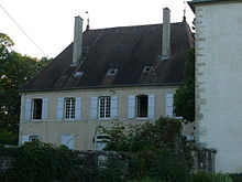
Near the church is a stone cross (15th century) in the Burgundian style. The 18th century castle marks the entrance to the old town center. In Essernay there is a chapel and a Calvary from the 18th century and a late medieval house. The Pierre-qui-Vire dolmen stands on the plateau on the road to Noroy-le-Bourg.
population
| Population development | |
|---|---|
| year | Residents |
| 1962 | 170 |
| 1968 | 178 |
| 1975 | 218 |
| 1982 | 264 |
| 1990 | 354 |
| 1999 | 405 |
| 2006 | 496 |
With 460 inhabitants (January 1, 2017) Colombe-lès-Vesoul is one of the smaller municipalities in the Haute-Saône department. After the population had decreased slightly in the first half of the 20th century (in 1901 there were still 249 people), there has been significant population growth again since the early 1970s. Since then the number of inhabitants has almost tripled.
Economy and Infrastructure
Colombe-lès-Vesoul was a village dominated by agriculture (arable farming, fruit growing and cattle breeding) and forestry until well into the 20th century. Today there are some local small businesses. In the last few decades the village has transformed into a residential community. Many workers are therefore commuters who go to work in the Vesoul agglomeration.
The village is well developed in terms of traffic. It is close to the main road N19 that runs from Vesoul to Belfort . Further road connections exist with Villersexel , Noroy-le-Bourg and Frotey-lès-Vesoul.

