
Grattery
| Grattery | ||
|---|---|---|

|
|
|
| region | Bourgogne-Franche-Comté | |
| Department | Haute-Saône | |
| Arrondissement | Vesoul | |
| Canton | Port-sur-Saône | |
| Community association | Terres de Saône | |
| Coordinates | 47 ° 40 ′ N , 6 ° 5 ′ E | |
| height | 218-296 m | |
| surface | 6.19 km 2 | |
| Residents | 213 (January 1, 2017) | |
| Population density | 34 inhabitants / km 2 | |
| Post Code | 70170 | |
| INSEE code | 70278 | |
 Mairie Grattery |
||

Grattery is a municipality in the French department of Haute-Saône in the region Bourgogne Franche-Comté .
geography
Grattery is located at an altitude of 232 m above sea level, about eight kilometers northwest of the city of Vesoul (as the crow flies). The village extends in the central part of the department, in the valley of the Scyotte, between the river valley of the Saône in the west and the basin of Vesoul in the east.
The area of the municipal area of 6.19 km² includes a section in the area of the gently undulating landscape east of the Saône valley. From northeast to southwest, the area is crossed by the valley of the Scyotte, which drains the river into the Saône. The flood plain has a maximum width of 500 m and averages 230 m. The valley is flanked on both sides by a plateau, which consists of alternating layers of sandy, marly and calcareous sediments from the Upper Jurassic . In the far north there are also older layers. The plateau is mainly used for agriculture. At 296 m, the highest point of Grattery is reached on the hilltop east of the village. To the west, the municipal area extends into the extensive wooded area of the Bois des Combes (up to 260 m).
The settlement of Rupt de Vellemoz (245 m) in the Scyotte valley belongs to Grattery . Neighboring municipalities of Grattery are Bougnon in the north, Charmoille and Pusey in the east, Vaivre-et-Montoille , Montigny-lès-Vesoul and Scye in the south and Port-sur-Saône in the west.
history
In the Middle Ages, Grattery belonged to the Free County of Burgundy and in that part of the Bailliage d'Amont . The lords of Chemilly held the local rule. Together with Franche-Comté , Grattery finally came to France with the Peace of Nijmegen in 1678. Today Grattery is a member of the communal association Communauté de communes de la Saône Jolie, which comprises 16 villages .
Attractions
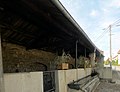
The village church Nativité de Notre-Dame in Grattery was built in the 18th century. It houses statues of the Holy Virgin from the 17th and 18th centuries. Near the church is the Fontaine- Lavoir , which once served as a fountain, wash house and cattle trough.

Nativité de Notre-Dame church
Fontaine-Lavoir


population
| Population development | |
|---|---|
| year | Residents |
| 1962 | 139 |
| 1968 | 145 |
| 1975 | 124 |
| 1982 | 146 |
| 1990 | 160 |
| 1999 | 168 |
| 2006 | 187 |
With 213 inhabitants (January 1, 2017), Grattery is one of the small communities in the Haute-Saône department. After the population had decreased significantly in the first half of the 20th century (249 people were still counted in 1886), population growth has been recorded again since the mid-1970s.
Economy and Infrastructure
Until well into the 20th century, Grattery was mainly a village characterized by agriculture (arable farming, fruit growing and cattle breeding) and forestry. Today there are some local small businesses. In the last few decades the village has transformed into a residential community. Many workers are therefore commuters who go to work in the Vesoul agglomeration.
The place is well developed in terms of traffic. It is located near the main road N19 , which leads from Belfort via Vesoul to Langres . There are other road connections with Bougnon , Scye and Villers-sur-Port . Grattery has a train station on the railway line from Vesoul to Langres.