
Vellefrie
| Vellefrie | ||
|---|---|---|
|
||
| region | Bourgogne-Franche-Comté | |
| Department | Haute-Saône | |
| Arrondissement | Vesoul | |
| Canton | Vesoul-2 | |
| Community association | Terres de Saône | |
| Coordinates | 47 ° 42 ' N , 6 ° 13' E | |
| height | 232-324 m | |
| surface | 5.91 km 2 | |
| Residents | 127 (January 1, 2017) | |
| Population density | 21 inhabitants / km 2 | |
| Post Code | 70240 | |
| INSEE code | 70534 | |
 Place view |
||

Vellefrie is a municipality in the French department of Haute-Saône in the region Bourgogne Franche-Comté .
geography
Vellefrie is located at an altitude of 241 m above sea level, five kilometers west of Saulx and about ten kilometers north-northeast of the city of Vesoul (as the crow flies). The village extends in the central part of the department, to the west of the Saulx basin, in the basin of the Ruisseau des Grands Prés , at the southern foot of the Haut de Chenevières .
The area of the municipal area of 5.91 km² includes a section in the area of the Saulx basin. The central part of the area is taken up by the basin of the Ruisseau des Grands Prés , which provides drainage to the southeast to the Durgeon . The hollow is on average 235 m and has a maximum width of one kilometer. The lowland is deepened into a plateau (at 260 m), which leads to the west to the valley of the Bâtard. Agricultural use prevails here. In the north, the valley basin is flanked by the Haut de Chenevières (295 m), in the east by the Moulmont (274 m). The community area extends to the southwest up to the forest crest of the Bois de Chevaney . At 324 m, Vellefrie's highest point is reached here. From a geological and tectonic point of view, the terrain consists of alternating layers of sandy-marl and calcareous sediments that were deposited during the Lias ( Lower Jurassic ). Red sandstone and shell limestone from the Triassic period also come to light in some places .
Neighboring municipalities to Vellefrie are Varogne and Vilory in the north, La Villeneuve-Bellenoye-et-la-Maize in the east, Colombier in the south and Flagy in the west.
history
In the Middle Ages, Vellefrie belonged to the Free County of Burgundy and in it to the area of the Bailliage d'Amont . The lords of Villeneuve held local rule. Together with Franche-Comté , the village finally came to France with the Peace of Nijmegen in 1678. In 1679 Vellefrie became part of the Flagy dominion. In 1786 the residents were granted freedom rights. Today Vellefrie is a member of the Terres de Saône municipal association, which comprises six localities .
Attractions
The Notre-Dame de l'Assomption church was rebuilt in 1735. The valuable furnishings include a statue of St. Barbara (15th / 16th century), a statue of Mary (16th century), the painted pulpit and richly carved altars with paintings and statues from the 18th century.

Notre-Dame de l'Assomption church

Altar of the church
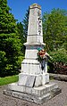
War memorial

Mairie Vellefrie


population
| Population development | |
|---|---|
| year | Residents |
| 1962 | 85 |
| 1968 | 86 |
| 1975 | 71 |
| 1982 | 88 |
| 1990 | 95 |
| 1999 | 100 |
| 2006 | 115 |
With 127 inhabitants (January 1, 2017), Vellefrie is one of the small communities in the Haute-Saône department. After the population had decreased significantly in the first half of the 20th century (272 people were still counted in 1881), population growth has been recorded again since the mid-1970s.
Economy and Infrastructure
Vellefrie is still a predominantly agricultural village (arable farming, fruit growing and cattle breeding). Outside of the primary sector there are few jobs in town. Some workers are therefore commuters who work in the larger towns in the area and in the Vesoul agglomeration.
The place is off the major thoroughfares on a department road that leads from Flagy to Saulx. There are other road connections with Varogne and Bellenoye.