Charcenne
| Charcenne | ||
|---|---|---|
|
|
||
| region | Bourgogne-Franche-Comté | |
| Department | Haute-Saône | |
| Arrondissement | Vesoul | |
| Canton | Marnay | |
| Community association | Monts de Gy | |
| Coordinates | 47 ° 22 ' N , 5 ° 47' E | |
| height | 214–351 m | |
| surface | 7.16 km 2 | |
| Residents | 336 (January 1, 2017) | |
| Population density | 47 inhabitants / km 2 | |
| Post Code | 70700 | |
| INSEE code | 70130 | |
Charcenne is a commune in the French department of Haute-Saône in the region Bourgogne Franche-Comté .
geography
Charcenne is located at an altitude of 226 m above sea level, five kilometers southwest of Gy and about 24 kilometers northwest of the city of Besançon (as the crow flies). The village extends in the south-west of the department, on the western edge of the heights of the Monts de Gy , in the lowland of the Colombine , which emerges here into the basin of the Saône .
The area of the 7.16 km² municipal area comprises a section of the undulating landscape between the river valleys of Saône and Ognon . From south to north, the area is crossed by the lowland of the Colombine, which provides drainage to the Morte . The stream rises south of the village below the Notre Dame de Leffond chapel. The valley of the Colombine is flanked on both sides by the wooded heights of the Monts de Gy: in the west of the Bois de Cugney (up to 315 m), in the south-east of the Bois de la Vergenne, where the highest point of Charcenne is reached at 351 m , and in the northeast the heights of the Bois de Natoy (up to 325 m). In geological and tectonic terms, the Monts de Gy consist of an alternating layer of calcareous and sandy-marly sediments that were deposited in the Upper Jurassic and Tertiary .
Neighboring communities of Charcenne are Choye and Gy in the north, Autoreille in the east, Avrigney-Virey in the south and Cugney in the west.
history
The discovery of a burial ground from Gallic times indicates an early settlement of the community area. In the Middle Ages, Charcenne belonged to the Free County of Burgundy and in it to the area of the Bailliage d'Amont . The rule of the local noble family has been documented since 1215. The sovereignty of Charcenne was held by the Lords of Gy, who were dependent on the Archbishop of Besançon. The Johanniterkommende Romagne and the Corneux monastery also owned land in the municipality. Charcenne was sacked in 1636 during the Thirty Years War . When the French king invaded Franche-Comté, the village was again affected in 1674. Together with Franche-Comté , Charcenne finally came to France with the Peace of Nijmegen in 1678. Today Charcenne is a member of the community association Communauté de communes des Monts de Gy, which comprises 20 villages .
Attractions
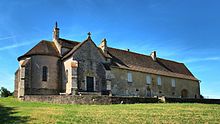
The village church of Charcenne was built in the 19th century in the neo-Gothic style and is equipped with a pulpit in the Louis XV style . The remains of the apse of the original Romanesque church can be seen in the cemetery .
The Notre-Dame-de-Leffond chapel at the source of the Colombine dates from the 13th and 15th centuries. Its furnishings include a statue of the Madonna from the 16th century and the statue of St. James from the 15th century.
There is a round fountain in the village square.
population
| Population development | |
|---|---|
| year | Residents |
| 1962 | 258 |
| 1968 | 266 |
| 1975 | 262 |
| 1982 | 292 |
| 1990 | 267 |
| 1999 | 329 |
With 336 inhabitants (January 1, 2017), Charcenne is one of the small communities in the Haute-Saône department. After the number of inhabitants had decreased significantly in the first half of the 20th century (603 people were counted in 1881), the number of inhabitants has increased again slightly since the beginning of the 1960s.
Economy and Infrastructure
Until well into the 20th century, Charcenne was a village dominated by agriculture (arable farming, viticulture, fruit growing and cattle breeding) and forestry. Today there are various local small-scale businesses, including a cheese dairy and several wineries. In the last few decades the village has transformed into a residential community, as many workers are commuters who go to work in the larger towns in the area.
The place is well developed in terms of traffic. It is close to the main D12 road that goes from Pesmes to Gy. Further road connections exist with Marnay , Choye, Pin and Autoreille.

