Molay (Haute-Saône)
| Molay | ||
|---|---|---|
|
|
||
| region | Bourgogne-Franche-Comté | |
| Department | Haute-Saône | |
| Arrondissement | Vesoul | |
| Canton | Jussey | |
| Community association | Hauts du Val de Saône | |
| Coordinates | 47 ° 44 ′ N , 5 ° 44 ′ E | |
| height | 254-426 m | |
| surface | 7.66 km 2 | |
| Residents | 67 (January 1, 2017) | |
| Population density | 9 inhabitants / km 2 | |
| Post Code | 70120 | |
| INSEE code | 70350 | |
 Look at Molay |
||
Molay is a commune in the French department of Haute-Saône in the region Bourgogne Franche-Comté .
geography
Molay is located at an altitude of 274 m above sea level, eleven kilometers west of Combeaufontaine and about 34 kilometers west-northwest of the city of Vesoul (as the crow flies). The village extends in the west of the department, in the undulating landscape on the southeastern edge of the Langres plateau, in the Rigotte valley, at the northern foot of the Montagne de la Roche . The area of the 7.66 km² municipal area includes a section in the area of the plateau northwest of the Saône valley . The central part of the area is occupied by a depression that is on average 280 m. The valley of the Rigotte flows into this depression from the north, which turns west at Molay and enters the valley of Charmes-Saint-Valbert. The depression in the north is flanked by the heights that form the southeastern foothills of the Langres plateau. Molay includes the plateaus of Partie Franche (361 m) east of the Rigotte and Bois de la Manche (375 m) west of the Rigotte. With a narrow tip, the municipality floor extends to the northwest to the edge of the Grands Bois .
South of the Molay depression rises the Pain de Beurre , where limestone cliffs from the middle Jurassic period appear in several places . It forms the northern end of the Montagne de la Roche . At 426 m, the highest point in Molay is reached here. To the southeast, the depression opens into a plateau that extends between the plateaus of Langres and the Saône . The municipal area extends to the stream of the Sorlière , a source stream of the Gourgeonne . In geological terms, with the exception of the Pain de Beurre, the subsoil consists of alternating layers of sandy-marly and calcareous sediments from the lower Jurassic period.
Molay includes the hamlet of Laître (337 m) in a panoramic position on the southern slope of the Partie Franche plateau. Neighboring municipalities of Molay are La Rochelle and Cintrey in the north, Malvillers in the east, La Roche-Morey in the south and Charmes-Saint-Valbert and Pressigny in the west.
history
The Molay area was inhabited as early as prehistoric times. The earliest evidence of human presence are the remains of a Paleolithic and a Neolithic settlement. The dolmen Pierre-qui-Vire is a testament to the megalithic culture. The area was also inhabited in Gallo-Roman times.
In the Middle Ages, Molay belonged to the Free County of Burgundy and in it to the area of the Bailliage d'Amont . The regional rule was under the Vergy family, while the existence of the local aristocratic Molay family is documented as early as the 11th century. Together with Franche-Comté , the village finally came to France with the Peace of Nijmegen in 1678. Today Molay is a member of the community association Communauté de communes du Pays Jusséen, which comprises 17 villages .
Attractions
The church of Saint-Pierre-et-Saint-Paul in the hamlet of Laître is parish church for the villages of Molay, La Rochelle and Cintrey. It dates from the 16th and 17th centuries and has remarkable furnishings , including furniture from the 18th century, a richly carved, gilded altar, a statue of St. Sebastian (16th century) and a Renaissance-style tombstone .
In the old town center, various houses from the 15th to 18th centuries have been preserved, which show the traditional style of the Haute-Saône.
population
| Population development | |
|---|---|
| year | Residents |
| 1962 | 96 |
| 1968 | 90 |
| 1975 | 73 |
| 1982 | 72 |
| 1990 | 59 |
| 1999 | 51 |
| 2006 | 54 |
With 67 inhabitants (January 1, 2017), Molay is one of the smallest municipalities in the Haute-Saône department. Throughout the 20th century, the population decreased significantly (410 people were counted in 1790 and 275 in 1886).
Economy and Infrastructure
Molay is still today a predominantly agricultural village (arable farming, viticulture, fruit growing and cattle breeding). Outside of the primary sector there are few jobs in town. Some workers are also commuters who work in the larger towns in the area.
The village is located off the major thoroughfares on a department road that leads from La Roche-Morey to Vitrey-sur-Mance . Other road connections exist with Malvillers, Charmes-Saint-Valbert and La Rochelle.
Personalities
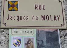
- Jacques de Molay (between 1244 and 1250–1314), last Grand Master of the Templar Order


