List of administrative districts and cities in Bavaria
The Free State of Bavaria is divided into a total of 71 rural districts and 25 independent cities . This list of rural districts and independent cities in Bavaria gives a general overview of these including their most important data. The current administrative structure of the Free State came about through the district reform of July 1, 1972 , in which the previous 143 districts and 48 independent cities were restructured. With effect from May 1, 1973, 25 districts were renamed.
With an area of 70,550.11 square kilometers, the Free State of Bavaria is the largest state in the Federal Republic of Germany . In terms of population, it ranks second with 13,124,737 people. The average population density is 186 inhabitants per square kilometer, although this can vary greatly within the individual districts. The population density in the state capital Munich is 4777 inhabitants per square kilometer, 528 inhabitants per square kilometer in the Munich district and only 66 inhabitants per square kilometer in the Neustadt an der Waldnaab district . The most populous district is the district of Munich with 350,473 inhabitants, the poorest in the district of Lichtenfels with 66,776 inhabitants. The largest independent city is the state capital Munich with 1,484,226 inhabitants. The largest district in terms of area is the district of Ansbach , which, with 1,971.84 square kilometers, ranks 32nd in terms of the size of the districts in Germany. The smallest district is the Fürth district with an area of 307.55 square kilometers .
The urban and rural districts are assigned to seven administrative districts :
| Administrative district | coat of arms | Administrative headquarters | Counties | independent cities |
|---|---|---|---|---|
| Middle Franconia |
|
Ansbach | 7th | 5 |
| Lower Bavaria |
|
Landshut | 9 | 3 |
| Upper Bavaria |
|
Munich | 20th | 3 |
| Upper Franconia |
|
Bayreuth | 9 | 4th |
| Upper Palatinate |
|
regensburg | 7th | 3 |
| Swabia |
|
augsburg | 10 | 4th |
| Lower Franconia |
|
Wurzburg | 9 | 3 |
| Bavaria |
|
Munich | 71 | 25th |
construction
The following list is structured as follows:
- District, independent city: Name of the district or the independent city
- District town: Name of the district town: The cell is empty for urban districts.
- Largest municipality: Largest municipality in the district according to number of inhabitants: The cell is empty in the urban districts.
- Coat of arms: the official coat of arms of the district or the independent city
- Reg.-Bez., Location: administrative district and location map of the districts or cities within the Free State of Bavaria
- Motor vehicle: vehicle registration number of the respective regional authority
- Ew: Population of the respective regional authority as of December 31, 2019
- Area: Area of the respective regional authority in square kilometers (km²)
- Ew / km²: population density in inhabitants per square kilometer
- Notes: further information regarding bordering federal states or neighboring states, special features and the like
- Image: a typical image from the region with which the respective regional authority is identified
Overview
| District, independent city |
County seat | Largest community | coat of arms | Reg.-Bez. location |
Vehicle | Ew | Area (in km²) |
Ew / km² | Remarks | image |
|---|---|---|---|---|---|---|---|---|---|---|
| Aichach-Friedberg | Aichach | Friedberg |

|
Swabia
|
AIC, FDB | 134,655 | 780.33 | 173 | As the former ancestral seat of the Wittelsbachers, also called Wittelsbacher Land . The Altlandkreis Aichach belonged before the district reform in 1972 for the district of Upper Bavaria. |

|
| Altötting | Altötting | Burghausen |

|
Upper Bavaria
|
AÖ, LF | 111,516 | 569.35 | 196 | The birthplace of Pope Benedict XVI is in the Altötting district . , the municipality of Marktl . The Gnadenkapelle Altötting is an important Bavarian pilgrimage site . The longest castle in Europe is located in Burghausen . |

|
|
Amberg (independent city) |

|
Upper Palatinate
|
AT THE | 42.207 | 50.14 | 842 | The historic city is one of the best preserved medieval city complexes. Here you will find the Eh'häusl , the Electoral Palace and the Electoral Government Chancellery as well as the St. Martin Church and the Maria Hilf pilgrimage church . |

|
||
| Amberg-Sulzbach | On the mountain | Sulzbach-Rosenberg |

|
Upper Palatinate
|
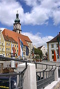
AS, BUL , ESB , NAB , SUL | 103.049 | 1,255.75 | 82 | The western district is located in the Upper Palatinate Jura , part of the Franconian Switzerland-Veldenstein Forest Nature Park on the south-eastern edge of Franconian Switzerland . Sulzbach was the capital of the Duchy of Pfalz-Sulzbach . |
|
|
Ansbach (independent city) |

|
Middle Franconia
|
ON | 41,798 | 99.91 | 418 | The government of Middle Franconia has its seat in the former residence of the Margraves of Brandenburg-Ansbach . The St. Gumbertus monastery also dates from this period . |

|
||
| Ansbach | Ansbach | Wet cheeks |

|
Middle Franconia
|
AN , DKB, FEU, ROT | 184,591 | 1,971.84 | 94 | The district is separated from northwest to southeast by the European watershed . Rothenburg ob der Tauber is known as a well-preserved medieval town . |

|
|
Aschaffenburg (independent city) |

|
Lower Franconia
|
FROM | 71.002 | 62.47 | 1137 | Johannisburg Castle dominates the image of the city, which is considered the gateway to the Spessart and, because of its mild climate, is also known as the Bavarian Nice . |

|
||
| Aschaffenburg | Aschaffenburg | Alzenau |

|
Lower Franconia
|
AB , ALZ | 174,200 | 699.15 | 249 | The former film set and postage stamps of Mespelbrunn Castle and Alzenau Castle as the venue for the Castle Festival and the Franconian Music Days are well worth seeing . |

|
|
Augsburg (independent city) |

|
Swabia
|
A. | 296,582 | 146.84 | 2020 | The Plärrer is the largest folk festival in Bavarian Swabia and the third largest in Bavaria. It takes place in spring, starting on Easter Sunday, and in late summer. |

|
||
| augsburg | augsburg | Koenigsbrunn |

|
Swabia
|
A , SMÜ, WHO | 253,468 | 1,071.13 | 237 | The Mercateum , the largest globe in the world based on historical cartography, is located in Königsbrunn . In the Archaeological Museum Königsbrunn you will find special, mainly regional exhibits. |

|
| Bad Kissingen | Bad Kissingen | Bad Kissingen |

|
Lower Franconia
|
KG, BRK, HAB | 103.235 | 1,136.96 | 91 | The district is strongly influenced by tourism through the spas in Bad Kissingen , Bad Brückenau and Bad Bocklet , the low mountain range and numerous ruins and palaces such as Saaleck Castle in Hammelburg. |

|
| Bad Toelz-Wolfratshausen | Bad Tölz | Geretsried |

|
Upper Bavaria
|
TÖL, WOR | 127.917 | 1,110.69 | 115 | The district is characterized by the Isar and Loisach as well as alpine lakes such as the Walchensee . The southern district lies in the Karwendel and reaches the highest point with the Schafreuter . The Benediktbeuern monastery, founded around 739/740, is located at the foot of the Benediktenwand . |

|
|
Bamberg (independent city) |

|
Upper Franconia
|
BA | 77,373 | 54.62 | 1416 | The lovely Old Town has the largest preserved historic center in Germany and since 1993 as a World Heritage Site in the list of UNESCO entered. In addition, Bamberg is known nationwide for its diverse and independent beer tradition . |

|
||
| Bamberg | Bamberg | Hirschaid |

|
Upper Franconia
|
BA | 147.163 | 1,167.83 | 126 | Here are parts of the three nature parks Steigerwald , Franconian Switzerland and Haßberge . |

|
|
Bayreuth (independent city) |

|
Upper Franconia
|
BT | 74,783 | 66.93 | 1117 | Bayreuth was the residence of the Principality of Bayreuth . The Richard Wagner Festival takes place here every year in the Festival Hall on the Green Hill . |

|
||
| Bayreuth | Bayreuth | Pegnitz |

|
Upper Franconia
|
BT, EBS , ESB , KEM , MÜB , PEG | 103.664 | 1,273.74 | 81 | In the district of Bayreuth lies part of Franconian Switzerland with the Devil's Cave and the Sophien Cave . |

|
| Berchtesgadener Land | Bad Reichenhall | Bad Reichenhall |

|
Upper Bavaria
|
BGL, BGD, LF , REI | 105,929 | 839.92 | 126 | In the southern district, the Königssee lies at the foot of the Watzmann in the Berchtesgaden Alps . The area is part of the national park in the Berchtesgaden Biosphere Reserve . |

|
| Cham | Cham | Cham |

|
Upper Palatinate
|
CHA, KÖZ, ROD , WÜM | 127.998 | 1,520.17 | 84 | The district lies in the Upper Bavarian Forest Nature Park , the Upper Palatinate Forest and the Bavarian Forest . |

|
|
Coburg (independent city) |

|
Upper Franconia
|
CO, NEC | 41,072 | 48.29 | 851 | The former residence of the dukes of Saxe-Coburg has a very well preserved old town. The Veste Coburg , also known as the Franconian Crown , is the second largest preserved castle in Germany. |

|
||
| Coburg | Coburg | Neustadt near Coburg |

|
Upper Franconia
|
CO, NEC | 86,747 | 590.47 | 147 | The northern part of the district lies in the foreland of the Thuringian Forest . The Lauterberg nature reserve is located in the Long Mountains . |

|
| Dachau | Dachau | Dachau |

|
Upper Bavaria
|
DAH | 154,899 | 579.18 | 267 | The Amper separates the moorland in the south from the rest of the area, which consists mainly of hill country. |

|
| Deggendorf | Deggendorf | Deggendorf |

|
Lower Bavaria
|
DEG | 119,478 | 861.3 | 139 | The district area lies partly in the Bavarian Forest and is traversed from northwest to southeast by the Danube , into which the Isar flows here. |

|
| Dillingen on the Danube | Dillingen on the Danube | Dillingen on the Danube |

|
Swabia
|
DLG, WHO | 96,562 | 792.22 | 122 | The district is traversed by the Danube from southwest to northeast and has a share in the foothills of the Swabian Alb and the Donauried . |

|
| Dingolfing-Landau | Dingolfing | Dingolfing |

|
Lower Bavaria
|
DGF, LAN | 96,683 | 877.79 | 110 | The Growing rocks of Uster Ling is one of the most important geotopes Germany . The Duke's Castle of Straubing-Holland in Dingolfing is a very well-preserved architectural monument from the early 15th century . |

|
| Danube Ries | Donauwörth | Nordlingen |

|
Swabia
|
DON, Lower Austria | 133,783 | 1,274.68 | 105 | In the northwest of the district, the Ries event took place around 15 million years ago , from which the Nördlinger Ries emerged . After the district reform in 1972, the district was initially called Nördlingen-Donauwörth with Nördlingen as the district seat , in 1973 it was renamed and Donauwörth was the administrative seat. |

|
| Ebersberg | Ebersberg | Vaterstetten |

|
Upper Bavaria
|
EBE | 143,649 | 549.36 | 261 | The Ebersberger Forst is one of the largest contiguous forest areas in Germany that is not interrupted by any settlement. At the edge of the lake lies the Egglburger See in a nature reserve . |

|
| Eichstatt | Eichstatt | Eichstatt |

|
Upper Bavaria
|
EGG | 132,881 | 1,214.06 | 109 | The Altmühltal Nature Park has its core area here. The area of the district belonged to the Hochstift Eichstätt before 1800 . Until 1972 Eichstätt was an independent city. |

|
| Erding | Erding | Erding |

|
Upper Bavaria
|
ED | 138.182 | 870.72 | 159 | In the west of the district, the new Munich Airport was built in Erdinger Moos and opened in 1992. About half of the airport is in the district area. |

|
|
Erlangen (independent city) |

|
Middle Franconia
|
HE | 112,528 | 76.95 | 1462 | The inner city was built as a baroque plan and ideal city with dead straight street and square fronts and uniform facades of the almost entirely two and three-story eaves-facing houses. The Margravial Palace , together with the palace garden , orangery and Concord Church, forms a self-contained baroque ensemble. |

|
||
| Erlangen-Höchstadt | gain | Herzogenaurach |

|
Middle Franconia
|
ERH, HÖS | 137.262 | 564.66 | 243 | The Main-Danube Canal runs through the district in a north-south direction. When the districts of Erlangen and Höchstadt were united , Höchstadt an der Aisch lost its status as a district town . |

|
| Forchheim | Forchheim | Forchheim |

|
Upper Franconia
|
FO, EBS , PEG | 116.203 | 642.79 | 181 | The majority of the district lies in the Franconian Switzerland Nature Park . Hiltpoltstein Castle is an almost completely preserved castle, and the castle and fortress in Forchheim have been preserved. |

|
| Freising | Freising | Freising |

|
Upper Bavaria
|
FS | 180.007 | 799.83 | 225 | Here is the former bishop's seat of the former Hochstift Freising , the Freising Cathedral . Half of the new Munich Airport is located in the Freising district. |

|
| Freyung-Grafenau | Freyung | Waldkirchen |

|
Lower Bavaria
|
FRG, GRA, WOS | 78,362 | 984.15 | 80 | In the north lies the Bavarian Forest National Park , which also extends over the neighboring district of Regen . |

|
| Fürstenfeldbruck | Fürstenfeldbruck | Germering |

|
Upper Bavaria
|
FFB | 219.311 | 434.79 | 504 | The former Cistercian - Kloster Furstenfeld was in 1263 by Duke Ludwig II. Donated. The attempt to rescue Israeli athletes from hostages during the 1972 Olympics ended at Fürstenfeldbruck airfield . |

|
|
Fürth (independent city) |

|
Middle Franconia
|
FÜ | 128,497 | 63.35 | 2028 | The title of City of Science was awarded to Fürth by the Bavarian State Minister for Science on its 1000th anniversary in 2007. Due to minor damage during the Second World War, the historic cityscape has largely been preserved. |

|
||
| Fuerth | Zirndorf | Zirndorf |

|
Middle Franconia
|
FÜ | 117,853 | 307.55 | 383 | The castle of the same name is in Markt Cadolzburg . The Hainberg nature reserve contains the largest sandy grassland area in Northern Bavaria. The humming top was invented in Zirndorf around 1913 . |

|
| Garmisch-Partenkirchen | Garmisch-Partenkirchen | Garmisch-Partenkirchen |

|
Upper Bavaria
|
Cap | 88,424 | 1,012.22 | 87 | The Wetterstein Mountains and Karwendel begin in the south . The Ettal Abbey , Linderhof Palace and the Oberammergau Passion Play are well worth seeing . |

|
| Gunzburg | Gunzburg | Gunzburg |

|
Swabia
|
GZ, KRU | 127.027 | 762.44 | 167 | The district is part of the Swabian Baroque Corner . Significant baroque buildings in the district are the Wettenhausen , Ursberg and Edelstetten monasteries , the pilgrimage churches of All Saints and Maria Vesperbild , the parish church of St. Michael in Krumbach and the Frauenkirche in Günzburg . In the north of the district, the district has a share in the Donauried , in the east in the Augsburg-Westliche Wälder nature park . In 2002 Legoland Germany (amusement park) opened near Günzburg . The Krumbad in the district is the oldest spa in Swabia. |

|
| Hatred Mountains | Hassfurt | Hassfurt |

|
Lower Franconia
|
HAS, EBN, GEO , HOH | 84,384 | 956.38 | 88 | The district is named after the low mountain range Haßberge , which rise in the nature park of the same name . Here, especially at Lichtenstein Castle, there are rocky seas made from Rhaetian sandstone blocks . |

|
|
Hof (independent city) |

|
Upper Franconia
|
HO | 45,825 | 58.03 | 790 | The city lies in the valley of the Saxon Saale . In the northeast of the city center is the Theresienstein Citizens' Park , which began in the early 19th century. The Biedermeier ensemble along Ludwigstrasse from the mid-19th century in Hof is of art historical importance . |

|
||
| court | court | Münchberg |

|
Upper Franconia
|
HO , MÜB , NAI, REH , SAN | 94,801 | 892.52 | 106 | Between the Franconian Forest , the Bavarian Vogtland and the Fichtel Mountains , which surround the district, the Münchberger Gneissasse lies southwest of Hof . |

|
|
Ingolstadt (independent city) |

|
Upper Bavaria
|
IN | 137.392 | 133.37 | 1030 | Ingolstadt has a largely preserved historic old town with buildings from all epochs of the city's history. The Bavarian Beer Purity Law was issued here in 1516 . |

|
||
|
Kaufbeuren (independent city) |

|
Swabia
|
Theatrical Version | 44,398 | 40.03 | 1109 | The former free imperial city lies on the Wertach . The city's landmark is the five-button tower , one of several towers that come from the former historic city wall. |

|
||
| Kelheim | Kelheim | Kelheim |

|
Lower Bavaria
|
KEH, MAY , PAR , RID, ROL | 123.058 | 1,065.97 | 115 | The western district lies in the Altmühltal nature park , the southern one forms the hill country of the Hallertau . The Danube Gorge near Weltenburg and the Liberation Hall on the Michelsberg above Kelheim are worth seeing . |

|
|
Kempten (Allgäu) (independent city) |

|
Swabia
|
KE | 69,151 | 63.28 | 1093 | The independent city of Kempten (Allgäu) is one of the oldest cities in Germany with a city history of around 2,100 years. It is the second largest city in Bavarian Swabia. |

|
||
| Kitzingen | Kitzingen | Kitzingen |

|
Lower Franconia
|
KT | 91,155 | 684.19 | 133 | The German Carnival Museum is housed in the crooked Faltertum in Kitzingen . In Geiselwind Bavaria is the largest amusement park . |

|
| Kronach | Kronach | Kronach |

|
Upper Franconia
|
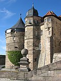
KC, SAN | 66,743 | 651.53 | 102 | The majority of the district area lies in the Franconian Forest . The Rosenberg Fortress near Kronach , one of the largest preserved fortifications in Europe, and the moated Mitwitz Castle are located here . |
|
| Kulmbach | Kulmbach | Kulmbach |

|
Upper Franconia
|
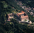
KU, EBS , SAN | 71,566 | 658.34 | 109 | The largest tin figure museum in the world with more than 300,000 figures is housed in the Kulmbacher Plassenburg . |
|
| Landsberg am Lech | Landsberg am Lech | Landsberg am Lech |

|
Upper Bavaria
|
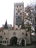
LL | 120,302 | 804.38 | 150 | The Ammersee, the third largest lake in Bavaria, lies entirely in the district, with the exception of the east bank. The well-preserved city fortifications of Landsberg am Lech and Kaltenberg Castle , the venue of the Kaltenberg knight tournament, are worth seeing . |
|
|
Landshut (independent city) |

|
Lower Bavaria
|
LA | 73.411 | 65.81 | 1115 | The city's landmarks are the Martinskirche with the tallest brick tower in the world and Trausnitz Castle . The Landshut Wedding , a historical festival, takes place every four years . |

|
||
| Landshut | Landshut | Ergolding |

|
Lower Bavaria
|
LA , MAY , MAL , ROL , VIB | 159,895 | 1,347.89 | 119 | The north-west of the district is in the Hallertau hop-growing region . The Archaeological Museum Essenbach shows the settlement history of the middle Isar valley . |

|
| Lichtenfels | Lichtenfels | Lichtenfels |

|
Upper Franconia
|
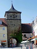
LIF, STE | 66,776 | 519.95 | 128 | The part of the district south of the Main lies in the Franconian Switzerland Nature Park . The God's Garden with the Langheim Abbey extends along the Upper Main . |
|
| Lindau (Lake Constance) | Lindau (Lake Constance) | Lindau (Lake Constance) |

|
Swabia
|
LI | 81,981 | 323.44 | 253 | In the border triangle between Germany, Austria and Switzerland, on the eastern shore of Lake Constance , the city of Lindau is partly on an island. Scheidegg is the sunniest place in Bavaria. |

|
| Main-Spessart | Karlstadt | Lohr am Main |

|
Lower Franconia
|
MSP | 126.158 | 1,321.42 | 95 | The Main and the Spessart shape the district, while the Archaeological Spessart Project provides information on current research in and about the Spessart. Shortly after the regional reform, the district seat was moved from Lohr am Main to Karlstadt . |

|
|
Memmingen (independent city) |

|
Swabia
|
MM | 44,100 | 70.14 | 629 | The Upper Swabian , former free imperial city is also known as the gateway to the Allgäu due to its proximity to the Allgäu . Memmingen's origins go back to Roman times. With its squares, town and patrician houses, palaces and the city fortifications, the old town is one of the best-preserved in southern Germany. Here the Memming Freedom Prize 1525 is awarded in memory of the Twelve Articles . The Wallenstein Festival has been held since 1980 . Fisherman's Day and the Memminger Children's Festival take place every year. |

|
||
| Miesbach | Miesbach | Wooden churches |

|
Upper Bavaria
|
MB | 100.010 | 866.23 | 115 | Here on the northern edge of the Bavarian Alps lie the Schliersee and the Tegernsee , on the lakeshore of the Tegernsee Monastery . The Schlierseer Bauerntheater is the oldest Bavarian farmer's theater. |

|
| Miltenberg | Miltenberg | Erlenbach am Main |

|
Lower Franconia
|
MIL, OBB | 128,743 | 715.86 | 180 | The Odenwald and the Spessart together with historical buildings and castles determine the landscape. The historic old town of Miltenberg and the Mildenburg as well as the ruins of the Collenburg on the right bank of the Main are worth seeing . |

|
| Mühldorf am Inn | Mühldorf am Inn | Waldkraiburg |

|
Upper Bavaria
|
MÜ, VIB , WS | 115,872 | 805.31 | 144 | The area around Mühldorf a.Inn belonged as an enclave to the Salzburg monastery and only became Bavarian in 1802. Mühldorf has a historic town center with buildings in the Inn-Salzach style . In the center of Schwindegg is a Renaissance moated castle . |

|
|
Munich (state capital) |

|
Upper Bavaria
|
M. | 1,484,226 | 310.7 | 4777 | The state capital and Olympic city from 1972 is the third largest city in Germany . The Frauenkirche is a landmark . In the fall takes place on the Theresienwiese , the Oktoberfest instead. |

|
||
| Munich | Munich | Unterschleissheim |

|
Upper Bavaria
|
M , AIB , WOR | 350,473 | 664.25 | 528 | The landscape is shaped by the Munich gravel plain , which is cut in the south by the high bank of the Isar . Schleissheim Palace is one of the most important baroque complexes in Germany . The medieval Grünwald Castle is well preserved . |

|
| Neuburg-Schrobenhausen | Neuburg on the Danube | Neuburg on the Danube |

|
Upper Bavaria
|
ND, SOB | 97,303 | 739.81 | 132 | The European Asparagus Museum is located in Schrobenhausen in one of the most important asparagus growing areas in Germany . In Schloss Neuburg other museums are housed. |

|
| Neumarkt in the Upper Palatinate | Neumarkt in the Upper Palatinate | Neumarkt in the Upper Palatinate |

|
Upper Palatinate
|
NM, PAR | 134,573 | 1,344.11 | 100 | In addition to the historic old towns of the district, there are numerous places worth seeing, such as the baroque pilgrimage church Maria Hilf , the Count Palatine Palace , the Wolfstein castle ruins and the King Otto stalactite cave . |

|
| Neustadt an der Aisch-Bad Windsheim | Neustadt an der Aisch | Neustadt an der Aisch |

|
Middle Franconia
|
NEA, SEF, UFF | 101.014 | 1,267.56 | 80 | In the south of the district lies the Frankenhöhe Nature Park and in the north the Steigerwald with Schwarzenberg Castle . |

|
| Neustadt an der Waldnaab | Neustadt an der Waldnaab | Vohenstrauss |

|
Upper Palatinate
|
NEW, ESB , VOH | 94,450 | 1,427.67 | 66 | In the Nature Park Northern Upper Palatinate Forest , there are numerous castles and ruins as Flossenburg , Schellenberg or Leuchtenberg . Bavaria's largest military training area is the Grafenwöhr military training area . |

|
| New Ulm | New Ulm | New Ulm |

|
Swabia
|
NU, ILL | 175.204 | 515.86 | 340 | The district is located on the so-called Iller-Lech-Platte. The castle of the patrician family Vöhlin in Illertissen , St. Johann Baptist and Roggenburg Abbey are well worth seeing . |

|
|
Nuremberg (independent city) |

|
Middle Franconia
|
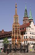
N | 518.370 | 186.38 | 2781 | The Nuremberg Castle is a landmark and one of the most important art and architectural monuments in the city of Nuremberg . The Schöne Brunnen is part of Nuremberg's historical mile and shines above all at the Christkindlesmarkt . |
|
||
| Nuremberg country | Run on the Pegnitz | Run on the Pegnitz |

|
Middle Franconia
|
LAU, ESB , HEB, N , PEG | 170,792 | 799.57 | 214 | In the foreland to the Franconian Alb there are numerous castles and ruins such as Hohenstein , Veldenstein Castle and the Rothenberg Fortress . |

|
| Oberallgäu | Sonthofen | Sonthofen |

|
Swabia
|
OA | 156.008 | 1528 | 102 | The southernmost district in Germany comprises the central area of the Allgäu Alps . The Breitachklamm is located in the alpine area with the Hochfrottspitze . Oberstdorf is an important center for winter sports . |

|
| Ostallgäu | Marktoberdorf | Marktoberdorf |

|
Swabia
|
OAL, FÜS, MOD | 141.182 | 1,394.91 | 101 | The castles of Hohenschwangau and Neuschwanstein are located here . |

|
|
Passau (independent city) |

|
Lower Bavaria
|
PA | 52,803 | 69.57 | 759 | Thanks to Italian builders and houses in the Inn and Salzach style, the three-river city is also known as the Venice of Bavaria due to its Mediterranean flair . |

|
||
| Passau | Passau | Vilshofen on the Danube |

|
Lower Bavaria
|
PA | 192.656 | 1,530.29 | 126 | The area that was mainly part of the Passau monastery before 1800 became Bavarian in 1806. Im from the Danube , Inn and Rott embossed area, numerous castles, palaces and monasteries, as are castle Freudensee , Schloss Neuburg am Inn and Monastery Sankt Salvator . |

|
| Pfaffenhofen on the Ilm | Pfaffenhofen on the Ilm | Pfaffenhofen on the Ilm |

|
Upper Bavaria
|
PAF | 128,227 | 761.14 | 168 | Most of the district belongs to the Hallertau . The German Hop Museum is located here in Wolnzach . The Scheyern Monastery , Vohburg Castle , Reichertshausen Castle and Rohrbach Castle are all worth seeing . |

|
| rain | rain | rain |

|
Lower Bavaria
|
REG, VIT | 77,410 | 974.92 | 79 | In the north-east of the district is the north-western extension area of the Bavarian Forest National Park . The highest mountain is the Great Arber . The namesake is the river Regen . |

|
|
Regensburg (independent city) |

|
Upper Palatinate
|
R. | 153.094 | 80.7 | 1897 | The old town of Regensburg with the Stadtamhof district is a UNESCO World Heritage Site . The stone bridge over the Danube and the Regensburg Cathedral on Domplatz are the city's landmarks. |

|
||
| regensburg | regensburg | Regenstauf |

|
Upper Palatinate
|
R. | 194.070 | 1,391.9 | 139 | The landscape is shaped by the valleys of the Danube , Laaber , Regen and Naab as well as the foothills of the Bavarian Forest in the east and the Franconian Alb in the west. Castles and palaces such as Schloss Wörth are mainly found along the Danube . |

|
| Rhön-Grabfeld | Bad Neustadt an der Saale | Bad Neustadt an der Saale |

|
Lower Franconia
|
NES, CAN, MET | 79,635 | 1,021.77 | 78 | The Rhön covers the west of the district with the Wechterswinkel Monastery , the Red and Black Moor . The Franconian Saale rises in the Grabfeld east and south-east of Bad Königshofen from two source streams. |

|
|
Rosenheim (independent city) |

|
Upper Bavaria
|
RO | 63,551 | 37.22 | 1707 | The favorable traffic situation between Munich , Salzburg and Innsbruck , the proximity to the Chiemgau and Chiemsee as well as the beautiful old town make Rosenheim tourist and economical interesting. |

|
||
| Rosenheim | Rosenheim | Bad Aibling |

|
Upper Bavaria
|
RO , AIB , WS | 261,330 | 1,439.54 | 182 | The district includes, among other things, part of the Chiemsee . However, only a few bays and the three larger islands - Herrenchiemsee , Frauenchiemsee and the uninhabited Krautinsel - belong to the district area. |

|
| Roth | Roth | Roth |

|
Middle Franconia
|
RH, HIP | 126,749 | 895.39 | 142 | In addition to the half-timbered houses in many communities, there are numerous castles such as Abenberg Castle and Wernfels Castle . The area of the district of Roth came to Bavaria in 1806 after the Reichsdeputationshauptschluss of 1803. |

|
| Rottal Inn | Parish churches | Eggenfelden |

|
Lower Bavaria
|
PAN, EG, GRI, VIB | 121.502 | 1,281.42 | 95 | The district is named after the two rivers Rott , which divides it in a west-east direction, and the Inn , which forms the border with Austria. |

|
|
Schwabach (independent city) |

|
Middle Franconia
|
SC | 40,981 | 40.82 | 1004 | Schwabach is famous for its gold bats and the gold leaf they produce and export worldwide . The Golden Hall in the town hall, decorated with 14,000 sheets of Schwabach gold leaf, was designed by Kurt Severin and Max Friese . |

|
||
| Schwandorf | Schwandorf | Schwandorf |

|
Upper Palatinate
|
SAD, BUL , NAB , NEN, OVI, ROD | 147,872 | 1,464.97 | 101 | The district area includes the Upper Palatinate Forest in the northeast and the Upper Palatinate hill country in the southwest. The Renaissance arcades of Fronberg Castle in Schwandorf- Fronberg are of cultural and historical significance . In Burglengenfeld that found anti-WAAhnsinns Festival 1986 instead. |

|
|
Schweinfurt (independent city) |

|
Lower Franconia
|
SW | 53,426 | 35.7 | 1497 | The German Academy of Sciences Leopoldina was founded in the former Free Imperial City in 1652 , today's National Academy of Sciences. |

|
||
| Schweinfurt | Schweinfurt | Werneck |

|
Lower Franconia
|
SW , GEO | 115,445 | 841.46 | 137 | Parts of the Steigerwald and Haßberge nature parks and the Schweinfurt Rhön are located in the third largest wine district in Franconia . Werneck Castle , with the English Garden, is the seat of one of the oldest psychiatric clinics in Germany. |

|
| Starnberg | Starnberg | Starnberg |

|
Upper Bavaria
|
STA, WOR | 136,667 | 487.71 | 280 | The district area corresponds to the region of the Five Lakes State . The Andechs monastery church is an important place of pilgrimage in Bavaria. The votive chapel in Berg lies above the place where the body of Ludwig II was found. |

|
|
Straubing (independent city) |

|
Lower Bavaria
|
SR | 47,791 | 67.58 | 707 | Straubing's landmark is the city tower . The Straubing Gäubodenvolksfest is the second largest folk festival in old Bavaria . |

|
||
| Straubing arch | Straubing | arc |

|
Lower Bavaria
|
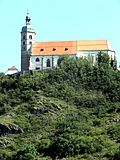
SR , BOG, MAL | 101.120 | 1,201.94 | 84 | The landscape of the district is characterized by the Danube plain , the fertile Gäuboden in the center and the Bavarian Forest in the north. The Bavarian diamonds have their origins in the Straubing-Bogen district . The destination of the oldest pilgrimage to Mary in Bavaria has been the Bogenberg pilgrimage church since 1104 . |
|
| Tirschenreuth | Tirschenreuth | Tirschenreuth |

|
Upper Palatinate
|
TIR, KEM | 72,046 | 1,084.23 | 66 | In Waldsassen is the basilica , one of the bemerkenswertesten baroque churches in Bavaria, and in Waldnaabtal lies the castle Falkenberg . In 1628 the eastern district , which largely belonged to the Waldsassen monastery , became part of Bavaria. |
 
|
| Traunstein | Traunstein | Traunreut |

|
Upper Bavaria
|
TS, LF | 177.319 | 1534 | 116 | The district includes the Chiemgau Alps in the south , the lake, river and hill landscape of the Chiemgau in the north and almost entirely the "Bavarian Sea", the Chiemsee . |

|
| Unterallgäu | Mindelheim | Bad Woerishofen |

|
Swabia
|
MN | 145.341 | 1,230.06 | 118 | In the district there are a large number of landscape and nature reserves , including the Benninger Ried , as well as almost 500 designated biotopes and more than 100 natural monuments. The Mindelburg is a landmark of Mindelheim . |

|
|
Weiden in the Upper Palatinate (independent city) |

|
Upper Palatinate
|
WHOM | 42,743 | 70.55 | 606 | The city center with the old town hall and the gabled houses from the period after 1540 is well worth seeing. The Art Nouveau church of St. Josef is the largest church building in the diocese of Regensburg after the Middle Ages . |

|
||
| Weilheim-Schongau | Weilheim in Upper Bavaria | Weilheim in Upper Bavaria |

|
Upper Bavaria
|
WM, SOG | 135,478 | 966.37 | 140 | The circle is the center of the Pfaffenwinkel with the Welfenmünster in the Premonstratensian monastery Steingaden and the Wieskirche . |

|
| Weissenburg-Gunzenhausen | Weißenburg in Bavaria | Weißenburg in Bavaria |

|
Middle Franconia
|
WUG, GUN | 94,734 | 970.91 | 98 | In the district is the Franconian Lake District, one of the largest artificially created lake areas in Europe. The stamp motif Ellinger Tor is part of the Weißenburg city wall from the 14th century. |

|
| Wunsiedel in the Fichtel Mountains | Wunsiedel | Marktredwitz |

|
Upper Franconia
|
WUN, MAK, REH , SEL | 72,655 | 606.43 | 120 | The district area lies entirely in the Fichtel Mountains and the nature park of the same name . The Rhine-Danube watershed runs along the border with the Bayreuth district . |

|
|
Würzburg (independent city) |

|
Lower Franconia
|
WÜ | 127.934 | 87.63 | 1460 | The Fortress Marienberg is the symbol of the city and the Wurzburg Residence part of the UNESCO - World Heritage Site . |

|
||
| Wurzburg | Wurzburg | Ochsenfurt |

|
Lower Franconia
|
WÜ , OCH | 162,302 | 968.4 | 168 | The FFH area Gramschatzer Wald is located east of the Main , which flows through the district from southeast to northwest. |

|
| Bavaria | 13.124.737 | 70,550.11 | 186 | |||||||
See also
- History of regional reform in Bavaria from 1971 to 1980
- District reforms in Bavaria (restructuring measures from 1972)
- List of districts and district offices in Bavaria (historical list)
- List of districts in Germany
- List of urban districts in Bavaria (historical list)
- List of independent cities in Germany
literature
- Wilhelm Volkert (Hrsg.): Handbook of the Bavarian offices, communities and courts 1799–1980 . CH Beck, Munich 1983, ISBN 3-406-09669-7 .
Individual evidence
- ↑ Bavarian State Ministry of the Interior: Directory of the municipalities, administrative communities and municipality-free areas in Bavaria as of January 1, 2013 . Online at www.verkuendung-bayern.de, accessed on June 19, 2016.
- ↑ Bavarian ordinance on the reorganization of Bavaria into counties and urban districts of December 27, 1971 (GVBl. P. 495)
- ↑ "Data 2" sheet, Statistical Report A1200C 202041 Population of the municipalities, districts and administrative districts 1st quarter 2020 (population based on the 2011 census) ( help ).
- ↑ [1] (accessed online on February 24, 2016) and [2] (unincorporated areas; accessed online on June 14, 2016)
- ↑ Scheidegg is the "sunniest place in Germany". In: Augsburger Allgemeine. January 8, 2012 ( augsburger-allgemeine.de ).
