
Federal motorway 2
| Bundesautobahn 2 in Germany | ||||||||||||||||||||||||||||||||||||||||||||||||||||||||||||||||||||||||||||||||||||||||||||||||||||||||||||||||||||||||||||||||||||||||||||||||||||||||||||||||||||||||||||||||||||||||||||||||||||||||||||||||||||||||||||||||||||||||||||||||||||||||||||||||||||||||||||||||||||||||||||||||||||||||||||||||||||||||||||||||||||||||||||||||||||||||||||||||||||||||||||||||||||||||||||||||||||||||||||||||||||||||||||||||||||||||||||||||||||||||||||||||||||||||||||||||||||||||||||||||||||||||||||||||||||||||||||||||||||||||||||||||||||||||||||||||||||||||||||||||||||||||||||||||||||||||||||||||||||||||||||||||||||||||||||||||||||||||||||||||||||||||||||||||||||||||||||||||||||||||||||||||||||||||||||||||||||||||||||||||||||||||||||||||

|
||||||||||||||||||||||||||||||||||||||||||||||||||||||||||||||||||||||||||||||||||||||||||||||||||||||||||||||||||||||||||||||||||||||||||||||||||||||||||||||||||||||||||||||||||||||||||||||||||||||||||||||||||||||||||||||||||||||||||||||||||||||||||||||||||||||||||||||||||||||||||||||||||||||||||||||||||||||||||||||||||||||||||||||||||||||||||||||||||||||||||||||||||||||||||||||||||||||||||||||||||||||||||||||||||||||||||||||||||||||||||||||||||||||||||||||||||||||||||||||||||||||||||||||||||||||||||||||||||||||||||||||||||||||||||||||||||||||||||||||||||||||||||||||||||||||||||||||||||||||||||||||||||||||||||||||||||||||||||||||||||||||||||||||||||||||||||||||||||||||||||||||||||||||||||||||||||||||||||||||||||||||||||||||||
| |
||||||||||||||||||||||||||||||||||||||||||||||||||||||||||||||||||||||||||||||||||||||||||||||||||||||||||||||||||||||||||||||||||||||||||||||||||||||||||||||||||||||||||||||||||||||||||||||||||||||||||||||||||||||||||||||||||||||||||||||||||||||||||||||||||||||||||||||||||||||||||||||||||||||||||||||||||||||||||||||||||||||||||||||||||||||||||||||||||||||||||||||||||||||||||||||||||||||||||||||||||||||||||||||||||||||||||||||||||||||||||||||||||||||||||||||||||||||||||||||||||||||||||||||||||||||||||||||||||||||||||||||||||||||||||||||||||||||||||||||||||||||||||||||||||||||||||||||||||||||||||||||||||||||||||||||||||||||||||||||||||||||||||||||||||||||||||||||||||||||||||||||||||||||||||||||||||||||||||||||||||||||||||||||||
| map | ||||||||||||||||||||||||||||||||||||||||||||||||||||||||||||||||||||||||||||||||||||||||||||||||||||||||||||||||||||||||||||||||||||||||||||||||||||||||||||||||||||||||||||||||||||||||||||||||||||||||||||||||||||||||||||||||||||||||||||||||||||||||||||||||||||||||||||||||||||||||||||||||||||||||||||||||||||||||||||||||||||||||||||||||||||||||||||||||||||||||||||||||||||||||||||||||||||||||||||||||||||||||||||||||||||||||||||||||||||||||||||||||||||||||||||||||||||||||||||||||||||||||||||||||||||||||||||||||||||||||||||||||||||||||||||||||||||||||||||||||||||||||||||||||||||||||||||||||||||||||||||||||||||||||||||||||||||||||||||||||||||||||||||||||||||||||||||||||||||||||||||||||||||||||||||||||||||||||||||||||||||||||||||||||
 |
||||||||||||||||||||||||||||||||||||||||||||||||||||||||||||||||||||||||||||||||||||||||||||||||||||||||||||||||||||||||||||||||||||||||||||||||||||||||||||||||||||||||||||||||||||||||||||||||||||||||||||||||||||||||||||||||||||||||||||||||||||||||||||||||||||||||||||||||||||||||||||||||||||||||||||||||||||||||||||||||||||||||||||||||||||||||||||||||||||||||||||||||||||||||||||||||||||||||||||||||||||||||||||||||||||||||||||||||||||||||||||||||||||||||||||||||||||||||||||||||||||||||||||||||||||||||||||||||||||||||||||||||||||||||||||||||||||||||||||||||||||||||||||||||||||||||||||||||||||||||||||||||||||||||||||||||||||||||||||||||||||||||||||||||||||||||||||||||||||||||||||||||||||||||||||||||||||||||||||||||||||||||||||||||
| Basic data | ||||||||||||||||||||||||||||||||||||||||||||||||||||||||||||||||||||||||||||||||||||||||||||||||||||||||||||||||||||||||||||||||||||||||||||||||||||||||||||||||||||||||||||||||||||||||||||||||||||||||||||||||||||||||||||||||||||||||||||||||||||||||||||||||||||||||||||||||||||||||||||||||||||||||||||||||||||||||||||||||||||||||||||||||||||||||||||||||||||||||||||||||||||||||||||||||||||||||||||||||||||||||||||||||||||||||||||||||||||||||||||||||||||||||||||||||||||||||||||||||||||||||||||||||||||||||||||||||||||||||||||||||||||||||||||||||||||||||||||||||||||||||||||||||||||||||||||||||||||||||||||||||||||||||||||||||||||||||||||||||||||||||||||||||||||||||||||||||||||||||||||||||||||||||||||||||||||||||||||||||||||||||||||||||
| Operator: |
|
|||||||||||||||||||||||||||||||||||||||||||||||||||||||||||||||||||||||||||||||||||||||||||||||||||||||||||||||||||||||||||||||||||||||||||||||||||||||||||||||||||||||||||||||||||||||||||||||||||||||||||||||||||||||||||||||||||||||||||||||||||||||||||||||||||||||||||||||||||||||||||||||||||||||||||||||||||||||||||||||||||||||||||||||||||||||||||||||||||||||||||||||||||||||||||||||||||||||||||||||||||||||||||||||||||||||||||||||||||||||||||||||||||||||||||||||||||||||||||||||||||||||||||||||||||||||||||||||||||||||||||||||||||||||||||||||||||||||||||||||||||||||||||||||||||||||||||||||||||||||||||||||||||||||||||||||||||||||||||||||||||||||||||||||||||||||||||||||||||||||||||||||||||||||||||||||||||||||||||||||||||||||||||||||
| Start of the street: |
Oberhausen ( 51 ° 32 ′ N , 6 ° 50 ′ E ) |
|||||||||||||||||||||||||||||||||||||||||||||||||||||||||||||||||||||||||||||||||||||||||||||||||||||||||||||||||||||||||||||||||||||||||||||||||||||||||||||||||||||||||||||||||||||||||||||||||||||||||||||||||||||||||||||||||||||||||||||||||||||||||||||||||||||||||||||||||||||||||||||||||||||||||||||||||||||||||||||||||||||||||||||||||||||||||||||||||||||||||||||||||||||||||||||||||||||||||||||||||||||||||||||||||||||||||||||||||||||||||||||||||||||||||||||||||||||||||||||||||||||||||||||||||||||||||||||||||||||||||||||||||||||||||||||||||||||||||||||||||||||||||||||||||||||||||||||||||||||||||||||||||||||||||||||||||||||||||||||||||||||||||||||||||||||||||||||||||||||||||||||||||||||||||||||||||||||||||||||||||||||||||||||||
| End of street: |
Lehnin Monastery ( 52 ° 20 ′ N , 12 ° 50 ′ E ) |
|||||||||||||||||||||||||||||||||||||||||||||||||||||||||||||||||||||||||||||||||||||||||||||||||||||||||||||||||||||||||||||||||||||||||||||||||||||||||||||||||||||||||||||||||||||||||||||||||||||||||||||||||||||||||||||||||||||||||||||||||||||||||||||||||||||||||||||||||||||||||||||||||||||||||||||||||||||||||||||||||||||||||||||||||||||||||||||||||||||||||||||||||||||||||||||||||||||||||||||||||||||||||||||||||||||||||||||||||||||||||||||||||||||||||||||||||||||||||||||||||||||||||||||||||||||||||||||||||||||||||||||||||||||||||||||||||||||||||||||||||||||||||||||||||||||||||||||||||||||||||||||||||||||||||||||||||||||||||||||||||||||||||||||||||||||||||||||||||||||||||||||||||||||||||||||||||||||||||||||||||||||||||||||||
| Overall length: | 473 km | |||||||||||||||||||||||||||||||||||||||||||||||||||||||||||||||||||||||||||||||||||||||||||||||||||||||||||||||||||||||||||||||||||||||||||||||||||||||||||||||||||||||||||||||||||||||||||||||||||||||||||||||||||||||||||||||||||||||||||||||||||||||||||||||||||||||||||||||||||||||||||||||||||||||||||||||||||||||||||||||||||||||||||||||||||||||||||||||||||||||||||||||||||||||||||||||||||||||||||||||||||||||||||||||||||||||||||||||||||||||||||||||||||||||||||||||||||||||||||||||||||||||||||||||||||||||||||||||||||||||||||||||||||||||||||||||||||||||||||||||||||||||||||||||||||||||||||||||||||||||||||||||||||||||||||||||||||||||||||||||||||||||||||||||||||||||||||||||||||||||||||||||||||||||||||||||||||||||||||||||||||||||||||||||
|
State : |
||||||||||||||||||||||||||||||||||||||||||||||||||||||||||||||||||||||||||||||||||||||||||||||||||||||||||||||||||||||||||||||||||||||||||||||||||||||||||||||||||||||||||||||||||||||||||||||||||||||||||||||||||||||||||||||||||||||||||||||||||||||||||||||||||||||||||||||||||||||||||||||||||||||||||||||||||||||||||||||||||||||||||||||||||||||||||||||||||||||||||||||||||||||||||||||||||||||||||||||||||||||||||||||||||||||||||||||||||||||||||||||||||||||||||||||||||||||||||||||||||||||||||||||||||||||||||||||||||||||||||||||||||||||||||||||||||||||||||||||||||||||||||||||||||||||||||||||||||||||||||||||||||||||||||||||||||||||||||||||||||||||||||||||||||||||||||||||||||||||||||||||||||||||||||||||||||||||||||||||||||||||||||||||||
| Development condition: | 2 × 3 lanes | |||||||||||||||||||||||||||||||||||||||||||||||||||||||||||||||||||||||||||||||||||||||||||||||||||||||||||||||||||||||||||||||||||||||||||||||||||||||||||||||||||||||||||||||||||||||||||||||||||||||||||||||||||||||||||||||||||||||||||||||||||||||||||||||||||||||||||||||||||||||||||||||||||||||||||||||||||||||||||||||||||||||||||||||||||||||||||||||||||||||||||||||||||||||||||||||||||||||||||||||||||||||||||||||||||||||||||||||||||||||||||||||||||||||||||||||||||||||||||||||||||||||||||||||||||||||||||||||||||||||||||||||||||||||||||||||||||||||||||||||||||||||||||||||||||||||||||||||||||||||||||||||||||||||||||||||||||||||||||||||||||||||||||||||||||||||||||||||||||||||||||||||||||||||||||||||||||||||||||||||||||||||||||||||
 |
||||||||||||||||||||||||||||||||||||||||||||||||||||||||||||||||||||||||||||||||||||||||||||||||||||||||||||||||||||||||||||||||||||||||||||||||||||||||||||||||||||||||||||||||||||||||||||||||||||||||||||||||||||||||||||||||||||||||||||||||||||||||||||||||||||||||||||||||||||||||||||||||||||||||||||||||||||||||||||||||||||||||||||||||||||||||||||||||||||||||||||||||||||||||||||||||||||||||||||||||||||||||||||||||||||||||||||||||||||||||||||||||||||||||||||||||||||||||||||||||||||||||||||||||||||||||||||||||||||||||||||||||||||||||||||||||||||||||||||||||||||||||||||||||||||||||||||||||||||||||||||||||||||||||||||||||||||||||||||||||||||||||||||||||||||||||||||||||||||||||||||||||||||||||||||||||||||||||||||||||||||||||||||||||
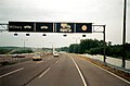
| Bundesautobahn 2 near Lünen towards the east | ||||||||||||||||||||||||||||||||||||||||||||||||||||||||||||||||||||||||||||||||||||||||||||||||||||||||||||||||||||||||||||||||||||||||||||||||||||||||||||||||||||||||||||||||||||||||||||||||||||||||||||||||||||||||||||||||||||||||||||||||||||||||||||||||||||||||||||||||||||||||||||||||||||||||||||||||||||||||||||||||||||||||||||||||||||||||||||||||||||||||||||||||||||||||||||||||||||||||||||||||||||||||||||||||||||||||||||||||||||||||||||||||||||||||||||||||||||||||||||||||||||||||||||||||||||||||||||||||||||||||||||||||||||||||||||||||||||||||||||||||||||||||||||||||||||||||||||||||||||||||||||||||||||||||||||||||||||||||||||||||||||||||||||||||||||||||||||||||||||||||||||||||||||||||||||||||||||||||||||||||||||||||||||||||
|
Course of the road
|
||||||||||||||||||||||||||||||||||||||||||||||||||||||||||||||||||||||||||||||||||||||||||||||||||||||||||||||||||||||||||||||||||||||||||||||||||||||||||||||||||||||||||||||||||||||||||||||||||||||||||||||||||||||||||||||||||||||||||||||||||||||||||||||||||||||||||||||||||||||||||||||||||||||||||||||||||||||||||||||||||||||||||||||||||||||||||||||||||||||||||||||||||||||||||||||||||||||||||||||||||||||||||||||||||||||||||||||||||||||||||||||||||||||||||||||||||||||||||||||||||||||||||||||||||||||||||||||||||||||||||||||||||||||||||||||||||||||||||||||||||||||||||||||||||||||||||||||||||||||||||||||||||||||||||||||||||||||||||||||||||||||||||||||||||||||||||||||||||||||||||||||||||||||||||||||||||||||||||||||||||||||||||||||||
The Bundesautobahn 2 (abbreviation: BAB 2 ) - short form: Autobahn 2 (abbreviation: A 2 ) - is a German federal motorway and runs from the Ruhr area starting in Oberhausen via Dortmund , Bielefeld , Hanover , Braunschweig and Magdeburg to the Werder triangle , where it is in the Berliner Ring opens up. Because of the relatively high proportion of Eastern European traffic, it is sometimes jokingly referred to as Warschauer Allee (especially in the western part) .
Built at the time of National Socialism as the main route in the Reichsautobahn network, the autobahn played a central role in transit traffic to and from West Berlin as the shortest of three connections after the division of Germany . After the fall of the Iron Curtain and the reunification of Germany , the route became the most important east-west traffic axis in Germany and has since been a connection between the Dutch and Belgian North Sea ports and the Eastern European countries. As a result of the sharp increase in traffic, most of the The route has been completely modernized and expanded to six lanes throughout.
course
The Bundesautobahn 2 begins today at the Oberhausen junction , where it is the continuation of the BAB 3 carriageway coming from Cologne . Originally the start of the BAB 2 was at the German-Dutch border crossing at Straelen , from there it led via Moers and Duisburg to the Kaiserberg junction , where it ran on the same route as the BAB 3 to Oberhausen. The motorway section from the Straelen border crossing to the Kaiserberg junction has been part of the BAB 40 since 1992 . First the BAB 2 leads through the cities of the northern Ruhr area. Behind Oberhausen, the BAB 31 branches off to Emden at the Bottrop triangle , after which Gladbeck and the northern districts of Gelsenkirchen are reached, where a short noise protection tunnel was built as part of the six-lane expansion. Then there is a connection to the BAB 43 ( Münster - Wuppertal ) at Kreuz Recklinghausen . The city of Recklinghausen is crossed in its southern districts and after crossing the Rhine-Herne Canal, Dortmund's urban area is reached. The BAB 45 in the direction of Frankfurt am Main begins here at the Dortmund-Northwest triangle .
After the motorway triangle, the Dortmund-Ems Canal is crossed, behind which there is a connection to the Dortmund city center. On Kamen Cross is BAB 1 ( Heiligenhafen - Hamburg - Bremen - Dortmund - Cologne - Saarbrücken ) crossed. The BAB 2 now runs south and east past Hamm . At Hamm-Uentrop , the Datteln-Hamm Canal is crossed, which ends just a few hundred meters east of the motorway bridge at the Westfalen power station . The Ruhr area is left and the rural Münsterland is reached.

Shortly after the start of the motorway in Bottrop

Noise protection enclosure in Gelsenkirchen-Alder

Near Dortmund

Bridge over the Datteln-Hamm Canal in Hamm-Uentrop


Past the cities of Beckum , Rheda-Wiedenbrück and Gütersloh , after the eastern Münsterland, the region of East Westphalia is crossed. At junction Bielefeld at Bielefeld District Sennestadt is BAB 33 ( Osnabrück - Paderborn - Bad Wünnenberg ) connected. After the cross, the Teutoburg Forest is crossed on a short uphill and downhill stretch and the Bielefeld core city, which is located north of the mountain ridge, is connected. The motorway then leads through the hilly Ravensberger Land past Herford and reaches the Weser at Bad Oeynhausen . At the Bad Oeynhausen junction , the BAB 30 coming from Osnabrück ends at BAB 2 and the Weser is crossed on two separate bridge structures (one for each lane). Behind the Porta Westfalica the ridge of the Weser Mountains is reached and crossed lengthways in a steep and sloping section. At the same time, the state border with Lower Saxony is located here . From Bielefeld to Bad Nenndorf , the crossed area is characterized by numerous mountain ranges.

In the Münsterland near Beckum

Crossing the Teutoburg Forest near Bielefeld

Mountainous section near Herford

Routing on the Weser Mountains

.jpg)
.jpg)

Shortly before reaching the urban area of Hanover , the Mittelland Canal is crossed for the first time , which runs parallel to the motorway as far as Magdeburg . At the Hanover-West triangle , the BAB 352 branches off , which on the one hand forms a corner connection to the BAB 7 in the direction of Hamburg , and on the other it connects to Hanover Airport . Passing the northern districts of the Lower Saxony state capital, the BAB 37 (Hannover Messe - Celle ) and then the BAB 7 ( Flensburg - Hamburg - Hanover - Kassel - Würzburg - Kempten ) are crossed. Then it leads past Lehrte and Peine and again over the Mittelland Canal to Braunschweig . The Braunschweig-Nord junction connects to the south with the BAB 391 , which connects to the Braunschweig city center, and to the north, the important B 4 through the Lüneburg Heath .

Between Bad Oeynhausen and Hanover

Busy route near Hanover

In the Hämeler Forest between Hanover and Braunschweig
_-_geo.hlipp.de_-_15717.jpg)
.jpg)

Passing the Braunschweig airport you will reach the Wolfsburg / Königslutter junction , where the BAB 39 ( Wolfsburg - Salzgitter ) will cross. Then the motorway leads into the Lappwald and past Helmstedt . The state border with Saxony-Anhalt runs through the Lappwald , which until 1990 was also the inner-German border with the former GDR . Until the fall of the Wall, the largest and most important border crossing between the two German states was in Helmstedt / Marienborn . The Lappwald is abandoned and the flat bordering landscape west of Magdeburg is crossed. Shortly before the state capital of Saxony-Anhalt, the BAB 14 to Leipzig / Halle is connected at the Magdeburg junction . Then the northern urban area of Magdeburg is connected before the Elbe is crossed immediately south of the waterway intersection. This is followed by a stretch characterized by long straights through the wooded and sparsely populated Fläming . At Ziesar the state border with Brandenburg is crossed and a few kilometers later the city of Brandenburg an der Havel is connected with a junction. Finally the Berliner Ring (BAB 10) is reached at the Dreieck Werder and the BAB 2 ends here.

Lower Saxony / Saxony-Anhalt state border and former inner-German border at Marienborn

At the Magdeburg cross

Crossing of the Rothensee connecting canal near Magdeburg

Elbe bridge near Hohenwarthe


.jpg)

Sections as a European route
Between the beginning of the autobahn and the Bad Oeynhausen junction , the BAB 2 is part of the E 34 ( Knokke-Heist –Bad Oeynhausen), from there to the end of the autobahn at the Werder triangle it is part of the E 30 ( Cork - Omsk ).
history
As an east-west connection between the Ruhr area, the most economically important conurbation in Germany (mining, heavy industry, ports) and the capital Berlin, the construction of this motorway connection was of particular interest. The route was therefore built under the National Socialists as early as the 1930s . After the Second World War it was the most important link between the Federal Republic of Germany and West Berlin; today it is one of the most important European trunk roads.
First plans
The first plans for roads that were to be reserved exclusively for motorized individual traffic came up with the advancement of motorization in the 1920s. The HaFraBa eV association (association for the construction of a road for express motor vehicle traffic from Hamburg via Frankfurt am Main to Basel) , founded at the end of 1926, initially designed a trunk road from Hamburg via Frankfurt am Main to the Swiss border to Basel under Robert Otzen . Later a northern continuation to Lübeck and a branch to Bremen and an extension through Switzerland to northern Italy were planned. As early as 1927, the association designed an all-German trunk road network. Numerous trunk road plans were then drawn up by the early 1930s. From 1929 on, the term “ autobahn” , coined by Otzen, was used instead of the previously usual name Nur-Autostraße .
The association's plans presented in 1927 already contained connections from the Ruhr area to Hanover and from there via Braunschweig and Magdeburg to Berlin. At the time of the Weimar Republic , however, there was no political support for these plans, especially since motorized individual transport was still very few in number. The first autobahn built in Germany was the Cologne – Bonn route in 1932, which was approved by the then mayor of Cologne, Konrad Adenauer . In contrast to the HaFraBa plans, this was a project initiated by the Rhenish provincial parliament .
Although the NSDAP was opposed to the HaFraBa plans and insulted them as "luxury streets for the rich", one of their first projects after the seizure of power in January 1933 was the construction of the same streets. The main reason was to create jobs through the construction of the motorway - in the crisis years of the Weimar Republic, the unemployment rate rose to a record level in the wake of the global economic crisis .
The HaFraBa plans served as the basis for the motorway projects that were carried out later. Despite this, it was propagandistically proclaimed that the National Socialists under Adolf Hitler were the real "inventors" of the Autobahn. To underpin this, the club's name was changed to GEZUVOR (Society for the Preparation of the Reichsautobahn eV) and the Cologne – Bonn route was downgraded to a state road.
Construction of the Reichsautobahn
The planning of the Reichsautobahn Ruhrgebiet – Berlin was between September 1933 and December 1934 in the sections Oberhausen – Kamen (line 1) , Kamen – Hanover (line 2) , Hanover – Magdeburg (line 3) and Magdeburg – Berlin (line 4) by the Construction departments of Essen (Oberhausen – Bielefeld), Hanover (Bielefeld – Braunschweig) and Magdeburg (Braunschweig – Berliner Ring) of the supreme construction management of the Reichsautobahn carried out. The route had been influenced in several places by environmental influences. A route was chosen in the northern part of the Ruhr area, since hard coal mining was moving north at this time and a tour through subsidence areas could be avoided. The continuation of the motorway to Cologne (today's BAB 3 ) therefore leads near Oberhausen in a relatively small radius from east-west to north-south.
In East Westphalia , the route followed the main settlement areas in a conurbation from Gütersloh / Bielefeld along via Herford to Bad Oeynhausen . In the Hanover area, it made sense to take the autobahn over a short route south of the city. Since Hanover Airport , located in the north of the city, was one of the hubs of German air traffic at that time, it was decided to bypass the city to the north. Added to this were the interests of the Reichsbahndirektion Hannover to connect the freight station, which is also located in the north of the city, to the autobahn, and to develop the industrial area planned for the north port .
Three possible variants were examined between Hanover and Berlin:
- A northern one via Stendal with a connection to the Berliner Ring in the northern area. It represented the shortest route for the considered extension towards Stettin and Königsberg - the disadvantage, however, was that the area crossed was sparsely populated and the railway was already the main mode of transport.
- A middle one about Genthin and Brandenburg an der Havel , which aimed at the center of Berlin. Here, too, the area was sparsely populated and already opened up by the railroad. Another difficulty was that there were numerous lakes and bogs here, which would have made construction difficult.
- A southern one, which was finally built, leads via Magdeburg to the southern Berliner Ring, which opened up the possibility of an extension to Breslau or Frankfurt (Oder) and Warsaw .
Together with 22 other routes, the groundbreaking ceremony for the Reichsautobahn Ruhrgebiet – Berlin was set on March 21, 1934 . The place where this ceremony was carried out was near Wendeburg between Hanover and Braunschweig, a few hundred meters east of today's service station Zweidorfer Holz . It was then built in parallel at a total of twelve locations. It was ordered to reduce the mechanical support of the construction work to a necessary minimum in order to involve as many workers as possible in the construction. The hoped-for noticeable reduction in the unemployment rate could never be achieved despite the many workers on the Reichsautobahn which are under construction all over the country.
First of all, on April 5, 1936, the 32 km long section between Braunschweig -West (today's Braunschweig-Watenbüttel AS ) and Lehrte was opened to traffic. This was the third motorway section completed under the Nazi regime, after the Frankfurt – Darmstadt and Darmstadt – Mannheim – Heidelberg routes that had been approved the year before. Three more sections from Hannover-Ost to Lehrte (10 km), Braunschweig-West to Helmstedt (43 km) and Burg / Schermen (today's AS Burg-Zentrum ) to Werder / Groß Kreutz (on the adjoining part of the Berliner Ring, today's A 10, located) (85 km) followed on August 17, 1936. On January 10, 1937, the opening of the 55 km section between Helmstedt and Burg / Schermen connected the Berliner Ring with Hanover.
In 1937, the first section between Düsseldorf and Recklinghausen was opened in the western area on December 17th . The section between Recklinghausen and Gütersloh was opened to traffic on November 12, 1938. At Kamen , preliminary work had already been carried out for a motorway junction in the shape of a cloverleaf with the planned Hansalinie (route Hamburg – Bremen – Ruhr area, later BAB 1 ). Although the shell of the cross was completed, it could only be gradually put into operation with the commissioning of the corresponding sections on the Hansalinie in the 1950s and 1960s. After the Schkeuditzer Kreuz ( A 9 - A 14 ), it was the second clover-leaf motorway junction in Germany, before the Frankfurter Kreuz opened in 1956 . The traffic handover of the section between Gütersloh and Bielefeld planned for the same day could not take place due to a landslide in the Teutoburg Forest . Only after the damage had been repaired on December 15th could this route be driven. The day before, the section between Bad Nenndorf and Hanover had already been opened. On September 23, 1939, the section between Bad Salzuflen and Bad Nenndorf was opened to traffic, initially only for "official traffic". On November 13, 1940, the section was expanded to two lanes.
A total of 230 bridges were built in the course of the motorway. The cross-section of the carriageway with the concrete guide strips and the shoulder was 24 m, which at that time corresponded to the dimensions customary for Reichsautobahn. It consisted of two 3.75 m wide lanes in each direction of travel with a 4.2 m wide median. Despite the planned speed of 160 km / h outside the section in the Teutoburg Forest, the motorway did not yet have a hard shoulder .
Rest areas
Between Kamen and Berlin, a total of nine petrol stations were built alongside numerous smaller parking lots along the motorway. On November 7, 1938, the Magdeburger Börde Rasthof was opened near Magdeburg, the first motorway service station with a motel in the Reichsautobahnnetz. It was designed as a prototype for similar systems that were planned on the Reichsautobahn at a distance of 150 to 200 km. In contrast to today's rest areas, these rest areas should preferably be located at motorway junctions and triangles. A motorway triangle with a junction to Halle / Leipzig (a predecessor of today's BAB 14 ) was planned in the immediate vicinity of the Magdeburger Börde service station, with preliminary construction work already being carried out. Although a second such service area at Hermsdorfer Kreuz in Thuringia was put into operation two days earlier , but not in the planned dimensions, the Magdeburger Börde service area remained the only such facility.
Another service area was to be built near Hamm - Rhynern , near a planned motorway junction to Kassel . Similar to Magdeburg, preliminary work such as earthworks and bridge construction were carried out here, but the connection realized later was changed in its course after the war (today's BAB 44 without connection to BAB 2, instead starting in Dortmund). Only two petrol stations were built on both sides of the motorway and put into operation in 1939 together with a temporary rest house on the south side. The striking architecture of these now listed gas station structures in the “Heimatstil” was intended to be a link to Westphalian farmhouses.
Second World War
During the Second World War , the construction of the Reichsautobahn mostly came to a standstill. Only individual sections, mostly provisional with only one lane, were opened to traffic without an elaborate inauguration ceremony, and as a rule this only affected the east-west connections intended for troop mobilization. The section between Bad Salzuflen and Bad Nenndorf was therefore partially released on September 23, 1939. Thus, this was only intended for so-called official traffic for the time being. With the use of Polish forced laborers and prisoners of war - many construction workers were drafted by the Wehrmacht - this section was built with two lanes until November 14, 1940. Just a three kilometers long section in the Weser crossing in Bad Oeynhausen could not be completed in time and was only accessible on the southern carriageway.
In the last days of the war, the Wehrmacht blew up the Elbe bridge near Magdeburg on April 13, 1945 . Road traffic was therefore carried out for a short time by ferry across the Elbe. A temporary bridge was built very soon, which was released that same year.
After the end of the Second World War, the section between Helmstedt and the end of the autobahn at the Berliner Ring was in the area of the Soviet occupation zone . Due to "urgent repair work", the temporary bridge over the Elbe was closed to traffic on June 15, 1948 by the military administration. As part of the looming Berlin blockade , the Soviet Union then closed the zone border at Helmstedt for both road and rail traffic just four days later, which brought the connection to and from West Berlin to a standstill. As early as January 1948, the Soviet military administration in Germany considered the transit traffic between the western occupation zones and Berlin, which had to be passed through the Soviet occupation zone, to be illegal, by declaring transit permits to be illegal.
In the course of 1949 the Berlin blockade ended and the two German states of the post-war period - the Federal Republic of Germany on the territory of the western occupation zones and the German Democratic Republic on the territory of the Soviet occupation zone - were founded. The provisional Elbe bridge was replaced in 1952 by a new building with a one-way carriageway.
At the time of the division of Germany
Establishment of the border crossing
As early as 1945, an allied checkpoint (Checkpoint Alpha) was set up at the zone border near Helmstedt . The counterpart on the border between the Soviet zone and West Berlin was the Bravo checkpoint at the AVUS feeder near Dreilinden . A third checkpoint was built within Berlin between the western part and the Soviet-occupied eastern part of the city ( Checkpoint Charlie ) . During the Berlin blockade in 1948, they were completely closed by the Soviet occupying forces. While the GDR border troops took over the border clearance from 1950 after the establishment of the two German states , the increasing security of the border began. In 1954, a 5 km wide area on the eastern side of the border was declared a restricted area , the climax of the border fortifications was the construction of the Berlin Wall in August 1961.
The border controls in Helmstedt / Marienborn, which were initially slow and caused massive delays, prompted a regulation on simplified transit traffic in the four-power agreement over Berlin in 1971 and the transit agreement came into force one year later . Both agreements were, like the rest of Eastern treaties , due to the policy of detente Willy Brandt became possible. From 1972 to 1974 a 35 hectare border clearance facility of the GDR was built in Marienborn. This was only responsible for entry and transit through the GDR, the Allied Checkpoint Alpha was reserved for military personnel and could be reached separately.
Over time, controls at the border crossing itself have been tightened. In addition to the GDR border troops, members of the Ministry for State Security (MfS) handled the clearance. If you approached the border crossing from the west, you first came to a passport control at which travelers' passports were removed and divided into the four categories FRG , West Berlin (WB) , foreigners and Cairo .
The “Cairo” category served people who, from the GDR government's point of view, could be of interest to the MfS for recruitment attempts - RAF terrorists also fell under this category and were given preferential treatment upon entry. People who were viewed as hostile and negative from the perspective of the GDR could be prevented from entering the country. The fact that the passport was immediately removed and conveyed to a different part of the facility via a belt was only used to confuse travelers. An extensive network of tunnels made it possible to switch between buildings without being recognized. Up to 1000 people were on duty at the facility.
Since the waiting time at the border crossing could be up to several hours, there were several serviced rest areas on the West German side that the waiting travelers could visit - for example the Waldkater rest area , which existed as early as the early 1950s. This explains the unusually dense sequence of rest stops and parking lots in this section to this day.
Travelers coming from the east were screened with radioactive cesium-137 emitters (so-called gamma cannons ) in order to track down refugees who were hiding in the vehicle. Since this procedure contradicted the regulations of the transit agreement (non-event-related vehicle inspection), the existence of these systems was kept secret by the MfS. To prevent attempts to escape by breaking through the control area, roller barriers were installed, which in this case blocked the road.

First border crossing at Marienborn (1954)

Checkpoint on the West German side near Helmstedt

At the Marienborn border crossing

Retractable road block at the Marienborn border crossing

.jpg)
.jpg)

Transit route to West Berlin
In addition to the border formalities, the transit agreement also regulated the flow of transit traffic through the GDR. Western traffic was only allowed to use certain routes in the GDR area. These led from the border crossings Wartha / Herleshausen (Hesse) and Rudolphstein / Hirschberg (Bavaria) via the Hermsdorfer Kreuz , also from Helmstedt / Marienborn to the southern Berliner Ring and to the Dreilinden border crossing in West Berlin. Another transit route was the trunk road 5 from the direction of Hamburg , which was replaced by a transit highway with border crossings in Gudow (Schleswig-Holstein) and Heiligensee (West Berlin) until the 1980s. The main part of the transit traffic was handled via the Helmstedt-Marienborn border crossing due to its relative proximity to West Berlin .
On a travel and traffic map of the GDR from 1979, the section of the autobahn between the Marienborn border crossing and the autobahn triangle on the Berliner Ring (then called Magdeburg junction , today Werder autobahn triangle ) is only marked with a T for transit route, on a later map (Reiseland DDR 1988) with the addition E 30 for Europastraße 30, which is still valid today . The signposting on motorways used in the GDR was blue, just like in the FRG, but differed in terms of the system. Reference was made to “Berlin capital of the GDR”, which meant the eastern part of the city - to get to the western part of the city, yellow areas with the inscription “Transit Westberlin” were printed on the signs.
Driving from the autobahn onto the secondary road network was forbidden for transit traffic; it had to arrive in West Berlin within a reasonable travel time. To monitor this regulation, civilian MfS vehicles were constantly on the move, including those vehicles of Western brands and BRD license plates, which actually hardly existed in the GDR. The GDR People's Police carried out intensive radar checks along the route and immediately imposed fines if the current maximum speed of 100 km / h was exceeded. These fines, around DM 7 million annually, were firmly integrated into the GDR's national economic plan.
The only way to leave the transit highway was to go to one of the rest stops on the way. Between Helmstedt and Berlin there were two transit rest stops at Hohenwarsleben west of Magdeburg (formerly the Börde rest stop ) and at Theeßen . At these there were inns that were operated by the eastern German part of the MITROPA company. Affiliated were Intershops , in which products that normally did not exist in the GDR could be bought with freely convertible currencies - West Germans paid in D-Marks, foreigners in their respective national currency.
Petrol stations were also available. Red and yellow petrol pumps at the Intertank petrol stations were intended for payment in GDR marks, green and white for payment in German marks. The fuel offered differed in terms of the octane number of the gasoline ( normal and extra for East German, Super and Special for West German vehicles, later also unleaded), diesel fuel was available at both. In order to prevent theoretically possible contact with GDR citizens at the rest stops - the offer there could be used by all motorists - the systems were monitored with cameras and (unofficial) employees of the MfS were on duty on the premises.
Lane division in front of the border crossing point from the east

Transit motorway in GDR times (August 1989) between Magdeburg and Berlin near Theeßen

Rest area with Intershop and Mitropa gastronomy in Theeßen

Advertising signs at the rest stop

Introduction of the name Bundesautobahn 2
On January 1, 1975, a new, uniform numbering scheme was introduced for the motorways in the Federal Republic of Germany and West Berlin. Initially, only internally managed numbering was used and only the numbers of the European roads running along the route were indicated on the signposts, but the new national numbering was brought forward. A system previously described in the requirement plan for federal trunk roads 1971–1985 that assigned the single-digit numbers A 1 to A 6 to the routes branching off from the Berlin Ring could not prevail , even with regard to the German division that still existed at the time .
Both in the system developed first and in the system implemented later, the Berlin – Ruhr area was given the designation Bundesautobahn 2 . This is due to the fact that the first system was assigned single-digit numbers to the routes branching off the Berliner Ring, starting with the A 1 for the Berlin – Hamburg route and continuing with the A 2 in the direction of the Ruhr area, followed by the A 3 in Towards Munich . The system ultimately used assigns the nationally important motorways, mostly routes from the HaFraBa planning, single-digit numbers - odd numbers for those running in north-south direction, especially in east-west direction, ascending from north to south or west to east.
In contrast to today, in the first scheme today's BAB 2 in what was then West Germany already had its current number for the most part, but ran west of the Oberhausen junction on the way of today's BAB 3 to the Heumar motorway triangle , the kilometers coming from the Berliner Ring even became westerly Direction continued to Aachen. From the introduction of the current numbering system in 1975, the BAB 2 began at the Dutch Straelen / Venlo border and ran together as BAB 2 and BAB 3 from the Kaiserberg junction to the Oberhausen junction, where the BAB 3 in the direction of Arnhem separated from the route. In the course of the numbering of interchanges, which began in 1992, duplicate names of motorway junctions, motorway junctions and double names such as the route between Duisburg and Oberhausen as BAB 2 / BAB 3 have been eliminated. The stretch between Venlo and Duisburg is now part of the BAB 40, which was newly formed in 1992 from the federal highways 2 and 430 .
The GDR did not use any motorway numbers in their signposting, only the long-distance destinations were indicated on the signs. Later the European roads were taken with them on the signposts. However, there was an internal numbering scheme that was used for administrative purposes only. In this, the transit route was assigned the number A 11 .
Expansion in the west
At Dortmund and Hanover, individual sections were expanded from four to six lanes as early as the 1970s. This involved the 12 km section between the Dortmund-Nordost junction and the Kamener Kreuz junction and the section between the Hanover-Bothfeld junction and the Hanover-East motorway junction . Construction work began on the section between Dortmund and Kamen in 1976, and at Hanover a year later in August 1977. Up until 1993, the expansion continued towards the west to the Hanover- Herrenhausen junction , with the named junction in a clover-leaf cross with a semi-direct ramp - from the south West Schnellweg (B 6) to the west (A 2) - was rebuilt.
Further developments until 1990
Since the north-south traffic within Germany was more important than the east-west traffic at the time of the division of Germany, the BAB 2 was only extended in a few places at that time - in the 1970s in the area of Hanover (between the AS Hanover -Bothfeld and the Hannover-Ost junction) and from the 1980s on some sections in the Ruhr area on six lanes. For the most part, the motorway still had no hard shoulder, but the road surface was constantly being replaced and renovated.
In the GDR, with financial support from the Federal Republic of Germany, an extensive renovation was carried out between 1976 and 1978, whereby the old concrete pavement was replaced by an asphalt pavement. Due to a lack of financial resources, the transit route through the GDR was only repaired sporadically. Until the turn of 1990, due to a lack of financial resources, it was in principle still in the same condition as when it was built in the 1930s. As on all GDR motorways, the maximum speed was set at 100 km / h.
List of traffic clearances
| section | year | km |
|---|---|---|
| (AS Oberhausen-Lirich -) AK Oberhausen - AS Recklinghausen-Süd | 1937 | 28.0 km |
| AS Recklinghausen-Süd - AS Herford / Bad Salzuflen | 1938 | 131.0 km |
| AS Herford / Bad Salzuflen - AS Bad Nenndorf | 1940 | 63.1 km |
| AS Bad Nenndorf - AK Hannover / Buchholz | 1938 | 35.0 km |
| AK Hannover-Buchholz - AS Helmstedt | 1936 | 85.0 km |
| AS Helmstedt - AS Burg | 1937 | 59.0 km |
| AS Burg - AD Werder | 1936 | 74.0 km |
Situation after 1989
The fall of the Iron Curtain in 1989 changed the situation in Europe suddenly - the east-west traffic, which had previously been interrupted by the border installations, increased steadily in the following years. There were bottlenecks in particular on the former inner-German transit routes, which were inadequately developed and repaired during the division of Germany due to their peripheral location in the west and lack of financial resources in the east. Therefore, together with the Federal Transport Infrastructure Plan in 1992, the Transport Projects German Unity program was initiated, which provides for the construction and expansion of important transport axes and infrastructure between the old and new federal states.
6-lane expansion Hannover – Berlin
The six-lane expansion between Hanover and the Werder triangle, together with the six- to eight-lane expansion of the southern and eastern Berliner Ring, was carried out as the German Unity Transport Project No. 11 (VDE No. 11). It began in 1994 and was largely completed by 1999 , also in view of the Expo 2000 world exhibition in Hanover . During the long expansion phase - in 1997 57 km of the motorway between Hanover and Berlin were affected by the expansion measures - there were frequent traffic jams for miles. Despite extensive safety measures, there were always numerous serious rear-end collisions with trucks involved.
As an early construction measure, the construction of the Nahmitzer Bridge between the Netzen and Lehnin junctions began in 1993, with the first new section 1.5 km between these two junctions being completed in 1995. In the section in Lower Saxony, construction work began in July 1994.
At the end of 1996, work began on the Werder triangle, which connects the BAB 2 to the Berliner Ring, with the triangle being transformed from a left-hand trumpet into a full-Y-shaped triangle with a continuous lane from BAB 2 to the southern Berliner Ring. This was completed in 1999, after the six-lane stretch of the BAB 2 immediately to the west had already been completed.
The two largest structures on the route, the Hohenwarthe Elbe Bridge and the bridge over the Rothenseer connecting canal northeast of Magdeburg , were replaced by new buildings from 1994. The two new buildings were completed in November 1997. The expansion between Magdeburg and Werder began in 1995, and in autumn 1998 this area was continuously under traffic on six lanes. A motorway junction was built northwest of Magdeburg with the extended BAB 14 , the Magdeburg junction was opened in October 1999.
The Marienborn and Ostingersleben junctions between Helmstedt and Magdeburg were no longer available in favor of the new Alleringersleben junction . The former Helmstedt / Marienborn border crossing facility was partially demolished as it stood in the way of the wider new construction route. The remaining parts of the facility were preserved and can now be viewed as part of a memorial. In the western part of the site, a motorway service station for the direction of Berlin was created.
With the exception of an approximately 5 km long section between the Braunschweig-Watenbüttel junction and the Braunschweig-Nord motorway junction, all sections between Hanover and the Werder triangle were completed in the course of 1999. The official inauguration of the six-lane stretch between Hanover and Berlin took place on November 9, 1999 - on the 10th anniversary of the fall of the Berlin Wall - on the site of the former Marienborn border crossing.
6-lane expansion Oberhausen – Hanover
Before 1990, the BAB 2 was expanded to six lanes in some areas with a high volume of traffic. With the exception of the few six-lane sections already mentioned, the motorway between the Ruhr area and Hanover was largely in the original cross-section, mostly with a hard shoulder added later, only when crossing the Teutoburg Forest and the Wiehengebirge there was sometimes a third, additional lane. In addition, some viaducts in this area were renovated in the 1980s and widened for a wider carriageway cross-section.
Together with the DEGES project for the six-lane expansion from Hanover to Berlin, the decision was made to extend the entire motorway to six lanes from the Oberhausen interchange, also with regard to the importance of the BAB 2 as a link between North Sea ports and Eastern European countries. In the Federal Transport Infrastructure Plan 1993, this measure, which had been planned since the 1970s, was classified as an urgent need . First of all, construction work began in 1996 in the partly mountainous section between Oelde and Hanover, where a mobile traffic jam warning system was put into operation for the first time. In the area of the Teutoburg Forest crossing ( Bielefelder Berg ) , a de-icing agent spray system was set up. Some viaducts from the 1930s that are under monument protection were supplemented by a parallel structure for the expansion. To replace some of the parking spaces that were no longer available, several rest areas with toilets and the Auetal rest area were built between Bad Oeynhausen and Hanover . Even before the start of the Expo 2000 in Hanover, it was possible to put the entire section of the route under traffic with six lanes in 2000.
The expansion between the Kamener Kreuz and Oelde did not begin until later in order to keep the motorway free of major construction sites during the Expo 2000: First, the section between the Hamm and Hamm-Uentrop junctions was completed in September 2005, with the ones in this area The Rhynern rest area was rebuilt. This was followed by the section to the east between Hamm-Uentrop and Oelde until 2007. From 2008 to 2011, the section from Kamener Kreuz to Bönen followed, which was opened in December 2011. Since then, the entire BAB 2 has been expanded to six lanes over its entire length.
Other extensions
Lower Saxony and North Rhine-Westphalia want to expand the heavily trafficked A 2 from Bielefeld to the border with Saxony-Anhalt to eight lanes. In order to counter the expected increase in traffic, especially of trucks on the important east-west connection, both countries had registered the expansion of the Federal Transport Infrastructure Plan 2030 . The final version of the corresponding requirements plan, which came into force at the end of 2016 with the amendment of the Highway Expansion Act, now only includes the expansion of the Bottrop and Hanover-West motorway triangles, the Hanover-Buchholz motorway junction and the eight-lane expansion from Herrenhausen to Hanover-West AD as an urgent need with the elimination of bottlenecks. The eight-lane expansion of the Bad Nenndorf to Herrenhausen and Hanover-West to Hanover-East sections are classified as additional requirements.
On the approximately 3.5 kilometer long section between the Hanover-Ost motorway junction and Lehrte, the hard shoulders were equipped with emergency bays, structurally adapted and set off with block markings and, since January 28, 2016, in the direction of Berlin and February 1, 2016 in the opposite direction as interlacing strips Approved. The traffic is directed there by means of LED boards and supplemented variable message signs.
Rest areas
With the increasing traffic, the need for rest areas along the federal motorway 2 grew, especially for truck traffic. Since 1990, some new rest areas have been built to replace older, low-capacity facilities.
- The Magdeburger Börde service station built during the Nazi era , the larger of the two transit rest stations along the route, was closed in 2003 and replaced by a new facility a few kilometers further west. The new Börde service station began operations in December 2002 on the south side and in June 2003 on the north side.
- In September 2005, the new Resser Mark facility opened between the Herten and Gelsenkirchen-Buer junctions in the direction of Oberhausen . It replaces the previously existing Hohenhorst rest area at Kreuz Recklinghausen, which was converted into an unmanaged rest area after the new facility opened.
- At the end of October 2013, after an 18-month construction period, the Lipperland fueling and rest area opened in the direction of Oberhausen north of the Ostwestfalen / Lippe junction. The rest area on the south side in the direction of Berlin had already been completed. The two systems replace the old Herford service station a few kilometers further north, which has been converted into an unmanaged rest area.
Traffic volume
As an uninterrupted east-west connection, the motorway carries a large part of the traffic between the North Sea ports and the Eastern European countries, which is why a lot of truck traffic is handled over this route. In the Ruhr area and the Hanover region, there is also a mix of long-distance traffic with regional traffic, which is why these areas have a high average daily traffic volume (DTV) and are therefore prone to congestion .
Sections with DTV in excess of 100,000 per day
| section | DTV |
|---|---|
| Cross Oberhausen - Oberhausen-Königshardt | 123,700 |
| Oberhausen-Königshardt - Bottrop triangle | 124,100 |
| Triangle Bottrop - Gladbeck-Ellinghorst | 105,900 |
| Gladbeck-Ellinghorst - Essen / Gladbeck | 115,000 |
| Wunstorf-Luthe - Garbsen | 107,900 |
| Garbsen - Hanover-Herrenhausen | 115,300 |
| Hannover-Herrenhausen - triangle Hannover-West | 107,600 |
| Hanover / Langenhagen - Hanover-Bothfeld | 107,500 |
| Hanover-Bothfeld - Hanover-Lahe | 106,500 |
particularities
Noise protection enclosure
The new housing in Gelsenkirchen-Erle (built in 2004, officially: Tunnel Gelsenkirchen-Erle ), which was built at the same time as the six-lane expansion of the autobahn (2001-2007), covers the carriageway, which runs in this area in a low position and is crossed by three streets , in the urban area over a length of 320 meters. The cover is green and is used as a park on the top. The eye-catching semicircular, royal blue acrylic glass shields that shield the two tunnel portals are visible from afar.
Incomplete junction

The Dortmund-Lanstrop junction , which was originally only built as a driveway to the garbage dump in the north-east of Dortmund, is a little special . Most of the garbage trucks from EDG Disposal Dortmund drive to the landfill via the motorway, but leave it via inner-city streets. This point can be recognized from afar by the " Lanstroper Egg ", an old steel water tower on a hill on the south side, which is about two kilometers away from the motorway. In the meantime, the city of Dortmund, which built the exit to Lanstrop, has agreed with the city of Lünen on the construction of an access road on the other side, which is in the Lüner area. After the planned completion of the northern access and exit in 2018 (?), The full connection is to be renamed Lünen-Süd .
Junction 10 (Recklinghausen-Ost) was only built in the 1990s and should originally be called Recklinghausen-Suderwich.
Oldest prestressed concrete bridge in the world
In Beckum - Vellern shortly before the Oelde exit , the Weg Hesseler overpass spanned the A 2. It is one of the first and therefore oldest girder bridges made of prestressed concrete with an immediate bond worldwide . The listed bridge was dismantled in September 2012 and was given a new location in the parking lot of the Vellern service area (south side, direction Hanover). Beckum is a center of the cement industry.
Hindu temple

The worshipers of the nearby Sri Kamadchi Ampal Temple in Hamm celebrate a procession to the Datteln-Hamm Canal at their annual temple festival and practice a religious ceremony under the motorway bridge.
Junction points in the Bielefeld area
In the Bielefeld area, the connection points have been renamed several times. Today's junction 26 "Bielefeld-Süd" was originally called " Brackwede " and junction 27 was called "Bielefeld". After the Sennestadt was built in the late 1950s / early 1960s, AS 26 was named "Brackwede / Sennestadt", after the two cities were incorporated into Bielefeld in 1973, it became "Bielefeld-Sennestadt", AS 27 was now called "Bielefeld-Zentrum ". AS 26 has been called "Bielefeld-Süd" since the opening of the section of the A 33 between the Bielefeld motorway junction and the new junction 19 of the A 33. The latter has taken over the name "Bielefeld-Zentrum" from the AS 26 of the A 2, which has since been called "Bielefeld-Ost".
Autobahn churches
The Exter village church in the district of the same name in the town of Vlotho was opened at Pentecost 1959 as the first Protestant motorway church in Germany. The Romanesque village church of the Protestant community of St. Benedikt in Hohenwarsleben has been the first motorway church in Saxony-Anhalt since September 21, 2002 . Another motorway church was inaugurated on November 29, 2009 in Hamm on the site of the Rhynern service station (north side). The listed gas station, which was built in 1947 and closed in 2005, was converted into a motorway chapel by the Hamm church district.
Line width
The middle green strip on the A 2 is often very wide (around four to five meters). On a short section ( geographical location ) at the Bad Oeynhausen junction (intersection with the federal motorway 30 ), the two directional lanes are even laid out separately, so that the green strip here is a few dozen meters wide and overgrown with trees.
East of the Lehrte exit , in the direction of Braunschweig, the left is separated from three strips (a total of six-lane expansion), since the width of the original bridge from 1936 had to be taken into account when the bridge over the Lehrte – Celle railway was renewed in 1996 .
Others
Speed monitoring on the Bielefelder Berg
On December 11, 2008, a speed monitoring system in the direction of Hanover was put into operation in the area of the “ Lämershagen viaduct ” on the so-called Bielefelder Berg (traversing the Teutoburg Forest ridge ) between the Bielefeld-Süd and Bielefeld-Ost junctions . In winding terrain, the route has a gradient of maximum 4.0129%. By August 2011, around 550,000 drivers were involuntarily photographed there. The system on the A 2 brought around 16 million euros to the cash register of the city of Bielefeld. The municipality can only prosecute every second speeder. Many come from Eastern European countries where the fines cannot be collected due to the lack of an agreement. The system is considered to be by far the most active speed camera in Germany. In the meantime, the speed limit of 100 km / h has been checked by VG Minden (Az .: 2 K 867/15) for its legality. The lawsuit was represented by the same lawyer who overturned the speed limit on the Fleher Bridge , whereupon the AG Düsseldorf discontinued over 500 fine proceedings. However, the lawsuit failed.
Lightning battle
In 2011, the districts of Peine and Helmstedt also installed stationary speed monitoring systems on their sections of the A 2. The accusation quickly arose that the districts were not concerned with traffic safety, but with fines. As a result, a dispute broke out between the districts as the installer of the systems and Jörg Bode , Minister of Transport for the State of Lower Saxony, who was responsible for traffic safety, and the ministry had signs put up 500 m and 100 m in front of the systems. In November 2011, the Lower Saxony Ministry of Transport refused to give the Schaumburg district an operating license for two systems planned near Bad Eilsen and Rehren. All these locations of the speed monitoring systems are in motorway sections that are equipped with a traffic control system, whereby at many times there is no speed limit to be observed.
Autobahngold
Again and again, the parking lots on the A 2 get in the headlines because of trickery with alleged gold (so-called motorway gold).
See also
Web links
Individual evidence
- ↑ Google search "Warschauer Allee"
- ^ Archives for Autobahn and Road History: The development of the network of motorways and trunk roads in Germany according to contemporary maps and plans. Retrieved March 14, 2019 .
- ↑ Marion Hombach, Joachim Telgenbüscher: The Tale of the highway. In: GEO EPOCHE No. 57 - 10/12 - Germany under the swastika - Part 1 . September 27, 2012, p. 85 , archived from the original on November 9, 2012 ; accessed on March 18, 2019 .
- ↑ Ulli Kulke: How Hitler stole the idea with the Autobahn. In: The world . May 1, 2016, accessed March 14, 2019 .
- ↑ Wolfgang Gemba: Autobahn BAB 2. Accessed on March 14, 2019 .
- ↑ Malte Samtenschnieder: Traffic has been rolling over the A2 for 80 years . In: Vlothoer Zeitung . September 25, 2019, p. 18 .
- ^ Reichsautobahn.de: Rasthof Magdeburger Börde. Retrieved March 17, 2019 .
- ↑ www.hamm.de: Rhynern tank and rest area. April 17, 2015, accessed March 17, 2019 .
- ↑ geschichte-doku.de: Four motorways to Berlin - transit routes and their meaning. Retrieved April 13, 2019 .
- ↑ List on www.autobahn-online.de
- ↑ Baedeker, Germany, The Federal Republic, 14th edition. Stuttgart 1975; Chapter Motorways, Route IV.
- ↑ Internal numbers for motorways in the GDR
- ↑ On six lanes on the A2 from the Ruhr area to Berlin , DERWESTEN from January 16, 2012
- ↑ a b c Six-lane expansion of the A 2 Ruhr area – Berlin, documentation 2000, page 70
- ↑ List of traffic clearances
- ↑ A 2 Expansion between Hamm and the Rhynern service area
- ↑ derwesten: On six lanes on the A2 from the Ruhr area to Berlin. January 16, 2012, accessed April 10, 2019 .
- ↑ “The A 2 is to be expanded to eight lanes” , in: Die Welt , February 22, 2014, accessed on December 23, 2014.
- ↑ Federal Law Gazette . In: www.bgbl.de. Retrieved January 6, 2017 .
- ↑ "A 2: Expansion for joint use of the hard shoulder between the Hanover-East intersection and Lehrte" , Nds. State authority for road construction and traffic, accessed on December 23, 2014.
- ↑ “Rasthof Börde” completed , general hotel and gastronomy newspaper
- ↑ Lipperland Nord service area opened , on nw-news.de from December 19, 2013
- ^ Report of the Federal Highway Research Institute .
- ↑ Bridge Hesseler Weg | Structurae
- ↑ The bell online
- ^ Information from the Hamm church district
- ↑ "Most successful" system: flashes of lightning paused. In: n-tv.de , July 21, 2010.
- ↑ Sina Wollgramm: Gütersloher is suing against Tempo 100 on Bielefelder Berg. In: nw.de , April 1, 2016.
- ^ Christian Herrendorf: Speed limit Fleher Brücke: Richter reprimands the country. In: rp-online.de , October 31, 2014.
- ^ Christian Herrendorf, Wulf Kannegiesser: Again Tempo 120 on Fleher Bridge. In: rp-online.de , January 6, 2015.
- ^ Matthias Bungeroth: Verdict: Tempo 100 and speed cameras stay on Bielefelder Berg. In: nw.de , November 10, 2016.
- ^ A 2 speed camera: Districts and ministers of transport argue In: paz-online.de , January 1, 2012.
- ^ Minister: No to radar speed cameras. In: sn-online.de , November 18, 2011.
- ↑ Information page about the so-called Autobahngold
- ↑ Investigators secure Autobahngold . In: Mindener Tageblatt , July 13, 2011.
- ↑ Jürgen Lauterbach: A2 service station Buckautal - man falls for Autobahngold fraudsters. In: maz-online.de. April 11, 2016. Retrieved October 26, 2018 .
