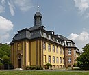
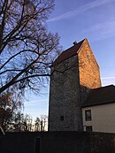
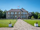
List of castles and palaces in Lower Saxony
This list shows the castles and palaces in the German state of Lower Saxony . These buildings, some of which can look back on 1000 years of history, were the scene of historical events and the workplaces of well-known personalities. They are often impressive buildings to this day. Are not counted to ornamental and replicas that were never used as a residence or for defense. After counting and recording the Lower Saxon castles , palaces , forts and palaces by the Lower Saxony State Office for Heritage feature at August 2018 1397 buildings (including about 200 fortifications 38) plus King Pfalzen registered, of the castle database "EBIDAT" German Castles Association were matched . Some of the castles in Lower Saxony are not listed in "EBIDAT" in order to protect them from robbery graves .
Ammerland district
![]() Map with all coordinates of the section Ammerland district : OSM
Map with all coordinates of the section Ammerland district : OSM
| Surname | Place / location | Type | Remarks | image |
|---|---|---|---|---|
| Elmendorf Castle |
Elmendorf 53 ° 12 ′ 49 ″ N, 8 ° 1 ′ 17 ″ E |
moth | The castle was probably built as a moth in the 9th century. There was also a twelve-sided residential tower. |

|
| Rastede Castle |
Rastede 53 ° 14 ′ 33 ″ N, 8 ° 12 ′ 7 ″ E |
lock | The castle, which is not open to the public, is located in the middle of an English-style park landscape. |

|
| Fikensolt Castle |
Westerstede 53 ° 14 ′ 29 ″ N, 7 ° 55 ′ 25 ″ E |
lock | The moated castle was built in the second half of the 18th century. The castle cannot be visited. |
|
| Mansing Castle |
Westerstede - Mansie 53 ° 14 ′ 27 ″ N, 7 ° 54 ′ 35 ″ E |
Castle (moth) | Documented in 1226; Abandoned at the end of the 14th century; Burgstall, cultural monument in LSG |

|
| Dringenburg Castle |
Dringenburg 53 ° 17 ′ 20 ″ N, 8 ° 4 ′ 43 ″ E |
Castle | Only mentioned as Dringenborch in 1383, archaeologically researched in the 1970s. |
Individual evidence
Location according to the historical map:
- Dringenburg Castle
- Measuring table sheet 1286: Wiefelstede, 1900 Wiefelstede. - record 1898. - 1: 25000. - [Berlin]: Reichsamt für Landesaufnahme, 1900
- online excerpt: kartenforum.slub-dresden
Aurich district
![]() Map with all coordinates of the section Aurich district : OSM
Map with all coordinates of the section Aurich district : OSM
| Surname | Place / location | Type | Remarks | image |
|---|---|---|---|---|
| Aurich Castle |
Aurich 53 ° 28 ′ 5 ″ N, 7 ° 28 ′ 40 ″ E |
lock | A first castle was built in 1380. The present castle was built between 1851 and 1855 on the foundation walls of 1448. |

|
| Beningaburg |
Dornum 53 ° 38 ′ 50 "N, 7 ° 25 ′ 48" E |
Castle |

|
|
| Beningaburg (Osterburg) | Krummhörn- Grimersum 53 ° 28 ′ 37 ″ N, 7 ° 10 ′ 32 ″ E |
Moated castle | Ruins |

|
| Beningaburg |
Brookmerland municipality - Willum 53 ° 28 ′ 37 ″ N, 7 ° 11 ′ 30 ″ E |
Moated castle | Burgstall, terps visible, information board |

|
| Norderburg Castle |
Dornum 53 ° 39 ′ 0 ″ N, 7 ° 25 ′ 0 ″ E |
Moated castle |

|
|
| Berum Castle |
Hage-Berum 53 ° 36 ′ 5 ″ N, 7 ° 17 ′ 50 ″ E |
Castle |

|
|
| Fresenhaus |
Rear - Loppersum 53 ° 25 ′ 30 ″ N, 7 ° 13 ′ 58 ″ E |
Castle, stone house | overbuilt with a castle, |

|
| Greetsiel Castle | Krummhörn- Greetsiel 53 ° 29 ′ 55 ″ N, 7 ° 5 ′ 53 ″ E |
Castle | Ancestral seat of the East Frisian count and princely family Cirksena , built between 1457 and 1460, demolished in 1777, individual houses preserved |

|
| Hinta Castle |
Rear 53 ° 24 ′ 46 ″ N, 7 ° 10 ′ 56 ″ E |
Moated castle | Preserved, today four-wing complex with a large inner courtyard and moat |

|
| Lütetsburg Castle |
Hage-Lütetsburg 53 ° 35 ′ 59 ″ N, 7 ° 15 ′ 47 ″ E |
lock |

|
|
| Midlum Castle |
Rear - Large Midlum 53 ° 24 ′ 36 ″ N, 7 ° 9 ′ 33 ″ E |
Niederungsburg | gone, only remnants of the wall with archway and base stone survived |

|
| Middelsteburg | Krummhörn-Groothusen 53 ° 26 ′ 4 ″ N, 7 ° 3 ′ 58 ″ E |
Niederungsburg, tower house | demolished, vault built over with villa |

|
| Nordeck Castle |
Hage-Berum 53 ° 36 ′ 12 ″ N, 7 ° 17 ′ 41 ″ E |
lock |

|
|
| Manningaburg |
Krummhörn - Pewsum 53 ° 26 ′ 8 ″ N, 7 ° 5 ′ 42 ″ E |
Castle |

|
|
| Oldeborg Castle (also Broke Castle ) |
Südbrookmerland - Oldeborg 53 ° 30 ′ 0 ″ N, 7 ° 19 ′ 58 ″ E |
Moated castle | Loosened in 1427, passed away | |
| Osterburg | Krummhörn- Groothusen 53 ° 26 ′ 7 ″ N, 7 ° 4 ′ 8 ″ E |
Moated castle | received rebuilt |

|
| Ulferts Börg |
Upgant bulkhead 53 ° 31 ′ 11 ″ N, 7 ° 17 ′ 0 ″ E |
Castle |

|
|
| Upleward Castle | Krummhörn- Upleward 53 ° 25 ′ 21 ″ N, 7 ° 2 ′ 44 ″ E |
Moated castle | Dismissed in 1782 |

|
| Uttum Castle | Krummhörn- Uttum 53 ° 27 ′ 6 ″ N, 7 ° 9 ′ 16 ″ E |
Beninga water castle | no remains, only graves available, modern house |

|
| Westerburg |
Dornum 53 ° 38 ′ 55 "N, 7 ° 25 ′ 36" E |
Moated castle with outer bailey | departed | |
| Westerburg Dornum | Krummhörn- Grimersum |
Castle | departed | |
| Westerburg Groothusen | Krummhörn-Groothusen 53 ° 26 ′ 9 ″ N, 7 ° 3 ′ 40 ″ E |
Moated castle | no remains, only grafts, ramparts and outer bailey buildings have been preserved | |
| Westerburg rear |
Rear 53 ° 24 ′ 46 ″ N, 7 ° 10 ′ 55 ″ E |
Wasserburg (probably stone house) | departed | |
| Westerhusen Castle |
Rear - Westerhusen 53 ° 24 ′ 46 ″ N, 7 ° 10 ′ 56 ″ E |
Niederungsburg, stone house | Burgstall, troops of the city of Hamburg destroyed the castle in 1436; Grafts and Zingel as well as the palace from 1600 preserved |

|
City of Braunschweig
![]() Map with all coordinates of the section City of Braunschweig : OSM
Map with all coordinates of the section City of Braunschweig : OSM
| Surname | Place / location | Type | Remarks | image |
|---|---|---|---|---|
| Dankwarderode Castle |
Braunschweig 52 ° 15 ′ 53 ″ N, 10 ° 31 ′ 27 ″ E |
Castle | Dankwarderode Castle was built between 1160 and 1175. The castle was the residence of the Brunswick dukes for centuries and is now part of the Herzog Anton Ulrich Museum . |

|
| Brunswick Castle |
Braunschweig 52 ° 15 ′ 47 ″ N, 10 ° 31 ′ 38 ″ E |
lock | The construction of the palace, which was the residence of the Brunswick dukes from 1753 to 1918 , began in 1717 under the direction of the master builder Hermann Korb on the site of an economic yard of the Cistercian monks . The building was destroyed by fire in 1830; the successor building based on plans by the court architect Carl Theodor Ottmer was inaugurated in 1841. This building was badly damaged in World War II and demolished in 1960. From 2005 to 2007 the “Schloss Arkaden” shopping center was built on this site, the front of which is a reconstruction of the old castle facade. |

|
| Richmond Castle |
Braunschweig 52 ° 14 ′ 24 ″ N, 10 ° 31 ′ 36 ″ E |
lock | The small baroque palace was built in 1768/69 by the later Duke Karl Wilhelm Ferdinand for his wife Duchess Augusta . The city of Braunschweig acquired the property in 1935 and uses the building for public events. The park, which is around four hectares today, was reconstructed in 1987 according to original plans and is open to the public. |

|
| New Richmond Castle |
Braunschweig 52 ° 14 ′ 33 ″ N, 10 ° 31 ′ 37 ″ E |
lock | The castle was built from 1833 by Duke Wilhelm von Braunschweig . The main buildings were the “ducal villa” and the “cavalier house”. The castle was abandoned in 1901 and demolished in 1906. |

|
District of Celle
![]() Map with all coordinates of the district of Celle : OSM
Map with all coordinates of the district of Celle : OSM
| Surname | Place / location | Type | Remarks | image |
|---|---|---|---|---|
| Bredebeck Castle |
Bergen Training Area 52 ° 47 ′ 14 ″ N, 9 ° 53 ′ 25 ″ E |
Mansion | The mansion was built from 1901 to 1902. It is located between the former towns of Hörsten and Hohne on the Bergen military training area and is not open to the public. |

|
| Eldingen Castle |
Eldingen 52 ° 41 ′ 17 ″ N, 10 ° 20 ′ 38 ″ E |
Mansion |

|
|
| Celle Castle |
Celle 52 ° 37 '26 "N, 10 ° 4' 40" E |
lock |

|
District of Cloppenburg
![]() Map with all coordinates of the district of Cloppenburg : OSM
Map with all coordinates of the district of Cloppenburg : OSM
| Surname | Place / location | Type | Remarks | image |
|---|---|---|---|---|
| Cloppenburg Castle |
Cloppenburg 52 ° 50 ′ 49 "N, 8 ° 2 ′ 42" E |
Castle | The castle was built in 1297. On August 24, 1716 the castle buildings burned down. In 1805 the castle tower was blown up and then an office building was built. In 1909 the district court was added. |

|
District of Cuxhaven
![]() Map with all coordinates of the district of Cuxhaven : OSM
Map with all coordinates of the district of Cuxhaven : OSM
| Surname | Place / location | Type | Remarks | image |
|---|---|---|---|---|
| Otterndorf Castle | Otterndorf 53 ° 48 ′ 32 ″ N, 8 ° 53 ′ 53 ″ E |
lock | The first castle in Otterndorf existed before 1400, but it was destroyed in the armed conflict around 1400, and another was demolished before 1773 because it was in disrepair. Today's castle, located in a small park with very old trees, dates from 1773 and today houses the Otterndorf District Court . | |
| Ritzebüttel Castle |
Cuxhaven 53 ° 51 '26 "N, 8 ° 41' 54" E |
lock | A castle was built here around 1340. From 1981 to 1996 the castle was renovated. Today there is a restaurant, exhibition rooms and a wedding room. All rooms can be visited. |

|
| Bederkesa Castle |
Bad Bederkesa 53 ° 37 ′ 35 ″ N, 8 ° 50 ′ 35 ″ E |
Castle |
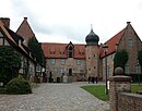
|
|
| Hagen Castle in the Bremen region |
Hagen in Bremen 53 ° 21 ′ 9 ″ N, 8 ° 38 ′ 21 ″ E |
Castle |

|
City of Delmenhorst
![]() Map with all coordinates of the section Stadt Delmenhorst : OSM
Map with all coordinates of the section Stadt Delmenhorst : OSM
| Surname | Place / location | Type | Remarks | image |
|---|---|---|---|---|
| Delmenhorst Castle |
Delmenhorst 53 ° 2 ′ 44 ″ N, 8 ° 37 ′ 38 ″ E |
Moated castle | The castle was probably built from 1234 onwards; it was first mentioned in a document in 1259. It formed the nucleus of Delmenhorst. From 1711 the castle was demolished, in 1787 the castle tower was the last to be dismantled and used as a stone store for the "Peter Elisabeth Hospital". Today there is a park here. |

|
District of Diepholz
![]() Map with all coordinates of the district of Diepholz : OSM
Map with all coordinates of the district of Diepholz : OSM
| Surname | Place / location | Type | Remarks | image |
|---|---|---|---|---|
| Freudenberg Castle (Bassum) |
Bassum 52 ° 50 ′ 42 "N, 8 ° 42 ′ 51" E |
Niederungsburg | The castle was probably built as a moth in the 14th century. From 1852 to 1974 Freudenburg Castle served as the seat of the Freudenberg District Court. Today the buildings are used by the adult education center as a seminar and conference center. |

|
| Diepholz Castle |
Diepholz 52 ° 36 ′ 13 ″ N, 8 ° 22 ′ 21 ″ E |
Moated castle | The moated castle was built at the turn of the 10th to the 11th century. |

|
| Auburg |
Wagenfeld 52 ° 33 ′ 31 ″ N, 8 ° 34 ′ 43 ″ E |
Protective festivals | The Auburg was built at the end of the 15th century as a protective fortress. |

|
Emsland district
![]() Map with all coordinates of the district Emsland : OSM
Map with all coordinates of the district Emsland : OSM
| Surname | Place / location | Type | Remarks | image |
|---|---|---|---|---|
| Good Altenkamp |
Aschendorf 53 ° 3 ′ 11 ″ N, 7 ° 20 ′ 30 ″ E |
Mansion |

|
|
| Good campe |
Stone image 52 ° 55 ′ 10 ″ N, 7 ° 18 ′ 45 ″ E |
grange |

|
|
| Clemenswerth Hunting Lodge |
Sögel 52 ° 50 ′ 18 ″ N, 7 ° 32 ′ 14 ″ E |
Hunting seat | The castle was built between 1737 and 1747. The hunting lodge and its outbuildings are open to visitors and house the Emslandmuseum Schloss Clemenswerth. |

|
| Dankern Castle |
Haren 52 ° 47 ′ 42 "N, 7 ° 12 ′ 2" E |
lock |

|
|
| Herzford Castle |
Lingen 52 ° 28 ′ 35 ″ N, 7 ° 17 ′ 7 ″ E |
lock |

|
District of Friesland
![]() Map with all coordinates of the district Friesland section : OSM
Map with all coordinates of the district Friesland section : OSM
| Surname | Place / location | Type | Remarks | image |
|---|---|---|---|---|
| Jever Castle |
Jever 53 ° 34 ′ 20 ″ N, 7 ° 54 ′ 11 ″ E |
lock |

|
|
| Moated Castle of Gödens |
Neustadtgödens , Sande 53 ° 29 ′ 7 ″ N, 7 ° 57 ′ 53 ″ E |
lock |

|
|
| Neuchâtel Castle |
Neuchâtel 53 ° 23 ′ 22 ″ N, 7 ° 56 ′ 56 ″ E |
lock | The castle was built in 1462. At the end of the 16th century the castle was converted into a palace. Today the castle houses an ornithological museum, the castle chapel of the Evangelical-Lutheran community and a wedding hall, which is also the meeting room of the Zetel municipal council. |

|
| Fischhausen Castle |
Wangerland 53 ° 38 ′ 28 ″ N, 7 ° 59 ′ 49 ″ E |
Castle |

|
|
| Christiansburg | Varel (harbor) | fortress | ||
| Ellenserdamm fortress | Ellen's | fortress | Fortress to protect the Ellenser Dam |
Gifhorn district
![]() Map with all coordinates of the Gifhorn district section : OSM
Map with all coordinates of the Gifhorn district section : OSM
| Surname | Place / location | Type | Remarks | image |
|---|---|---|---|---|
| Brome Castle |
Brome 52 ° 36 ′ 11 "N, 10 ° 56 ′ 55" E |
Castle | The castle was first mentioned in 1203, so it must have been built before that. The ownership changed over time. From 2009 to 2014 the castle was completely renovated. The castle has been accessible again since 2014 and is used as a museum. |

|
| Gifhorn Castle |
Gifhorn 52 ° 29 ′ 22 ″ N, 10 ° 32 ′ 50 ″ E |
lock | The castle was built from 1525 to 1581 in the Weser Renaissance style. Today, in addition to the Gifhorn district facilities, there is also a museum. |

|
| Mundburg |
Tired (Aller) 52 ° 31 ′ 9 ″ N, 10 ° 22 ′ 4 ″ E |
Castle | The castle was built in 993. The castle has gone. |

|
| Wahrenholz Castle |
Wahrenholz 52 ° 36 ′ 56 ″ N, 10 ° 36 ′ 25 ″ E |
Wallburg |

|
District of Goslar
![]() Map with all coordinates of the district Goslar : OSM
Map with all coordinates of the district Goslar : OSM
District of Göttingen
![]() Map with all coordinates of the district of Göttingen : OSM
Map with all coordinates of the district of Göttingen : OSM
| Surname | Place / location | Type | Remarks | image |
|---|---|---|---|---|
| Adelebsen Castle |
Adelebsen 51 ° 34 ′ 39 ″ N, 9 ° 44 ′ 55 ″ E |
Höhenburg, rock castle | Medieval castle on a rock above the village. The tower that characterizes today's image of the castle was built around the 14th and 15th centuries. After it was destroyed in the Thirty Years War, it was rebuilt as a castle, which is still privately owned today. |

|
| Frauenstein Castle | Bad Lauterberg |

|
||
| Bernshausen Castle | Bernshausen | moth | ||
| Plesse Castle |
Bovenden 51 ° 35 ′ 51 ″ N, 9 ° 57 ′ 57 ″ E |
Castle |

|
|
| Friedland Castle |
Friedland 51 ° 25 ′ 3 ″ N, 9 ° 55 ′ 6 ″ E |
Hilltop castle | Built in 1280 as a Guelph border castle to Hesse, destroyed in 1625, demolished around 1780, castle ruins: castle hill and remains of walls |

|
| Bodenhausen Castle |
Friedland - Ballenhausen 51 ° 27 ′ 5 ″ N, 9 ° 58 ′ 4 ″ E |
Castle | Spornburg probably from the 12th century, destroyed several times in 1396 and 1400, castle ruins: castle hill, terrain formation |

|
| Gieboldehausen Castle |
Gieboldehausen 51 ° 36 ′ 34 ″ N, 10 ° 12 ′ 49 ″ E |
lock | Gieboldehausen moated castle as a predecessor |

|
|
The same ( old and new same) |
Same 51 ° 28 ′ 2 ″ N, 10 ° 2 ′ 19 ″ E |
Castles |

|
|
|
Niedeck Castle (Alte Niedeck) |
Gleichen - Benniehausen - Niedeck 51 ° 30 ′ 2 ″ N, 10 ° 3 ′ 43 ″ E |
Hilltop castle | 13th century, disintegrated in the 17th century, castle stable with visible castle hill; was the official seat of the small office of Niedeck , from the 2nd half of the 17th century this function was taken over by the domain / manor Niedeck in the valley to the southeast |

|
| Reinhausen Castle |
Gleichen - Reinhausen 51 ° 28 ′ 4 ″ N, 9 ° 59 ′ 0 ″ E |
Castle | gone, built over with monastery complex while retaining parts of the castle | |
| Palatinate Grona |
Göttingen 51 ° 33 ′ 7 ″ N, 9 ° 54 ′ 46 ″ E |
Palatinate |

|
|
| Bramburg |
Hann. Münden 51 ° 31 ′ 7 ″ N, 9 ° 36 ′ 16 ″ E |
Castle ruins |

|
|
| Welfenschloss Münden |
Hann. Münden 51 ° 25 ′ 5 ″ N, 9 ° 39 ′ 16 ″ E |
lock |

|
|
| Herzberg Castle | Herzberg am Harz |

|
||
| Scharzfels Castle | Herzberg am Harz |

|
||
| Jühnde Castle |
Jühnde 51 ° 27 ′ 45 ″ N, 9 ° 48 ′ 1 ″ E |
lock |

|
|
| Old castle | Osterode am Harz |
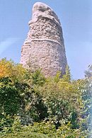
|
||
| Lichtenstein castle ruins | Osterode am Harz |

|
||
| Palatinate Pöhlde | Poehlde |

|
||
| Brackenburg castle ruins |
Scheden 51 ° 25 ′ 59 ″ N, 9 ° 44 ′ 51 ″ E |

|
||
| Sichelnstein castle ruins |
Staufenberg 51 ° 21 ′ 2 ″ N, 9 ° 38 ′ 16 ″ E |
Castle ruins |

|
County of Grafschaft Bentheim
![]() Map with all coordinates of the district Grafschaft Bentheim section : OSM
Map with all coordinates of the district Grafschaft Bentheim section : OSM
| Surname | Place / location | Type | Remarks | image |
|---|---|---|---|---|
| Bentheim Castle |
Bad Bentheim 52 ° 18 ′ 9 ″ N, 7 ° 9 ′ 22 ″ E |
Castle | The castle was built in the 11th century. There is a wedding room in the castle. Today the castle can be visited. |

|
Hameln-Pyrmont district
![]() Map with all coordinates of the district Hameln-Pyrmont section : OSM
Map with all coordinates of the district Hameln-Pyrmont section : OSM
Hanover region
![]() Map with all coordinates of the Hannover Region section : OSM
Map with all coordinates of the Hannover Region section : OSM
| Surname | Place / location | Type | Remarks | image |
|---|---|---|---|---|
| Stemmen manor |
Barsinghausen 52 ° 20 ′ 37 ″ N, 9 ° 31 ′ 22 ″ E |
Manor | The manor house of the former manor was laid out around 1560/1580. Around 1875 it was significantly redesigned. The oldest farm buildings were built around 1700. |

|
| Ricklingen Castle |
Ricklingen Castle , Garbsen 52 ° 25 ′ 28 ″ N, 9 ° 30 ′ 23 ″ E |
Office building | The forerunner was a moated castle built around 1225. The office building, built in 1399 in the forecourt of the castle, was replaced around 1600 by a two-storey half-timbered building handed down from Merian. Around 1750 it was transformed into a representative office building. |

|
| Linen lock |
Hanover 52 ° 22 ′ 14 ″ N, 9 ° 44 ′ 0 ″ E |
lock |

|
|
| Herrenhausen Palace ( reconstruction 2013) |
Hanover 52 ° 23 '28 "N, 9 ° 41' 52" E |
lock | The castle was completely destroyed in the Second World War in 1943. It was rebuilt by 2013, the facade has been rebuilt true to the original. Inside there is a day center. |

|
| Welfenschloss |
Hanover 52 ° 22 ′ 57 ″ N, 9 ° 43 ′ 4 ″ E |

|
||
| George's Palace |
Hanover 52 ° 23 ′ 3 ″ N, 9 ° 42 ′ 28 ″ E |
Palace | Today the Georgenpalais is used as the Wilhelm Busch - German Museum for Caricature and Drawing (previously: Wilhelm Busch Museum). |

|
| Fürstenhaus Herrenhausen Museum |
Hanover 52 ° 23 '32 "N, 9 ° 41' 34" E |

|
||
| Hardenberg's house |
Hanover 52 ° 23 ′ 31 ″ N, 9 ° 41 ′ 42 ″ E |
Mansion |

|
|
| Wangenheim Palace |
Hanover 52 ° 22 ′ 9 ″ N, 9 ° 44 ′ 5 ″ E |
Palace |

|
|
| Landestrost Castle |
Neustadt am Rübenberge 52 ° 30 ′ 9 ″ N, 9 ° 27 ′ 47 ″ E |
lock |

|
|
| Calenberg Castle |
Pattensen - Schulenburg 52 ° 11 ′ 47 ″ N, 9 ° 47 ′ 47 ″ E |
Castle ruins | The castle was built near the Leine in 1292. After the Thirty Years' War the castle fell asleep. Today walls and cellars are still there. |

|
| Marienburg Castle |
Pattensen 52 ° 10 ′ 22 ″ N, 9 ° 45 ′ 58 ″ E |
lock | The castle was built from 1857 to 1867 according to plans by Conrad Wilhelm Hase and Edwin Oppler . The castle can be visited today. |

|
| Pattensen Castle |
Pattensen 52 ° 15 ′ 45 ″ N, 9 ° 45 ′ 50 ″ E |
Burgstall | The castle was built at the beginning of the 13th century, much later than the village. Only a hill remains from the castle today. |

|
| Hunting lodge Springe |
Jump 52 ° 11 ′ 20 ″ N, 9 ° 34 ′ 25 ″ E |
Hunting lodge |

|
|
| Wilhelmstein Fortress |
Steinhude , Wunstorf 52 ° 27 ′ 38 ″ N, 9 ° 18 ′ 27 ″ E |
fortress |

|
|
| Bokeloh Castle |
Wunstorf 52 ° 24 ′ 38 ″ N, 9 ° 22 ′ 23 ″ E |
lock |

|
Harburg district
![]() Map with all coordinates of the district Harburg : OSM
Map with all coordinates of the district Harburg : OSM
| Surname | Place / location | Type | Remarks | image |
|---|---|---|---|---|
| Winsen Castle |
Winsen (Luhe) 53 ° 21 ′ 47 ″ N, 10 ° 12 ′ 15 ″ E |
lock | First a castle was built here, this was first mentioned in a document in 1315. Around 1600 the castle was converted into a palace. Today the district court is located here. |

|
Heidekreis district
![]() Map with all coordinates of the district Heidekreis section : OSM
Map with all coordinates of the district Heidekreis section : OSM
| Surname | Place / location | Type | Remarks | image |
|---|---|---|---|---|
| Ahlden Castle |
Ahlden 52 ° 45 ′ 33 ″ N, 9 ° 33 ′ 28 ″ E |
Moated castle | The moated castle was built from 1549. It is used as an art auction house. |

|
| Rethem Castle |
Rethem (Aller) 52 ° 47 ′ 6 ″ N, 9 ° 23 ′ 8 ″ E |
Castle | The castle was built in the 13th century. Due to the extensive destruction, only a few walls are left of the original castle. From 2004 the castle courtyard was rebuilt. |

|
District of Helmstedt
![]() Map with all coordinates of the district Helmstedt : OSM
Map with all coordinates of the district Helmstedt : OSM
| Surname | Place / location | Type | Remarks | image |
|---|---|---|---|---|
| Castle camping |
Gauge 52 ° 21 ′ 9 ″ N, 10 ° 42 ′ 33 ″ O |
Castle |

|
|
| Essenrode mansion |
Gauge 52 ° 22 ′ 18 ″ N, 10 ° 38 ′ 7 ″ O |
Mansion | The mansion was built in 1738. The mansion is located in a park and is surrounded by a moat. The von Bülow and von Lüneburg families lived here, among others . |

|
| Wendhausen Castle |
Gauge 52 ° 19 ′ 10 ″ N, 10 ° 37 ′ 58 ″ O |
lock |

|
|
| Schöningen Castle |
Schöningen 52 ° 8 ′ 26 ″ N, 10 ° 57 ′ 54 ″ E |
lock |

|
|
| Warberg Castle |
Warberg 52 ° 11 ′ 0 ″ N, 10 ° 55 ′ 0 ″ E |
Castle |

|
|
| Warburg castle ruins |
Warberg 52 ° 10 ′ 11 ″ N, 10 ° 53 ′ 59 ″ E |
Burgstall |
|
Hildesheim district
![]() Map with all coordinates of the section Hildesheim district : OSM
Map with all coordinates of the section Hildesheim district : OSM
| Surname | Place / location | Type | Remarks | image |
|---|---|---|---|---|
| Ahrbergen Castle | Ahrbergen | Hilltop castle | departed | |
| Brüggen Castle |
Brüggen 52 ° 2 ′ 33 ″ N, 9 ° 46 ′ 29 ″ E |
lock | The castle was built in 1693 by Friedrich von Steinberg according to plans by the Wolfenbüttel court architect Hermann Korb . The castle has been owned by the Barons von Cramm since 1911, and the castle complex is only accessible during events. |

|
| Wohldenberg Castle |
Holle 52 ° 3 ′ 31 ″ N, 10 ° 9 ′ 11 ″ E |
Castle ruins | The former castle stands at the entrance to the Ambergau . Important hand routes ran in north-south and west-east directions below the castle. The castle was built between 1153 and 1160. Today there is a youth education center here. |

|
| Söder Castle |
Holle 52 ° 3 ′ 23 ″ N, 10 ° 5 ′ 22 ″ E |
lock | The origin of the palace complex is a small castle with an agricultural estate that belonged to the Lords of Bortfeld . In 1690 the Jobst estate was transferred to Edmund von Brabeck , who had the castle built on this site from 1741 to 1742. The castle housed an extensive art collection that Friedrich Moritz von Brabeck had amassed from 1788. The art collection was sold in 1859. The castle is now privately owned and is not open to the public. |

|
| Imperial Palace Dahlum |
Königsdahlum 51 ° 59 ′ 9 ″ N, 10 ° 7 ′ 13 ″ E |
Imperial Palace | The Palatinate was an important base for the Ottonians in the 10th century and was visited five times by King Otto I alone between 936 and 950 . The complex, of which there are no more remains today, was destroyed by Heinrich the Lion in 1192 . |

|
| Henneckenrode Castle |
Holle 52 ° 3 ′ 32 ″ N, 10 ° 7 ′ 44 ″ E |
lock | The castle was built in 1579 by Heinrich von Saldern in the Weser Renaissance style. The following year the palace garden was laid out according to the Italian model. The castle was converted into an orphanage in 1838 and is used today by the child and youth welfare of the Caritas Association of the Diocese of Hildesheim. |

|
| Rautenberg Castle |
Harsum - Rautenberg 52 ° 13 ′ 18 ″ N, 10 ° 2 ′ 11 ″ E |
Tower Hill Castle | Motte of the 13th century of the lower aristocratic family Rautenberg , 1480 part of the local fortification, abandoned in the Thirty Years War at the latest, today Burgstall |

|
| Rheden Castle |
Rheden 52 ° 3 ′ 26 ″ N, 9 ° 47 ′ 24 ″ E |
lock | The castle was built in 1729 as a mansion for the von Rheden family. The family came from an old noble family of the Hildesheim diocese , which was first mentioned in a document in 1251. The castle was rebuilt to its present form in 1899 and is privately owned. |

|
| Steinbrück Castle |
Steinbrück 52 ° 13 ′ 6 ″ N, 10 ° 13 ′ 5 ″ E |
Castle | The moated castle was built in 1383, it is located directly on the Fuhse River . The castle separates the Hildesheim Monastery from the Duchy of Braunschweig . In the 1950s, the Kehrwiederturm battery tower was expanded into a church. |

|
| Nettlingen Castle |
Nettlingen 52 ° 9 ′ 44 ″ N, 10 ° 9 ′ 21 ″ E |
lock | The castle was built by Kurt von Saldern around 1570 on the site of a former wall courtyard. The von Cramm family later bought the castle, but sold it again before the Second World War. Today the building is rented to several parties. |
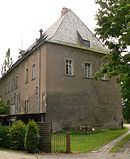
|
| Winzenburg Castle |
Winzenburg 51 ° 56 ′ 35 ″ N, 9 ° 56 ′ 42 ″ E |
Castle | Essentially only parts of the castle keep are still in existence. The castle was built between 1130 and 1150, although a castle must have stood here before, because the first documentary mention was in 1109. |

|
| Wrisbergholzen Castle |
Wrisbergholzen 52 ° 1 ′ 45 ″ N, 9 ° 54 ′ 52 ″ E |
lock | Erected between 1740 and 1745 by Freiherr Johann Rudolph von Wrisberg in the Baroque style. |

|
| Derneburg |
Derneburg 52 ° 5 ′ 42 ″ N, 10 ° 7 ′ 13 ″ E |
lock | The castle emerged from the Augustinian women's choir foundation of Derneburg, which was founded in 1213 and converted into a Cistercian monastery in 1651 . The monastery was dissolved in 1803 as a result of secularization and in 1815 by King George III. given to his minister Ernst Friedrich Herbert zu Munster . His son had the monastery building converted into a Tudor-style castle from 1846–1848 . The zu Münster family sold the castle in 1975 and it is now privately owned. |

|
Holzminden district
![]() Map with all coordinates of the district of Holzminden : OSM
Map with all coordinates of the district of Holzminden : OSM
| Surname | Place / location | Type | Remarks | image |
|---|---|---|---|---|
| Bodenburg Castle |
Bodenburg 52 ° 1 ′ 37 ″ N, 10 ° 0 ′ 27 ″ E |
lock | Castle building from a 12th century castle |

|
| Bevern Castle |
Bevern 51 ° 51 ′ 26 ″ N, 9 ° 29 ′ 46 ″ E |
lock |

|
|
| Bodenwerder Castle |
Bodenwerder 51 ° 58 ′ 34 ″ N, 9 ° 30 ′ 48 ″ E |
Castle of Baron Munchausen . |
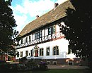
|
|
| Everstein Castle |
Negenborn 51 ° 52 ′ 37 ″ N, 9 ° 32 ′ 40 ″ E |
Castle Hill |

|
|
| Hehlen moated castle |
Hollow 51 ° 59 ′ 15 ″ N, 9 ° 28 ′ 28 ″ E |
Moated castle | preserved, privately owned, Weser Renaissance |

|
| Homburg |
Stadtoldendorf 51 ° 54 ′ 7 ″ N, 9 ° 38 ′ 33 ″ E |
ruin |

|
|
| Lauenburg |
Bodenwerder 51 ° 59 ′ 44 ″ N, 9 ° 31 ′ 11 ″ E |
Spurburg | Castle stable, castle hill and moat preserved |

|
| Neuhaus Hunting Lodge (Solling) |
Neuhaus im Solling 51 ° 45 ′ 12 ″ N, 9 ° 31 ′ 24 ″ E |

|
||
| Polle castle ruins |
Polle 51 ° 53 ′ 50 ″ N, 9 ° 24 ′ 25 ″ E |
ruin |

|
|
| Poppenburg |
Holzen 51 ° 56 ′ 22 ″ N, 9 ° 40 ′ 28 ″ E |
Burgstall | Wall and moat remains of an abandoned spur castle, only rediscovered in 1984 |
District of Leer
![]() Map with all coordinates of the district of Leer : OSM
Map with all coordinates of the district of Leer : OSM
| Surname | Place / location | Type | Remarks | image |
|---|---|---|---|---|
| Stone house Bunderhee | Bunderhee | Stone house |

|
|
| Stickhausen Castle | Detern |

|
||
| Evenburg | Loga |

|
||
| Haneburg | Empty |

|
||
| Philippsburg |
Loga 53 ° 14 ′ 15 ″ N, 7 ° 29 ′ 49 ″ E |

|
||
| Harderwykenburg |
Empty 53 ° 13 ′ 46 ″ N, 7 ° 26 ′ 54 ″ E |
Castle |

|
Lüchow-Dannenberg district
![]() Map with all coordinates of the district Lüchow-Dannenberg section : OSM
Map with all coordinates of the district Lüchow-Dannenberg section : OSM
| Surname | Place / location | Type | Remarks | image |
|---|---|---|---|---|
| Dannenberg Castle with Waldemart Tower |
Dannenberg 53 ° 5 ′ 58 ″ N, 11 ° 5 ′ 52 ″ E |
lock |

|
|
| Göhrde hunting lodge |
Goehrde 53 ° 8 ′ 26 ″ N, 10 ° 52 ′ 42 ″ E |
Hunting lodge | The hunting lodge was built between 1706 and 1709. The palace complex consisted of a two-winged and a three-story main building. Its use is unclear, but it is planned that a seminar center will be built. |

|
| Lüchow Castle |
Lüchow 52 ° 57 ′ 57 ″ N, 11 ° 9 ′ 20 ″ E |
lock | Gone |

|
| Gartow Castle |
Gartow 53 ° 1 ′ 21 ″ N, 11 ° 28 ′ 6 ″ E |
Mansion |

|
District of Lüneburg
![]() Map with all coordinates of the section Lüneburg district : OSM
Map with all coordinates of the section Lüneburg district : OSM
| Surname | Place / location | Type | Remarks | image |
|---|---|---|---|---|
| Bleckede Elbe Castle | Bleckede |
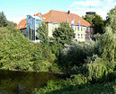
|
||
| Ludersburg Castle | Ludersburg |

|
||
| Lueneburg City Palace | Luneburg | lock | Today the district court of Lüneburg is located here. |

|
District of Nienburg / Weser
![]() Map with all coordinates of the district Nienburg / Weser : OSM
Map with all coordinates of the district Nienburg / Weser : OSM
| Surname | Place / location | Type | Remarks | image |
|---|---|---|---|---|
| Hoya Castle | Hoya |

|
||
| Brokeloh manor | Landesbergen-Brokeloh |

|
||
| Eickhof Castle | Liebenau |

|
||
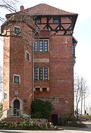
| Nienburg Castle with stock tower | Nienburg / Weser |
|
||
| Rehburg Castle | Rehburg |
|
Northeim district
![]() Map with all coordinates of the district Northeim : OSM
Map with all coordinates of the district Northeim : OSM
| Surname | Place / location | Type | Remarks | image |
|---|---|---|---|---|
| Nienover Castle |
Nienover 51 ° 40 ′ 50 ″ N, 9 ° 31 ′ 22 ″ E |
lock |

|
|
| Erichsburg |
Dassel 51 ° 49 ′ 21 ″ N, 9 ° 43 ′ 6 ″ E |
Castle |

|
|
| Hunnesrück Castle |
Dassel 51 ° 49 ′ 16 ″ N, 9 ° 40 ′ 57 ″ E |
Castle |

|
|
| Grubenhagen Castle |
Einbeck 51 ° 45 ′ 53 ″ N, 9 ° 49 ′ 2 ″ E |
Castle | The castle was probably built in the 13th century by Henry the Lion . It has not been used since the end of the 16th century. The 19 m high keep and an adjacent former horse stable from the 19th and 20th centuries have been preserved. Century. Both buildings were restored in the 1980s and are open to the public. |

|
| Heldenburg |
Einbeck 51 ° 47 '59 "N, 9 ° 54' 45" E |
Castle | There is a salt spring at the foot of the castle; the castle was built in the 13th century to protect this spring. Today services and events take place at the castle. |

|
| Hardeg Castle |
Hardegsen 51 ° 39 ′ 4 ″ N, 9 ° 49 ′ 34 ″ E |
Castle |

|
|
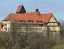
| Katlenburg |
Katlenburg-Lindau 51 ° 40 ′ 40 ″ N, 10 ° 6 ′ 1 ″ E |
Castle |
|
|
| New Lindau Castle | Lindau | Niederungsburg | Mushaus |

|
| Greene Castle |
Kreiensen 51 ° 51 ′ 15 ″ N, 9 ° 56 ′ 4 ″ E |
Castle |

|
|
| Hardenberg Castle | Norten-Hardenberg | Castle |

|
|
| Hardenberg Castle | Norten-Hardenberg | lock |

|
|
| Freudenthal castle ruins | Uslar | lock |

|
City of Oldenburg
![]() Map with all coordinates of the section City of Oldenburg : OSM
Map with all coordinates of the section City of Oldenburg : OSM
| Surname | Place / location | Type | Remarks | image |
|---|---|---|---|---|
| Oldenburg Castle |
Oldenburg 53 ° 8 ′ 16 ″ N, 8 ° 13 ′ 0 ″ E |
formerly a moated castle, now a castle |

|
|
| Heidenwall | Oldenburg | Ring wall | ||
| Donnerschwee Castle | Oldenburg | Niederungsburg | ||
| Beverbäke Castle | Oldenburg | moth |
District of Osnabrück
![]() Map with all coordinates of the district of Osnabrück : OSM
Map with all coordinates of the district of Osnabrück : OSM
City of Osnabrück
![]() Map with all coordinates of the section City of Osnabrück : OSM
Map with all coordinates of the section City of Osnabrück : OSM
District of Peine
![]() Map with all coordinates of the section Landkreis Peine : OSM
Map with all coordinates of the section Landkreis Peine : OSM
| Surname | Place / location | Type | Remarks | image |
|---|---|---|---|---|
| Fürstenau Castle | Fürstenau , municipality of Vechelde | Pleasure palace | demolished, a section of the castle moat was preserved |
|
| Oberg Castle | Oberg , Ilsede municipality |
|
||
| Ölsburg | Ölsburg , Ilsede municipality | Burgstall | Protective castle from the 9th to 10th centuries, built over by a canon monastery after 1000, the archaeological evidence of the Ölsburg was only provided in 2019 | |
| Peine Castle | Torment | Niederungsburg | from 1659 expanded like a fortress, between 1803 and 1816 demolition of all castle buildings, a section of the moat, remains of a casemate and an escarp wall remained |

|
| Sophiental Castle | Sophiental , Wendeburg municipality | Hunting and pleasure palace | worn away |
|
| Vechelde Castle | Vechelde | Hunting and pleasure palace | Demolished in 1880 and replaced by a neoclassical building |

|
| Vöhrum moated castle | Vöhrum | moth | underground remains |

|
| Moth from Wipshausen | Wipshausen , municipality of Edemissen | moth | departed |
|
Rotenburg (Wümme) district
![]() Map with all coordinates of the district of Rotenburg (Wümme) : OSM
Map with all coordinates of the district of Rotenburg (Wümme) : OSM
| Surname | Place / location | Type | Remarks | image |
|---|---|---|---|---|
| Bremervörde Castle |
Bremervörde 53 ° 28 ′ 59 ″ N, 9 ° 9 ′ 5 ″ E |
Castle | The first castle complex was built in the 12th century. In 1682 the castle was razed, only the office building remained. Today the Bachmann Museum is located here with the bog body from Bremervörde Gnattenbergswiesen . |

|
City of Salzgitter
![]() Map with all coordinates of the section Stadt Salzgitter : OSM
Map with all coordinates of the section Stadt Salzgitter : OSM
| Surname | Place / location | Type | Remarks | image |
|---|---|---|---|---|
| Gebhardshagen Castle |
Salzgitter-Gebhardshagen 52 ° 6 ′ 15 ″ N, 10 ° 21 ′ 31 ″ E |
Moated castle | First mentioned in 1186, the fortifications were the headquarters of the von Hagen family. After the Thirty Years War, the castle was rebuilt and was run as an agricultural domain. Today the facility is owned by the city of Salzgitter and is mainly used for events. |

|
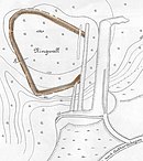
| Ringwall Gebhardshagen |
Salzgitter - Gebhardshagen 52 ° 6 ′ 16 ″ N, 10 ° 20 ′ 34 ″ E |
Fliehburg (ring wall) |
Early medieval Fliehburg, dry stone ring wall documented in 1933 |
|
| Lichtenberg Castle |
Salzgitter-Lichtenberg 52 ° 7 ′ 17 ″ N, 10 ° 17 ′ 19 ″ E |
Castle | The castle was built by Heinrich the Lion and served to secure his empire against the Duchy of Hildesheim and the city of Goslar . The castle was destroyed in 1552 by the troops of Count Vollrad von Mansfeld . At the end of the 19th century, the foundations were exposed and the keep was rebuilt as a lookout tower. |

|
| Ringelheim Palace and Park |
Salzgitter-Ringelheim 52 ° 2 ′ 4 ″ N, 10 ° 18 ′ 39 ″ E |
lock | The castle emerged from the Ringelheim monastery founded in 941 . This was secularized in 1803 and, after 1817, expanded by Adolf von der Betten into today's manor house. The Reichswerke Hermann Göring took over the castle in 1938 as the administrative seat, later it belonged to the state of Lower Saxony. The castle has been privately owned since 2002. |

|
| Salder Castle |
Salzgitter-Salder 52 ° 8 ′ 9 ″ N, 10 ° 20 ′ 15 ″ E |
lock | The renaissance castle was built in 1608 by David Sachse, a royal Brunswick colonel and privy councilor. Duke August Wilhelm von Braunschweig bought the palace in 1695 and had it rebuilt according to plans by the state master builder Hermann Korb . In 1939 the palace and the domain were taken over by the Reichswerke. Since 1954 the castle has belonged to the city of Salzgitter, which opened its municipal museum here in 1962. |

|
| Stederburg |
Salzgitter-Thiede 52 ° 11 ′ 36 ″ N, 10 ° 28 ′ 19 ″ E |
Burgstall | Protective castle from the 10th century, probably built at the instigation of Heinrich I (around 876–936) to ward off the Hungarian invasions . Overbuilt after 1000 by the Steterburg monastery . |
Schaumburg district
![]() Map with all coordinates of the district of Schaumburg : OSM
Map with all coordinates of the district of Schaumburg : OSM
District of Stade
![]() Map with all coordinates of the district of Stade : OSM
Map with all coordinates of the district of Stade : OSM
| Surname | Place / location | Type | Remarks | image |
|---|---|---|---|---|
| Agathenburg Castle | Agathenburg |

|
||
| Castle in the Dannsee | Beckdorf |
|
||
| Harsefeld Castle | Harsefeld |
|
||
| Horneburg Castle | Horneburg |
|
||
| Wehrscher Hof | Borstel |
|
||
| Esteburg Castle | Moor end |
|
District of Uelzen
![]() Map with all coordinates of the section Uelzen district : OSM
Map with all coordinates of the section Uelzen district : OSM
| Surname | Place / location | Type | Remarks | image |
|---|---|---|---|---|
| Bodenteich Castle |
Bad Bodenteich 52 ° 50 ′ 4 ″ N, 10 ° 40 ′ 59 ″ E |
Castle | The former moated castle was built in 1250. During the Hildesheim collegiate feud , the castle was destroyed and rebuilt in its present form. Today the castle is used for cultural events. |

|
| Holdenstedt Castle |
Uelzen - Holdenstedt 52 ° 55 ′ 2 ″ N, 10 ° 30 ′ 58 ″ E |
Castle, later a castle | Moated castle from the end of the 12th century replaced by a moated castle at the end of the 16th century. 1708 new baroque palace. Today museum of local history |

|
| Wichmannsburg |
Bienenbüttel - Wichmannsburg 53 ° 7 ′ 57 ″ N, 10 ° 30 ′ 41 ″ E |
Moated castle | The Wichmannsburg was probably built by Wichmann I in the first half of the 10th century . The remains of the castle are not preserved. |
District of Vechta
![]() Map with all coordinates of the section Vechta district : OSM
Map with all coordinates of the section Vechta district : OSM
| Surname | Place / location | Type | Remarks | image |
|---|---|---|---|---|
| Dinklage Castle |
Dinklage 52 ° 39 ′ 15 ″ N, 8 ° 8 ′ 12 ″ E |
Monastery and castle | A castle was mentioned in a document as early as 980. The current castle was built in 1394. A Benedictine monastery has been located here since 1941. |

|
| Hopen Castle |
Lohne 52 ° 39 ′ 26 ″ N, 8 ° 13 ′ 42 ″ E |
Moated castle | The moated castle was built in 1517. |

|
Verden district
![]() Map with all coordinates of the district Verden : OSM
Map with all coordinates of the district Verden : OSM
| Surname | Place / location | Type | Remarks | image |
|---|---|---|---|---|
| Etelsen Castle | Etelsen |

|
Wesermarsch district
![]() Map with all coordinates of the Wesermarsch district section : OSM
Map with all coordinates of the Wesermarsch district section : OSM
| Surname | Place / location | Type | Remarks | image |
|---|---|---|---|---|
| Elsfleth Hunting Lodge | Elsfleth |
|
||
| Friedeburg | Nordenham | Niederungsburg | Bremen fortress against the Frisians in Stadland and Butjadingen. | |
| Ovelgönne Castle | Ovelgönne | |||
| Langwarden stone house | Boredom | Frisian stone house | ||
| Vri jade | jade | |||
| Hoskenwurt Castle | Remove | |||
| Eiswürden Castle | Eckwarden | Frisian stone house | ||
| Hasenburg (Butjadingen) | Coarse warden | |||
| Sievertsborch | Langwarden | |||
| Oldeborch | Ruhwarden | |||
| Dornebbe Castle | Dornebbe | |||
| Lienenburg | Elsfleth | |||
| Lichtenberg | Elsfleth | |||
| Lauenburg | Berne | moth | ||
| Weyhausen Castle | Altenesch | Moated castle | ||
| Altena Castle | Bardfleth | |||
| Santborch | Elsfleth | |||
| Johanniter coming Roddens | Roddens | Frisian stone house | ||
| Johanniterkommende Inte | Inte | Frisian stone house | ||
| Finkenburg | Golzwarden | |||
| Harrierburg | Brake | |||
| Ellwürden Castle | Ellwild | |||
| Gutzwarden Castle | Butjadingen | |||
| Versfleth Castle | Lemwerder |
City of Wilhelmshaven
![]() Map with all coordinates of the section Stadt Wilhelmshaven : OSM
Map with all coordinates of the section Stadt Wilhelmshaven : OSM
| Surname | Place / location | Type | Remarks | image |
|---|---|---|---|---|
| Pinching | Wilhelmshaven |
|
||
| Stone house in Dauens | Wilhelmshaven | Stone house | ||
| Dauens log cabin | Wilhelmshaven | |||
| Sengwarden | Wilhelmshaven | |||
| Inhausen | Wilhelmshaven | |||
| Heddoburg | Wilhelmshaven | |||
| Cleaning two | Wilhelmshaven | |||
| Siebetsburg | Wilhelmshaven | Niederungsburg |

|
|
| Kniphausen Castle | Wilhelmshaven | Niederungsburg |

|
Wolfenbüttel district
![]() Map with all coordinates of the district Wolfenbüttel : OSM
Map with all coordinates of the district Wolfenbüttel : OSM
| Surname | Place / location | Type | Remarks | image |
|---|---|---|---|---|
| Oelber Castle |
Oelber am white path 52 ° 6 ′ 6 ″ N, 10 ° 14 ′ 16 ″ E |
lock | The circular palace complex was built around 1580 on the foundations of an earlier moated castle from the 12th century in the style of a Renaissance palace. From the beginning the castle belonged to the noble von Cramm family , who shared the property with other noble families until 1766. The facility was extensively renovated in 1974 and is open to the public at events such as trade fairs and exhibitions. |

|
| Destedt Castle |
Destedt 52 ° 14 ′ 23 "N, 10 ° 42 ′ 37" E |
Moated castle | Origin of the castle is in the middle ages resulting Wasserburg . It is the headquarters of the Brunswick ministerial family von Veltheim . The current building was built in 1693 by Joachim Ludolf von Veltheim in the baroque style. From 1750 a park was laid out in the north of the castle, which has been under landscape protection since 1953 and is open to the public. |

|
| Ampleben Castle |
Kneitlingen 52 ° 10 ′ 37 ″ N, 10 ° 44 ′ 43 ″ E |
Burgstall | The castle, surrounded by a moat, was built in the 12th century. At the beginning of the 15th century, the castle, which was considered the seat of muggers, was destroyed. According to tradition, Till Eulenspiegel was baptized here around 1300 . |
|
| Hornburg Castle |
Hornburg 52 ° 1 ′ 44 ″ N, 10 ° 36 ′ 26 ″ E |
Castle | The castle, located on a rock above the town, was first mentioned in a document in 994. It served the Halberstadt diocese to secure the trade routes from Halberstadt to Braunschweig and Hildesheim . The castle was attacked several times during the Thirty Years War and destroyed in 1645. From 1922 the castle was partially rebuilt using old engravings. The facility is now privately owned. |

|
| Veltheim Castle |
Veltheim (Ohe) 52 ° 13 ′ 8 ″ N, 10 ° 41 ′ 8 ″ E |
Moated castle | The origin was a moated castle built by the von Veltheim family in the 12th century , which was destroyed by the citizens of Brunswick in 1430. The von Veltheim family sold the complex in 1494 to the von Honrodt family, who built the Renaissance- style castle here in 1555, which is surrounded by a moat. After the von Honrodt family died out, the von Veltheim family bought the castle again in 1832 and have lived there to this day. |

|
| Royal Palace Werla |
Werlaburgdorf 52 ° 2 ′ 16 ″ N, 10 ° 33 ′ 17 ″ E |
Königspfalz | The Palatinate emerged from a residential complex built in the 9th century, which was later surrounded by a wall and expanded into a fortified Palatinate. In the 10th century it was an important base for the Ottonians and was visited by all emperors between 924 and 1013. After the establishment of the Kaiserpfalz Goslar , Werla lost its importance and fell into disrepair from the 14th century. The complex was rediscovered in the 19th century and has been extensively researched ever since. The facility has been partially reconstructed since 2010 and is open to the public. |

|
| Asseburg |
Wittmar 52 ° 8 '22 "N, 10 ° 38' 7" E |
Hilltop castle | The Asseburg is a hilltop castle , it was built between 1218 and 1223 under Gunzelin von Wolfenbüttel . The facility was around 180 m long and 50 m wide, making it one of the largest hilltop castles in northern Germany . It was secured by five consecutive gates and transverse walls and was considered impregnable. In 1492 the castle was abandoned by the occupation and set on fire in the feud between Duke Heinrich the Elder of Brunswick and the city of Brunswick. The ruins from this period are still preserved today. |

|
| Asselburg |
Burgdorf 52 ° 8 ′ 39 ″ N, 10 ° 12 ′ 47 ″ E |
Castle | The castle was the ancestral seat of the Counts of Assel and is considered the birthplace of the later Bishop Bernward von Hildesheim , who was born in 933 or around 950/960. After the death of the last male heir from Assel in 1171/75, Heinrich the Lion took over the castle. Under him, the protective function of the castle was transferred to Lichtenberg Castle and the Asselburg fell into disrepair. | |
| Kukeriulenburg |
Gielde 52 ° 2 ′ 51 ″ N, 10 ° 29 ′ 14 ″ E |
Wallburg | The 65 × 105 meter ramparts are located on a hilltop of the castle hill north of Gielde. The complex was probably built in the early Middle Ages. It is believed that it served as a refuge for the royal palace Werla, about 4 km away . | |
| Schalksburg |
Groß Flöthe 52 ° 5 ′ 44 ″ N, 10 ° 30 ′ 7 ″ E |
Wallburg | The rampart was probably built in the 8th century. The complex, surrounded by a ditch and a 1 to 2 meter high wall, has a diameter of 100 to 120 meters and is considered to be very well preserved. The complex was probably used as a refuge and served as a place of retreat when there was a risk of war. |

|
| Wolfenbüttel Castle |
Wolfenbüttel 52 ° 9 ′ 46 ″ N, 10 ° 31 ′ 48 ″ E |
lock | The building, originally built as a moated castle, served the dukes of Braunschweig-Lüneburg as the Wolfenbüttel residence until 1754. Today's Renaissance construction of the castle, first mentioned in 1074, was started in 1553 by Duke Heinrich the Younger , the Hausmannsturm was built in 1613. The half-timbered facade was given to the palace in 1714–1716 under the master builder Hermann Korb . After 1754 the castle stood empty for a long time until a girls' school was founded here in 1866, from which today's high school in the castle emerged . The former representative rooms now house the castle museum. |

|
| Little lock |
Wolfenbüttel 52 ° 9 ′ 43 ″ N, 10 ° 31 ′ 49 ″ E |
lock | The Small Castle , located next to Wolfenbüttel Castle , was built in 1643 as the residence of the Hereditary Princes of Braunschweig and Lüneburg . From 1687 to 1712 it housed the Rudolph-Antoniana , a knight academy for the sons of noble families. The castle was sold in 1791. In 1830 the castle was reduced in size, only the west wing was preserved and received its current appearance. |

|
| Salzdahlum Castle |
Salzdahlum 52 ° 11 ′ 32 "N, 10 ° 34 ′ 58" E |
lock | Former pleasure palace in Salzdahlum, built between 1688 and 1694 by Duke Anton Ulrich von Braunschweig-Wolfenbüttel . For reasons of cost, the buildings were almost exclusively made of wood , with the cladding giving the impression of a structure made of sandstone . In 1813 the castle was demolished because it was in disrepair. |

|
City of Wolfsburg
![]() Map with all coordinates of the section City of Wolfsburg : OSM
Map with all coordinates of the section City of Wolfsburg : OSM
| Surname | Place / location | Type | Remarks | image |
|---|---|---|---|---|
| Fallersleben Castle |
Wolfsburg 52 ° 25 ′ 2 ″ N, 10 ° 42 ′ 59 ″ E |
Moated castle | The castle was completed in 1551. In the middle of the 17th century the palace became the official seat, from 1855 public administrations were in the building. Today the Hoffmann von Fallersleben Museum is located here . |

|
| Neuhaus Castle |
Wolfsburg 52 ° 24 '56 "N, 10 ° 51' 23" E |
Castle | The castle was first mentioned in 1371. The castle protected important trade routes between Lüneburg and Leipzig and Bremen and Magdeburg |

|
| Wolfsburg Castle |
Wolfsburg 52 ° 26 ′ 21 ″ N, 10 ° 47 ′ 58 ″ E |
lock | The castle, or Wolfsburg, was first mentioned in 1302. The castle has been a solid four-sided structure since the 17th century. The castle gave its name to the city of the KdF car . |

|
Web links
Individual evidence
- ↑ Lower Saxony counts its castles in the district newspaper of August 22, 2018
- ↑ Castle surveying - archaeologically a very modern thing in: Reports on the preservation of monuments in Lower Saxony, 4/2004
- ↑ Simon Benne: Lower Saxony counts its castles in Hannoversche Allgemeine Zeitung from August 21, 2018
- ^ Eckard Steigerwald: Pattensen. On the history and development of the villages (until the end of the 16th century). Publication and distribution: Stadt Pattensen 1986, ISBN 3-7729-3104-9 , pages 17-19
- ↑ Peiner Allgemeine Zeitung - Archaeological sensation: Thomas Budde discovers the Ölsburg (February 5, 2019)


