
Shelby County, Texas
 Shelby County Courthouse |
|
| administration | |
|---|---|
| US state : | Texas |
| Administrative headquarters : | center |
| Address of the administrative headquarters: |
Shelby County Courthouse Courthouse Square P.O. Box 1987 Center, TX 75935 |
| Foundation : | 1836 |
| Made up from: | Original County |
| Area code : | 001 936 |
| Demographics | |
| Residents : | 25,448 (2010) |
| Population density : | 12.4 inhabitants / km 2 |
| geography | |
| Total area : | 2161 km² |
| Water surface : | 105 km² |
| map | |
 |
|
| Website : www.co.shelby.tx.us | |
Shelby County is a county in the eastern part of the US state Texas on the border with the US state Louisiana . The county seat is Center . Founded in 1836, Shelby County is one of the original counties of the Republic of Texas and was named after Isaac Shelby , a former governor of Kentucky . Until the Civil War , Shelby County was part of the slavery region that stretched across the deep south . In terms of landscape, it is part of the East Texas Piney Woods region. Economic factors are poultry production , the timber industry , cotton and - to a lesser extent - oil and gas production . According to the US census , the population in 2016 was 25,448 people.
geography

Shelby County is in the far east of Texas. With an area of over 2100 square kilometers - 105 square kilometers of which is water - it is one of the medium-sized Texas counties. The Sabine River forms its eastern border . The river - dammed south of the city of Joaquin to the Toledo Bend Reservoir - forms the border with the US state Louisiana. Neighboring counties in clockwise order are: Sabine and San Augustine in the south, Nacogdoches in the southwest, Rusk in the west and Panola in the north. To the east, Shelby County borders the two Louisiana Parishes De Soto and Sabine . The boundary water to the two counties Nacogdoches and Rusk to the west is the Attoyac Bayou - a stagnant body of water that flows into the Sam Rayburn Reservoir .
Two other major bodies of water within the county boundaries are Fiat Fork Creek and Tenaha Creek. They flow through the county in a west-east direction and both flow into the Sabine River. The most striking point in the landscape is the Toledo Bend Reservoir. The reservoir occupies almost the entire eastern shore of the county. At 104 kilometers long and an average width of 16 kilometers, it is the largest artificially created body of water in the southern United States . To the west of the reservoir is the Angelina National Forest , which takes up about a third of the county area.

In terms of landscape, the county - advertising its natural wealth with the slogan Gateway to the Texas Forest Country - belongs to the Piney Woods region or the East Texas Timberlands - a wooded ecoregion that extends beyond its core in East Texas to Louisiana, Arkansas and East Oklahoma extends. A flat landscape with gently undulating elevations is predominant . The area is characterized by strong forest cover . Dominant tree species are pine , cypress and oak . The average altitude varies between 40 and 120 meters above sea level. The type of soil varies between gray, sandy loam in the higher elevations and black loam soil. Between 21 and 30 percent of the land is considered prime arable land . In addition to the timber industry , which is strongly operated in the whole of East Texas, hay cultivation , cattle breeding and chicken husbandry dominate agriculture . In terms of raw materials, the district has deposits of lignite , crude oil , natural gas and sand .


The settlement structure is grouped around the district capital Center, located in the middle of the county - with over 5000 inhabitants the largest city in the area. Other places with the status City or Town are Timpson , Tenaha and the villages of Joaquin and Huxley on the Sabine River or the Toledo Bend Reservoir . The former district capital Shelbyville , around seven kilometers southeast of Center, no longer has its own administrative rights . The south and southeast of the county have no permanent settlements. Overall, the settlement has an agrarian character, characterized by individual farmsteads and small settlements. One consequence of this are numerous, almost unknown, small settlements such as White Elephant, Toomey, Sarat and Rainsville - villages whose names often only have historical value. Meanwhile ghost villages (English: Ghost Towns) are the former localities Brooklyn and Buena Vista.
The two US highways 59 and 96 are the most important national connecting roads . The former runs from Nacogdoches across the northern part of the county towards Louisiana. The second crosses the county area in a north-south direction towards the Gulf Coast . In addition, the county has several farm-to-market roads, the destination of which is usually the district capital Center. Railroad lines in the county maintain the Union Pacific Railroad and the BNSF Railway - the former in a north-south direction via Center, the latter through the northern part of the county with the stations Timpson, Tenaha and Paxton.
The air in the region is - according to the classification of Koppen - subtropical -feucht (type: Cfa). Hot, humid summers and mild to cool winters are typical . Summers are usually a little wetter than winters. The average temperatures range from 34 ° C in July and + 1 ° C in January . The average monthly rainfall is 127 millimeters; the growing season extends over an average of 240 days per year. The rating website homefacts.com classifies the tornado risk as “moderate”. The largest tornado in the region was an F4 (category "devastating") in February 1950, which resulted in 77 injuries and 18 deaths.
|
Average monthly temperatures and rainfall for Center, Texas
Source: US climate data
|
|||||||||||||||||||||||||||||||||||||||||||||||||||||||||||||||||||||||||||
history
Until the 20th century
.svg)

Before the arrival of Spanish conquistadors , this part of what is now Texas was mainly inhabited by tribes and peoples of the Caddo - an Indian culture that practiced agriculture and whose members included the Mississippi culture (around 1000 AD). Which Europeans explored the region first cannot be said with any certainty today. It is possible that the Moscoso expedition of 1542 roamed this area. It is also possible, however, that the first contact between local Indian tribes and whites did not take place until the 18th century . A first connecting road into the region was based on an old Indian trail that later became part of the Old San Antonio Road . The area to the north of it, which today includes the territory of Shelby County, also belonged to the viceroyalty of New Spain , but was probably only explored in more detail towards the end of the 18th century.


The first Anglo-American settlers settled in the region in the 1810s. Under Mexican rule, it operated under the names Tenehaw District and Tenaha Municipally. The first permanent settlement was Nashville - later Shelbyville. Shelby County was officially founded in 1836 - as one of the seven original Texas counties with Shelbyville from the capital. In the 1840s, the region was badly affected by a bloody feud between two competing vigilante groups - the regulator-moderator War . The clash between the two groups is considered to be the bloodiest feud in Texan history. Between 30 and 40 people were violently killed in the process. After it expanded geographically and affected several neighboring counties, the Texas President Sam Houston intervened and had it ended by sending the Texan militia.
Around 1847, around 3,300 people lived in Shelby County - a state roughly equivalent to that of the neighboring counties Panola and San Augustine. By the time of the civil war, the population rose to around 5,300. At first the economy of the district was based on corn and oat cultivation and cattle breeding. The cultivation of cotton initially played a subordinate role. However, due to the commercial returns that the cotton industry promised, it expanded significantly until the civil war. The established economic structure went hand in hand with the establishment of slavery, which was introduced from the southern states . In 1860 there were almost 1,500 unfree Afro-Americans in the area. Their share in the total population had risen from 23% in 1847 to 28%. Like much of East Texas, Shelby County was part of the classic antebellum slave-holding region.
The secession of the south was supported almost unanimously by the residents of the county. It is estimated that nearly 750 Shelby County men served in local and national Confederate units during the Civil War . The county was not affected by immediate fighting; He was also spared the compulsory occupation by Union troops in large parts of the south . As in many places in the south, the policy of reconstruction and the enslaved liberation of slaves led to the outbreak of new conflicts. Since Shelby County was not a focus of the reconstruction policy, the district was controlled again by supporters of the southern states - Democrats from 1869 . In 1866, the city center, located in the middle of the county, was designated the new county seat. While the importance of the new administrative center grew steadily, Shelbyville, 17 kilometers away, was increasingly sidelined.
20th and 21st centuries
_(14770388191).jpg)
Shelby County remained a rural, agricultural area until the 1920s. The transport network and other infrastructure were gradually adapted to the current conditions. Since 1885, the northern part of the county was connected to the route network of the Houston East and West Texas Railway ; from 1904 the railway connections were completed by the Golf, Beaumont and Great Northern Railroad , which crossed the center of the district from north to south. The result of the railway connection was the establishment of several new cities near the northern county border - for example Timpson and Joaquin. Others - like Tenaha - developed from small patches into prosperous towns. The social upheaval in the years after the First World War also led to a resurgence of racist activities in East Texas . A peculiarity of this nationwide wave of lynching law was the frequent lynching of African Americans. Two of these incidents - one in 1924 and one in 1928 - took place in the district capital Center. In both cases, an angry crowd took African American suspects out of prison and publicly hung them from a tree in front of the courthouse.

Up until the 1940s, the district's agriculture, the transport links and the living comfort of the rural population were at a level that clearly lagged behind the technical and mechanical possibilities. As recently as 1940, nearly 90 percent of the farmhouses were without electricity or telephone connections . 50 percent of the farmers did not own a tractor ; the number of trucks and automobiles were 392 and 1,119, respectively, with a farm number of 4,952. In addition, many streets were (still) unpaved. A closer connection to the regional and supra-regional connection networks took place on the one hand through the modernization of the existing road network, on the other hand through the connection to the US network of state and US highways .
Regardless of the traditional infrastructure, the county's population increased steadily in the first decades of the 20th century . It reached its peak in 1940 with 29,235 residents. After the Second World War , however, increased emigration from the district began. By 1990 the population had reduced to 22,034 people. One countermeasure against emigration and loss of importance were strategies of economic diversification . As a result, traditional economic sectors such as maize and cotton cultivation as well as poultry farming were flanked step by step by further employment opportunities such as wood cutting, mining , processing industry and activities in the field of tourism . The Toledo Bend Reservoir, completed in 1967, also enabled the county to participate more in the optimized water and energy industry.
At the beginning of the 21st century , the county came into the public eye for accusations of racist practices. One of the triggers was in Tenaha Township. The Sheriff's Department had under the pretext of drug money to confiscate, in many non-white people passing through monetary and Sachwert- confiscations carried out and fed to the income local police stations. After the civil rights organization ACLU was brought in and a class action lawsuit , this practice ended with a settlement, in the course of which the amounts withheld were repaid and some of those responsible were dismissed. The Shelby v. Holder before the Supreme Court 2013 - the result of another class action lawsuit that prompted racially exclusive practices in registering voters. The high-profile case ended in defeat for the plaintiffs. The Supreme Court, dominated by the Republicans , declared the constitutional amendment passed in 1964, which provides for federal intervention options, to be outdated and accordingly granted the county the right to determine the detailed regulations for the preparation and execution of elections at the local level. The then US President Barack Obama , among others, was critical of the judgment . Like a number of civil rights activists, he viewed the verdict as a setback for efforts to ensure a level playing field in the exercise of the right to vote.
Demographics and Politics
| growth of population | |||
|---|---|---|---|
| Census | Residents | ± in% | |
| 1850 | 4230 | - | |
| 1860 | 5362 | 26.8% | |
| 1870 | 5732 | 6.9% | |
| 1880 | 9523 | 66.1% | |
| 1890 | 14,365 | 50.8% | |
| 1900 | 20,452 | 42.4% | |
| 1910 | 26,423 | 29.2% | |
| 1920 | 27,464 | 3.9% | |
| 1930 | 28,627 | 4.2% | |
| 1940 | 29,235 | 2.1% | |
| 1950 | 23,479 | -19.7% | |
| 1960 | 20,479 | -12.8% | |
| 1970 | 19,672 | -3.9% | |
| 1980 | 23,084 | 17.3% | |
| 1990 | 22,034 | -4.5% | |
| 2000 | 25,224 | 14.5% | |
| 2010 | 25,448 | 0.9% | |

Demographics
Geographically, the county's population is very irregularly distributed. According to the graphic representation of the website statisticalatlas.com , the majority is concentrated in the middle around the district capital Center. The north and west of the county, in which the rest of the larger settlements are concentrated, has a population density of between 25 and 50 people per square mile. The population density of the southern half of the county is less than 25 people per square mile. The difference is even more striking in the more detailed overview by wing. A dense settlement with over 290 people per square mile can be found in the district capital Center and the immediate vicinity alone. In the rest of the county, the population density varies between 10 and 80 people per square mile .
The population development experienced a continuous increase after the civil war and reached its zenith in 1940 with 29,235 inhabitants. In the following decades the population continued to decline to 19,672 in 1970 - the lowest level in the 20th century. In the decades that followed, the district was able to consolidate and even increase its population. In 2016, according to the US census, there were 25,705 people in the county. 12,614 of them were male , 13,091 female . 18,786 inhabitants were older than 18 years, 6,919 inhabitants were children or adolescents , 4,095 were older than 65 years. The median age was 37.1 years - a value roughly equivalent to that of the United States as a whole (37.7 years) and just under three years above that for all of Texas (34.2 years). Ethnically, whites were the strongest group with 16,111 inhabitants (62.7%). 4,523 (16.6%) described themselves as African-American, 4,523 (16.6%) as Hispanics or Latinos , 353 (1.4%) as Asians and 29 residents (0.5%) as natives or Native Americans. 125 (0.5%) said they belong to two or more ethnic groups . The median income per household was 36,312 US dollars (USD). In comparison, it was significantly below that of the state of Texas ($ 54,700) and that of the United States as a whole ($ 55,300). The census showed people living in poverty to be 21.1%, and people without health insurance 25.2%.
In relation to individual towns and cities, the values determined for the county vary greatly. Huxley, for example, a town on the Toledo Bend Reservoir that is exclusively inhabited by whites, has a median age that is well above the average - as well as a well above average median household income. On the other hand, Tenaha - one of the cities in the north that has grown large as a result of the railway boom - has an above-average proportion of African Americans, as well as a median household income that is well below the average and high percentages for the problem indicators poverty and lack of health insurance. The district capital, Center, corresponds most to the average - with over 5,000 inhabitants, it is by far the largest settlement in the district.
politics

Shelby County is - like the region of East Texas in general - a stronghold of the Republicans. The major party-political trend in the 20th century - the massive and especially characteristic of the former US South - voter migration from Democrats to Republicans was also reflected in the behavior of voters in Shelby County. Like all of Texas, the county was a Democratic stronghold well into the 1960s. In the presidential elections in 1960 , John F. Kennedy achieved an outstanding result with over two thirds of the votes (comparative values for Texas overall: 50.5%). In contrast, the results in the 1964 presidential election were slightly below the Texan average : while Texan Lyndon B. Johnson received 63.3% of the vote in his home state, he achieved 61.1% in Shelby County. In 1968 , the voters of Shelby - like those of most other East Texas counties - largely voted for the right-wing conservative and racially segregated ex-Democrat George Wallace (Shelby County result: 47.5%; Texas result: 19%).
The state trend towards Republicans, which began in the 1970s, was followed relatively late by voters in Shelby County: While the majority of the votes in the state went to the Republicans in the 1980 , 1988 , 1992 and 1996 presidential elections , the residents voted in Shelby County for Democratic candidates Jimmy Carter , Michael Dukakis and Bill Clinton . Since 2000, both Shelby County and Texas voters have consistently voted for the Republican Party's presidential candidates. Since the 2008 election ( John McCain versus Barack Obama), the Republican share of the vote in the county has exceeded those in the state by more than fifteen percent - results that are above average even for the strongly republican region of East Texas. In 2016 , Donald Trump won a majority of 79% of the votes cast against Hillary Clinton (overall Texas: 52.1%). In some East Texas counties, the results for Trump were even higher (example: neighboring Sabine County with 86.0% to 13.2%). Trump drove even higher results - with more than 90% - in some counties in the Central Texas prairie region and in the north Texas panhandle .
There was also a change in the number of MPs for the US House of Representatives, who have been appointed by the Democratic Party in uninterrupted fashion since 1871 . The republican Louie Gohmert has been the representative for the First District of Texas since 2004 . The district, which includes the East Texas counties Marion , Upshur , Harrison , Gregg , Smith , Rusk , Panola , San Augustine, Nacogdoches, Sabine, Angelina and parts of Cass County , has been confirmed by Gohmert since his first election in all subsequent elections up to and including 2016 Gohmert is one of the partisans of the tea party movement ; Particularly in the areas of climate change , abortion law and immigration , he strongly represents right-wing conservative positions.
Economy, education and culture


Agriculture remains an important part of the economy in Shelby County. A 2012 district profiling by the Department of Agriculture identified 800 km² of farmland for the county. 50.3% of this was pasture land, 25.3% forest and 18.5% arable land. The county ranks first in Texas in terms of poultry and eggs produced . Shelby County's production of melons and tomatoes is above average . On the other hand, it ranks far behind in livestock products that are not based on chicken farming. The most important economic factors are now mining and the production of crude oil and natural gas. In addition, there are large branches of education , handicrafts and medical and social services . The highest paying industries are engineering maintenance and development, mining, and oil and gas exploration. On the one hand, oil and natural gas are indeed economic locomotives. However, price drops such as 2015 drag the accompanying infrastructure - such as hotels and restaurants - into the doldrums.
The figures determined by the American Community Survey (ACS) for 2015/2016 gave the following picture in detail: 13.4% of employees worked in the education sector , 10.1% in the health care and social services sector. Production , construction and retail took third to fifth place with 13%, 9.8% and 8.7%. Behind them came the two traditional sectors of mining / oil and gas production and agriculture and forestry with 7.6% and 6% respectively . The total number of employees was 9,480. The death rate is high compared to the greater East Texas region . In 2017 it was 8.6 per 100,000 residents. Only the three East Texas counties Jefferson (9), Gregg (9.4) and Newton (11) have higher values .
The school supply in Shelby County is ensured by six Independent School District (ISD): Center, Excelsior, Joaquin, Shelbyville, Tenaha and Timpson. The ISD Center is a K-12 school district. The Center also has a branch of Panola College , which is based in Carthage , Panola County .
Due to its proximity to the Toledo Bend Reservoir, Shelby County also participates in the local recreational and water sports tourism. There is also the Sabine National Forest, which occupies the eastern third of the county. Nationally known festivals in the region are the What-A-Melon Festival in July and the East Texas Poultry Festival in October . The district also has a number of designated historical sites and landmarks . Among other things, these are
- In Center: the former Shelby County Courthouse, the First Christian Church and the Eva Taylor Lane House
- In Joaquin: the Fellowship Baptist Church and the old BF Morris and Town of Joaquin train station
- In Shelbyville: the former county seat building of the district, the First Methodist Church and a designated marking site at the beginning of the Regulator-Moderator Wars.
- In Tenaha: the First United Methodist Church and the Tennessee Presbyterian Church .
gallery

Sabine River Bridge at Joaquin

Water tower in Timpson

Timpson Police Station

Downtown Center

Former courthouse in center

First Baptist Church in Center
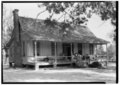
Emzy C. Smith House in Center (1936)

Louis Jones House in Center (1933)


Individual evidence
- ↑ a b c d e f g h i j Shelby County , Cecil Harper, Jr., Texas State Historical Association (TSHA), June 15, 2010 (Engl.)
- ↑ a b c See map overview Shelby County , Texas Almanac (PDF) and Overview of Shelby County, Texas , statisticalatlas.com, accessed December 6, 2018 (Engl.)
- ↑ The City of Center, Texas , east-texas.com, accessed December 6, 2018.
- ↑ Welcome to Shelby County Texas , Jane Keppler, 1997, countygenweb.com, accessed December 6, 2018 (Engl.)
- ^ Early Rural Communities in Shelby County . East Texas Press, June 21, 2018 (Eng.)
- ↑ February 12, 1950 - Longest Path for the Day , tornadotalk.com, accessed December 6, 2018 (Engl.)
- ^ Shelby County . Short portrait in Texas Almanac, accessed December 6, 2018 (Engl.)
- ^ Center Hanging Oak . Famous Threes of Texas, accessed December 6, 2018
- ^ East Texas town struggles with the past . Allan Turner, Washington Times, July 5, 2015.
- ↑ Texas police will return cash in case that prompted lawsuit . Gary Tuchman / Katherine Wojtecki, CNN, May 7, 2009; Update: 2014 (Engl.)
- ^ Settlement Means No More Highway Robbery in Tenaha, Texas . Elora Mukherjee, ACLU, August 9, 2012 (Engl.)
- ↑ Discriminatory voter laws have surged in load-five years, federal commission finds . Eric Bradner, CNN, September 12, 2018 (Engl.)
- ↑ Obama Voting Rights Act: President Reacts To Supreme Court Decision . Huffington Post, June 25, 2013
- ↑ a b Population of Shelby County . Data on Population.us, accessed December 6, 2018.
- ^ Population of Shelby County, Texas , statisticalatlas.com, accessed December 6, 2018.
- ↑ Shelby County, Texas , ACS Demographic and Housing Estimates 2012-2016, American Fact Finder, accessed December 6, 2018.
- ↑ a b Shelby County, Texas , brief overview on the website of the United States Census Bureau, accessed December 6, 2018 (Engl.)
- ^ Household Income in Shelby County, Texas . Overview of household income on Statisticalatlas.com, accessed December 6, 2018 (Engl.)
- ↑ a b 2016 Presidential General Election Results . Interactive map on USElectionatlas.org, results accessed on December 6, 2018 (Engl.).
- ^ US Congressman Louie Gohmert . Louie Gohmert's MP website, accessed October 24, 2018
- ↑ Louie Gohmert . Info page at ballotpedia.org, accessed on October 24, 2018 (Engl.)
- ^ Profiles on the Right: Louie Gohmert . Matthew Parkes, Political Research Associates, Jan. 2, 2014
- Jump up ↑ County Profile: Shelby County - Texas . 2012 Census of Agriculture, accessed December 6, 2018 (PDF; Engl.)
- ^ Shelby County economy in trouble after oilfield business comes to a halt . ktre.com, January 21, 2015 (Engl.)
- ^ Shelby County, TX . datausa.com, accessed December 6, 2018 (Engl.)
- ↑ Complete listing on Shelby County Historical Markers & Sites , shelbycountytexashistory.net, accessed December 6, 2018.
Web links
- Shelby County in the Handbook of Texas Online (Engl.)
- Statistics for Shelby County at datausa.io (Engl.)
List of counties in Texas
Anderson |
Andrews |
Angelina |
Aransas |
Archer |
Armstrong |
Atascosa |
Austin |
Bailey |
Bandera |
Bastrop |
Baylor |
Bee |
Bell |
Bexar |
Blanco |
Borden |
Bosque |
Bowie |
Brazoria |
Brazos |
Brewster |
Briscoe |
Brooks |
Brown |
Burleson |
Burnet |
Caldwell |
Calhoun |
Callahan |
Cameron |
Camp |
Carson |
Cass |
Castro |
Chambers |
Cherokee |
Childress |
Clay |
Cochran |
Coke |
Coleman |
Collin |
Collingsworth |
Colorado |
Comal |
Comanche |
Concho |
Cooke |
Coryell |
Cottle |
Crane |
Crockett |
Crosby |
Culberson |
Dallam |
Dallas |
Dawson |
Deaf Smith |
Delta |
Denton |
DeWitt |
Dickens |
Dimmit |
Donley |
Duval |
Eastland |
Ector |
Edwards |
El Paso |
Ellis |
Erath |
If |
Fannin |
Fayette |
Fisher |
Floyd |
Foard |
Fort Bend |
Franklin |
Freestone |
Frio |
Gaines |
Galveston |
Garza |
Gillespie |
Glasscock |
Goliad |
Gonzales |
Gray |
Grayson |
Gregg |
Grimes |
Guadalupe |
Hale |
Hall |
Hamilton |
Hansford |
Hardeman |
Hardin |
Harris |
Harrison |
Hartley |
Haskell |
Hays |
Hemphill |
Henderson |
Hidalgo |
Hill |
Hockley |
Hood |
Hopkins |
Houston |
Howard |
Hudspeth |
Hunt |
Hutchinson |
Irion |
Jack |
Jackson |
Jasper |
Jeff Davis |
Jefferson |
Jim Hogg |
Jim Wells |
Johnson |
Jones |
Karnes |
Kaufman |
Kendall |
Kenedy |
Kent |
Kerr |
Kimble |
King |
Kinney |
Kleberg |
Knox |
La Salle |
Lamar |
Lamb |
Lampasas |
Lavaca |
Lee |
Leon |
Liberty |
Limestone |
Lipscomb |
Live Oak |
Llano |
Loving |
Lubbock |
Lynn |
Madison |
Marion |
Martin |
Mason |
Matagorda |
Maverick |
McCulloch |
McLennan |
McMullen |
Medina |
Menard |
Midland |
Milam |
Mills |
Mitchell |
Montague |
Montgomery |
Moors |
Morris |
Motley |
Nacogdoches |
Navarro |
Newton |
Nolan |
Nueces |
Ochiltree |
Oldham |
Orange |
Palo Pinto |
Panola |
Parker |
Parmer |
Pecos |
Polk |
Potter |
Presidio |
Rains |
Randall |
Reagan |
Real |
Red River |
Reeves |
Refugio |
Roberts |
Robertson |
Rockwall |
Runnels |
Rusk |
Sabine |
San Augustine |
San Jacinto |
San Patricio |
San Saba |
Schleicher |
Scurry |
Shackelford |
Shelby |
Sherman |
Smith |
Somervell |
Rigid |
Stephens |
Sterling |
Stonewall |
Sutton |
Swisher |
Tarrant |
Taylor |
Terrell |
Terry |
Throckmorton |
Titus |
Tom Green |
Travis |
Trinity |
Tyler |
Upshur |
Upton |
Uvalde |
Val Verde |
Van Zandt |
Victoria |
Walker |
Catfish |
Ward |
Washington |
Webb |
Wharton |
Wheeler |
Wichita |
Wilbarger |
Willacy |
Williamson |
Wilson |
Winkler |
Wise |
Wood |
Yoakum |
Young |
Zapata |
Zavala