Pforzheim
| coat of arms | Germany map | |
|---|---|---|

|
Coordinates: 48 ° 53 ' N , 8 ° 42' E |
|
| Basic data | ||
| State : | Baden-Württemberg | |
| Administrative region : | Karlsruhe | |
| Height : | 261 m above sea level NHN | |
| Area : | 98 km 2 | |
| Residents: | 125,542 (Dec. 31, 2018) | |
| Population density : | 1281 inhabitants per km 2 | |
| Postcodes : | 75172-75181 | |
| Primaries : | 07231, 07234 | |
| License plate : | PF | |
| Community key : | 08 2 31 000 | |
| LOCODE : | DE PFO | |
| NUTS : | DE129 | |
| City structure: | 16 districts | |
City administration address : |
Marktplatz 1 75175 Pforzheim |
|
| Website : | ||
| Lord Mayor : | Peter Boch ( CDU ) | |
| Location of the city of Pforzheim in Baden-Württemberg |
||
Pforzheim is a city with 125,542 inhabitants (December 31, 2018) in northwest Baden-Württemberg on the northern edge of the Black Forest at the confluence of the Enz , Nagold and Würm rivers . Pforzheim is an urban district and at the same time the seat of the Enzkreis , which almost completely encloses the urban area. The city is a center of the Karlsruhe / Pforzheim agglomeration, which has around 650,000 inhabitants. The city is also the regional center of the Northern Black Forest region . The next larger cities are Karlsruhe (around 25 kilometers northwest) and the state capital Stuttgart (around 37 kilometers southeast). Pforzheim is home to numerous secondary schools and a university for applied science ( Pforzheim University ).
Pforzheim was originally founded by the Romans . The name is derived from the Latin Port (us) (= perhaps river port or stacking place), the Roman (partial) name of the Roman settlement in today's urban area of Pforzheim that has been handed down on the Leugenstein of Friolzheim . As the capital of a civitas in the province of Germania superior , the Roman city of Portus was an administrative center.
In 1067, Pforzheim was first mentioned in a document from Emperor Heinrich IV . As the royal seat of Baden , Pforzheim was destroyed several times by French troops at the end of the 17th century. The British air raid on Pforzheim on February 23, 1945 destroyed 80 percent of the city area and claimed almost 18,000 lives.
Pforzheim became world-famous through the jewelry and watch industry founded by Margrave Karl Friedrich von Baden in 1767 . This is what the nickname Goldstadt or gold, jewelry and watch city refers to. About 75 percent of German jewelry is produced in the city; The only goldsmith's school with a watchmaking school in Germany is also located here.
Pforzheim is also called the gateway to the Black Forest . The Black Forest hiking trails to Basel ( Westweg ), Waldshut ( Mittelweg ) and Schaffhausen ( Ostweg ) begin here . The Black Forest-Swabian-Alb-Allgäu-Weg also has its starting point there, it leads over 311 kilometers into the Allgäu . The place is also the end point of the Bertha Benz Memorial Route .
geography
City structure
The city of Pforzheim consists of the core city and the municipalities of Büchenbronn , Eutingen an der Enz , Hohenwart , Huchenfeld and Würm , which were incorporated by the territorial reform of the 1970s and which, according to § 8 ff. Of the main statutes of the city of Pforzheim, represent their locality as a local council and a local administration to have. The formerly incorporated villages of Dillweißstein , which was formed shortly before the incorporation to Pforzheim from the villages of Dillstein and Weißenstein, and Brötzingen belong to the core town. The modern urban structure only partially corresponds to the earlier municipal boundaries.
The city of Pforzheim consists of the following 15 districts. In addition to the districts with their own local administration, this also includes sub-areas of the core city:
- Au (with Haidach, Hagenschieß and old slope)
- Brötzingen (with Arlinger)
- Buckenberg
- Büchenbronn (with Sonnenberg )
- Dillweißstein (with Sonnenhof)
- Eutingen (with Mäuerach )
- Hohenwart
- Huchenfeld
- Downtown
- Nordstadt (with Maihälden)
- East town
- Southeast town
- Southwest town
- West town
- Worm
Neighboring communities
The following communities border on the community of Pforzheim. They are all located in the Enzkreis - with the exception of Unterreichenbach in the south, which belongs to the Calw district.
In the north: Ispringen , Neulingen , Kieselbronn
In the east: Niefern-Öschelbronn , Wurmberg , Wimsheim
In the south: Tiefenbronn , Neuhausen , Unterreichenbach , Engelsbrand
In the west: Birkenfeld , Keltern , Kämpfelbach
Division of space

According to data from the State Statistical Office , as of 2015.
Spatial planning
The tasks of regional spatial planning are carried out by the Northern Black Forest Regional Association . Pforzheim is shown as a regional center. The regional association is based in Pforzheim. The regional association includes the urban district of Pforzheim and the districts of Enzkreis , Calw and Freudenstadt .
Natural location
According to the natural spatial structure of Germany, both the former city limits and today's municipal territory extend to the Gäu area ( Enztal , Kraichgau ) and the Black Forest . The city center lies in a widening of the Enz valley at the confluence of the Nagold and Enz rivers . In the valley floor, the rocky subsoil changes from shell limestone (Gäuland) to red sandstone (Black Forest). The Nagold takes on the Würm on the southern outskirts , which is why people in Pforzheim like to speak of a three-river city. The outskirts and incorporations also extend to the south and north adjoining plateaus of the Black Forest and Kraichgau, Dillstein and Weißenstein are located in the Nagold Valley, which extends south, and Würm in the Würmtal, which extends to the southeast. The water volume and catchment area of the Nagold are much higher at the confluence with the Enz, but the river is called Enz in the further course.
The municipality of Pforzheims extends to the following natural spatial units (recorded for the geographical survey of Germany):
- 12 Neckar-Tauber-Gäue (Gäu areas characterized by shell limestone, which also extend east and north of the Black Forest)
- 122 Obere Gäue (after Kraichgau and Neckar basin the third large Gäu area in the Pforzheim region, extends between Würm and Baar and begins a little southeast of the city limits)
- 123 Neckar basin (wide Gäu basin between Stuttgart and Heilbronn)
- 123.1 Southwestern Neckar Basin
- 123.10 Eastern Hagenschießen
- 123.1 Southwestern Neckar Basin
- 125 Kraichgau (also includes areas that are not popularly counted as part of the actual Kraichgau, e.g. the Pforzheimer Enztal)
- 125.3 Pfinzhügelland (also includes areas outside the Pfinz catchment area , e.g. the Pforzheimer Enztal)
- 125.32 Eastern Pfinzgau
- 125.33 building lottery plate
- 125.34 Pforzheimer Enztal
- 125.3 Pfinzhügelland (also includes areas outside the Pfinz catchment area , e.g. the Pforzheimer Enztal)
- 15 Black Forest (low mountain range between Pforzheim and Hochrhein , marked by red sandstone in the Pforzheim area)
- 150 Black Forest edge plates (along the northern and eastern edge of the Black Forest)
- 150.1 Eastern Black Forest edge plates
- 150.13 Enz-Nagold plate
- 150.1 Eastern Black Forest edge plates
- 150 Black Forest edge plates (along the northern and eastern edge of the Black Forest)
There are therefore a total of five natural subunits in the municipality of Pforzheim:
125.34 Pforzheimer Enztal: Central natural subunit for Pforzheim, around which the other subunits are grouped. The Pforzheimer Enz valley extends in a south-west-north-east direction from Birkenfeld to Enzberg . While the upstream areas are included in the Black Forest to the south and the downstream areas in the Neckar basin to the east, the Enztal in Pforzheim, due to its ecological similarities, is part of the Kraichgau, which extends north and west of Pforzheim. In this unit are mainly the Pforzheim city center, Oststadt, in Eutingen down the river Enzufer is the ascent to the Bauschlotterplatte. To the right of the Enz, the Black Forest at the edge of the Eutinger Eichwald runs out and merges into the Neckar Basin (natural area 125) in Niefern, Nordstadt, Weststadt and Brötzingen as well as the northern areas of the districts of Südweststadt and Südoststadt. The Pforzheimer Enztal is a 150 m deep sole valley with terraced valley slopes. The wide, waterlogged valley floor consists of an alluvial clay cover lying over red sandstone gravel. The valley floor and slopes are almost completely built.
125.33 Bauschlott Platte: extends north of the Pforzheim Enztal, named after the village of Bauschlott . The northern parts of the Pforzheim districts Nordstadt and Eutingen are in this unit. The Bauschlotter Platte is a weakly broken shell limestone plateau with soils that are very suitable for arable farming (Korngäu type). However, the fertile arable land based on this is increasingly declining due to the new Hohenäcker industrial park that is expanding around the Pforzheim-Nord motorway junction. The low level of demolition of the Bauschlotter Platte indicates that direct Rhenish erosion has hardly arrived here.
125.32 Eastern Pfinzgau: Extends northwest of the Pforzheim Enz valley. The north-western parts of the Pforzheim district of Nordstadt are located in this unit (especially the Wilferdinger Höhe industrial park). It is a heavily broken shell limestone plateau of the Heckengäu type.
150.13 Enz-Nagold-Platte: Extends south of the Pforzheimer Enztal and has a misleading name, as it mainly includes the Nagold area. This unit mainly includes the southern areas of the Pforzheim districts Südweststadt and Südoststadt as well as the districts Büchenbronn, Dillweißstein, Huchenfeld, Hohenwart, Würm and Buckenberg with Haidach. This Black Forest slab, made up mainly of red sandstone, is predominantly forested and relatively extensive (extends to Altensteig in the south ). The valleys of the Nagold are deep and cut into the plate with steep slopes. On the Riedeln between the valleys there are clearing islands (e.g. Huchenfeld and Hohenwart).
123.10 Eastern Hagenschieß: Covers a small area southwest of the Pforzheim Enz Valley. The name is misleading because the unit not only includes the eastern half of the Hagenschieß, but also the neighboring Gäu regions (Wurmberg and Wiernsheim) to the east. The Hagenschieß itself is a large forest area in the east of the city, most of which belongs to Pforzheim. While the western Hagenschieß belongs to the Black Forest (to the unit "150.13 Enz-Nagold-Platte"), the eastern Hagenschieß is counted as part of the Neckar basin, as it is predominantly a shell limestone plateau (wave mountains). Despite its suitability for agriculture, the eastern Hagenschieß is largely forested for historical reasons (formerly the cooperative forest of the surrounding communities).
Nature reserves
Pforzheim has a share in three nature reserves . The Felsenmeer , with its size of 5.6 hectares, as well as the nature reserve Mangerwiese-Wotanseiche with its size of 65.4 hectares, is completely on the Pforzheim municipal area. Pforzheim has a share of 125.8 ha in the 158.5 ha nature reserve Unteres Würmtal . A total of 196.80 ha are under nature protection, that is 2.01 percent of the marked area.
Dialect geography
Pforzheim is located in an area in which Swabian and South Franconian dialect features mix. This transitional area extends from the northern Black Forest to the east to south of Heilbronn and has a relatively large north-south extension at Pforzheimer latitude (in the south to beyond Calw and Weil of the city ). Pforzheim is more on the northern edge of this transition area.
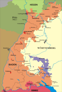
In the Pforzheim area, the linguistic boundary lines are geographically hardly based on natural spatial boundaries and connecting routes, but rather on earlier political and church boundaries. Initially, the new political northern border of Alemannia , which was drawn around 500, had an influence , through which the Alemannic Pforzheim area came to Franconian rule and was accordingly linguistically influenced. The new border ran approx. 20 km south of Pforzheim, near Calw. Later the area near Pforzheim came to Baden. However, this Baden area always extended finger-shaped into the surrounding Württemberg area and took part in the linguistic development from a formerly Alemannic to a new Swabian language area. A variety of fine linguistic borders therefore linguistically separate the Pforzheim region from the northern Baden area around Karlsruhe to this day.
The actual city dialect of Pforzheim was characterized by numerous interactions between native and immigrant dialects. The dialect of the Au district, which was shaped by rafters, contrasted with the dialect of the actual core city, which was shaped by traders and craftsmen. The increasingly rural and rural settlement of the old town east of the city also had its own character. Due to industrialization , immigration and urban growth, Au and Alte Stadt lost their linguistic peculiarities. Industry-related immigration (mainly between 1870 and 1910, but also before the 18th century) took place mainly from the Swabian-speaking areas. Sexauer distinguished four dialect groups in the early 20th century: the conservative Au-Dillsteiner dialect, an older and a younger town dialect and the dialect of the immigrants. The town dialects gave up southern Franconian in favor of Swabian dialect features, but southern Franconian innovations were also introduced. Over time, the influence of the written language in particular grew. The earlier strong French influence in the city dialect was lost as well as various expressions typical of the jewelry industry.
climate
| Pforzheim 2010-2020 | ||||||||||||||||||||||||||||||||||||||||||||||||
|---|---|---|---|---|---|---|---|---|---|---|---|---|---|---|---|---|---|---|---|---|---|---|---|---|---|---|---|---|---|---|---|---|---|---|---|---|---|---|---|---|---|---|---|---|---|---|---|---|
| Climate diagram | ||||||||||||||||||||||||||||||||||||||||||||||||
| ||||||||||||||||||||||||||||||||||||||||||||||||
|
Average monthly temperatures and precipitation for Pforzheim 2010-2020
Source: [2]
|
||||||||||||||||||||||||||||||||||||||||||||||||||||||||||||||||||||||||||||||||||||||||||||||||||||||||||||||||||||||||||||||||||||||||||||||||||||||
history
Overview of the political event history
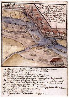
Before the Roman conquest in the first century AD, the area of today's Pforzheim was in the area of the Celts . Direct traces of the Celts can be found from 500 to 300 BC. A bronze horse figure that was found near Pforzheim is dated from this early Celtic period. A statue of the Celtic goddess of healing Sirona was recovered in a well. An altar fragment found during the great Enzregulation in 1909 near the old town church is attributed to the Celtic Black Forest goddess Abnoba . The find led to the naming of the Enzuferweg in Abnobastraße. The Roman era lasted until the 3rd century, at which time a ford was set up on the Enz for the Roman road Strasbourg - Cannstatt . The resulting settlement was called Portus. In Neuenbürg / Waldrennach , the Celts' smelting furnaces / racing furnaces for iron extraction have been identified (Neuenbürg mine). Roads or waterways were necessary for further processing and transport of the iron products. It can therefore be assumed that the Enzfurt was already important in Celtic times.
Around 259/260, Alemannic population groups conquered the Limes. Around 500 Alemannia was incorporated into the Franconian Empire . The northern border of Alemannia was moved far to the south; If it was previously close to the Main , it now ran far south of Pforzheim, near Calw. Pforzheim was possibly part of Salian territories in the 11th century and passed from the Salians to the Staufers in 1125 .
Pforzheim came to the Guelphs by marriage in 1195 and a few years later, 1220–1227, again by marriage, from the Guelphs to the von Baden. The process of becoming a town began possibly as early as the Hohenstaufen era and lasted until the 14th century. 1344 the property went to the parish church (included both St. Martin and St. Michael with a) from Hirsau to the monastery Lichtenthal over. Between 1462 and 1750 Pforzheim was only a fief of the Electorate of Palatinate near Baden. An order of the Baden margrave Christoph I brought the city the loss of political autonomy in 1486.
Jörg Ratgeb was committed to the rebels in the Duchy of Württemberg during the peasant uprising in 1525. That was his undoing. After the suppression of the uprising on May 18, 1525 near Böblingen by the Truchsess von Waldburg-Zeil , he was captured and sentenced in Pforzheim on the basis of the Bamberg Neck Court Code . The verdict was "for the Paurenkriegs and Hertzog Ulrichs sake" on the difficulty of dividing into quarters by horses alive and was carried out on the market square in front of today's town hall.
After the division of Baden, Pforzheim belonged to the Lower Margraviate of Baden from 1515/1535 to 1771 (with interruptions) (Ernestine Line, later also called Margraviate Baden-Durlach ). In 1535 Pforzheim was chosen as the residence of the Lower Margraviate, but the residence was moved to Durlach as early as 1565 . Pforzheim also became the central burial place of the Ernestine line in 1538 and remained so for the unified Baden after 1771.
The Reformation was introduced in Pforzheim and Baden-Durlach between 1519 and 1556 . Through the sale of Liebenzell and other areas to Württemberg in 1594 and the following years, Pforzheim came to the periphery of Baden-Durlach. In the Thirty Years War (1618–1648), the city was mostly withdrawn from Baden's access (1624–1635 occupied by imperial or Swedish troops, 1635–1645 Pforzheim belonged to Bavaria ).
In 1803 Baden became an electorate and in 1806 a grand duchy. Baden was a federal state of the German Empire between 1871 and 1933, and a free state since 1918 . Took place under the Nazi regime of the German Reich in 1933, the DC circuit Baden and Pforzheim (abolition of the rights of the entities, appointment of Pforzheim mayor by the NSDAP, transformation of the City Council on the basis of general election results 1933). From April 1945 the city belonged to the French zone of occupation for a few months, from July 1945 to 1949 to the US zone of occupation, in which the state of Württemberg-Baden was established. In 1952, Württemberg-Baden became part of the state of Baden-Württemberg.
Historical political geography
Before the Napoleonic clean-up in 1803/1806, the districts located in what is now Pforzheim's urban area were predominantly part of the Baden-Durlach Oberamt Pforzheim . Other municipalities of the Pforzheim district (e.g. Dietlingen, Ispringen, Eisingen, Bauschlott, Dürrn, Niefern) were mainly in the north and northwest, as were other Baden areas, namely the Stein and Frauenalb departments. The present-day Pforzheim districts Würm and Hohenwart belonged to family territories organized in the imperial knighthood, both under Baden sovereignty. Hohenwart was part of the land of the imperial knight family von Gemmingen-Steinegg , the so-called Biet , which remained Catholic in the southeast, along the Würm . Wuerttemberg territories lay in the east and southwest, above all the offices of Neuenbürg and Liebenzell in the southwest and the extensive territory of the Maulbronn monastery in the east.
Early history
The city goes back to a Roman settlement at a river Enz (around 90 AD), the name probably from Latin portus = port / stacking place.
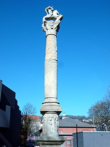
The first document, the Roman Leugenstein from Friolzheim from 245 AD, indicates the Roman settlement of Portus . The settlement was on the Roman Heerstraße between the Upper Rhine and Neckar areas, precisely where the Fernhandels- und Heerstraße crossed the Enz in a ford shortly after it was merged with the Nagold . Rafting established itself in the Roman settlement at this time , as the Enz from Portus becomes navigable due to the tributaries of Nagold and Würm . Nothing is known about a suspected port facility on the Enz. It is very likely that the Latin name is incomplete and had other components. A widespread misconception that goes back to Philipp Melanchthon is that the name Pforzheim can be traced back to porta = gate / Porta Hercyniae (to the Black Forest). Even Reuchlin speculative derivation of the name of the Trojan Phorkys as mythical founder of the city is wrong.
Large Roman buildings that began in the 3rd century lead to the conclusion that the small craftsmen's settlement should be expanded into an administrative center, such as a Civitas capital. In 259 and 260 the Franks and Alemanni conquered the areas on the right bank of the Rhine of the Roman Empire. The Portus settlement was razed to the ground. The tradition about the settlement breaks off for the time being.
Some ceramic shards and coins make the settlement likely to continue, but the continuity of the settlement could also have been very weak in real terms. Settlement is actually only really tangible again with the row graves from the 6th and 7th centuries, which are, however, about 800 m downstream of the Roman settlement. About the Roman settlement itself later grew up in the Carolingian period the old city of Pforzheim. A testimony to this time is, among other things, the excavation facility at Kappelhof in the basement of the Caritas building.
1067 to 1500

Pforzheim was mentioned for the first time in a document from Emperor Heinrich IV. In 1067, and around 1080 the settlement was granted market rights . Authenticated visits Pforzheim by Henry IV. Were in the years 1067 and 1074. 1100 was the Codex of the Monastery Hirsau be seen that the Old City of Pforzheim had before 1100 Market Law and was owned by the monastery Hirsau. In the 12th century the old town was shaped by monastic and ecclesiastical aspects with a Nikolauskapelle (patron saint of raftsmen and boatmen), protected by an early Martinskirche, and faced competition from a new settlement core (Neustadt) , below a castle hill 800 m upstream with a Michael's chapel (today's Schlossberg with castle church ). The new town grew quickly.
In 1220 the margraves of Baden chose Pforzheim as their residence . The focus shifted in favor of the new town ; the old city became less important. A Pforzheim mayor was first mentioned in a document in 1240 . In 1447, the marriage of Margrave Karl I of Baden with Catherine of Austria , the sister of Emperor Frederick III, was the wedding of the Prince of Pforzheim . , celebrated with great pomp.
In the second half of the 15th and 16th centuries, the Pforzheim Latin School developed into one of the most important schools for scholars in southern Germany. Their teachers and students played an important and prominent role in the spread of humanism and the Reformation . Among the most famous students were Philipp Melanchthon and the humanist Johannes Reuchlin, who was born in Pforzheim . He is the namesake of the Reuchlinhaus cultural center, which was inaugurated in 1961 and which also includes an international jewelry museum, as well as the Reuchlin grammar school . In addition, the Reuchlin Prize was named after the scholar. The award was first presented in 1955 on the occasion of the celebration of the 500th birthday of Johannes Reuchlin.
1500 to 1680
In 1501 Margrave Christoph I issued the order of the flötzer or schiffer zu Pfortzheim . The rafting is one of the oldest trades in Pforzheim . The single trunks and small rafts from the Black Forest rafted over Enz, Nagold and Würm (the long and straight fir trees were ideal as building material) were tied in the Pforzheimer Au to form large rafts for the lower Enz and the Neckar / Rhine waterline . The rafting stations Weißenstein, Dillstein and Pforzheim were fixed terms for every raft driver of the past centuries. At the time, Pforzheim also had a customs post where raftsmen had to pay a fee for shipping the waterways.
From 1535 to 1565, the town became the residence of the Baden Margrave Ernst I when the Baden region was divided up . After that, the residence was moved to Durlach , which is why it is referred to as the Baden-Durlach line . However, the city remained the seat of a Baden office and the castle church continued to be burial place of the Baden margraves. Ernst's son Charles II introduced the Reformation in 1556 . The Dominican monastery church became the Lutheran town church. In 1618, at the beginning of the Thirty Years' War , Pforzheim had around 2,500 to 3,000 inhabitants, making it by far the largest among the cities of the Margraves of Baden. At this point in time, Pforzheim had lost a lot of its importance, partly because many upper-class families (patricians) left the city in the 15th century.
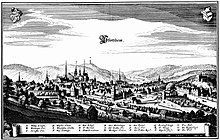
In 1645, towards the end of the Thirty Years War , Bavarian troops burned the old town down. It was rebuilt without fortifications; this sealed the status of a village-like hamlet, and it disappeared from historiography except for a few marginal notes. The new town continued to exist. From 13th to 15th In the 19th century, Pforzheim flourished economically thanks to the active support of the Baden margraves, who viewed the city as the most important base of their domestic power, and the favorable location at the crossroads of major trade routes. The timber trade and rafting, tannery, cloth and fabric-making contributed to the city's wealth as well as handicrafts. Three orders settled in the city. The last decades of this heyday, in which political and economic supremacy began to falter, are spiritual highlights of the city's history.
1680 to 1830
From 1689 to 1697 the War of the Palatinate Succession caused great destruction in southwest Germany. Pforzheim was plundered and burned down three times by French troops under King Louis XIV . Brigadier Comte Ezéchiel de Mélac was responsible for the occupation of the town in October 1688, the devastating burn down of the town in January 1689, the artillery fire and a second burn down in August 1689. Further destruction was under the orders of Marshal Joseph de Montclar and Marshal Duc de Lorge . Furthermore, Duc de Villeroy was responsible for the artillery bombardment of the city and the looting in August 1691. Under General Chamilly , the city was reoccupied and sacked in September 1692. The princely crypt in the castle church was devastated.
In 1718 the Pforzheimer orphanage (state orphanage ) was opened in the building of the former Dominican convent. This orphan, madhouse, hospital, breeding and workhouse later became the nucleus of the jewelry and watch industry that still exists today.
In 1767 the jewelery and watch industry was founded in Pforzheim by Margrave Karl-Friedrich . With the support of an entrepreneur from Switzerland, a watch factory was set up in the orphanage to employ the orphans. Some time later the production of jewelry was added. The company developed rapidly, and soon it was exported all over the world, although watch production soon disappeared and only experienced a renaissance with the manufacture of wristwatches from 1920. Around 1800 Pforzheim, with 900 factories, was the first factory town in Baden and the most important center of jewelry manufacturing in the world. Many of the 26,000 employees came from the surrounding area and were therefore commuters. These were called rasslers . In 1809, the Baden office of Pforzheim was divided into a city office and a first and a second rural office . However, the latter two were reunited in 1813 to form the Pforzheim Land Office. In 1819 the Pforzheim City and Land Office were combined to form the Pforzheim Regional Office, which was transferred to the Pforzheim District Office in 1864 .
1830 to 1918
In 1836 Ferdinand Oechsle developed the must scale in the city , with which the must weight of the freshly pressed grape juice is still measured in degrees Oechsle . From 1861 to 1863, the Karlsruhe – Mühlacker railway was built to connect Pforzheim to the railway network. In 1868 and 1874, with the construction of the Enz Valley Railway and the Nagold Valley Railway , the two large Black Forest valleys that flow into Pforzheim were also connected to the railway. This ushered in the end of rafting .
In the Year of Three Emperors in 1888 was Pforzheim goal of the first cross-country trip with a car , the native Pforzheimerin Bertha Benz without the knowledge of her husband Carl Benz and her two sons from Mannheim took off. The Bertha Benz Memorial Route has been a reminder of this pioneering act since 2008 . Ten years later, the entrepreneur Bernhard Heinrich Mayer was the first Pforzheimer to buy his own automobile, a Benz "Victoria" .
Jewish families had lived in the city since the 19th century . In 1846 they laid out the Jewish cemetery , which was occupied until 1877, after which a Jewish cemetery was established in the new non-denominational main cemetery in Pforzheim . In 1893 the Jewish community built a synagogue . In the 19th century, the textile, metal and jewelry factories in Pforzheim formed the industrial center of the Grand Duchy of Baden.
Pforzheim's city master builder Alfons Kern founded the urban tradition . He planned the new town hall building from 1893/1895 and made a name for himself by building up a city antiquity and painting collection as well as enlarging and reorganizing the city archive. In 1905 he resigned from the building authorities and now only devoted himself to expanding the collections that moved into their own buildings in the 1920s and 1930s. Kern was given honorary citizenship of the city in 1939 , and the collection of paintings bore his name from that year.
Furthermore, in the course of the years 1830 to 1918, two previously autonomous districts were incorporated; the Brötzingen district was incorporated at the turn of the year 1904/1905, the Dillweißsteiner at the turn of the year 1912/1913. A total of 1762 hectares were incorporated in parallel.
1918 to 1945
During the November pogroms in 1938 , the Old Synagogue in Pforzheim was desecrated and badly damaged. The Jewish community was obliged to pay for the demolition. On October 22, 1940 Jews remaining in the city were 186 in the Wagner-Bürckel action deported . Few of the survivors returned.
The Pforzheim district emerged from the Pforzheim district office in 1939 and became the seat of Pforzheim. At the same time the city became a district. In 1944 there were 18,622 workers in 101 factories, at least 10,000 of them in the armaments industry.
The Pforzheim industry was significantly involved in the development of technological innovations such as the X-beam method for better target acquisition (developed by G. Schaub Apparaturenbau-GmbH, used against Coventry , among others ). In some areas of the on-board radios, up to 50% of the parts came from Pforzheim. In order to be able to meet the increasing demand, Pforzheim companies also resorted to forced labor , such as forced deported workers from the Vosges (from autumn 1944), interned Italian prisoners of war (from 1943/44), forced laborers from Ukraine and Russia. The demands made by concentration camp inmates are well known.
There was a factory for the manufacture of anti-aircraft shells on the outskirts . In addition, the city played an important key role in the rail transport of the military units. Should the north-south line in the Rhine Valley fail, the city, which was on the alternative route across the Black Forest and provided a connection to the east-west lines, would have been an important transshipment point for supplying the southern eastern front and the western front. However, the British Royal Air Force originally only listed Pforzheim as a lower-ranking alternative target in the target hierarchy.
On February 23, 1945, the city was almost completely destroyed within 22 minutes during an air raid on Pforzheim by 379 British bombers. At least 17,600 people were killed. The bombs and the firestorm that developed in the densely built-up old town killed almost a third of the population present. In terms of the number of victims, it was the third strongest attack by Allied bombers during the Second World War after the bombings of Hamburg and Dresden . 98% of the city center was destroyed. Pforzheim was one of the most heavily destroyed cities during the war. Overall, this attack was the most concentrated and the most momentous of the Allies . As elsewhere, his aim was to demoralize the population; perhaps the precision engineering industry, which had largely switched to the production of detonators during the war years, also played a role . However, since some of the operations had been outsourced, the attack was possibly also aimed directly at the old town, which, with its half-timbered houses, was selected as a rapidly burning target.
In the end, Germany gradually lost the Second World War . At the beginning of April 1945, Pforzheim was declared a so-called fixed place , which meant that the city had to be relentlessly defended. In the period from April 8 to April 18, the city was completely occupied by French troops. Elsewhere in Germany, the war continued until the beginning of May. It finally ended on May 8th with the unconditional surrender of the Wehrmacht .
Since 1945
From 1945 to 1948 Pforzheim (after the initial French occupation) was under US military administration and was part of the new state of Württemberg-Baden . In these and the following years, the population grew again due to the influx of displaced persons, refugees, repatriates and immigrants. As early as 1950, Pforzheim's industry was again recording sales of millions in exports. The city was already booming, the reconstruction planning had hardly been noticed by the citizens in 1946 and was passed almost unanimously.
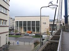
Today's cityscape is shaped by the functionalism-oriented architecture of the 1950s. As in many cities destroyed by the war, the immediate post-war era in Pforzheim was about the rapid reconstruction of the urban infrastructure. Representative individual buildings in the architectural style of those years are the main station, the district court and the Reuchlinhaus . The Evangelical City Church , inaugurated in 1968, also follows this sober architecture. Only in the north and south of the city there are older buildings in terms of style. Exemplary streets that have a significant number of buildings from the pre-war period are Zähringerallee and Nebeniusstraße.
In 1955 the city of Pforzheim donated the Reuchlin Prize, named after the Pforzheim humanist Johannes Reuchlin , for excellent German-language work in the field of humanities.
In the 1960s, the Wilferdinger Höhe was developed and later developed industrially and commercially; previously there were orchards and fields there. Other industrial areas are Hohenäcker and Brötzinger Tal .
On July 10, 1968, the city and its surroundings were hit by an F4 tornado . Two people died, over 200 were injured, and 2,300 houses were damaged.
During the district reform on January 1, 1973 , the Pforzheim district was incorporated into the newly formed Enzkreis , whose seat was the city of Pforzheim. She herself remained free of circles. Pforzheim also became the seat of the Northern Black Forest region formed in 1973 . On January 1, 1975, the number of inhabitants exceeded 100,000 due to the incorporation of Huchenfeld , making Pforzheim a major city . In 1983 the Baden-Württemberg Home Days took place in Pforzheim . Pforzheim-Ost was redesigned for the State Garden Show in 1992. At the end of the 20th century, the manufacture of jewelry and watches in Pforzheim lost its importance. In addition, the Maihälden area was developed in the 1990s and then extensively developed.
Since 1999/2000 some parts of the city have been redeveloped.
population
Population development
In 1881 Pforzheim had 25,000 inhabitants, by 1902 this number had doubled to 50,000. In 1905 the Brötzinger district was incorporated, and almost 6,000 Brötzinger residents were also there. During the Second World War , the city lost about half of its inhabitants. Already in 1951, Pforzheim, which was almost completely destroyed, had one of the lowest unemployment figures in Baden and developed extensive construction activity to cope with the influx. Already in 1960 the population reached the pre-war level with around 80,000. On January 1, 1975 the population of the city of Pforzheim exceeded the limit of 100,000 due to the incorporation of Huchenfeld, which made it a major city . Pforzheim is the eighth largest city in Baden-Württemberg and 64th among the largest cities in Germany. In the period from 2000 to 2010, the population grew by 2.24%, mainly due to immigration from abroad. According to the 2011 census , the population as of May 9, 2011 was 114,411, which is less than previously assumed.
Pforzheim has been heavily influenced by immigrants since the 1950s . In 2017, the share of non-German residents in the total population was 26.0 percent (32,646 people), according to the city administration. Most of the foreigners came from Turkey (5,042), Italy (3,877), Romania (3,499) and Iraq (3,495). At the end of 2017, 67,543 inhabitants had a migration background, which corresponds to 53.7% of the total population. Among the residents under the age of 18, the proportion of people with a migration background was 74.1%. This makes Pforzheim one of the major German cities with the highest proportion of non-German residents and residents with a migration background.
The following overview shows the number of inhabitants according to the respective territorial status. Up to 1833 these are mostly estimates, then census results (¹) or official updates by the respective statistical offices or the city administration itself. The information relates to the local population from 1843 , to the resident population from 1925 and to the population at Location of the main residence . Before 1843, the number of inhabitants was determined according to inconsistent survey methods.
|
|
|
¹ census result
Population forecast
The forecast of the 2011 “Wegweiser Kommune” study by the Bertelsmann Foundation predicts the following development for Pforzheim:
| date | Residents |
|---|---|
| December 31, 2009 | 119,680 |
| December 31, 2012 | 121,986 |
| December 31, 2015 | 121,800 |
| December 31, 2020 | 122,590 |
| December 31, 2025 | 122,660 |
| December 31, 2030 | 122.120 |
Source: Bertelsmann Foundation
Incorporations
Formerly independent communities or districts that were incorporated into the city of Pforzheim:
| year | places | Increase in ha |
|---|---|---|
| January 1, 1905 | Brötzingen | 1301 |
| January 1, 1913 | Dillweissenstein | 461 |
| April 1, 1924 | Parts of the Haidach district | 76 |
| October 1, 1929 | Parts of the Hagenschieß district | 1623 |
| 1st September 1971 | Worm | 822 |
| April 1, 1972 | Hohenwart | 492 |
| 1st January 1974 | Büchenbronn | 1114 |
| 1st January 1975 | Huchenfeld | 947 |
| 20th September 1975 | Eutingen an der Enz | 845 |
religion
Denomination statistics
According to the 2011 census , in 2011 34.1% of the population were Protestant , 26.1% Roman Catholic and 39.9% were non-denominational , belonged to another religious community or did not provide any information. Of the residents (as of December 31, 2019), 22.7% were Catholic, 25.6% Protestant and 51.6% (1.3% more than in the previous year) had no religious affiliation or belonged to other religions and denominations. The number of Protestants and Catholics has therefore decreased in the observed period.
Christianity
After Margrave Karl II of Baden introduced the Reformation in 1556 in the margraviate of Baden , whose residence Pforzheim was at the time , Pforzheim was a Protestant city for centuries. Since the 19th century at the latest, Catholics have moved to Pforzheim again, they belong to the Pforzheim Dean's Office of the Archdiocese of Freiburg . The Protestant Christians belong to the deanery Pforzheim-Stadt of the Evangelical Church in Baden . There are also a large number of free churches in Pforzheim , e.g. B. Methodist Church , Baptists , Salvation Army , Seventh-day Adventists , Bible Congregation . The New Apostolic Church and Jehovah's Witnesses are also represented in Pforzheim.
Judaism
There is an Israelite community in Pforzheim .
Islam
The Fatih Mosque , which was built from 1990 to 1992, is one of the first larger mosques in Baden-Württemberg to be planned as a mosque and designed accordingly .
Other
Since 2008, a now about 2500 heads has scoring Yezidis settled Association of Pforzheim. There has also been a Hindu congregation with around 200 members in Turnstrasse for several years.
politics
(Lord) Mayor
The mayor appointed by the city lord was at the head of the city administration . Later there was a council headed by a mayor who has held the title of Lord Mayor since 1849 . The term of office of the mayor until 1750 is only partly known. Only the names of the mayors are mentioned in the historical sources.
|
|
Municipal council
All municipal councils in the city are represented in the transparency portal parliamentwatch.de. There every citizen can publicly ask questions to the elected local politicians. It is made up of 40 community councilors who work on a voluntary basis and the chairman of the community council, Lord Mayor Peter Boch. The members of the parish council are elected directly and for five years. The municipal council forms committees to relieve the workload and to deal with factual issues in more depth. Municipal council submissions, decision documents, meeting dates and agendas of the municipal council are published in the council information system of the city of Pforzheim.
In addition to the municipal council, there are also local councils for the districts of Büchenbronn, Eutingen, Hohenwart, Huchenfeld and Würm.
Youth Council
A youth council was elected for the first time in 2014. It consists of 20 young people who represent the interests and concerns of their voters towards the city.
badges and flags
The blazon of the coat of arms of the city of Pforzheim reads: Split; in front a red diagonal bar in gold, in the back divided three times by red, silver, blue and gold.
In 1256 the first seal was made, which only contains the sloping beam shield of the rule. Since the end of the 15th century it has been replaced by the coat of arms, which is now almost unchanged, in seals and numerous non-verbal reproductions. The front half of the shield shows the sloping beam of Baden, to which the colors red and gold also refer in the rear. The meaning of silver and blue is controversial; Obvious is the opinion that it is about the colors borrowed from the Wittelsbach's diamond coat of arms of the Electoral Palatinate, since the city was under the Palatinate sovereignty from 1463 to 1750.
The sloping beam has been demonstrable as a symbol of the city lords of Pforzheim since the 13th century, which later also became the state coat of arms of Baden, but its meaning is still unclear today. From 1489 the coat of arms can be proven in its entire form, the meaning of which could not be proven either. Today's tinging has only been in use since 1853, before the color scheme was different.
The city flag is white and blue.
Town twinning
Pforzheim maintains a city partnership with the following cities :
| Gernika | Spain | 1989 |
|
|
| Saint-Maur-des-Fossés | France | 1989 |
|
|
| Vicenza | Italy | 1991 |
|
|
| Czestochowa | Poland | 2007 |
|
|
| Irkutsk | Russian Federation | 2007 |
|
|
| Nevşehir | Turkey | 2007 |
|
|
| Győr-Moson-Sopron county | Hungary | 2007 |
|
|
| Osijek | Croatia | 2008 |
|
For several years the city of Pforzheim has been inviting people from La Bresse as a symbol of peace and reconciliation . During the Second World War, around 500 men were deported to Pforzheim and used as slave labor.
The partnership with Gernika is related to the similar fate caused by air strikes . In the foyer of the town hall there is a reproduction of the painting Guernica by Pablo Picasso.
Economy and Infrastructure
Pforzheim is one of the regional centers in Baden-Württemberg and has one of the highest industrial densities in the state. There are 593 employed people for every 1000 inhabitants. In 2016, Pforzheim achieved a gross domestic product (GDP) of € 4,943 billion within the city limits . In the same year, GDP per capita was € 40,227 (Baden-Württemberg: € 43,632, Germany € 38,180) and is thus well below the regional average. It is 64,584 per labor force. The city has four large industrial areas: the Wilferdinger Höhe, the Brötzinger Tal, the Altgefäll and the Hohenäcker.
The economy is only partially geared towards the manufacture of watches and jewelry. 75 percent of German jewelry comes from Pforzheim (e.g. Wellendorff ). The Federal Association of Jewelry, Watches, Silverware and Related Industries is based in Pforzheim. Many jobs are provided by the metal processing, electronics and electrical engineering sectors. The mail order business ( Bader Versand , Versandhaus Klingel , Wenz) occupies a leading position in Germany with sales in the millions. There are around 68,100 people in employment in Pforzheim. The purchasing power per inhabitant was 19,400 euros.
In the future atlas 2016 , the independent city of Pforzheim was ranked 87th out of 402 districts, municipal associations and independent cities in Germany, making it one of the places with "high future opportunities". In the 2019 edition, it was ranked 163 out of 401.
Structural change and job losses
The city of Pforzheim has been struggling with industrial structural change since the early 1980s . The jewelry industry migrated extensively. This results in high job losses. In 1990 there were around 65,000 employees subject to social security contributions in Pforzheim; in 2011 it was only around 50,000. This corresponds to a decrease of 25%.
The number of people in employment remains constant at around 70,000.
The unemployment rate in June 2008 was 7.0 percent. Looking at the city and rural districts in November 2011, the city of Pforzheim had a rate of 7.7 percent for 4,539 unemployed people; the highest in Baden-Württemberg. In December 2018 the unemployment rate was 5.3%.
Resident companies (selection)
- Active bank
- Allgemeine Gold- und Silberscheideanstalt AG
- Amazon.com
- Aristo
- Bad shipping
- Doduco
- Kramski Group
- Heimerle + Meule
- Mahle Behr
- Sparkasse Pforzheim Calw
- Stadtwerke Pforzheim
- Stöber drive technology
- Mail order bell
- Volksbank Pforzheim
- Wellendorff
- Witzenmann Group
- Zapp AG
traffic
Road traffic
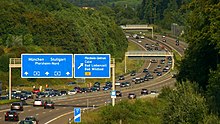
North of Pforzheim, the federal motorway 8 runs from Karlsruhe to Stuttgart, from which the city can be reached via four exits. The fourth exit Pforzheim Süd was completed in 2008, making it easier to reach the southern and especially the south-eastern districts of the city. Stuttgart International Airport can be reached in around 35 minutes by car via the A 8, and Karlsruhe / Baden-Baden Airport in around 60 minutes by car.
Through the city itself, the B 10 runs parallel to the motorway and the B 294 in a north-south direction. The B 463 in the direction of Nagold also begins here .
A traffic development plan presented at the end of 2009 contains a. a new east-west axis along the railway line, with which the city, which is characterized by car and through traffic, is to be relieved.
Rail transport
The Pforzheim Hauptbahnhof is located on the railway line Mühlacker-Karlsruhe . Furthermore, two railway lines lead into the Black Forest to Bad Wildbad ( Enztalbahn ) and to Horb am Neckar ( Nagoldtalbahn ). Pforzheim is also connected to the Karlsruhe city railway .
Between 1900 and 1968 local traffic was largely ensured by the Pforzheimer Kleinbahn to Ittersbach (1900 to 1968), the urban tram Pforzheim (1911 to 1964) and the trolleybus Pforzheim (1951 to 1969).
Overview Pforzheim Hbf local transport :
- Inter-Regio-Express line IRE 1 (Karlsruhe-Pforzheim-Mühlacker-Vaihingen / Enz-Stuttgart) - operator: Go-Ahead Verkehrsgesellschaft Deutschland
- Regional train line RB 17a (Pforzheim – Mühlacker – Vaihingen / Enz – Bietigheim-Bissingen – Stuttgart) - operator: Abellio Rail Baden-Württemberg
- Regional train line R 61 (Pforzheim – Horb – Tübingen) Kulturbahn - operator: DB ZugBus Regionalverkehr Alb-Bodensee
- City railway line S 5 / S 51 (Wörth – Karlsruhe – Pforzheim) - operator: Albtal-Verkehrs-Gesellschaft
- Tram line S 6 (Pforzheim – Bad Wildbad) - operator: Albtal-Verkehrs-Gesellschaft
Overview Pforzheim Hbf long-distance traffic :
- In long-distance traffic, the trains of the Intercity line 61 (Karlsruhe – Pforzheim – Stuttgart – Aalen – Nuremberg) stop here every two hours - operator: DB Fernverkehr
Transportation
The city has a bus station, ZOB ( Zentraler Omnibusbahnhof ). Other local public transport ( ÖPNV ) in the city is served by RVS buses (Regionalbusverkehr Südwest, DB subsidiary) and various other transport companies. They all travel at uniform prices within the Pforzheim-Enzkreis transport association .
Before mid-2014 there were still 3 bus stations, ZOB Mitte, which was rebuilt, ZOB South and ZOB North. There is now a green area on the former area of the ZOB Nord.
media
The daily newspapers in Pforzheim are the Pforzheimer Zeitung and the Pforzheimer Kurier , a regional edition of the Badische Neuesten Nachrichten (BNN), which has its main editorial office in Karlsruhe . The responsible private area transmitter is antenna 1 on 107.0 MHz, which maintains a regional studio in the city. The private local station for Pforzheim is Die neue Welle on 91.4 MHz.
Courts and authorities
Pforzheim is the seat of the Pforzheim Local Court , which belongs to the Karlsruhe Regional Court and Higher Regional Court , and the Pforzheim Labor Court . The city also houses a branch of the Karlsruhe Public Prosecutor's Office , which is also responsible for the district of the Maulbronn District Court .
Pforzheim is also the seat of the Regional Council of the Black Forest , the Chamber of Commerce (IHK) Nordschwarzwald whose chamber district the northern Black Forest includes an employment agency , a tax office and a customs office .
The city is also the seat of the Pforzheim church district of the Evangelical Church in Baden and the Pforzheim dean's office in the Archdiocese of Freiburg .
The city of Pforzheim operates as one of three organizations (20%) together with the Enzkreis (30%) and the German Red Cross (50%) the local integrated control center for fire brigade , rescue service and disaster control . This started its service on October 15, 2015 and replaced the previous control centers of the fire brigade, the sponsor here was the city of Pforzheim, which also took care of the legal task for the Enzkreis during this financial compensation, and the rescue service, which was sponsored by the DRK.
Pforzheim is home to the Pforzheim detention center , which previously housed the Pforzheim juvenile detention center as a branch of the Heimsheim correctional facility . Furthermore, the city is the seat of the Enzkreis district office.
Due to its population of over 100,000, the city has to maintain a professional fire brigade .
education
The Pforzheim University - University of Design, Technology, Economics and Law has around 6,000 students. It came into being in 1992 through the merger of the former Grand Ducal School of Applied Arts and Technical College for the Metal Industry, founded in 1877, with the former State Higher Business School founded in 1963 . The areas of design and technology / economy have separate locations. The university attaches great importance to internationality; among other things, it is a member of the NIBES network and, for example, maintains regular academic exchanges with the Josip Juraj Strossmayer University in Osijek in Croatia. There are numerous master’s courses at the Pforzheim Graduate School , which is part of the Pforzheim University.
Furthermore there is the goldsmith school with watchmaking school in Pforzheim . It is the only one of its kind in Europe, which means that it is visited by many foreign students.
Pforzheim also has a state seminar for didactics and teacher training (primary and secondary schools).
The Pforzheim State Education Authority has been located in Maximilianstrasse since 2010. The authority is the lower school supervisory authority for all elementary, secondary, technical and secondary schools as well as for the special needs education and advice centers in the area of the city of Pforzheim, the Enzkreis and the Calw district.
The Abitur can be taken at the Reuchlin-Gymnasium , the Kepler-Gymnasium , the Hebel-Gymnasium , the Theodor-Heuss-Gymnasium , the Hilda-Gymnasium , the Schiller-Gymnasium (private all-day high school ), the Fritz-Erler-Schule ( economics high school ) , the Heinrich-Wieland-Schule ( technical grammar school ), the Johanna-Wittum-Schule (nutritional science grammar school / biotechnological grammar school), the Goetheschule ( Waldorf school ) and the Ludwig-Erhard-Schule Pforzheim (business school). The advanced technical college entrance qualification can be acquired at the state-recognized private Carlo Schmid School of the International Federation .
There are also a number of special educational and advisory centers in Pforzheim: The Pestalozzi and Bohrain Schools focus on learning, with the Bohrain School being attended by students from the Pforzheim urban area and the Pestalozzi School by students from neighboring communities in the Enzkreis . Schoolchildren with a mental disability attend the Gustav Heinemann School in Pforzheim or the school on Winterrain in Ispringen, the Enzkreis District Office is responsible for these two schools and the Pestalozzi School. The local special needs education and advice center with a focus on language the Schlossparkschule. In addition, the Raphael School in Pforzheim-Eutingen is a private, anthroposophy- oriented special educational and advisory center with a focus on emotional and social development and learning.
Supply and disposal
The Pforzheim thermal power station in the east of Pforzheim generates electricity and district heating primarily through combined heat and power. It is operated by Heizkraftwerk Pforzheim GmbH. With 270 million kilowatt hours annually, the power plant has the largest share of Pforzheim's electricity supply. Its electrical output is 102.6 MW, its gross thermal output 212 MW. The cogeneration plant was put into operation in 1964 and expanded to its current state in several construction stages. It was last modernized in 2004 by the Swiss company Colenco Power Engineering AG.
Attractions
Museums
- Kappelhof archaeological site - Roman and medieval excavations
- Rural Museum Eutingen
- GDR Museum 'Against Forgetting' :
- House of the country teams
- Gasometer Pforzheim : Since December 2014, the world's largest 360 ° panoramic paintings by the artist Yadegar Asisi have been shown in a renovated and converted former gas storage facility in Enzauenpark .
- Municipal gallery Pforzheim
- Reuchlinhaus
- Pforzheim jewelry museum in the Reuchlinhaus
- City Museum Pforzheim (city history)
- Technical museum of the Pforzheim jewelry and watch industry
- Weißenstein station - railway history in the Pforzheim area
- Roman estate in the Chancellor Forest
- Gemstone exhibition Widow Schütt
- Mineral museum and jewelry worlds Pforzheim : a shopping and experience center for jewelry and watches
- Museum Johannes Reuchlin : The museum was opened in September 2008 and is at the same time the completion of the reconstruction of the castle and collegiate church of St. Michael. The exhibits in the exhibition report on four levels about the origin, life, work and impact of Johannes Reuchlin, Germany's first humanist.
Cityscape and architecture
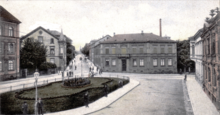
Complaints about an inconsistent and unattractive cityscape have been affecting the city's image to this day. You will happily be tied to the reconstruction of Pforzheim in the style of post-war modernism in the late 1940s and early 1950s. However, such complaints existed long before the air raid on Pforzheim in 1945. The lack of a classic, representative old town due to the multiple destruction of the city, changes in rulers and internal shifts in the focus of settlement was already negative in Pforzheim.
Many of the early post-war buildings in Pforzheim are, however, important pioneering buildings for post-war architecture in Germany: for example the Protestant Church of the Resurrection, designed by Otto Bartning in 1948 , the first Bartning emergency church in Germany; also the Matthäuskirche , 1953–1956 by Egon Eiermann ; as well as the Reuchlinhaus .
building
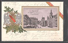
- Old town hall on the market square
- new town hall
- Archive building
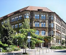
- Former district office building of the Grand Ducal Baden
- Emma-Jaeger-Bad , Art Nouveau building
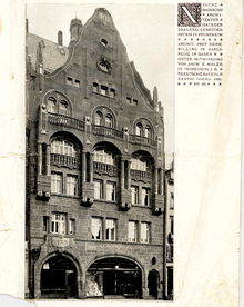
- Industrial building Pforzheim with jewelry worlds
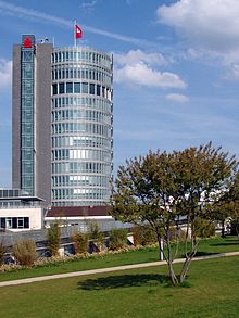
- Sparkassenturm, a 75 meter high office tower in the city center
- Reuchlinhaus with jewelry museum
- Arch bridge in Dillweißstein
- Leitgastturm
- Lake house
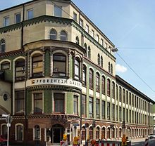
- Old wine press Brötzingen
- Water tower on the Rodrücke, an approx. 45 meter high water and observation tower at the Reuchlin-Gymnasium, completed in 1900
- Hachelturm, a 10 meter high listed observation tower in the Hachelanlage built in 1903/1904
- Copper hammer
- Büchenbronn observation tower
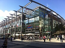
- Schlössle-Galerie (shopping center)
- Il Tronco (administrative center of the mail order company Klingel , built 2011/12)
- Villa Becker at the eastern end of the Wilferdinger Höhe
- Wartturm on the Wartberg, an 11 meter high former fortification and signal tower from the 15th century, which is now used as a lookout tower
- Buckenberg barracks
- Hohe Warte , 40 meter high wooden observation tower in the Hohenwart district
- Villa Rothschild in the Hachelallee
- Former Villa Kahn
- Central bus station (ZOB)
- Customs office (Pforzheim) in Durlacher Strasse
- Pregizer pharmacy at Leopoldplatz, oldest pharmacy in Pforzheim
- Melanchthon House
Castle ruins
- Hoheneck Castle , Pforzheim-Dillweißstein
- Kräheneck castle ruins , Pforzheim-Dillweißstein, see Weißenstein (noble family)
- Liebeneck castle ruins , Pforzheim-Würm
- Pforzheim castle ruins
- Rabeneck castle ruins (Weißenstein, Dillweissenstein), Pforzheim-Dillweissenstein
Churches
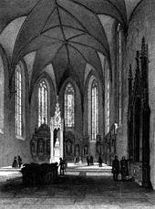
- Castle Church of St. Michael , the symbol of the city
- Old town church St. Martin (Protestant)
- Church of the Resurrection (Protestant), designed by Otto Bartning in 1948 and the first Bartning emergency church in Germany
- Barefoot Church (Catholic)
- Evangelical town church , 1965–1968 by Heinrich Otto Vogel
- Herz-Jesu-Kirche (Catholic), 1928–1929 by Otto Linder
- Matthäuskirche (Protestant), 1953–1956 by Egon Eiermann
- St. Franziskus Church (Catholic), 1888–1891 by Adolf Williard
- Luther Church (Protestant), 1954 by Olaf Andreas Gulbransson
- formerly St. Martin in Brötzingen, today a local museum
- Christ Church in Brötzingen (Protestant), 1909–1912
- St. Antonius in Brötzingen (Catholic), 1934–1935
Other sights
- Main cemetery : The main cemetery in Pforzheim emerged from the municipal cemetery on the Schanz, which was laid out in 1877. The cemetery shows the building complex Campo Santo from 1914 to 1917, in whose arcade numerous historical tombs from older burial places have been moved. The funeral hall of the main cemetery in Pforzheim is also a cultural monument. In the cemetery there are several honorary graves of local dignitaries as well as numerous artistically significant tombs. In the cemetery, which is a cultural monument, there are not only the mass graves for the victims of February 23, 1945, but also honorary graves for those who died in the First and Second World Wars , a Jewish cemetery section and various memorials, including a memorial with the names of the euthanasia murders during the action T4 as well as an urn field and grave slabs with the names of murdered concentration camp prisoners from eleven countries.
- Brötzinger Friedhof : The 'Brötzinger Friedhof' contains the graves and a memorial plaque for 32 women, children and men who were deported to Germany in the Second World War and were victims of forced labor .
- Kollmar & Jourdan House with Technical Museum
- Pforzheim Gallery
- Carlo Schmid School
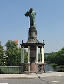
- Young man kneeling, WWI memorial
- Old Jewish Cemetery (Pforzheim) : memorial plaque at the site of the old Jewish cemetery on the Eutinger street in memory of the good location and in more than 200 Jewish residents who were victims of the Nazi era Shoa were
- Memorial stone in memory of the Jewish doctor Rudolf Kuppenheim and his wife with a bronze plaque from 1981 opposite the Siloah Hospital in Kuppenheimstrasse am Wallberg in memory of the Jewish doctor Rudolf Kuppenheim and his wife Lily, who committed suicide in 1940 to the Escape deportation to the Camp de Gurs
- Memorial stone in memory of the 1938 November pogrom of 1967 in Zerrennerstrasse at the site of the former synagogue
- Brötzinger Tal stadium : The stadium, which opened in 1913, is the football stadium of the 1st CfR Pforzheim from 1896.
- Sculpture Trail Seehaus Pforzheim : 14 artists are exhibiting their works in the Hagenschiess forest area (as of 2016). The sculpture path is designed as a permanent exhibition that is constantly evolving. Around two to three new objects are added each year, while other works are dismantled or replaced.
- Enzauenpark : built for the State Garden Show 1992, the last heavily attended State Garden Show in Baden-Württemberg with 1.33 million visitors.
- Wildlife park with high ropes course :
- Bertha Benz Monument: Monument by René Dantes in front of the CongressCentrum Pforzheim, as well as directly in front of it the Bertha Benz Memorial Route , from Mannheim to Pforzheim and back, which leads past numerous sights.
- Weststadtpark : a green area in the Pforzheim residential district Maihälden. It was built in the course of the 19th century on the slopes of the Wallberg, abandoned around 1907 and subsequently restructured into a park landscape.
- Hindu temple Sri Nagapoosani Amman Aalayam :
- Wallberg memorial: on the summit of Wallberg, steel steles commemorate the air raid on Pforzheim on February 23, 1945 .
Regular events
- January: Rudolf Reinacher tournament, international AH football indoor tournament of 1. FC Pforzheim (oldest indoor tournament in the world)
- January: The Goldstadtpokal , a large international dance tournament organized by the Schwarz-Weiss-Club Pforzheim
- June: Pforzemer Mess
- August: Oechsle Festival ; Wine festival with culinary delicacies from the region, named after Christian Ferdinand Oechsle from Pforzheim , who gave the wine and cider scales its name
- November: Sparkassen Cross Pforzheim , at Lohwiesenhof in the Huchenfeld district
- December: Golden Christmas Market Pforzheim
Culture
theatre
- The Pforzheim Theater is a multi-branch theater with opera, operetta, musical, drama, ballet and a young stage. The Kulturhaus Osterfeld sees itself as a socio-cultural center and is at the same time a performance location for independent groups (e.g. amateur theater) and a meeting point for various groups and associations.
- Evening events, children's performances and short programs take place in the Mottenkäfig puppet theater.
music
- Badische Philharmonie Pforzheim : The Badische Philharmonie Pforzheim under the direction of Markus Huber is the concert and opera orchestra at the Pforzheim City Theater.
- South West German Chamber Orchestra Pforzheim : The South West German Chamber Orchestra Pforzheim was founded in 1950 by Friedrich Tilegant . Among other things, it participated in the world premiere of a work by Boris Blacher . As a pure string ensemble, it comprises 14 musicians from seven nations.
Cultural institutions
- CongressCentrum Pforzheim (CCP) :
- KOKI Kommunales Kino : Since 2003, the arthouse cinema has been showing films in the 106-seat cinema hall in the new venue at Schlossberg 20.
- City library : In 2012, the city library loaned 981,000 items from a media inventory of 213,000 items. In addition to the main office, there are two branches in Buckenberg-Haidach and Huchenfeld, and there is also a mobile library for those parts of the city without branches. The online loan is also offered (2400 media are digitally available).
- Kulturhaus Osterfeld :
- Kupferdächle (youth culture meeting) : Offers band rehearsal rooms, theater, photo group and more for young people from the area free of charge. Furthermore events such as B. Concerts and poetry slams.
- Kappelhof Roman Manor:
- House of Youth (Opened on December 9, 1949, thanks to an American initiative. To this day, an institution for open child and youth work of the SJR Betriebs GmbH - Stadtjugendring.)
Sports
Pforzheim is a regional handball stronghold, in the 2013/14 season the TGS Pforzheim plays in the 3rd division , in the Oberliga Baden-Württemberg plays the SG Pforzheim / Eutingen , Patrick Groetzki's home club ; the male A-youth of SG Pforzheim / Eutingen plays in the A-youth league .
In the football season 2015/16, the 1st CfR Pforzheim, founded in 2010, plays in the fifth-class Oberliga Baden-Württemberg .
Arthur Hiller was the captain of 1. FC Pforzheim in 1905 , when the team reached the final of the German championship. In 1908 Hiller was the first captain of the German national team. On April 3, 1910, Arthur Hiller's nephew, Marius Hiller , made his first international match in a 3-2 win over Switzerland and scored a goal. At the age of 18, he is the second youngest DFB debutant and the youngest DFB goalscorer.
The Sparkassen Cross Pforzheim , held at Lohwiesenhof in the Huchenfeld district , is one of the most important cross-country runs in Germany.
The Schützengesellschaft Pforzheim 1450 eV operates large and small caliber disciplines , as well as compressed air and archery as an amateur and competitive sport. The state shooting sports center of Baden-Württemberg is integrated into the shooting society. Its shooting sports training courses are known throughout the Federal Republic of Germany . The Schützengesellschaft Pforzheim was the venue for the world championships in 1989 and 2012 and the European championships in 1999 and 2005 in muzzle-loading shooting . The club is a member of the Baden sports shooting association, the German shooting association and the International Shooting Sport Federation . The association is active in youth work; Among other things, he offers regular training for young shooters.
Personalities
An overview of the honorary citizens of the city of Pforzheim as well as of other people who were born in Pforzheim or are related to the city can be found in the list of personalities of the city of Pforzheim .
The personalities who were born in Pforzheim and who have become particularly well-known include the philosopher and humanist Johannes Reuchlin , the chemist Heinrich Otto Wieland (Nobel Prize 1927), the boxer René Weller , the digital art pioneer Manfred Mohr and the former Prime Minister of Baden-Württemberg Stefan Mappus . In the USA, Christopher Bechtler from Pforzheim became known, who produced the first standardized gold dollars. Pforzheim was the destination of the first long-distance car journey in history by Bertha Benz , who was born in Pforzheim , who without her husband's knowledge, together with her sons, used his vehicle to visit her parents.
literature
- Klaus Kortüm: Portus - Pforzheim. Studies on archeology and history in Roman times. In: Sources and studies on the history of the city of Pforzheim. Vol. 3, Thorbecke, Sigmaringen 1995, ISBN 3-7995-7403-4 .
- F. Huttenlocher, H. Dongus: The natural space units on sheet 170 Stuttgart. Bad Godesberg 1967.
- Stefan Pätzold: A short history of the city of Pforzheim. Braun, Karlsruhe 2007, ISBN 978-3-7650-8359-4 .
- Christian Groh: History of the City of Pforzheim. Wartberg-Verlag, Gudensberg-Gleichen 2005, ISBN 3-8313-1514-0 .
- Hans Georg Zier: History of the city of Pforzheim. Theiss, Stuttgart 1982, ISBN 3-8062-0234-6 .
- The state of Baden-Württemberg. Volume V, Stuttgart 1976, pp. 437-452.
- Johann Pflüger: History of the city of Pforzheim. Pforzheim 1989. (Reprint of the 1862 edition) ( full text )
- Hans-Peter Becht (Ed.): Pforzheim in the Middle Ages. Studies on the history of a sovereign city. Thorbecke, Sigmaringen 1983, ISBN 3-7995-6044-0 .
- Hans-Peter Becht (Ed.): Pforzheim in the early modern times. Thorbecke, Sigmaringen 1989, ISBN 3-7995-6045-9 .
- Hans-Peter Becht (Ed.): Pforzheim in the 19th and 20th centuries. Thorbecke, Sigmaringen 1996, ISBN 3-7995-6046-7 .
- Hans Peter Becht u. a .: The "Chronicle of the City of Pforzheim" 1891–1939. Verl. Regionalliteratur, Ubstadt-Weiher, 1996, ISBN 3-929366-41-X .
- Ottmar Sexauer: The dialect of Pforzheim. H. Eichblatt, Leipzig 1927. (also phil. Dissertation Heidelberg 1925)
- G. Heinz: Dialect of the Pforzemer Seggl. Pforzheim 1984.
- Robert Künzig a. a .: Pforzheim, a home book. Biesinger, Neuenbürg 1956.
- Kurt Schwab: Tram and small train in Pforzheim. Kenning, Nordhorn 1997, ISBN 3-927587-64-8 .
- Christoph Timm: Pforzheim. Cultural monuments in the urban area. Regional culture publishing house, Ubstadt-Weiher 2004, ISBN 3-89735-221-4 .
- Folke Damminger: Pforzheim: From the Roman vicus to the margravial residence. In: Acta Praehistorica et Archaeologica. Volume 34, 2002. pp. 241-257.
- Luigi Monzo: Plea for bitter beauties. Guest contribution as part of the exhibition 'SOS Brutalism - Rettet die Betonmosnter'. In: Pforzheimer Zeitung, February 27, 2018, p. 6.
Web links
- Literature from and about Pforzheim in the catalog of the German National Library
- City of Pforzheim
- Pforzheim in the Stadtwiki Pforzheim-Enz
- Article and photos on “Baukunst Baden” to criticize the Pforzheim cityscape
- Video on the cityscape and the plans of the Pforzheim Chamber of Architects to establish 1950s architecture as a special feature of Pforzheim
- Forum on Pforzheim, Enzkreis, Kreis Calw and Northern Black Forest with work on regional history topics
Individual evidence
- ↑ State Statistical Office Baden-Württemberg - Population by nationality and gender on December 31, 2018 (CSV file) ( help on this ).
- ↑ State Statistical Office Baden-Württemberg - Population by nationality and gender on December 31, 2018 (CSV file) ( help on this ).
- ^ Folke Damminger: Pforzheim: From the Roman vicus to the margravial residence. In: Acta Praehistorica et Archaeologica , Volume 34, 2002. P. 245
- ↑ Wolfgang Pieper: History of the Pforzheimer watch industry 1767-1992. Baden-Baden 1992.
- ↑ pforzheim.de
- ↑ Survey of land according to type of actual use in 2015
- ↑ Huttenlocher / Dongus 1967, map
- ↑ Huttenlocher / Dongus 1967
- ↑ a b Huttenlocher / Dongus 1967, p. 55
- ↑ Huttenlocher / Dongus 1967, pp. 54–55
- ↑ Huttenlocher / Dongus 1967, p. 58
- ↑ Huttenlocher / Dongus 1967, p. 41
- ^ Historical atlas of Baden-Württemberg . Map XII-7
- ↑ Sexauer 1927, p. 25. Heinz 1984, pp. 13-14
- ↑ Sexauer 1927, pp. 3, 7, 42, 45–47, 65–66
- ^ Holes, Kurt: Advice, Jörg. Neue Deutsche Biographie 21, 2003, accessed on May 9, 2019 .
- ↑ Thomas T. Müller, Uwe Schirmer, Werner Greiling. Reformation and Peasants' War. Vandenhoeck & Ruprecht, 2019. p. 288
- ^ Historical Atlas Baden-Württemberg, Map VI-13
- ^ Philipp Filtzinger, Dieter Planck, Bernhard Crämer (Ed.): The Romans in Baden-Württemberg. 2nd Edition. Konrad Theiss Verlag, Stuttgart / Aalen 1976, ISBN 3-8062-0133-1 , p. 448
- ^ Folke Damminger: Pforzheim: From the Roman vicus to the margravial residence. In: Acta Praehistorica et Archaeologica. Volume 34, 2002. p. 246
- ^ Folke Damminger: Pforzheim: From the Roman vicus to the margravial residence. P. 248
- ^ Folke Damminger: Pforzheim: From the Roman vicus to the margravial residence. P. 252
- ^ Company history of BH Mayer's IdentitySign - BH Mayer's Benz "Victoria" ( Memento from December 30, 2010 in the Internet Archive )
- ↑ Memorial sites for the victims of National Socialism. A documentation. Volume I. Federal Agency for Political Education, Bonn 1995, ISBN 3-89331-208-0 , p. 68 f.
- ^ Christian Groh (Pforzheim City Archives): Pforzheim - February 23, 1945.
- ^ The year 1945. Pforzheim , accessed on: May 20, 2018
- ^ A b Karl Moersch, Reinhold Weber (ed.): The time after the war: Cities in reconstruction. W. Kohlhammer Verlag, 2008, ISBN 978-3-17-019724-4 , pp. 302-303. (Volume 37 of writings on the political geography of Baden-Württemberg)
- ↑ www.bwgruen.de
- ↑ z. B. the Au, the Oststadt and the area around Kaiser-Friedrich-Straße.
- ↑ List of major cities in Germany
- ↑ Baden-Württemberg State Statistical Office, 2011 census: Population of Pforzheim on May 9, 2011
- ↑ Federal Statistical Office, press release No. 188 of May 31, 2013
- ↑ City Pforheim: Pforzheimer population 2,017
- ^ Federal Statistical Office (ed.): Historical municipality directory for the Federal Republic of Germany. Name, border and key number changes in municipalities, counties and administrative districts from May 27, 1970 to December 31, 1982 . W. Kohlhammer, Stuttgart / Mainz 1983, ISBN 3-17-003263-1 , p. 473 and 488 .
- ^ City of Pforzheim Religion , 2011 census
- ^ Pforzheim population booklet 2019 page 60 , accessed on April 13, 2020
- ↑ Pforzheim Yearbook 2017, Table 6: Population by district and religious affiliation on December 31, 2017, p. 16 . Retrieved June 25, 2019
- ↑ Stuttgarter Zeitung of December 18, 2014
- ↑ https://wahlen.pforzheim.de/wahlen2019/Gemeinderat_2019.html
- ↑ parliamentwatch.de: Pforzheim ( Memento from June 21, 2011 in the Internet Archive )
- ↑ Youth Council. Retrieved June 17, 2018 .
- ^ Members. Retrieved June 17, 2018 .
- ↑ Klemens Stadler: German coat of arms. Volume VIII: Baden-Württemberg. Angelsachsen-Verlag, Bremen 1971, p. 85.
- ↑ Contemporary witness: Forced laborers from La Bresse. on: pz-news.de , May 18, 2011.
- ↑ Union advocates closer relations with France. ( Memento from July 23, 2012 in the web archive archive.today ) on the website of the CDU community association Niefern-Öschelbronn, September 26, 2007
- ↑ As of 2004 / Source: Werner Brachat-Schwarz: Die Großstädte Baden-Württemberg - A comparison based on selected indicators. ( Memento of June 7, 2007 in the Internet Archive ) (PDF; 119 kB) In: Statistisches Landesamt Baden-Württemberg: Statistical monthly magazine Baden-Württemberg 1/2007 . P. 15 - accessed March 28, 2009.
- ↑ Current results - VGR dL. Retrieved January 7, 2019 .
- ↑ As of 2006 / Source: Statisches Landesamt Baden-Württemberg: Employed persons in Baden-Württemberg 1991 to 2006 ( Memento from July 28, 2010 in the Internet Archive ) - accessed on March 28, 2009.
- ↑ Baden-Württemberg State Statistical Office: Purchasing power in Baden-Württemberg at 16,000 euros per inhabitant , press release from January 10, 2008 ( Memento from May 17, 2009 in the Internet Archive ) - (wayback archive May 17, 2009)
- ↑ Future Atlas 2016. Archived from the original on October 2, 2017 ; accessed on March 23, 2018 .
- ↑ Future Atlas 2019. Accessed December 10, 2019 .
- ↑ Employees subject to social security contributions according to economic departments: Stadtkreis Pforzheim. ( Memento from January 1, 2016 in the Internet Archive ) at: statistik.baden-wuerttemberg.de
- ↑ Employed persons according to economic sectors: Pforzheim urban district. ( Memento from April 12, 2013 in the web archive archive.today ) at: statistik.baden-wuerttemberg.de
- ^ Relaxation on the job market in Pforzheim and the Enzkreis. on: pz-news.de , November 2, 2011.
- ^ State Statistical Office of Baden-Württemberg: Regional labor market development in Baden-Württemberg. ( Memento from November 28, 2010 in the Internet Archive ) (PDF; 4.1 MB) Stuttgart 2008 - accessed on March 28, 2008.
- ^ Federal state of Baden-Württemberg. Federal Employment Agency, accessed on January 7, 2019 .
- ↑ https://www.feuerwehr-pforzheim.de/service/s10/article/detail/News/integrierte-leitstelle-fuer-pforzheim-und-den-enzkreis-in-betrieb.html
- ↑ Christian Groh: "Free path to the capable!" Modern reconstruction and urban identity using the example of Pforzheim. (PDF; 109 kB) Lecture at the conference: Reconstruction of cities: Europe since 1945 / Rebuilding European Cities: Reconstruction-Policy since 1945 in Hamburg from 23 to 25 September 2009.
- ↑ Monument Protection Foundation honors Reuchlinhaus as a 1960s model. In: Pforzheimer Zeitung. 4th August 2010. ( Memento from 6th August 2010 in the Internet Archive )
- ↑ Water tower on the Rodrücke on Stadtwiki Pforzheim-Enz
- ↑ Hachelturm on Stadtwiki Pforzheim-Enz
- ↑ Pforzheim guard tower on Stadtwiki Pforzheim-Enz
- ↑ Central bus station (ZOB). In: City of Pforzheim. August 21, 2015, accessed June 22, 2016 .
- ^ Pforzheim castle ruins
- ^ O. V. Schützengesellschaft Pforzheim 1450 eV: SGi Pforzheim Archive. SGi Pforzheim 1450 eV, accessed on February 22, 2019 (12/2012).
- ↑ Gert Hager: Greetings from Mayor Gert Hager on the occasion of the opening ceremony for the Muzzle Loader World Championship. City of Pforzheim, August 14, 2012, accessed on February 22, 2019 .


