
Federal motorway 4
| Bundesautobahn 4 in Germany | ||||||||||||||||||||||||||||||||||||||||||||||||||||||||||||||||||||||||||||||||||||||||||||||||||||||||||||||||||||||||||||||||||||||||||||||||||||||||||||||||||||||||||||||||||||||||||||||||||||||||||||||||||||||||||||||||||||||||||||||||||||||||||||||||||||||||||||||||||||||||||||||||||||||||||||||||||||||||||||||||||||||||||||||||||||||||||||||||||||||||||||||||||||||||||||||||||||||||||||||||||||||||||||||||||||||||||||||||||||||||||||||||||||||||||||||||||||||||||||||||||||||||||||||||||||||||||||||||||||||||||||||||||||||||||||||||||||||||||||||||||||||||||||||||||||||||||||||||||||||||||||||||||||||||||||||||||||||||||||||||||||||||||||||||||||||||||||||||||||||||||||||||||||||||||||||||||||||||||||||||||||||||||||||||||||||||||||||||||||||||||||||||||||||||||||||||||||||||||||||||||||||||||||||||||||||||||||||||||||||||||||||||||||||||

|
||||||||||||||||||||||||||||||||||||||||||||||||||||||||||||||||||||||||||||||||||||||||||||||||||||||||||||||||||||||||||||||||||||||||||||||||||||||||||||||||||||||||||||||||||||||||||||||||||||||||||||||||||||||||||||||||||||||||||||||||||||||||||||||||||||||||||||||||||||||||||||||||||||||||||||||||||||||||||||||||||||||||||||||||||||||||||||||||||||||||||||||||||||||||||||||||||||||||||||||||||||||||||||||||||||||||||||||||||||||||||||||||||||||||||||||||||||||||||||||||||||||||||||||||||||||||||||||||||||||||||||||||||||||||||||||||||||||||||||||||||||||||||||||||||||||||||||||||||||||||||||||||||||||||||||||||||||||||||||||||||||||||||||||||||||||||||||||||||||||||||||||||||||||||||||||||||||||||||||||||||||||||||||||||||||||||||||||||||||||||||||||||||||||||||||||||||||||||||||||||||||||||||||||||||||||||||||||||||||||||||||||||||||||||
| |
||||||||||||||||||||||||||||||||||||||||||||||||||||||||||||||||||||||||||||||||||||||||||||||||||||||||||||||||||||||||||||||||||||||||||||||||||||||||||||||||||||||||||||||||||||||||||||||||||||||||||||||||||||||||||||||||||||||||||||||||||||||||||||||||||||||||||||||||||||||||||||||||||||||||||||||||||||||||||||||||||||||||||||||||||||||||||||||||||||||||||||||||||||||||||||||||||||||||||||||||||||||||||||||||||||||||||||||||||||||||||||||||||||||||||||||||||||||||||||||||||||||||||||||||||||||||||||||||||||||||||||||||||||||||||||||||||||||||||||||||||||||||||||||||||||||||||||||||||||||||||||||||||||||||||||||||||||||||||||||||||||||||||||||||||||||||||||||||||||||||||||||||||||||||||||||||||||||||||||||||||||||||||||||||||||||||||||||||||||||||||||||||||||||||||||||||||||||||||||||||||||||||||||||||||||||||||||||||||||||||||||||||||||||||
| map | ||||||||||||||||||||||||||||||||||||||||||||||||||||||||||||||||||||||||||||||||||||||||||||||||||||||||||||||||||||||||||||||||||||||||||||||||||||||||||||||||||||||||||||||||||||||||||||||||||||||||||||||||||||||||||||||||||||||||||||||||||||||||||||||||||||||||||||||||||||||||||||||||||||||||||||||||||||||||||||||||||||||||||||||||||||||||||||||||||||||||||||||||||||||||||||||||||||||||||||||||||||||||||||||||||||||||||||||||||||||||||||||||||||||||||||||||||||||||||||||||||||||||||||||||||||||||||||||||||||||||||||||||||||||||||||||||||||||||||||||||||||||||||||||||||||||||||||||||||||||||||||||||||||||||||||||||||||||||||||||||||||||||||||||||||||||||||||||||||||||||||||||||||||||||||||||||||||||||||||||||||||||||||||||||||||||||||||||||||||||||||||||||||||||||||||||||||||||||||||||||||||||||||||||||||||||||||||||||||||||||||||||||||||||||
 |
||||||||||||||||||||||||||||||||||||||||||||||||||||||||||||||||||||||||||||||||||||||||||||||||||||||||||||||||||||||||||||||||||||||||||||||||||||||||||||||||||||||||||||||||||||||||||||||||||||||||||||||||||||||||||||||||||||||||||||||||||||||||||||||||||||||||||||||||||||||||||||||||||||||||||||||||||||||||||||||||||||||||||||||||||||||||||||||||||||||||||||||||||||||||||||||||||||||||||||||||||||||||||||||||||||||||||||||||||||||||||||||||||||||||||||||||||||||||||||||||||||||||||||||||||||||||||||||||||||||||||||||||||||||||||||||||||||||||||||||||||||||||||||||||||||||||||||||||||||||||||||||||||||||||||||||||||||||||||||||||||||||||||||||||||||||||||||||||||||||||||||||||||||||||||||||||||||||||||||||||||||||||||||||||||||||||||||||||||||||||||||||||||||||||||||||||||||||||||||||||||||||||||||||||||||||||||||||||||||||||||||||||||||||||
| Basic data | ||||||||||||||||||||||||||||||||||||||||||||||||||||||||||||||||||||||||||||||||||||||||||||||||||||||||||||||||||||||||||||||||||||||||||||||||||||||||||||||||||||||||||||||||||||||||||||||||||||||||||||||||||||||||||||||||||||||||||||||||||||||||||||||||||||||||||||||||||||||||||||||||||||||||||||||||||||||||||||||||||||||||||||||||||||||||||||||||||||||||||||||||||||||||||||||||||||||||||||||||||||||||||||||||||||||||||||||||||||||||||||||||||||||||||||||||||||||||||||||||||||||||||||||||||||||||||||||||||||||||||||||||||||||||||||||||||||||||||||||||||||||||||||||||||||||||||||||||||||||||||||||||||||||||||||||||||||||||||||||||||||||||||||||||||||||||||||||||||||||||||||||||||||||||||||||||||||||||||||||||||||||||||||||||||||||||||||||||||||||||||||||||||||||||||||||||||||||||||||||||||||||||||||||||||||||||||||||||||||||||||||||||||||||||
| Operator: |
|
|||||||||||||||||||||||||||||||||||||||||||||||||||||||||||||||||||||||||||||||||||||||||||||||||||||||||||||||||||||||||||||||||||||||||||||||||||||||||||||||||||||||||||||||||||||||||||||||||||||||||||||||||||||||||||||||||||||||||||||||||||||||||||||||||||||||||||||||||||||||||||||||||||||||||||||||||||||||||||||||||||||||||||||||||||||||||||||||||||||||||||||||||||||||||||||||||||||||||||||||||||||||||||||||||||||||||||||||||||||||||||||||||||||||||||||||||||||||||||||||||||||||||||||||||||||||||||||||||||||||||||||||||||||||||||||||||||||||||||||||||||||||||||||||||||||||||||||||||||||||||||||||||||||||||||||||||||||||||||||||||||||||||||||||||||||||||||||||||||||||||||||||||||||||||||||||||||||||||||||||||||||||||||||||||||||||||||||||||||||||||||||||||||||||||||||||||||||||||||||||||||||||||||||||||||||||||||||||||||||||||||||||||||||||
| further operator: | Via Solutions Thüringen GmbH & Co. KG (between the state border HE / TH and AS Gotha) |
|||||||||||||||||||||||||||||||||||||||||||||||||||||||||||||||||||||||||||||||||||||||||||||||||||||||||||||||||||||||||||||||||||||||||||||||||||||||||||||||||||||||||||||||||||||||||||||||||||||||||||||||||||||||||||||||||||||||||||||||||||||||||||||||||||||||||||||||||||||||||||||||||||||||||||||||||||||||||||||||||||||||||||||||||||||||||||||||||||||||||||||||||||||||||||||||||||||||||||||||||||||||||||||||||||||||||||||||||||||||||||||||||||||||||||||||||||||||||||||||||||||||||||||||||||||||||||||||||||||||||||||||||||||||||||||||||||||||||||||||||||||||||||||||||||||||||||||||||||||||||||||||||||||||||||||||||||||||||||||||||||||||||||||||||||||||||||||||||||||||||||||||||||||||||||||||||||||||||||||||||||||||||||||||||||||||||||||||||||||||||||||||||||||||||||||||||||||||||||||||||||||||||||||||||||||||||||||||||||||||||||||||||||||||
| Start of the street: |
Aachen ( 50 ° 49 ′ N , 6 ° 2 ′ E ) |
|||||||||||||||||||||||||||||||||||||||||||||||||||||||||||||||||||||||||||||||||||||||||||||||||||||||||||||||||||||||||||||||||||||||||||||||||||||||||||||||||||||||||||||||||||||||||||||||||||||||||||||||||||||||||||||||||||||||||||||||||||||||||||||||||||||||||||||||||||||||||||||||||||||||||||||||||||||||||||||||||||||||||||||||||||||||||||||||||||||||||||||||||||||||||||||||||||||||||||||||||||||||||||||||||||||||||||||||||||||||||||||||||||||||||||||||||||||||||||||||||||||||||||||||||||||||||||||||||||||||||||||||||||||||||||||||||||||||||||||||||||||||||||||||||||||||||||||||||||||||||||||||||||||||||||||||||||||||||||||||||||||||||||||||||||||||||||||||||||||||||||||||||||||||||||||||||||||||||||||||||||||||||||||||||||||||||||||||||||||||||||||||||||||||||||||||||||||||||||||||||||||||||||||||||||||||||||||||||||||||||||||||||||||||
| End of street: |
Görlitz ( 51 ° 11 ′ N , 15 ° 1 ′ E ) |
|||||||||||||||||||||||||||||||||||||||||||||||||||||||||||||||||||||||||||||||||||||||||||||||||||||||||||||||||||||||||||||||||||||||||||||||||||||||||||||||||||||||||||||||||||||||||||||||||||||||||||||||||||||||||||||||||||||||||||||||||||||||||||||||||||||||||||||||||||||||||||||||||||||||||||||||||||||||||||||||||||||||||||||||||||||||||||||||||||||||||||||||||||||||||||||||||||||||||||||||||||||||||||||||||||||||||||||||||||||||||||||||||||||||||||||||||||||||||||||||||||||||||||||||||||||||||||||||||||||||||||||||||||||||||||||||||||||||||||||||||||||||||||||||||||||||||||||||||||||||||||||||||||||||||||||||||||||||||||||||||||||||||||||||||||||||||||||||||||||||||||||||||||||||||||||||||||||||||||||||||||||||||||||||||||||||||||||||||||||||||||||||||||||||||||||||||||||||||||||||||||||||||||||||||||||||||||||||||||||||||||||||||||||||
| Overall length: | 583 km | |||||||||||||||||||||||||||||||||||||||||||||||||||||||||||||||||||||||||||||||||||||||||||||||||||||||||||||||||||||||||||||||||||||||||||||||||||||||||||||||||||||||||||||||||||||||||||||||||||||||||||||||||||||||||||||||||||||||||||||||||||||||||||||||||||||||||||||||||||||||||||||||||||||||||||||||||||||||||||||||||||||||||||||||||||||||||||||||||||||||||||||||||||||||||||||||||||||||||||||||||||||||||||||||||||||||||||||||||||||||||||||||||||||||||||||||||||||||||||||||||||||||||||||||||||||||||||||||||||||||||||||||||||||||||||||||||||||||||||||||||||||||||||||||||||||||||||||||||||||||||||||||||||||||||||||||||||||||||||||||||||||||||||||||||||||||||||||||||||||||||||||||||||||||||||||||||||||||||||||||||||||||||||||||||||||||||||||||||||||||||||||||||||||||||||||||||||||||||||||||||||||||||||||||||||||||||||||||||||||||||||||||||||||||
|
State : |
||||||||||||||||||||||||||||||||||||||||||||||||||||||||||||||||||||||||||||||||||||||||||||||||||||||||||||||||||||||||||||||||||||||||||||||||||||||||||||||||||||||||||||||||||||||||||||||||||||||||||||||||||||||||||||||||||||||||||||||||||||||||||||||||||||||||||||||||||||||||||||||||||||||||||||||||||||||||||||||||||||||||||||||||||||||||||||||||||||||||||||||||||||||||||||||||||||||||||||||||||||||||||||||||||||||||||||||||||||||||||||||||||||||||||||||||||||||||||||||||||||||||||||||||||||||||||||||||||||||||||||||||||||||||||||||||||||||||||||||||||||||||||||||||||||||||||||||||||||||||||||||||||||||||||||||||||||||||||||||||||||||||||||||||||||||||||||||||||||||||||||||||||||||||||||||||||||||||||||||||||||||||||||||||||||||||||||||||||||||||||||||||||||||||||||||||||||||||||||||||||||||||||||||||||||||||||||||||||||||||||||||||||||||||
| Development condition: | 2 × 2, 2 × 3 lanes | |||||||||||||||||||||||||||||||||||||||||||||||||||||||||||||||||||||||||||||||||||||||||||||||||||||||||||||||||||||||||||||||||||||||||||||||||||||||||||||||||||||||||||||||||||||||||||||||||||||||||||||||||||||||||||||||||||||||||||||||||||||||||||||||||||||||||||||||||||||||||||||||||||||||||||||||||||||||||||||||||||||||||||||||||||||||||||||||||||||||||||||||||||||||||||||||||||||||||||||||||||||||||||||||||||||||||||||||||||||||||||||||||||||||||||||||||||||||||||||||||||||||||||||||||||||||||||||||||||||||||||||||||||||||||||||||||||||||||||||||||||||||||||||||||||||||||||||||||||||||||||||||||||||||||||||||||||||||||||||||||||||||||||||||||||||||||||||||||||||||||||||||||||||||||||||||||||||||||||||||||||||||||||||||||||||||||||||||||||||||||||||||||||||||||||||||||||||||||||||||||||||||||||||||||||||||||||||||||||||||||||||||||||||||
 |
||||||||||||||||||||||||||||||||||||||||||||||||||||||||||||||||||||||||||||||||||||||||||||||||||||||||||||||||||||||||||||||||||||||||||||||||||||||||||||||||||||||||||||||||||||||||||||||||||||||||||||||||||||||||||||||||||||||||||||||||||||||||||||||||||||||||||||||||||||||||||||||||||||||||||||||||||||||||||||||||||||||||||||||||||||||||||||||||||||||||||||||||||||||||||||||||||||||||||||||||||||||||||||||||||||||||||||||||||||||||||||||||||||||||||||||||||||||||||||||||||||||||||||||||||||||||||||||||||||||||||||||||||||||||||||||||||||||||||||||||||||||||||||||||||||||||||||||||||||||||||||||||||||||||||||||||||||||||||||||||||||||||||||||||||||||||||||||||||||||||||||||||||||||||||||||||||||||||||||||||||||||||||||||||||||||||||||||||||||||||||||||||||||||||||||||||||||||||||||||||||||||||||||||||||||||||||||||||||||||||||||||||||||||||
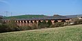
| Federal motorway 4 near Jena | ||||||||||||||||||||||||||||||||||||||||||||||||||||||||||||||||||||||||||||||||||||||||||||||||||||||||||||||||||||||||||||||||||||||||||||||||||||||||||||||||||||||||||||||||||||||||||||||||||||||||||||||||||||||||||||||||||||||||||||||||||||||||||||||||||||||||||||||||||||||||||||||||||||||||||||||||||||||||||||||||||||||||||||||||||||||||||||||||||||||||||||||||||||||||||||||||||||||||||||||||||||||||||||||||||||||||||||||||||||||||||||||||||||||||||||||||||||||||||||||||||||||||||||||||||||||||||||||||||||||||||||||||||||||||||||||||||||||||||||||||||||||||||||||||||||||||||||||||||||||||||||||||||||||||||||||||||||||||||||||||||||||||||||||||||||||||||||||||||||||||||||||||||||||||||||||||||||||||||||||||||||||||||||||||||||||||||||||||||||||||||||||||||||||||||||||||||||||||||||||||||||||||||||||||||||||||||||||||||||||||||||||||||||||||
|
Course of the road
|
||||||||||||||||||||||||||||||||||||||||||||||||||||||||||||||||||||||||||||||||||||||||||||||||||||||||||||||||||||||||||||||||||||||||||||||||||||||||||||||||||||||||||||||||||||||||||||||||||||||||||||||||||||||||||||||||||||||||||||||||||||||||||||||||||||||||||||||||||||||||||||||||||||||||||||||||||||||||||||||||||||||||||||||||||||||||||||||||||||||||||||||||||||||||||||||||||||||||||||||||||||||||||||||||||||||||||||||||||||||||||||||||||||||||||||||||||||||||||||||||||||||||||||||||||||||||||||||||||||||||||||||||||||||||||||||||||||||||||||||||||||||||||||||||||||||||||||||||||||||||||||||||||||||||||||||||||||||||||||||||||||||||||||||||||||||||||||||||||||||||||||||||||||||||||||||||||||||||||||||||||||||||||||||||||||||||||||||||||||||||||||||||||||||||||||||||||||||||||||||||||||||||||||||||||||||||||||||||||||||||||||||||||||||||
The federal highway 4 (abbreviation: BAB 4 ) - short form: Autobahn 4 (abbreviation: A 4 ) - is the fourth longest highway in Germany after the federal highways 7 , 3 and 1 and runs from the Dutch border near Aachen via Cologne , Bad Hersfeld , Erfurt , Chemnitz and Dresden to the Polish border near Görlitz . The motorway between Kreuztal-Krombach and the Kirchheimer Dreieck is interrupted.
During the division of Germany , it formed one of the transit routes through the GDR with the Wartha / Herleshausen border crossing . Since the opening of the border in 1989, it has been an important east-west link for European transit traffic, as a result of which the volume of traffic has increased sharply. In its eastern part, the route has therefore been continuously modernized and expanded.
For the most part of its course, the motorway is part of the European route 40 , and in parts of the European routes 314 and 55 . Its total length is 583 km - 150 km on the western branch and 433 km on the eastern branch.
course
Aachen – Krombach
The motorway begins at the Vetschau border crossing as a continuation of the Dutch Rijksweg A 76 . It runs in four lanes through the northern urban area of Aachen and meets the BAB 544 coming from Europaplatz at the Aachen junction , at the same time the BAB 44 leading from the Belgian border to Düsseldorf is crossed. The BAB 544 can only be reached from the east, as the western part of the Aachener Kreuz is designed as a fork that is connected to the clover leaf cross via several connecting ramps - six lanes with up to 17 lanes run between the two parts of the cross. From the west you have to use the Aachen-Zentrum junction to reach Europaplatz .
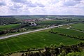
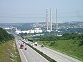
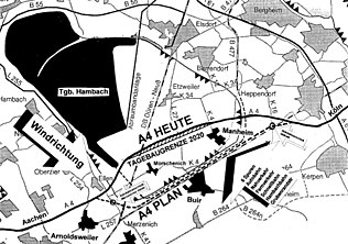
The BAB 4 has six lanes behind the cross. It leads past Eschweiler on the northern edge of the Eifel and then through the flat Jülich-Zülpicher Börde . At Weisweiler there is a large lignite power station directly on the motorway, a few kilometers further east behind Düren , the motorway was relocated several kilometers to the south due to the expansion of the Hambach opencast mine . In Kerpen crossing BAB 61 ( Venlo - Hockenheim ), which represents the fastest connection to southern Germany. After Kerpen, the motorway leads over the foothills and descends near Frechen to the Rhine . In an easterly direction of travel there is a sweeping view of the city of Cologne .

Just before the Dutch border

In the Aachen cross before the renovation

Near Eschweiler, in the background the Weisweiler power station
Six-lane route near Düren

Six-lane new construction route between Düren and Kerpen
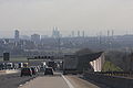
View of Cologne


The Cologne-West junction , where the BAB 1 crosses , marks the beginning of the southern Cologne motorway ring . The Cologne-Eifeltor container station is located directly on the motorway and has its own junction. Then the BAB 555 leads to Bonn at the Köln-Süd junction . Then the Rhine is crossed on the Rodenkirchener Brücke and the Köln-Gremberg junction crosses the BAB 559 from Deutz to Cologne / Bonn Airport and on to Königswinter . The main carriageway of the BAB 4 ends at the following triangle Cologne-Heumar and leads to that of the BAB 3 .
As far as the Köln-Ost junction, motorways 3 and 4 run on a shared, eight-lane route in a northerly direction. Behind the cross, the BAB 4 then leads back on its own route in an easterly direction. It leads past some eastern districts of Cologne and through the Königsforst near Bergisch Gladbach from the Cologne Bay up to the Bergisches Land . The following section of the route is characterized by the character of low mountain ranges with numerous curves, longitudinal inclines and valley bridges. Past Overath , Engelskirchen , Gummersbach and Bergneustadt , it finally reaches the Sauerland , where the Olpe-Süd junction crosses the BAB 45 ( Dortmund - Aschaffenburg ). For years, this motorway junction was the end point of the western section of the BAB 4. Since 2006, a new line has continued to Krombach , where it merges seamlessly into the motorway-like B 54 ( Hüttentalstraße ) to Siegen .

Departure to the Eifeltor container station

Rodenkirchener Bridge over the Rhine in Cologne

At the Refrath junction (before renaming in 2019)

Routing in the Bergisches Land near Overath
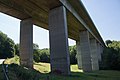
One of the numerous viaducts between Cologne and Olpe


_AS_Refrath.jpg)
.jpg)

Kirchheim – Görlitz
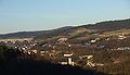
At the Kirchheimer Dreieck , the eastern section of the BAB 4 branches off from the BAB 7 . The initially four-lane route leads through the hilly and heavily forested Hessian mountains past Bad Hersfeld and reaches the state border with the Free State of Thuringia at Wildeck , which is crossed three times between Obersuhl and Herleshausen . From the Wommen junction , the motorway has six lanes, bypasses Eisenach widely and reaches the Thuringian Basin . Along the northern edge of the Thuringian Forest , it leads past Gotha and crosses the BAB 71 ( Sangerhausen - Schweinfurt ) at the Erfurt interchange .
Kirchheim triangle
Refurbished Wommen viaduct

Near Eisenach
Between Gotha and Erfurt


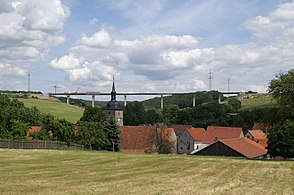
It goes around the state capital Erfurt , then reaches Weimar and leads through the Jagdberg tunnel before reaching the Saale valley and the university town of Jena . In the city of Jena, the motorway leads through another tunnel that was built for noise protection reasons. Behind Jena, the wooded Thuringian woodland is crossed and the BAB 9 ( Berlin - Munich ) crossed at the Hermsdorfer Kreuz .
At the Erfurt cross

Between Erfurt and Weimar

Jagdberg tunnel
In the Saale valley near Jena

At the Hermsdorfer Kreuz
_Erfurter_Kreuz_-_geo.hlipp.de_-_6937.jpg)
_bei_Eichelborn_im_Weimarer_Land_-_geo.hlipp.de_-_6935.jpg)

.JPG)
After the Hermsdorfer Kreuz you reach the East Thuringian city of Gera and then the border with the Free State of Saxony near Schmölln . After Glauchau and a route through the Rabensteiner Forest , the Autobahn reaches Chemnitz and crosses the BAB 72 ( Leipzig - Hof ). It then leads through the Erzgebirge foothills to Nossen , where the BAB 14 coming from Magdeburg ends. From there it goes on to Dresden .
In the west of the Saxon state capital, the BAB 17 branches off to the Czech Republic , then the BAB 4 descends into the Elbe Valley and crosses the Elbe in the north-western Dresden city area. Dresden Airport is connected to the north of the city and the BAB 13 branches off in the direction of Berlin . The six-lane expansion also ends there.
When you leave the Dresden metropolitan area, the autobahn has four lanes again and crosses Upper Lusatia . Passing Bautzen , the Königshain Mountains are crossed in a more than 3 km long tunnel before the border town of Görlitz is reached. In the north of the city the Lusatian Neisse is crossed and with it the state border with Poland . On the Polish side, the autostrada A4 continues to Wroclaw , via the Upper Silesian industrial area and Krakow to the Polish-Ukrainian border.
At Gera

at Meerane with B 93

At the Chemnitz cross

Bahrebachmühlen viaduct near Chemnitz

Near Dresden

Former border crossing in Ludwigsdorf before the demolition


history
First plans
Plans for roads that were to be reserved exclusively for motorized individual traffic came up with the advancement of motorization in the 1920s. In the Prussian Rhine Province in particular , due to the large number of inhabitants and the high degree of industrialization, this happened very quickly, so that the narrow and unpaved roads were no longer able to cope with the traffic. New provincial roads should remedy this. The first plans for such a road between Aachen and Cologne date back to 1925; in March 1926, the Rhenish provincial parliament decided to build a provincial road from Cologne to Düsseldorf.
The HaFraBa eV association ( association for the construction of a road for express motor vehicle traffic from Hamburg via Frankfurt am Main to Basel ), founded at the end of 1926, initially designed a trunk road from Hamburg via Frankfurt am Main to the Swiss border to Basel under Robert Otzen . In 1927, the association designed the first nationwide long-distance road network, from 1929 onwards, instead of the previously usual name Nur-Autostraße, under the term “ autobahn ” coined by Otzen, analogous to the railway . The Aachen – Cologne connection also appears in most of the HaFraBa overview plans from 1927 onwards. A connection Erfurt - Chemnitz - Dresden - Breslau , which can be seen as the preliminary planning of the realized eastern BAB-4 section, was also listed, as was a direct connection between Frankfurt am Main and Erfurt, plus a route from Kassel to Erfurt. A route from Cologne in an easterly direction was not planned.
1934 to 1943 - Reichsautobahn construction
Although the NSDAP was still against HaFraBa's autobahn plans at the time of the Weimar Republic and insulted them as “luxury roads for the rich”, one of the first projects after the seizure of power in January 1933 was to tackle those plans - primarily as a measure to address the curb high unemployment at the time. For this purpose, the HaFraBa association was changed to GEZUVOR ("Society for the preparation of the Reichsautobahnen eV"), but the plans were adopted almost unchanged from the times of the Weimar Republic.
Kirchheim - Görlitz (- Wroclaw)
At the start of construction, this connection consisted of the Reichsautobahn sections 17 ( Kirchheim - Erfurt - Gera ), 18 ( Gera - Dresden ) and 19 (Dresden - Görlitz). The groundbreaking ceremony took place on March 21, 1934 for route 18 near Dresden-Neustadt. On that date, the construction of the Reichsautobahn began at 22 locations in the German Reich as part of the so-called Second Labor Battle. The main event in the presence of Adolf Hitler took place on the Munich – Salzburg route.
By 1936, a 12 km long section between Wilsdruff and Dresden and the 26 km long route between Lobsdorf and Oberlichtenau between Gera and Chemnitz had been opened. The following year, 1937, the 48 km long gap was closed in three sections - on May 8, 1937 between Frankenberg and Siebenlehn and on June 25, 1937 between Oberlichtenau and Frankenberg and between Siebenlehn and Wilsdruff. On the latter date, the first part of the western extension of 77 km to Jena in the Lobsdorf – Meerane section was completed. Then followed the 63.2 km long section from Meerane to Jena. Another 4 km of route 19 were released in December 1937 eastwards from Dresden-Neustadt to the Bautzener Dreieck (today's Dresden-Nord triangle ). A continuous two-lane motorway was thus completed between Jena and Dresden.
In 1938 the numbering system of the Reichsautobahn was changed. The route numbers 81 (Kirchheim– Eisenach ), 79 (Eisenach – Erfurt), 80 (Erfurt – Chemnitz), 83 (Chemnitz – Dresden), and 73 (Dresden – Görlitz) have now been assigned to the Kirchheim – Görlitz motorway .
The most outstanding bridge structure in the construction of this route was the Teufelstal Bridge east of Jena, which was only opened to traffic in August 1938 , and at that time one of the largest arched bridges in the world. It was created according to a design by Arnold Agatz under the supreme construction management of the Reichsautobahnen (until 1935 supreme construction management of the motorways ) Halle. A multitude of other larger bridges were built along the route to cross the numerous river valleys in the hilly landscape of the northern Erzgebirge foothills . The Bahrebachmühlen Viaduct - a striking arched railway bridge near Chemnitz - is crossed by the motorway at an acute angle, which made it necessary to widen the median.
The construction of line 80 between Erfurt and Jena began in 1937. On August 18, 1939, the section between Weimar and Jena was opened to traffic by Fritz Todt , General Inspector for Roads, at the level of the Saale Valley Bridge near Jena.
On route 73 , which was supposed to lead from Dresden via Görlitz to a junction near Bunzlau of the Reichsautobahn Berlin-Breslau, two sections were completed in 1938 - on October 3rd the section Uhyst on Taucher-Bautzen-West and on December 4th the section Bautzener Dreieck - Ottendorf-Okrilla . The last approved sections on this route for the time being were on July 1, 1940, the sections Bautzen-West-Weißenberg and Ottendorf-Okrilla-Uhyst am Taucher. The last-mentioned stretch could largely be released as two-lane except for an approx. 5 km long section. On the same day, the section between Erfurt and Weimar was also completed on route 80 . The outbreak of World War II led to a reduction in construction work, and inauguration ceremonies were also dispensed with from now on. The further construction from Weißenberg via Görlitz to Bunzlau had also started. Various preserved bridge abutments and the prepared route in the Königshain mountains are evidence of this to this day.
Between Eisenach and Erfurt, the Reichsautobahn route 79 was therefore largely opened to traffic with only one lane until 1940. The Waltershausen – Erfurt section was released in 1940 and had a southern carriageway that was only partially concreted - here both driving directions were directed to the northern carriageway. To the west of it, between Eisenach-Ost and Waltershausen, there was also only one directional lane on some sections. In addition, the church bridge at Trenkelhof was no longer completed, which is why a temporary valley bypass was set up.
What is striking is the route through the Hörselberge with its height-offset lanes and the frontal view of the Wartburg in the westerly direction of travel. As with most of the Reichsautobahn, the entire route from Kirchheim to Görlitz is characterized by certain lines of sight and guided tours along mountain ranges in order to create a certain staging of the surrounding landscape. The “beauty of the German landscape” should open up to the “car hiker”.
The mostly half-finished route between the Eisenach-West and Eisenach-Ost junctions was released in 1941. To the west of it, between Herleshausen and Eisenach-West, construction of the Werra Valley Bridge began in 1939. From July 1, 1943, the construction site's bypass road with a wooden Werra bridge was used to close the gap.
As the last section of the Reichsautobahn halfway completed during the National Socialist era, earthworks on route 81 between Kirchheim and Herleshausen began in September 1937 . Before that, construction work on the Kirchheimer Dreieck, where route 81 was to branch off from the HaFraBa main route Kassel – Frankfurt, had already begun in 1936. The work in the hilly and wooded area between Kirchheim and Eisenach was initially quick, so that the construction of the roadway began as early as 1938 and some sections were released in 1940 - the two-lane line between the Kirchheimer Dreieck and Sorga (east of Bad Hersfeld ) was completed and below Traffic, whereby the Asbachtalbrücke was only supplemented by a second lane in 1941. The motorway between Wildeck and Gerstungen was also completed in 1940, but not yet under traffic due to the ongoing construction work.
Only with the completion of the Sorga – Wildeck section in 1943, which provisionally only included the southern carriageway, was this section also opened to traffic. Most recently, the Gerstungen – Herleshausen section was completed at this time, with the exception of the Richelsdorf viaduct with the southern carriageway. A ramp was therefore temporarily relocated through the valley around the unfinished bridge structure. The Wommen viaduct was only completed on its southern side. When construction work on the Reichsautobahn ceased in 1943, a stretch from the Kirchheimer Dreieck to Weißenberg east of Bautzen was in operation, in some cases with only one lane.

Teufelstalbrücke near Jena from 1938 (picture from 1988)

In the Triebischtal between Chemnitz and Dresden

Unfinished motorway bridge near Thiemendorf east of Bautzen
_Teufelstalbr%C3%BCcke_A4.jpg)

.jpg)
Aachen - Cologne
The groundbreaking ceremony for the Aachen – Cologne motorway took place on March 22, 1936 between Eschweiler and Weisweiler . Only two weeks earlier, Wehrmacht troops were relocated to the Rhineland , which had been demilitarized due to the Versailles Treaty , and thus remilitarized . Partly the Reichsautobahn was to run on the already measured route of the planned Cologne - Düren - Eschweiler - Aachen railway. The first 15 km long section from Eschweiler to Düren was opened to traffic in 1939 after three years of construction. By 1941, a further 5.5 km to Aachen- Verlautenheide were completed to the west .
Construction of the Reichsautobahn began near Cologne as well, so from 1938 the section from Cologne-Heumar to Cologne-South was under construction. This line served primarily as a connection between the Reichsautobahn Ruhrgebiet – Frankfurt and the Cologne – Bonn line. In addition to connecting this route, which was built in 1932 as the first motorway in Germany, to the newly created network, it was intended to serve as an advance payment for a motorway ring around Cologne.
Even before the opening of the first Reichsautobahn ( Frankfurt - Mannheim ) in 1935, the Cologne – Bonn route was degraded by the National Socialists to a country road - although large parts of the motorway network had been planned in the 1920s, the NSDAP wanted the motorway to be built spend your own invention. From a legal point of view, the Cologne-Süd connection was not a motorway junction, but a connection to a country road.
The most outstanding structure of this relatively short section is the Rodenkirchen bridge over the Rhine . Construction of the bridge began on March 1, 1938. Since the construction of the bridge was classified as a strategic measure, there was no interruption in construction during the initial phase of the Second World War, which began in 1939 . On September 20, 1941, what was then the largest suspension bridge in Europe was completed.
Due to the Second World War and the associated suspension of road construction work, the entire route was no longer completed. Construction work only started again here in the 1950s.
Post-war period and division of Germany

In the last months of the war there was destruction of structures along the route. After an Allied bombing raid, the Rodenkirchen Bridge collapsed on January 28, 1945. Shortly before the end of the war, on April 11, 1945, the Saale bridge near Jena and on April 19, 1945 the Spree bridge near Bautzen were blown up by the Wehrmacht in order to prevent Allied troops from advancing. Since the Spreebrücke separated the only partially completed section between Bautzen and Weißenberg from the rest of the route coming from Dresden, its importance to traffic was still relatively minor, which is why there was initially no reconstruction and the section Bautzen – Weißenberg was later permanently closed.
With the gradual isolation between the American and Soviet occupation zones, traffic came to a standstill. In August 1946, the American and Soviet occupation authorities agreed to set up a border crossing at Herleshausen / Wartha . According to the interpretation of the GDR , border controls for the transit route to West Berlin were only possible east of Herleshausen at the Wartha / Herleshausen border crossing - the section to the west of the border crossing in the so-called Thuringian corner between Wildeck-Obersuhl and Herleshausen, which crossed the inner-German border twice therefore closed to traffic and slowly fell into disrepair.
In the area of what is now the Dresden-North motorway triangle, the A 4 was used from 1951 to 1971 as a motorcycle and car racing track at times ( Dresden motorway spider ). The Bautzen motorway ring at the Bautzen-West junction and the eastern branch of the route was also a temporary race track from 1955 to 1974.
1950s and 1960s - construction work resumed
Reconstruction of destroyed structures

In the early 1950s, most of the destroyed structures on the line were repaired or rebuilt - the Rodenkirchen Bridge was rebuilt from 1952 to 1954 using the pylons that had been preserved . The Saale Valley Bridge, which was faithfully rebuilt, was also built in the same period.
Due to the fact that the Spree bridge at Bautzen was not built, the section Bautzen-Ost-Weißenberg remained closed during GDR times. The GDR government decided in 1965 to divest it. In the following year, 66 grain storage halls were built on a total length of 16 km on the roadway, which were supposed to maintain the food supply of the GDR in the event of a crisis. The route was also cordoned off with fences. The reconstruction of the Spree bridge in Bautzen was not carried out until 1973 to 1977 so that the trucks for the delivery of concrete slabs for the residential area Bautzen-Gesundbrunnen did not have to be driven through the city.
After the end of the war, the northern lane between the Hönebach and Obersuhl junctions was opened for agricultural traffic, and the Raßdorf and Bosserode temporary exits were set up for this purpose. The two-lane operation on a one-way carriageway was only released at the end of the 1960s after the new road between Hönebach and Bosserode was built.
Completion Aachen - Cologne
The Aachen – Cologne line was completed in sections by 1960. First of all, the southern bypass of Cologne was completed, so that in 1957 the motorway extended 4 km in a westerly direction to the Köln- Klettenberg junction and in 1958 another 5 km to just before Frechen . In the same year, a 10 km stretch to the east from Düren to the Buir junction was completed, and in 1959 a further 11 km to the Kerpen junction . The 13 km long gap between Kerpen and Frechen was closed in 1960
Further construction
Dutch border - Aachen
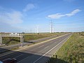
The approximately 10 km long route from the Aachen junction to the German-Dutch border crossing in the Aachen district of Vetschau was opened in 1970. This branches off to the west of the existing motorway junction from the Aachen-Europaplatz-Cologne motorway and is connected to it via parallel lanes. At the same time, the route was continued on the Dutch side via Heerlen to the Belgian border, today's Rijksweg 76 , which was completed in sections by 1976.
A section several hundred meters long, which belongs to the German A 4 and the Dutch A76, is signposted as a motor road in the area of the border crossing . In this area there has been a junction in the form of a single ramp that can only be reached from Cologne since the late 1990s, which branches off the autobahn in Germany and connects to the cross-border Avantis business park on the Dutch side .
Cologne - Olpe
A motorway stretch leading from Cologne to the east in the direction of Kassel was already listed in route plans during the Nazi era in the mid-1930s to replace Reichsstrasse 55 . In 1959 and 1960 these plans were resumed, initially as a replacement federal road EB 55 as a bypass of Bergisch Gladbach . With the construction of the Sauerland line between Dortmund and Gießen in the 1960s, a connection between the Kölner Ring and this line was planned, especially since a planned widening of the existing federal road was not possible without extensive interventions for reasons of space.
A route from Cologne- Merheim via Bensberg , Overath , Engelskirchen , Gummersbach and Denklingen to the Sauerland line at Wenden- Gerlingen was preferred as the most cost-effective implementation . Alternatively, it would have started on the Cologne – Frankfurt motorway near Rösrath , which would have been more in line with the course of the planned Reichsautobahn. From 1967 the route was planned as a motorway with the designation Autobahn 73 .
The westernmost part of the four-lane route leads through the eastern Cologne districts of Merheim and Brück and then through the northern Königsforst to Untereschbach , where the mountainous part begins through the Bergisches Land and the Sauerland . The route finding was therefore time-consuming in many places. With a height difference of around 400 m between Merheim (around 50 m) and Hespert (around 450 m) - numerous valley bridges , dams and cuttings had to be built in order to keep the longitudinal slope of the route as low as possible. Between Untereschbach and Gummersbach, an additional lane was added on some of the steeper gradients.
The connection to the Sauerland line was initially intended as a motorway triangle without any continuation. With the decision of the new road construction authority in Siegen to continue the route to the Hattenbacher Dreieck between Kassel and Gießen , a motorway junction in the form of a clover leaf was realized with a junction immediately to the east. This connection marked the eastern, provisional end of the Cologne – Olpe motorway.
The section between the Refrath and Moitzfeld junctions was the first of this line to be completed in 1968, followed by the eastern continuation to Untereschbach in 1970. Between Engelskirchen and Gummersbach, the next section followed in 1973, before the connection to the Kölner Ring at the Köln-Ost junction was opened in 1974 . The section between Untereschbach and Engelskirchen was completed in 1975, the last section from Gummersbach to the Olpe-Süd junction in 1976, which meant that the route between the Kölner Ring and the Sauerland line - from 1975 the federal motorways 3 and 45 - was continuously passable.
(Transit) route in the GDR
During the time of the division of Germany , the section from Eisenach to Hermsdorfer Kreuz , which was located in the GDR and connected to the Berlin – Munich route , was one of three (from 1982 four) transit highways between West Germany and the western part of Berlin. In the 1970s and 1980s, new border crossing points were built in Herleshausen and Wartha for this purpose , and the subsequent route was brought up to motorway standards. Only between Wildeck and Wommen was the road no longer reactivated due to its location in the border area. From the Hermsdorfer Kreuz to Dresden , the autobahn was equipped with a two-lane standard even before the GDR was founded, while the section from Dresden to the provisional end of the autobahn at Bautzen, with long, single-lane sections, fell into disrepair despite ongoing operations.
Provisional arrangements
When the Reichsautobahn route Kirchheim – Dresden was built at the end of the 1930s, east of Eisenach, a route through the wooded Hörselberge with steep longitudinal slopes and relatively tight curves was created. On Trenkelhof in Wutha also one was interchange with the planned route 85 from Nordhausen to Bamberg provided - at this point would be at a complete network realizing the connections Cologne - Berlin and Hamburg - Munich made. Due to the moving terrain, a 170 m long and 30 m high bridge over the church valley was planned for the road in this area . In 1937 the construction of the line and the bridge began, since a delayed completion of this structure was already foreseeable, a provisional single-lane bypass was laid north of the construction site and the Eisenach – Weimar section was put into operation in autumn 1940.
In the GDR , the viaduct was no longer built and the provisional Trenkelhof bypass was still used. Although the last single-lane sections between Eisenach and Erfurt were removed in the 1960s, the completion of the Kirchtalbrücke was not pursued further initially due to a lack of financial resources, then due to a lack of interest in the section ending a few kilometers west of the zone border. It was only with the signing of the transit agreement in 1971, which regulated transit traffic through the GDR mainly to West Berlin , that there was a noticeable increase in the volume of traffic on the route - it was the main connection from Frankfurt am Main and large parts of southwest Germany to Berlin. Therefore, with financial support from the FRG, the two-lane expansion was carried out. In the 1970s, instead of a bridge, a dam was built in the Kirchtal valley, over which the motorway was led. In 1982 the new route was opened and the Trenkelhof bypass closed. It was not until 2006 that the asphalt was removed as part of the construction work on the re-routing around Eisenach.
Construction of the border crossing


The section from Wommen to Herleshausen, which had been shut down in the course of the division of Germany, was reopened as a single lane in 1978 to relieve Herleshausen of through traffic, which increased as a result of the transit agreement. In 1980 the second lane followed. There was thus a vacant lot between the border crossing facilities in Herleshausen and the start of the motorway on GDR territory at the Eisenach-West junction. As part of an agreement between the FRG and the GDR, it was decided in April 1980 to realize a motorway border crossing on GDR territory and to use the fallow section between Herleshausen and Eisenach-West with a new, 80 m high Hörschel bridge . The construction work on the cross-border motorway stretch was almost completely neglected in the Eisenach local press. The Werra Valley Bridge between the FRG and GDR checkpoints was completed in 1983, the border systems in Wartha were put into operation a year later in 1984, which meant that it was no longer necessary to use country roads when crossing the border.
Reorganization of the motorway network
On January 1, 1975, a new uniform numbering scheme was introduced for the motorways in the Federal Republic of Germany and West Berlin. Initially, only internally managed numbering was used and only the numbers of the European roads running along the route were indicated on the signposts, but the new national numbering was brought forward. A previously in demand plan national highways 1971-1985 described system, the by Berliner Ring the digit numbers A 1 zuordnete branching routes to A 6, could, also in view of the then still existing German division , not prevail. The designation A 4 was therefore for lying in the GDR route Berlin- Cottbus -Polish border at Forst provided as today BAB 4 designated route was as A 71 (Dutch. Limit junction Aachen), A 15 (Aachen-Europaplatz- Dreieck Heumar), A 73 (Kreuz Köln-Ost – Hattenbacher Dreieck) and A 23 (Kirchheimer Dreieck – Herleshausen).
With the introduction of the current system, which assigned single-digit numbers to the most important long-distance routes, most of which were already planned as main routes during the Weimar Republic , the number was dialed for the second continuous east-west connection from the north BAB 4 (Federal Motorway 4). A major advantage of the system, which also assigned the leading number of two- and three-digit motorways to a specific region, was that, in the event of reunification, it could easily assign numbers for the motorway routes in the former GDR (essentially these were the ones previously for the West Berlin city highways assigned numbers in the 10 range).
The motorway, which was then completed from the Dutch border near Aachen to the Olpe-Süd junction and from the Kirchheimer Dreieck to the Wartha / Herleshausen border crossing with a break in the border area, was given the number BAB 4, which meant that a gap between Olpe and Kirchheim was part of the planning. In the event of the reunification of the two German states, the numbering should continue along the route via Erfurt and Dresden until the end of the autobahn at Bautzen , which existed during the GDR era . At the Aachen junction you have to leave the main carriageway in a westerly direction, at the Heumar triangle and the Köln-Ost junction in both directions to stay on the BAB 4 - here the Cologne – Aachen route became the continuation of the 1970s to the Dutch border and from Cologne to Olpe.
An alternative designation for the western part of the BAB 4 (Aachen – Olpe) was Bundesautobahn 50 (BAB 50), this number was to be used in the 1970s when the plans for the further construction of Olpe to the east were discontinued.
The GDR never used motorway numbers in its signposting, only the long-distance destinations were indicated on the signs. Later the European roads were taken with them on the signposts. However, there was an internal numbering scheme that was used for administrative purposes only. In this, the Eisenach – Dresden route was assigned the number A 7 and the Dresden – Bautzen route the number A 6 .
After the turn
The fall of the Iron Curtain in 1989 changed the situation in Europe suddenly - the east-west traffic, which had previously been interrupted by the border installations, increased steadily in the following years. There were bottlenecks in particular on the former inner-German transit routes, which had been inadequately developed and repaired during the division of Germany due to their peripheral location in the west and lack of financial resources in the east. Therefore, together with the Federal Transport Infrastructure Plan in 1992, the Transport Projects German Unity program was initiated, which provides for the construction and expansion of important transport axes and infrastructure between the old and new federal states.
In the case of the BAB 4, there was also the fact that some sections were still inaccessible, lay fallow or only had a one-way carriageway. A thorough renovation of the entire route from Kirchheim to Bautzen with the aim of a continuous two-lane passability was therefore the first measure carried out before the six-lane expansion and the extension to Görlitz was tackled.
The six-lane expansion between Eisenach and Dresden, including the relocation of individual sections, as well as the expansion from Bautzen to the Polish border near Görlitz, together with the new construction of the BAB 44 between Kassel and Eisenach, has been designated by DEGES as a German Unity Transport Project No. 15 .
Closing the gap in the Thuringian corner

First, the fallow section between the Wildeck-Obersuhl and Wommen junctions in the Thuringian corner was restored. Just a few days after the opening of the border, in November 1989 it was temporarily prepared for traffic between Obersuhl and Untersuhl (provisional border system in the western part of the Gerstungen junction ) in order to be able to accommodate the masses of outgoing road users. Work on the section between Gerstungen and Wommen with a guided tour over the old Wommen viaduct began in April 1990, initially with a single-lane traffic route bypassing the unfinished Weihetalbrücke on the approaches to the Gerstungen junction - the wooden structure on the completed bridge piers was still ahead was dismantled again at the end of the war in 1945. This route was opened in June 1990. In the summer of 1991, the second carriageway (north carriageway) was rebuilt and opened to traffic, and the provisional valley passage near Gerstungen / Richelsdorf was also built with two lanes .
Five of the seven pillars of the now incomplete Weihetalbrücke were blown up in July 1992 to make way for a new building. Two pillars were preserved as memorials. In October 1993 the northern half of the Weihetalbrücke and in December 1993 the new northern half of the Wommen Viaduct was completed. In December 1994, the completed southern half of the Weihetalbrücke and the renovated old Wommen viaduct, which crosses the Dresden carriageway, were both large bridges. This was followed by October 1995 and May 1996, respectively, with the completion of the northern and southern carriageway between Wildeck-Obersuhl and Gerstungen, which meant that the autobahn from Kirchheim to Bautzen was continuously passable on two lanes.
Construction of Bautzen - Görlitz - Polish border
At the time of reunification in 1990, drivers on the motorway section between Dresden and Bautzen were faced with a desolate picture. Due to the low traffic importance of the line, almost no repair work was carried out during the entire GDR period. Large parts were only passable with one-way carriageway with oncoming traffic, the alignment of the carriageway and most of the junctions ( e.g. in Ohorn ) was basically the same as when it was built in the 1930s. Neither hard shoulder nor crash barriers existed. Although the generally valid maximum speed of 100 km / h on motorways in the GDR was valid on the route, driving at this speed was not possible in practice, which is why the limit was usually reduced to 60 to 80 km / h after the fall of the Wall. A section between Puschwitz and Bautzen was made of granite paving even in the early 1990s and was limited to a maximum speed of 20 km / h. Long-distance traffic from Dresden to the east usually switched to federal highway 6 due to the poor condition of the route .
The granaries on the route of the disused section from Bautzen-Ost to Weißenberg were demolished in 1992 in order to put the motorway back into operation at this point. By the mid-1990s, the motorway between Dresden and Bautzen was completely renewed by first building the missing directional lane and then completely refurbishing the existing lane. When the line between Dresden and Weißenberg was completely renovated in the mid-1990s, construction from Bautzen to the Polish border near Görlitz followed . For reasons of nature conservation, it was decided not to follow the originally planned and prepared line over the Königshain Mountains , but to tunnel the road a little further north into the underground. The Königshainer Berge tunnel, which was built between 1996 and 1999, was the second longest motorway tunnel in Germany at the time. In contrast, two prepared RAB bridges at Thiemendorf near the western tunnel portal have been preserved.
Extension of Wenden - Krombach
From 2002 to 2006 the BAB 4 was extended by approx. 6 km from Wenden in an easterly direction to the new Krombach junction . After the junction, the motorway then turns into the similarly developed B 54 , which leads via Kreuztal to the existing expressway to Siegen ( Hüttentalstraße ). Eight viaducts, ten overpasses and underpasses were built on the approximately twelve-kilometer section of the two roads A 4 / B 54. A total of 2 million m³ of soil was moved. The costs were around € 130 million.
The new BAB-4 section between Olpe-Süd and Kreuztal-Krombach ( Krombacher Höhe ) was opened on December 1, 2006, the further section from Krombacher Höhe via Kreuztal to Siegen as a continuation of Hüttentalstraße is already open on June 23, 2006 for opened to traffic.

Newly built section between Wenden and Krombach

Junction Krombach, crossing BAB 4 / B 54

Highway-like continuation to Kreuztal / Siegen


List of traffic clearances
| section | year | length |
|---|---|---|
| Dutch border - Aachen cross | 1970 | 10 km |
| Aachen junction - AS Eschweiler | 1941 | 5.5 km |
| AS Eschweiler - AS Düren | 1939 | 15.0 km |
| AS Düren - AS Buir | 1958 | 10 km |
| AS Buir - AS Kerpen | 1959 | 11 km |
| AS Kerpen - Cologne-Dürener Strasse | 1960 | 13 km |
| Cologne-Dürener Strasse - AS Cologne-Klettenberg | 1958 | 5 km |
| AS Köln-Klettenberg - Kreuz Köln-Süd | 1957 | 4 km |
| Kreuz Köln-Süd - Dreieck Köln-Heumar | 1941 | 7.9 km |
| Kreuz Köln-Ost - AS Refrath | 1974 | 4.5 km |
| AS Refrath - AS Moitzfeld | 1968 | 6 km |
| AS Moitzfeld - AS Untereschbach | 1970 | 4 km |
| AS Untereschbach - AS Engelskirchen | 1975 | 16.9 km |
| AS Engelskirchen - AS Gummersbach | 1973 | 7.8 km |
| AS Gummersbach - Kreuz Olpe-Süd | 1976 | 22.8 km |
| Kreuz Olpe-Süd - AS Wenden | 2001 | 0.3 km |
| AS Wenden - AS Krombach | 2006 | 8.8 km |
| Kirchheimer Dreieck - AS Bad Hersfeld | 1940 | 10.7 km |
| AS Bad Hersfeld - Sorga | 1940 | 4.7 km |
| Sorga - AS Wildeck-Obersuhl | 1943 | 20 km |
| AS Wildeck-Obersuhl - AS Wommen | 1943 1994 |
9.3 km |
| AS Wommen - AS Herleshausen | 1943 1978 |
4 km |
| AS Herleshausen - AS Eisenach-West | 1984 | 8.8 km |
| AS Eisenach-West - Eisenach | 1941 | 3.2 km |
| Eisenach - AS Eisenach-Ost | 1941 1973 |
1.9 km |
| AS Eisenach-Ost - Trenkelhof | 1940 | 1.3 km |
| Trenkelhof - Wutha | 1982 | 1.8 km |
| AS Wutha - Mechterstädt | 1940 | 8.4 km |
| Mechterstädt - Hörselgau | 1940 1969 |
5.7 km |
| Hörselgau - Emleben | 1940 | 9.8 km |
| Emleben - Günthersleben | 1940 1968 |
4.2 km |
| Günthersleben - Wechmar | 1940 | 3.0 km |
| Wechmar - AS Wandersleben | 1940 1968 |
2.2 km |
| AS Wandersleben - AS Weimar | 1940 | 35.3 km |
| AS Weimar - AS Jena-Lobeda | 1939 | 26.5 km |
| AS Jena-Lobeda - Lobsdorf | 1937 | 77 km |
| Lobsdorf - Oberlichtenau | 1936 | 26 km |
| Oberlichtenau - AS Wilsdruff | 1937 | 48 km |
| AS Wilsdruff - AS Dresden-Neustadt | 1936 | 12 km |
| AS Dresden-Neustadt - AS Dresden-Nord | 1937 | 4 km |
| AS Dresden-Nord - AS Ottendorf-Okrilla | 1938 | 12 km |
| AS Ottendorf-Okrilla - Großröhrsdorf | 1940 | 11.1 km |
| Großröhrsdorf - Röderbrunn | 1940 1959 |
5.4 km |
| Röderbrunn - Glaubnitz | 1940 | 9.8 km |
| Glaubnitz - AS Uhyst a. T. | 1940 | 1.3 km |
| AS Uhyst a. T. - AS Bautzen-West | 1938 | 14 km |
| AS Bautzen-West - Gröditz | 1940 | 16.6 km |
| Gröditz - AS Weißenberg | 1940 1996 |
1.9 km |
| AS Weißenberg - AS Nieder Seifersdorf | 1996 | 7.8 km |
| AS Nieder Seifersdorf - AS Kodersdorf | 1999 | 10.7 km |
| AS Kodersdorf - AS Görlitz | 1997 | 4.9 km |
| AS Görlitz - Polish border | 1996 | 5 km |
Traffic volume
The section from Aachen to Cologne, which has a lot of transit traffic to Belgium, northern France and Luxembourg, has a particularly high volume of traffic. The motorway is also relatively busy between Nossen and Dresden. The most heavily loaded sections with an average daily traffic volume (DTV) with more than 100,000 vehicles are all located near Cologne , as numerous traffic flows, both regional and long-distance traffic, meet here.
Sections with DTV in excess of 100,000 per day
| section | DTV |
|---|---|
| Kreuz Köln-West - Köln-Klettenberg | 117,900 |
| Cologne-Klettenberg - Cologne-Eifeltor | 123,400 |
| Köln-Eifeltor - Kreuz Köln-Süd | 125,400 |
| Kreuz Köln-Süd - Köln-Poll | 134,200 |
| Köln-Poll - Kreuz Köln-Gremberg | 125,000 |
| Kreuz Köln-Ost - Köln-Merheim | 122,200 |
expansion
Large parts of the BAB 4 have been expanded to six lanes in recent years - the last missing piece between Aachen and Cologne was completed in 2016, which means that at least three lanes can be used in each direction from the Aachen motorway junction to the Cologne-Merheim junction, on the shared route with the BAB 3 there is a total of eight lanes. Since 2014, the motorway has also consisted of six lanes between Wommen and the Dresden-Nord motorway triangle. On the four-lane section between Cologne and Olpe as well as the Kirchheimer Dreieck and Wommen there are sections of additional lanes due to the hilly terrain.
Aachen – Cologne
In the 1990s to 2010s, the BAB 4 between the Aachen junction and the Heumar triangle was expanded from four to six lanes. The Aachen cross was extensively rebuilt and a section between Düren and Kerpen was moved a few kilometers to the south due to the expanding Hambach opencast mine .
Reconstruction at the Aachen cross
Since 2009 the Aachen motorway junction has been rebuilt in seven construction phases, expected to be up until 2020, in order to increase its capacity and enable faster and easier motorway changes. Additional parallel lanes will be set up, expanding the main east-west axis of the cross from ten to 17 lanes. Furthermore, the bridge structures on the BAB 44 and over the BAB 544 were renewed and some connecting ramps were re-routed.
Six-lane expansion Aachen – Cologne

In the 1980s, the six-lane expansion began in the area of the southern Cologne ring. Initially, the section from the Cologne-West junction to Cologne-Klettenberg was expanded before six lanes were available to the Cologne-South junction by 1990. The widening between the Cologne-Süd junction and the Cologne-Heumar triangle, which was carried out between 1990 and 1994, was laborious - the Rodenkirchen Bridge had to be extended by a second parallel structure. With the commissioning of the new Rhine bridge on December 9, 1994, the expansion of the southern Cologne ring was completed.
The expansion between Aachen and Cologne began in 1998 with the section between Aachen and Eschweiler, which was completed at the end of 2001. With a view to the 2006 World Cup with the Cologne Rheinenergiestadion as the venue, construction work continued in December 2001 between the Weisweiler and Düren junctions and between the Kerpen and Cologne-West motorway junctions. After about four years of construction, both sections were opened to traffic in 2005 with six lanes, with a new semi-junction being built in the latter section ( Frechen-Nord ). Construction between Eschweiler and Weisweiler began at the end of August 2004. On this section, which was completed in 2008, a new junction ( Eschweiler-Ost ) was also built, which was originally set up to replace the Weisweiler junction before it was decided to keep the latter. The former Eschweiler junction was also renamed Eschweiler-West . In December 2015, the new Langerwehe junction was opened east of Weisweiler .
Relocation of the Düren – Kerpen route
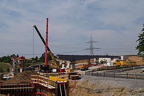
Relocation of the section between the Düren junction and the Kerpen junction had been planned since the start of expansion planning in the 1990s. The determination of the line for this took place on October 21, 2001. In September 2008, construction of the new route began. At the same time, the Hambachbahn , which previously ran parallel to the autobahn, will be relocated parallel to the new autobahn route. After six years of construction, the laid line was inaugurated on September 16, 2014 by Enak Ferlemann (Parliamentary State Secretary at the Federal Ministry of Transport and Digital Infrastructure ), State Transport Minister Michael Groschek and the CEO of RWE Power AG, Matthias Hartung. The Cologne carriageway between the junction with the existing road near Düren and the Merzenich junction was provisionally opened to traffic in April 2014.
Over a length of around 17.6 kilometers, the motorway was relocated out of the Hambach Forest by around 1.7 kilometers to the south to make room for the expansion of the Hambach opencast mine . The motorway now runs largely between the Hambachbahn and the high-speed line Cologne - Aachen , so that the traffic flows are bundled .
As a replacement for the discontinued Buir junction, the two new junction points Merzenich and Elsdorf were built - the latter was only completed at the end of 2014. In the course of the new building, 18 new bridges were built, including a 35 meter wide green bridge . As a design measure, the avenue “Tree of the Year” was created on the section near Kerpen-Buir - all the trees of the year from the past 25 years were planted on the embankment . On the dead straight section of the motorway, the planting in combination with the color-designed information boards is intended to attract the attention of drivers. In the spring of 2019, the trees from 2015 to 2018 were added to the avenue.
By 2016, the sections on the existing road between Düren and the Kerpen junction were expanded. In 2009 the Neolithic settlement near Arnoldsweiler was uncovered near Düren . On June 29, 2016, with the completion of the Elsdorf – Kerpen section, the six-lane expansion between Aachen and Cologne was finally completed after 18 years of construction. There was no formal opening.
A solar system was installed in 2017 on the westernmost section of the old motorway route in the Niederzier municipality , which is not in the expansion area of the Hambach opencast mine. This solar freeway is operated by Energiepartner Niederzier GmbH , in which the Niederzier municipality and innogy are involved, and has an output of almost 750 kW. The 2820 solar modules are located on the asphalt of the former motorway over a length of 620 m.
Site plan for the highway relocation in 1995

Expansion between Düren and Merzenich in December 2013

Blocked route between Kerpen and Buir

worn lane in the old motorway route

New six-lane route

.JPG)


Kirchheim – Dresden
The entire route between Kirchheim and Dresden was gradually renewed after the fall of 1989/90 and largely expanded to include six lanes. The route was relocated to the north in three sections - on the one hand to avoid routing through valleys with steep inclines, and on the other hand for reasons of nature conservation. From the Kirchheimer Dreieck to Wommen (planned motorway triangle with the BAB 44 coming from Kassel) there will be a four-lane expansion with additional lanes in sections and a defused route.
Extension of the AD Kirchheim to Wildeck-Obersuhl
The renovation and expansion of the 35-kilometer stretch between Kirchheimer Dreieck and Wildeck-Obersuhl began in 2006 with construction on the first section between Kirchheim and the Asbachtal bridge . The A 4 is to be extended to include hard shoulders and additional lanes on inclines and to be re-routed in sections. Additional lanes will have both directions of travel for more than 20 kilometers, so that most of the route will have five or six lanes after the construction work is completed.
Six-lane expansion Wommen – Dresden
Along with the extension of the federal motorway 44 from Kassel to the A4 at Wommen is the section Wommen - interchange Dresden-Nord of the highway expansion to six lanes and east of Dresden rehabilitation with growing emergency lane and partially four-lane construction after German reunification part of the transport project German Unity No. 15 from 1991. The new construction and expansion between Gerstungen and Eisenach was one of the first building measures. Plans for a continuous six-lane expansion of the carriageway with additional hard shoulder were not implemented. During this time, it was expanded to four lanes with hard shoulder to improve the traffic situation. For this purpose, the Weihetalbrücke between Gerstungen and Richelsdorf was built as well as a superstructure of the Wommen viaduct , an arched bridge made of red sandstone, which was conventionally renovated and a second superstructure, based on the first, was newly built. The elaborate repair and new construction with a red sandstone view was due to the monument protection for the renovated, south-facing old arched bridge over the Frauenborn stream and the Wommen valley. In 2005, the six-lane expansion between the Wommen junction and the Werra valley bridge was completed after three years.
In the 1990s, the six-lane expansion of the BAB 4 between Eisenach and Dresden began. The listed Teufelstalbrücke immediately west of the Hermsdorfer Kreuz was gradually replaced by two new bridges between 1996 and 2002. The Bahrebachmühlen viaduct near Chemnitz was rebuilt between 2000 and 2002 in such a way that the technical monument was preserved and a six-lane underpass was still possible. The Rüdersdorf to Gera section was expanded to six lanes from 1999 to 2001, the Gera - Gera-Leumnitz section from 2005 to 2007. In Gera in the course of the six-lane expansion arose simultaneously with the relocation of the B 2 the new junction cross Gera. The last section between Ronneburg and Schmölln was released on December 23, 2010, so that the continuous six-lane expansion between the Hermsdorf Cross and the Thuringia / Saxony border has been completed, with the exception of the planned expansion of the Hermsdorf Cross.
Realignment near Eisenach
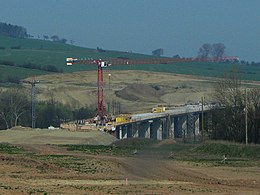
In January 2008, the new construction of the approximately 25 km long, six-lane section between the Werra Valley Bridge near Eisenach and the Waltershausen junction began. Between January 6 and November 24, 2010, the two lanes were gradually released, the PWC system "Hainich" and the Sättelstädt junction were put into operation.
The new line now has three connection points in a wide arc north of the Hörselberge, almost 14 km through the Hörselberg-Hainich community and around the city of Eisenach. At the end of construction west, the new Eisenach-West junction was built near Krauthausen , about two kilometers west of the previous exit. The Eisenach-Ost junction opens up about five kilometers northeast of the old driveway, located on the Böbertalbrücke near Großenlupnitz , the federal highway 84 . The newly created Sättelstädt junction , at the east end of the Hörselberge, serves as a junction with federal highway 7 and is intended to better connect the Ruhla / Bad Liebenstein traffic area . The location of the motorway maintenance depot will remain in Eisenach and will be expanded to include a large technology location in the Sättelstädt industrial park.
With the commissioning of the A-4 north route, some of the federal highways 7, 19, 84 and 88 in the Eisenach area were relocated and downgraded. The old autobahn between the former Eisenach-West (now Eisenach Weststadt) and Wutha-Farnroda junctions is used as a motor road on the Bundesstrasse 19 and Bundesstrasse 88 to bypass the Eisenach location. The subsequent eight kilometer long section Wutha-Farnroda - Sättelstädt was completely dismantled and renatured, including the dispensable old Hörseltal bridge in Sättelstädt. The removed carriageway material was broken up and reused for the second carriageway in the northern direction in the area between the Nessetalbrücke and the eastern end of the construction. In return, clean excavation could be installed when the old route was renatured.
685,000 m² of new road surface was created along the entire route. 202,000 m³ of concrete were processed. There were 73,000 tons of bituminous materials, 225,000 tons of gravel base layer and 894,000 tons of antifreeze gravel. A total of 3,200,000 m³ of earth had to be moved. 77,500 m³ of concrete, 8,500 tons of reinforcing steel, 515 tons of prestressing steel and 5,500 tons of structural steel were used to build the bridges. Three viaducts (Hörseltal 422 m; Nessetal 414 m and Böbertal 200 m) were created, five overpass structures and 19 motorway bridges were built.
The route was realized as a private motorway and the entire construction contract was awarded as part of a public-private partnership (PPP) in 2007. The expansion of the A 4 was the first of four PPP pilot projects to be completed. The PPP contract stipulates that the private partner “Via Solutions Thuringia” will take over the construction of the new line between kilometers 256.0 and 280.5 and the 44.7 kilometer section between the Gotha junction and the Thuringia / Hesse border managed for a period of 30 years and provided the financing of the service package. Via Solutions Thüringen receives the truck toll for the new construction, operation and maintenance of the section.
Construction site of the new Böbertalbrücke near Großenlupnitz
Hörseltal bridge near Sättelstädt
Nessetalbrücke near Ettenhausen / Nesse

Completed Hörseltal bridge

New motorway section before the Eisenach-Ost exit in the direction of Frankfurt a. M.


Reallocation near Jena
Between 2004 and 2009 the motorway near Jena was expanded to six lanes and provided with a noise protection enclosure (tunneling) to reduce noise. A second bridge was built south of the existing listed Saale valley bridge. In the Jena-Lobeda area, the directional lane to Dresden was also built 7 m further south next to the old motorway. After the new Saale valley bridge and half of the noise protection tunnel had been completed, the old autobahn was rebuilt as a directional lane to Erfurt. The Stadtrodaer Straße (L 1077, four-lane expressway from the motorway to the center of Jena) no longer leads under the motorway, but over it. The new, multi-lane bridge was opened to traffic on June 30, 2008. As a result of these construction measures, the former motorway junction with the new name “Jena-Zentrum” (previously Jena-Lobeda) was reopened for traffic on July 31, 2008.
West of Jena, since October 30, 2014, in the direction of Frankfurt and since November 18, 2014, in the direction of Dresden, the motorway between Magdala , Bucha and Jena- Göschwitz has been routed through the Jagdberg tunnel to relieve the nature reserve of the Leutratal . The traffic ran on the old route from the Magdel valley over the crest of the Ilm-Saale-Platte through the Leutratal down into the Saale valley on two lanes each without hard shoulder with a gradient of up to 6%, which is no longer permitted for new lines. Even when the weather was fine, it caused truck speeds to slow down considerably; in winter conditions, it led to frequent traffic jams and accidents.

Jena-Göschwitz junction, construction site of the Saale valley bridge with Lobdeburg tunnel (2008)

View from the Lobdeburgtunnel to the Saale valley bridge, on the right the listed part and on the left the new bridge

East portals for driving the Jagdberg tunnel near Jena-Göschwitz (2008)

A4 demolition in the Leutratal

Old and new A4 at the Jagdberg tunnel near Göschwitz


Realignment at Wilsdruff
The motorway ran between the triangle Nossen and Dresden until a small bypass with three viaducts was completed through the Tanneberger Loch , a narrow passage through the Triebisch valley . The ramps in the side valleys originally saved the need for a viaduct. The at Wilsdruff subsequent viaduct over the Wilde Sau had after already blown up on the war and in the postwar period had been rebuilt by the East, a third time to be built as part of the six-lane expansion.
Planning
Aachen to Olpe
The six-lane expansion of the Aachen-Laurensberg junction - Aachen junction and the eight-lane expansion of the Cologne-West junction - Cologne-south junction are included in the Federal Transport Infrastructure Plan 2030 in the “Further Needs”. The eight-lane expansion of the following section to AK Köln-Gremberg and the six-lane expansion of the section AK Köln-Ost - AS Bergisch Gladbach-Bensberg are in the highest priority level “urgent need - elimination of bottlenecks”. The six-lane expansion of the section AS Bergisch Gladbach-Bensberg - AS Untereschbach is again only in "further demand".
Half junction Frechen-Königsdorf
As part of the relief of the Frechen-Königsdorf thoroughfare, a semi-junction on Aachener Strasse in Cologne between Horrem and Königsdorf has been under construction since spring 2017. For this purpose, a 538 m long section (L 361n) east of the intersection of the L 361 with the RWE North-South Coal Railway will be led by means of a roundabout to the A4 , where it will enable connections to and from Cologne. The state of North Rhine-Westphalia is responsible for construction and financing. The project is not expected to be completed until spring 2021. According to the original plan, the costs amounted to around 8.3 million euros, but according to the latest estimates they are now at 22.3 million euros (Note: in December 2016, “only” was 15.6 million and a completion at the end of 2019 Speech).
The construction of the semi-junction became part of the state road construction program in 2013 and should begin after the 2013 state budget has been approved. In fact, individual preparatory measures did not begin until the end of 2014.
The project is part of a package of measures, which also includes the expansion of the Frechen-Nord half-connection point (9a) for full connection.
Full connection Frechen-Nord
The full extension of the AS Frechen -Nord the four-lane expansion is part of the L183 (from Aachen road to the hospital road) and the installation of an extra lane on the A 4 (on both sides of the AS Frechen-Nord until the Köln-West). The planning is currently (January 2013) available to the State Office for Road Construction NRW for post-processing. The plan approval procedure is expected to be initiated in the second half of 2013. Although the financing for the project - estimated total costs 16.4 million euros - seems to be finally in place (as of June 2018), the planning approval process is currently still in progress, so that a specific date for the start of construction cannot yet be given.
Eight-lane expansion between the Köln-Süd intersection and Köln-Gremberg intersection
In addition to the already planned - but not yet further specified (status: February 2020) - further renovation at the Cologne-Süd intersection, due to the significant traffic load, an expansion of the BAB 4 between the Cologne-Süd intersection and the Cologne-Gremberg intersection to eight lanes is planned in order to better link the two motorways BAB 59 and BAB 555, which run south towards Bonn . This expansion was already recorded as an urgent need in the Federal Transport Infrastructure Plan 2030 . This would also require an extension of the Rodenkirchen bridge .
Six-lane expansion from Cologne East to Bergisch Gladbach-Bensberg
The continuous six-lane expansion from the Köln-Ost motorway junction to Bergisch Gladbach-Bensberg is one of the urgent needs of the Federal Transport Infrastructure Plan 2030.
Six-lane expansion from Bergisch Gladbach-Bensberg to Untereschbach
The six-lane expansion from Bergisch Gladbach - Bensberg to Untereschbach is part of the further requirements of the Federal Transport Infrastructure Plan 2030.
Closing the gap between Krombach and Hattenbach
The previously planned "gap closure" between the Olpe Süd motorway junction ( Wenden ) and Hattenbach / Kirchheim in Hesse was discarded. Instead, a section between the Kreuz Olpe Süd and Kreuztal-Krombacherhöhe was built. At the junction there, the motorway merges seamlessly into the HTS expressway ( B 54 ). This continues via Kreuztal and Siegen to the connection Siegen to the A 45. Originally, a route was planned via Hilchenbach , Erndtebrück , north of Bad Laasphe , over the bagpipe and through the Marburg-Biedenkopf district to the Hattenbacher Autobahn triangle . When the Federal Transport Infrastructure Plan was updated in 2004, the extension of the A 4 was no longer given priority and was then completely removed from the planning. In the course of the federal highways B 508 and B 62, the bypasses of Kreuztal, Erndtebrück and Bad Laasphe are the primary planning priority of the federal trunk road requirement plan . The European route 40 to the abutting parts of the A 4 belong is diverted in the area of this gap on Wetzlar and casting (A 45, A 480, A 5). A further bypass of this gap in a northerly direction will in future be via the A 44 currently under construction between the future Herleshausen - Wommen and Kassel triangle (part of the German Unity Transport Project No. 15) and then in the further course to the Dortmund / Unna junction and from from there via the A1 to the Köln-West junction .
Kirchheim to the federal border near Görlitz
Six-lane expansion from Kirchheim to Wommen
The continuous six-lane expansion from Kirchheim to Wommen is part of the further requirements of the Federal Transport Infrastructure Plan 2030.
Expansion of the Hermsdorf Cross
After the first renovation of the Hermsdorfer Kreuz in 1992, a further renovation and expansion of the main lanes to three lanes in each direction was planned from 2010. It was planned to span the new junction with a semi-direct ramp, which is to be implemented in two lanes, from the direction of Erfurt in the direction of Berlin , in order to relieve the traffic flow from the direction of Erfurt to Berlin, as there are often major backlogs on the A4 due to heavy traffic There are traffic on the A 9. In December 2010 it was announced that the expansion would be delayed until the end of 2014 / beginning of 2015. The reason for this is an additional bridge for pedestrians and cyclists included in the renovation work. The total costs should amount to 43 million euros . A three-year construction period is expected.
In the meantime it became known that the expansion of the Hermsdorfer Kreuz will be postponed until at least 2020. The reason for this are federal funding problems. Therefore, only renovation work was carried out on the carriageways that was completed in June 2016.
Six-lane expansion from Dresden to the federal border near Görlitz
The structural strengthening law for coal regions , which is currently in preparation, provides funds for the six-lane expansion of the motorway between Dresden and the state border as a compensation for the coal phase-out.
Special events
Danger of fog

Since the early 1980s, there has been recurring heavy fog formation on the busy stretch between Aachen and Cologne , due to the nearby power plants and lignite opencast mines in connection with the cooling water that is fed into the Erft . Between the beginning of 1985 and February 1987, a total of 20 people died in pile-ups on this section. By order of the Cologne administrative district , after the appearance of a fog bank with visibility of well under 30 m, the entire section between the Dutch border and Cologne was completely closed for the first time on December 20, 1987 - traffic had to use country roads. A fog warning system was later installed on the section .
Accident on the Wiehl valley bridge in 2004
After an accident on the Wiehl valley bridge, the A 4 was closed from the end of August 2004 to October 7 between the Engelskirchen and Gummersbach junctions . A truck loaded with 32,000 liters of fuel was hit by a car, then fell down the Wiehl valley bridge and caught fire. The truck driver died and the bridge structure was severely damaged. The bridge was initially reopened to limited traffic on October 7, 2004. The actual repair began on June 28, 2006 and was completed on August 22, 2006; After the final renovation of the road surface, the bridge can be used again without restrictions.
The repair was carried out using a complex process that was used for the first time in Germany. During this time, during which, among other things, a bridge segment measuring 20 m × 31 m was replaced, the bridge was completely closed. The total cost of repair and refurbishment was 30 million euros. It is the most expensive road accident in the Federal Republic of Germany to date.
Bus accident near Dresden in 2014
On the night of July 19, 2014, two coaches from Poland and the Ukraine and a minibus near Dresden were involved in an accident. There were eleven dead and several injured.
Others
- The songwriter Götz Widmann mentions the A 4 in the chorus of the song to keep Zöllner from execution from 2003, in which it says:
- I've tried a lot, today I know what amuses me.
- My Sunday afternoon pleading is to keep customs officers from executing on the A 4.
- It refers to the section of the motorway immediately behind the Dutch-German border.
- One of the first episodes of the Tatort television series ( Kressin and the truck to Lüttich ) was filmed in 1970 on the section between the Vetschau border crossing and the Aachen motorway junction, which was then just completed but not yet opened to traffic. Real customs officers served as extras at that time.
- As a witness from the time the autobahn was built, there is a kilometer stone on the median between Friedewald and Bad Hersfeld with the inscription "350 km from Berlin" . It is one of the very few original milestones that are still in their original location from this time. The small monument is a cultural monument according to the Hessian Monument Protection Act . However, due to pending expansion work, it will probably not be able to remain in its original location.
- A bratwurst snack at the Jagdberg tunnel is well known. Until the opening of the tunnel, it was located directly on the motorway at Schorbaer Berg in the direction of Dresden as one of the last free snack stands directly on the motorway and is now located in an industrial park near the motorway in Magdala.
See also
literature
- Bertram Kurz: Reichsautobahn in Central Germany. Chemnitz 2014, ISBN 978-3-00-048180-2
Web links
- Detailed route description of the federal motorway 4
- Federal motorway 4. In: Structurae
- History of the A4 on autobahn-online.de , last accessed on May 15, 2010
Individual evidence
- ^ Website of Via Solutions Thuringia , accessed on September 23, 2018.
- ↑ a b c “Moitzfeld” becomes “Bensberg” - all signs at Gladbach's A4 exits have been renamed . In: Kölner Stadt-Anzeiger . Rhein-Berg region . May 17, 2019. Retrieved May 17, 2019.
- ^ Archives for Autobahn and Road History: The development of the network of motorways and trunk roads in Germany according to contemporary maps and plans. Retrieved July 16, 2019 .
- ↑ Marion Hombach and Joachim Telgenbüscher: Das Märchen von der Autobahn, p. 85. (No longer available online.) In: GEO EPOCHE No. 57 - 10/12 - Germany under the swastika - Part 1. September 27, 2012, archived from the original on November 9, 2012 ; accessed on July 26, 2018 .
- ↑ Detlev Humann: "Labor Battle". Job creation and propaganda in the Nazi era 1933–1939. Wallstein, Göttingen 2011. ISBN 978-3-8353-0838-1 .
- ↑ a b Reichsautobahn building: Chemnitz - Erfurt: route 80 / A 4. Accessed on July 23, 2019 .
- ↑ a b Archive for Autobahn and Road History: Events of 1937. Retrieved on July 23, 2019 .
- ↑ reichsautobahn.de: Route 83 Chemnitz-Dresden. Retrieved July 23, 2019 .
- ^ Archives for Motorway and Road History: Events of 1939. Retrieved on July 23, 2019 .
- ^ Archives for Autobahn and Road History: Events of 1940. Retrieved July 23, 2019 .
- ↑ eAUTOBAHN.de: A 4 Hörselbergtrasse. Retrieved July 23, 2019 .
- ↑ Reichsautobahn structure: Erfurt - Herleshausen: route 79 / A 4. Accessed on July 23, 2019 .
- ↑ Archive for Autobahn and Road History: Events of 1945. Retrieved on August 1, 2019 .
- ↑ autobahn-online.de: Autobahn construction in Germany - on the history of the A 4. Accessed on August 1, 2019 .
- ^ History of the A4 , autobahn-online.de.
- ↑ Thüringer Allgemeine: Eisenach in the 1930s: A motorway planned through the Hainich. November 14, 2017, accessed September 4, 2019 .
- ↑ Archive for motorway and road history: BAB A4: route between the Kleine Hörselberg and the AS Eisenach-Ost, the so-called "Trenkelhof bypass". Retrieved September 4, 2019 .
- ↑ eAUTOBAHN.de: A 4 Hörselbergtrasse. Retrieved September 4, 2019 .
- ↑ a b The German Reichsautobahn on autobahn-online.de , accessed on May 15, 2010.
- ↑ Association motorway history (AgAb) eV: BAB 4: bypass Trenkelhof. Retrieved September 4, 2019 .
- ↑ The A 4 between Bad Hersfeld and Eisenach. Retrieved September 5, 2012 .
- ^ Friedrich Standfuss, Joachim Naumann: Bridges in Germany for roads and ways. Deutscher Bundesverlag, Cologne 2006, ISBN 978-3-935064-41-5 ; Pp. 106-107.
- ↑ Network plan 1972
- ^ Autobahn numbering before 1974 , autobahn-online.de.
- ↑ Patrick Scholl: A 50 Aachen - Düren - Cologne - Wiehl - Olpe. autobahnatlas-online.de, February 13, 2010, accessed on August 23, 2010 (German, English, 1,119,576 visitors since May 2004): "Website about the German motorway network including discarded plans"
- ↑ Internal numbers for motorways in the GDR
- ↑ a b Autobahn Kirchheim - Bad Hersfeld - Obersuhl - Gerstungen - Herleshausen - Eisenach through the ages. (PDF) In: wissenswertes-ahnatal-wildeck-burghasungen.de. Retrieved September 9, 2019 .
- ↑ The resurrection of the A4 in the Thuringian corner. In: Thuringian General. March 20, 2015, accessed September 9, 2019 .
- ^ Motorway construction in Germany - on the history of the A 4. In: autobahn-online.de. Retrieved March 6, 2018 .
- ↑ List of traffic clearances
- ↑ Open to traffic
- ^ Section AS Verlautenheide – AS Eschweiler (today Eschweiler-West ), today partially BAB 544.
- ↑ Later at Kreuz Kerpen with BAB 61.
- ↑ Provisional connection east of today's Cologne-West cross.
- ↑ Today AS Chemnitz-Ost.
- ^ Report of the Federal Highway Research Institute .
- ↑ Information on the website of the Landesbetrieb Straßenbau NRW : The conversion of the Aachen motorway junction (accessed: January 21, 2018).
- ↑ hambach-a4.de: A4 - line determination. (PDF) Retrieved September 20, 2019 .
- ^ Katrin Ehlert: Regional economic effects of the soccer world championship 2006 in Germany . Diploma thesis German Sport University Cologne , Diplomica Verlag 2003, p. 13.
- ↑ Aachener Nachrichten: A4: Expansion from Eschweiler starts. September 1, 2004, accessed September 20, 2019 .
- ^ A4: Ceremonial inauguration of the new section between Düren and Kerpen. Retrieved September 16, 2014 .
- ↑ The relocation of the Hambachbahn to rwe.com
- ^ Course of the A 4, A 4 new, Hambachbahn and railway line between Düren and Kerpen on OpenStreetMap , accessed on May 15, 2010.
- ↑ Expansion and relocation of the A4n between Düren and Kerpen. Retrieved June 26, 2014 .
- ↑ Aachener Zeitung: The dried up "Trees of the Year" on the A4. August 22, 2019, accessed September 20, 2019 .
- ↑ A4 is completed. Retrieved June 29, 2016 .
- ^ Rhenish advertising papers: At the edge of the mine: Solar autobahn on the route of the old A4. August 2, 2017. Retrieved October 17, 2019 .
- ↑ A4 - Kirchheim / Wildeck-Obersuhl - fundamental renovation. Retrieved September 5, 2017 .
- ↑ East-West motorway back in operation ( Memento from March 15, 2006 in the Internet Archive )
- ↑ Autobahn 4 is now completely drivable. Retrieved September 5, 2012 .
- ↑ About the PPP model A4. Via Solutions Thuringia, accessed on June 27, 2019 .
- ↑ On new paths - bypass Hörselberge. (PDF; 4 MB) project brochure. Via Solutions Thuringia, accessed on June 27, 2019 .
- ↑ Jagdberg tunnel on A4 near Jena from November 18, completely released Online article of the Thüringer Allgemeine from November 10, 2014. dpa. Accessed November 10, 2014.
- ↑ Information center Jagdberg tunnel - description of the old route. Retrieved July 14, 2014 .
- ↑ New motorway connection: a further three years of permanent construction on the A4 near Frechen , Kölnische Rundschau , April 14, 2018.
- ↑ Frechen-Königsdorf junction Costs rise to 15.6 million euros. In: Kölner Stadt-Anzeiger . Rhine-Erft region. September 13, 2016, accessed December 11, 2016 .
- ↑ a b A4 planning: "Before the World Cup it was faster back then". Retrieved July 2, 2013 .
- ↑ City of Frechen - Press Office: Frechen: Königsdorf - Relief of the through traffic connection to the A 4 - plans will be laid out at the end of August. (No longer available online.) Press release-NRW.de, July 27, 2009, archived from the original on October 12, 2016 ; accessed on December 11, 2016 .
- ↑ No specific construction date. Complete connection for Frechen is financed. In: Kölnische Rundschau . June 23, 2018 ( rundschau-online.de ).
- ↑ Information from the State Office for Road Construction North Rhine-Westphalia : A4 / A555: New bridge construction at the Cologne-Süd motorway junction , accessed on February 9, 2020.
- ↑ A4plus - expansion in the south of Cologne. Project website of the State Office for Road Construction NRW (as of April 10, 2020).
- ↑ Expansion of the A4 - Rodenkirchener Brücke is to receive two more lanes. In: Kölnische Rundschau . February 5, 2020 ( rundschau-online.de ), accessed on February 9, 2020.
- ↑ Traffic can now roll quickly over the Hermsdorfer Kreuz (OTZ, December 16, 1992) , accessed on October 7, 2011.
- ↑ Hermsdorfer Kreuz will be expanded later
- ↑ Hermsdorf is suing the expansion of the Hermsdorf Cross. In: Deutsche Verkehrs-Zeitung , February 15, 2011.
- ↑ Reconstruction of the Hermsdorfer Kreuz , accessed on October 23, 2016.
- ↑ Free travel at the Hermsdorfer Kreuz. June 17, 2016. Retrieved October 23, 2016.
- ↑ Draft by the Federal Ministry for and Energy: Structural Strengthening Act of Coal Regions , p. 26.
- ↑ "Some had 140 things on it" . In: Der Spiegel . No. 52 , 1987 ( online - 21 December 1987 ).
- ↑ World premiere at the Wiehltalbrücke ( Memento from September 29, 2007 in the Internet Archive )
- ↑ A 4: Repair of the Wiehltalbrücke begins - full closure from June 28th to August 21st. ( Memento of July 15, 2006 in the Internet Archive ) Straßen.NRW press release, March 6, 2006.
- ↑ Detailed report by the State Office for Road Construction NRW on the replacement of the bridge segment ( Memento from September 11, 2011 in the Internet Archive )
- ↑ Bus accident near Dresden: Number of dead rises to eleven. In: Stuttgarter Zeitung . July 21, 2014, accessed May 16, 2020 .
- ↑ FILMING LOCATION AACHEN - Tatort 1970/1971 Aachen Underground Culture, November 30, 2011.
- ↑ Reiner Ruppmann: A unique item from the time of the Reichsautobahn construction. In: Monument Preservation and Cultural History. 4/2014, pp. 30-31.
- ↑ Legendary freeway snack bar at the Jagdberg tunnel reopened in a new building. In: Thüringische Landeszeitung . tlz.de, September 19, 2014, accessed on January 16, 2016 .
