Bundesstrasse 414
| Bundesstrasse 414 in Germany | |

|
|
| map | |
| Basic data | |
| Operator: |
|
| Start of the street: | Altenkirchen ( 50 ° 42 ′ N , 7 ° 39 ′ E ) |
| End of street: | Hohenroth ( 50 ° 39 ′ N , 8 ° 8 ′ E ) |
| Overall length: | 38 km |
|
State : |
|
|
Course of the road
|
|
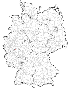
The federal highway 414 (abbreviation: B 414 ) is an approximately 38 km long German federal highway in the north of Rhineland-Palatinate and (to a small extent) in the west of Hesse . It leads in a west-east direction over the Hohen Westerwald and connects the B 256 with the B 255 .
course
The road begins in Altenkirchen (Westerwald) as a continuation of the B 256 . This had crossed the B 8 shortly before and then bypassed Altenkirchen to the north. At the point north of Altenkirchen, where the B 256 turns north to the Siegtal, the B 414 continues east.
It initially runs on a plateau south of Kroppacher Schweiz to Hachenburg and then follows the valley of the Great Nister for a few kilometers . As soon as it has left this east again, it passes Bad Marienberg north, crosses the B 54 near Salzburg (Westerwald) and then crosses the Fuchskaute , the highest elevation of the Westerwald, on its southern flank. Shortly afterwards, it crosses the state border to Hesse and meets the B 255 at a roundabout 1.8 km later near Hohenroth , where it ends.
It is continued from the B 255 in an easterly direction to Herborn .
