List of streets and squares in Berlin-Wilmersdorf

The list of streets and squares in Berlin-Wilmersdorf shows the streets and squares in the Berlin district of Wilmersdorf with their historical references. At the same time, this compilation is part of the lists of all Berlin streets and squares .
overview
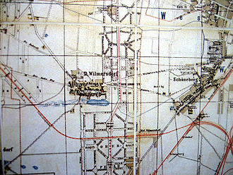
The original core of Alt-Wilmersdorf is on the Wilhelmsaue . Part of the Wilmersdorfer development goes back to the " Carstenn figure ", which the entrepreneur and urban developer Johann Anton Wilhelm von Carstenn planned in 1870 as a regular urban development figure with an avenue in the center: The corner points of this figure are Fasanenplatz , Nürnberger Platz , Prager Platz and Nikolsburger Platz . The northern boundary is formed by the Schaperstraße , which runs in a slight curve , the southern boundary is formed by the Trautenaustrasse . The Prager Straße , today Graniauer road are the eastern and Pheasant Street and Nikolsburger road the western boundaries of the fabric. Administrative changes between 1900 and 1910 affected the naming of the streets in the district. The streets and squares form a ring, from which several streets run in a star shape to a central section of the Bundesallee , on which the Spichernstraße underground station is located today , which connects the two underground lines U3 and U9 . These are Hohenzollerndamm , Meierottostraße , Nachodstraße and Spichernstraße .
The federal autobahn 100 (A 100) and the former federal autobahn 104 (A 104) with the Wilmersdorf junction run right through Wilmersdorf . The A 104 was downgraded to a branch of the A 100 and therefore no longer has its own number that identifies it as an independent federal motorway. Between the junction of Mecklenburgische Straße and Breitenbachplatz , the motorway runs through a house that was built around the motorway in the West Berlin period between 1976 and 1981 with the extreme lack of building land. In the vernacular , this motorway development is known as "Schlange" for short. The tunnel section is around 600 meters long. At the Hohenzollerndamm the junction of the A 104 flows into the inner-city traffic.
Wilmersdorf has 102,619 inhabitants (as of December 30, 2019) and includes the postcode areas 10707, 10709, 10711, 10713, 10715, 10717, 10719, 10777, 10779, 10789, 14195, 14197 and 14199. There are 165 dedicated streets and 22 in the district named places, of which 30 streets partly belong to neighboring districts. The total length of the streets mentioned in this list in the district is 79.5 kilometers.
Overview of streets and squares
The following table gives an overview of the streets and squares in the district as well as some related information.
- Name / location : current name of the street or square. Via the link Location , the street or the square can be displayed on various map services. The geoposition indicates the approximate center of the street length.
- Traffic routes not listed in the official street directory are marked with * .
- Former or no longer valid street names are in italics . A separate list may be available for important former streets or historical street names.
-
Length / dimensions in meters:
The length information contained in the overview are rounded overview values that were determined in Google Earth using the local scale. They are used for comparison purposes and, if official values are known, are exchanged and marked separately.
For squares, the dimensions are given in the form a × b for rectangular systems and for (approximately) triangular systems as a × b × c with a as the longest side.
If the street continues into neighboring districts, the addition ' in the district ' indicates how long the street section within the district of this article is. - Name origin : origin or reference of the name.
- Notes : further information on adjacent monuments or institutions, the history of the street and historical names.
- Image : Photo of the street or an adjacent object.
| Name / location | Length / dimensions (in meters) |
Origin of name | Date of designation | Remarks | image |
|---|---|---|---|---|---|
|
Aachener Strasse
( Location ) |
310 | Aachen , city in North Rhine-Westphalia | Aug 4, 1906 | The road between Mecklenburgische and Brabanter Strasse was laid out around 1900 and was named Strasse 12 and Strasse 25 until 1906 . On May 1, 1971, the western section of Detmolder Strasse between Aachener and Brabanter Strasse was incorporated into Aachener Strasse due to the construction of the city motorway . |

|
| Ahrweilerstrasse
( Location ) |
420 | Ahrweiler , district of Bad Neuenahr-Ahrweiler | Aug 19, 1909 | The street between Deidesheimer and Rauenthaler Straße lies in the Rheingauviertel , where the streets were named after places in the Rheingau. The houses Ahrweilerstraße 7-27 belong to the artist colony |

|
| Albrecht-Achilles-Strasse
( Location ) |
510 | Albrecht Achilles (1414–1486), as Albrecht I Margrave of Ansbach and Kulmbach | 1896 | The street ran from 1896 to 1911 between Kurfürstendamm and Westfälischer Strasse. On June 18, 1911, it was extended by Brieger Straße and from then on ran between Hohenzollern- and Kurfürstendamm. After the construction of the tram station (BVG bus station since the late 1960s) between 1928 and 1930, the southern part was omitted, so that it is now between Westfälischer Strasse and Kurfürstendamm. |

|
| At the Volkspark
( Location ) |
400 + 610 | adjacent Volkspark Wilmersdorf | Nov 18, 1955 | The street with lots 4 and 80 (even) and 15-23 and 31-85 (odd) lies between Blissestraße and Bundesallee , with the Volkspark mostly forming the north side of the street. As a park path, it still leads to Prinzregentenstrasse and Hans-Rosenthal-Platz; it is divided into two parts by the Volkspark. The original street in this route was established in 1885 as street 23a of the development plan and named Erfurter Straße in 1890 . Around 1912 it was included in Am Seepark , which also included Strelitzsche Strasse , which was laid out before 1902 . In the Berlin address book of 1912, both Erfurter Straße (cross street: Prinzregentenstraße) and Strelitzsche Straße (cross street: Ringbahnstraße) are listed as vacant for Deutsch-Wilmersdorf . In 1913, Strelitzsche Strasse was run with several construction sites, while Erfurter Strasse , starting from Prinzregentenstrasse , was still undeveloped. Since 1912 there have been frequent renaming in this area, because for a long time in and around the park area (initially: Seepark, then: Hindenburgpark , today: Volkspark) several changes were made that influenced the course of the street. In 1914, according to the address book, lots 2–12, 37–78 and 86–112 are construction sites, some of them belong to Querstraße. Plots 34–36 and 80–85, whose houses are occupied by up to 30 tenants, are developed. On December 6, 1917, Am Seepark in Hindenburgstrasse was named, and this name change was recorded in the 1918 address book. In 1955, Hindenburgstrasse was renamed Am Volkspark and on September 1, 1967, sections in Apeldoorner Strasse, Blissestrasse, Mannheimer Strasse, Strasse am Schoelerpark and Wallenbergstrasse were renamed or incorporated into existing streets. The Apeldoorner Straße was partially renamed on October 23, 1970 and the remaining part was de-dedicated. |

|
| Aschaffenburger Strasse
( Location ) |
360 (in the district) |
Aschaffenburg , city in Bavaria | Aug 20, 1906 | The part between Prager Platz / Motzstrasse and Bamberger Strasse is located in the district and continues to the southeast in Schöneberg . The street was named as early as 1896. The northern section belonging to Wilmersdorf, since 1888 as Sadowastraße , was included on August 20, 1906. The Schöneberger Branch was laid out as Preußische Strasse before 1875 , renamed Victoriastrasse around 1876 and was given its current name in 1906. | |
|
Assmannshauser Strasse
( Location ) |
560 | Assmannshausen , district of Rüdesheim am Rhein | March 1, 1912 | The street is between Heidelberger Platz and Homburger Straße. The street was planned as Heidelberger Straße in October 1905 , but the section south of Rüdesheimer Platz was renamed Schwarzwaldstraße in 1908 and the northern part was renamed Aßmannshauser Straße in 1912 . The underground line running under the street was opened in 1913. The above-ground development took place only afterwards, beginning on both sides in the southern area of the street, then on the entire east side. Most of the west side remained undeveloped before World War II . Allotment gardens of the 'Johannisthal' association were laid out here in 1923, most of which are still there today, so house numbers from 7 to 10 were never assigned. The dental clinic of the Free University of Berlin was built on property No. 4–6 in 1955/1956 , now part of the Charité as the southern dental clinic . |

|
|
Augsburger Strasse
( Location ) |
180 (in the district) |
Augsburg , city in Bavaria | March 11, 1887 | The street is between Passauer Strasse and Nürnberger Strasse. With lots 1–13 (odd) on the south side in the district, it forms the border with Schöneberg , with the road area belonging to Schöneberg. The entire street continues to the west in Charlottenburg . The street initially consisted of the traffic routes Straße 29, Straße 29a and Straße 30, Section IV of the Berlin development plan. This was cut through with the construction of Lietzenburger Straße . On October 29, 1957, the eastern part of Augsburger Strasse between Eisenacher and Passauer Strasse, separated by the southern bypass, was renamed Fuggerstrasse , as many streets in this area had southern German names. The Augsburger Strasse underground station is located at the intersection with Nürnberger Strasse and has a southeast exit in Wilmersdorf. |

|
|
Babelsberger Strasse
( Location ) |
680 | Babelsberg Palace, a palace built for Wilhelm I. | Jan. 8, 1892 | The street between Berliner Strasse and the Volkspark was formed in 1892 from Hannöverschen Strasse , which was laid out around 1875, and Elberfelder Strasse, which was established around 1885 . In the vicinity of this street, other traffic routes are named after places that played a role in Wilhelm I's life. |

|
| Badensche Strasse
( Location ) |
700 (in the district) |
Grand Duchy of Baden , federal state of the German Empire | March 16, 1888 | The street lies between Kufsteiner and Berliner Straße in the district and continues after Schöneberg to John-F.-Kennedy-Platz. This traditional path between Wilmersdorf and Schöneberg was initially called Mühlenweg , sometimes also called Wilmersdorfer Weg , until it was renamed Wilmersdorf in 1888. The name in Schöneberg followed in 1912. Between 1856 and 1875, the name Schöneberger Weg is also documented and then up to the current name in 1888 Schleswiger Strasse . |

|
| Ballenstedter Strasse
( Location ) |
200 | Ballenstedt , small town on the edge of the Eastern Harz | Feb. 19, 1911 | The street lies between Brandenburgischer and Eisenzahnstraße. The previous name was Street 9 . It was renamed Briloner Strasse on June 14, 1910, and its current street name in 1911. |

|
| Bamberger Strasse
( Location ) |
1020 (in the district) |
Bamberg , city in Franconia | 1900 | The quiet, central residential street with old, new and post-war buildings has little through traffic due to the surrounding traffic, it is located between Geisberg and Berliner Straße with the road and the western properties in the district, the east side of the street is in the Schöneberg district . The street 51 , at that time still completely in Schöneberg, lay between the Geisberg street and today's Wex street . With the renaming, the southern section was initially referred to as the extended Bamberger Straße . In 1906 this southern section of Bamberger Strasse was separated as Kufsteiner Strasse. |

|
| Barbarossastrasse
( Location ) |
80 (in the district) |
Friedrich Barbarossa , Holy Roman Emperor | June 15, 1892 | The western section between Aschaffenburger and Bamberger Straße is in the district, the larger part is in Schöneberg . Before 1876, the Buschstrasse in the direction of Hopfenbruch was here . From 1890, the northeastern section between Bamberger and Aschaffenburger Strasse was named Strasse 50 and finally in 1892 Barbarossastrasse. The southern section between Aschaffenburger and Berliner Straße was named part of Straße 48 and in 1906 Jenaer Straße . |

|
| Bar Street
( Location ) |
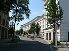
920 | Bar-sur-Aube , French town with an important role in the Napoleonic liberation struggles | Jan. 8, 1892 | The street lies (in north-south direction) between the Brandenburgische and Mecklenburgische Strasse. It crosses the Fennsee between Mannheimer and Wallenbergstrasse . The street that was laid out around 1885 was called Straße 34a according to the development plan until 1892 . |
|
| Bavarian Street
( Location ) |
560 | Kingdom of Bavaria , federal state of the German Empire | 1908 | The street connects Olivaer Platz and Pommersche Straße. It was laid out around 1885 with the name Straße 16a and has been recorded as Baiersche Straße since 1892 ; the spelling of "Baiern" was changed in 1908. |

|
| Bechstedter way
( Location ) |
360 | Bechstedt , place in Thuringia | Dec 15, 1930 | The street lies with the plots 1-19 (continuous) between Rudolstädter Straße and Hohenzollerndamm along the trench of the Ringbahntrasse and the city motorway , whereby the district boundary to Schmargendorf lies between the motorway and the railway. Since the path runs along the Graben, only the north-eastern side is built on, while the plots of land at the entrance from Rudolstädter Straße belong to it. |

|
| Bergheimer Platz
( Location ) |
70 × 70 | Bergheim , town in North Rhine-Westphalia | Dec 18, 1919 | Bergheimer Platz is on Laubacher Strasse in the Rheingauviertel . The Bergheimer and Wetzlarer Strasse flow to the west and the Schwalbacher Strasse to the east. The St. Mary's Church from 1914 stands on the square designed after the church, which is surrounded by trees . The properties Bergheimer Platz 1/2 and 4 belong to the artists' colony . | |
| Bergheimer Strasse
( Location ) |
60 | Bergheim , town in North Rhine-Westphalia | Aug 19, 1909 | The street in the Rheingauviertel lies between Bergheimer Platz and Südwestkorso . The parish hall and rectory built by Carl Kühn between 1929 and 1930 is a listed building. The properties at Bergheimer Strasse 2 and 4–7 belong to the artists' colony . |

|
| Berlin street
( Location ) |
1100 | Former connecting road between Wilmersdorf and Old Berlin | 1888 | The street is between Hoffmann-von-Fallersleben-Platz / Konstanzer Straße and the suburb of Schöneberg on Kufsteiner / Bamberger Straße. In 1871 Berlin became the capital of the Reich and the municipality of Wilmersdorf named an arterial road leading in the direction by merging some of the existing streets. To the existing Berliner Weg , which has been documented since the period after 1695, the Hintere Strasse, laid out around 1856, and the Spandauer Weg , which was expanded around 1856 and led west from Blissestrasse, were included in 1888. The Hohe Weg , which existed around 1830 and was so named until 1856, and the Holsteiner Strasse created around 1875 were also included. |

|
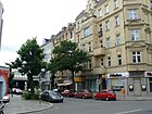
| Bernhardstrasse | 60 + 60 | Bernhard Wagner, landowner in Wilmersdorf | Aug 24, 1893 | The centrally located residential and commercial street with mostly old buildings and access to the S-Bahn is located directly on the city motorway. There is a parking lot on the former road under the motorway. The street with the plots 2-18a (continuous) consists of two parallel parts, both are between Wexstraße and the city motorway , which is next to the ring road outside the district and the accessible area leads under the surface of the motorway with access to the Berlin Bundesplatz station . The street was laid out by the owner around 1890 on his property and he gave his first name for the name, previously street 12 of the development plan. The centrally located residential and commercial street has direct access to the S-Bahn . There are mostly old buildings on the street. |
|
| Beverstedter Weg
( Location ) |
80 | Beverstedt , place in the district of Cuxhaven in Lower Saxony | Dec 15, 1930 | The previous name was street S 6 . The street is between Sylter and Borkumer Straße. |

|
| Bielefelder Strasse
( Location ) |
470 | Bielefeld , city in North Rhine-Westphalia | Jan. 22, 1958 | The previous name from 1895 until the renaming in 1958 was Osnabrücker Straße . The street lies between Westfälischer Straße and Hohenzollerndamm . |

|
| Binger Street
( Location ) |
1190 | Bingen am Rhein , town in Rhineland-Palatinate | Apr 25, 1894 | Binger Strasse is located in the Rheingauviertel between Mecklenburgischer and Wiesbadener Strasse with consecutive numbering. The road that had already been laid out was initially named Bingener Strasse on January 18, 1892 , and the name was changed two years later. |

|
| Birger-Forell-Platz
( Location ) |
40 × 40 (triangular shape) |
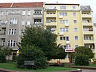
Birger Forell (1893–1958), Swedish pastor | June 25, 1981 | The square is a previously nameless intersection with a few additional open spaces that create a square structure and is located at the confluence of Paretzer Strasse on the southwest corner and Hildegardstrasse in the northeast on Blissestrasse. |
|
| Blissestrasse
( Location ) |
800 | Christian Blisse (1823–1905), the so-called “ millionaire farmer ” and his wife Amalie Blisse (1845–1907), reindeer and patronage elder | July 31, 1947 | The street is between Berliner Straße and through the Ringbahn and Autobahn bridge to Varziner Straße. In the southern part, the old country route from Wilmersdorf to Steglitz was known as the Steglitzer Weg even before 1856 . When Friedenau came into being , this was the boundary between Wilmersdorf and Friedenau and became Steglitzer Strasse . In 1888 the traffic route was given the name Augustastraße because of the formation of the Reich in 1871 and during the Nazi era and from 1937 onwards it was renamed Stenzelstraße . With the denazification in 1947, it was named after another Wilmersdorfer citizen. On September 1, 1967, the section of the street Am Volkspark in front of the Friedrich-Ebert-Schule was included. |

|
| Blüthgenstrasse
( Location ) |
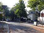
130 | Victor Blüthgen (1844–1920), writer | Jan. 2, 1914 | The street was created by merging Straße 74 and Straße 7 on the occasion of the 70th birthday of the namesake Blüthgen. It is between Ruhrstrasse and Westfälischer Strasse. |
|
| Bonner Strasse
( Location ) |
180 | Bonn , city in North Rhine-Westphalia | Aug 19, 1909 | This street in the Rheingauviertel lies between Kreuznacher Straße and Südwestkorso . The properties on Bonner Strasse 1–15 belong to the artists' colony . |

|
| Borkumer Strasse
( Location ) |
280 (in the district) |
Borkum , East Frisian island | March 6, 1891 | The street lies between Norderneyer and Misdroyer Straße, with the section to the west of Sopoter Straße in Schmargendorf . |

|
| Brabanter Platz
( Location ) |
40 × 40 (triangular shape) |
Brabant , former province of the Kingdom of Belgium | Feb. 19, 1911 | The previous place C of the development plan was created in 1911 in the route of Mecklenburgische Strasse. The square with plots 1–3 is a green area at the mouth of the curved Paretzer Straße, although the original mouth of Brabanter Straße on the square was probably moved by corner house number 20. |

|
| Brabanter Strasse
( Location ) |
115 | Brabant , former province of the Kingdom of Belgium | Feb. 1, 1921 | The street lies between the Mecklenburgische Strasse and the extension called Aachener Strasse. When moored, it led from Wallenberg to what was then Detmolder Straße . With the expansion of the city motorway , the situation at the southern end of the street changed. Since May 1, 1971, it has only run between Mecklenburgischer Strasse and Aachener Strasse, the remaining section has been included. |

|
| Brandenburg Street
( Location ) |
1760 | Brandenburg , Electorate and Prussian Province | March 16, 1888 | The busy thoroughfare is located between Berliner Straße and Kurfürstendamm on Adenauerplatz . The street lies in the route of the historical connecting route between Wilmersdorf and Charlottenburg . The Charlottenburger Weg , named around 1856, was initially divided with the urbanization of the area, the southern part between the Westfälische and Berliner Strasse was named Westendstrasse around 1880 , the northern part to Kurfürstendamm kept the name Charlottenburger Weg . With its traffic-friendly expansion, it became Wilmersdorfer Chaussee . In 1888 the street was finally given its current name.
Shortly after the end of the Second World War , the newly formed food office of the city of Berlin took its seat in this street. On the corner of Paulsborner Straße is the building of the German Lottery , known as the “Lottohaus” . Café Pssst is located at Brandenburgische Straße 73 ! , a pub for sexual services. The Preußenpark offers peace and quiet from the traffic noise. |

|
| Bregenz Street
( Location ) |
240 | Bregenz , city in Austria | June 16, 1908 | The street between Düsseldorfer Straße and Olivaer Platz was laid out around 1900 as Straße 33 . | |
|
Breitenbachplatz
( Location ) |
200 × 100 (oval shape) |
Paul von Breitenbach (1850–1930), Prussian Minister for Public Works | Aug 26, 1913 | The name between 1892 and 1913 was Rastatter Platz , the renaming took place in 1913 on the occasion of the opening of the underground line to Dahlem , in the construction of which the Prussian Minister Paul von Breitenbach played a major role. The garden architect Georg Kuphaldt designed the green areas of the square . Plots 1 and 4 on the northern edge of the square are in the district, the majority of the square is in Dahlem and Steglitz . |

|
| Brienner Strasse
( Location ) |
250 | Battle of Brienne at Brienne-le-Château | Jan. 8, 1892 | The street lies between Hohenzollerndamm and Berliner Straße and was named Straße 32a in the development plan around 1885 . It was named in memory of Brienne-le-Château, a place known from the Wars of Liberation. |

|
| Bruchsaler Strasse
( Location ) |
160 | Bruchsal , town in Baden-Württemberg | June 30, 1908 | The reason for the naming of the street between Durlacher and Wexstraße is probably the battle of June 24, 1849 in which the Baden Revolution in 1849 was bloodily suppressed under the Commander-in-Chief of the Army of Operations of the Prince of Prussia and later Emperor Wilhelm I in Baden . |

|
|
Bundesallee
( Location ) |
2300 (in the district) |
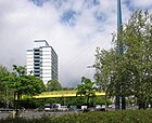
Bundeshaus between Schaperstrasse and Spichernstrasse | July 18, 1950 | The avenue was laid out between 1872 and 1874 under the name Kaiserstraße and renamed Kaiserallee after the emperor's death in 1888 . After the Second World War , with the inauguration of the Federal Palace by Chancellor Konrad Adenauer in this street, the traffic route received its new name. The street forms part of the north-south axis of the " Carstenn figure ", it is located in the district between Lietzenburger Straße and the city motorway , on the north side of which the district boundary runs. The southern continuation to Walther-Schreiber-Platz is in the Friedenau district . On the area of the wide main thoroughfare in the immediate vicinity of City-West, there are some striking buildings such as the Berlin University of the Arts (the former Joachimsthal Gymnasium ), the Bundeshaus, the Berlin Investment Bank and the Shaolin Temple. Two road tunnels from the times of car-friendly urban planning (Wilmersdorfer Tunnel, tunnel under Berliner / Badenscher Strasse) allow traffic to flow mostly smoothly on the multi-lane carriageway. For pedestrians, there are usually only short green phases in one lane, only at Volkspark Wilmersdorf the “Volksparksteg” facilitates the transition over the busy street. Residential and commercial buildings line the roadside. |
|
|
Bundesplatz
( Location ) |
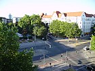
200 × 120 | Located in the route of the Bundesallee | July 18, 1950 | The Bundesallee widens at the intersection of Detmolder Strasse and Wexstrasse. In order to dampen the traffic noise, the Bundesallee was led underground. The busy intersection has traffic connections and there are residential and commercial buildings around the square. In 1875 the course was as Strasbourg court created in 1888 after the previous week late Emperor William I in Kaiserplatz renamed. In 1909 the central area of the square was prepared as a park with fountains and flower beds. In 1950 it was renamed together with the adjacent Bundesallee. The square is located with plots 1–20 (continuous) as an extension of the Bundesallee between Detmolder / Wexstrasse at the level of Tübinger Strasse, Mainzer Strasse ends here, and the Bundesplatz underground station is under the square. During the construction work in the 1960s, the square was also called "Buddelplatz", since the U9 line of the subway was also extended by another tunnel parallel to the Wilmersdorfer road tunnel. After completion, the tunnel ceiling was redesigned and today's square with the sculpture “Phoenix” was created. |
|
| Burgundy Street
( Location ) |
140 | Burgundy , French region | Aug 19, 1909 | The street lies between Laubacher and Spessartstraße south of the ring railway and the city motorway . |

|
|
Cicerostrasse
( Location ) |
1030 | Johann Cicero (1455–1499), Elector of Brandenburg | Jan. 8, 1892 | Lying between Kurfürstendamm and Seesener Straße, the street with its eastern properties belongs to the district, the western side belongs to Halensee . The complete intersection with Paulsborner and Westfälische Strasse is in the district. From 1885, road 41 of the development plan was the northern section, which was named in 1892. On March 2, 1911, the previous Liegnitzer Strasse was included in the southern extension . |

|
|
Darmstädter Strasse
( Location ) |
140 | Darmstadt , at the time it was named Grand Duchy of Hesse-Darmstadt | Jan. 16, 1908 | The street lies between Württembergische and Sächsische Strasse and was built as street 19 according to the development plan . |

|
| Deidesheimer Strasse
( Location ) |
310 (in the district) |
Deidesheim , Rhineland-Palatinate city | Aug 19, 1909 | The street, first street 14 according to the development plan, lies between Südwestkorso and Spessartstraße, but only west of Laubacher Straße in the district, it continues eastward in the district of Friedenau . It is located in the Rheingauviertel . |

|
| Detmolder Strasse
( Location ) |
1000 | Detmold , city in East Westphalia-Lippe | Dec 22, 1911 | Margarethenstrasse was laid out here before 1874 and was incorporated into Ringbahnstrasse in 1888 . In 1911 the street was renamed. The central and easily accessible residential and business street is between Bundesplatz and Mecklenburgischer Straße. With the construction of the city freeway on May 1, 1971, the section between Aachener and Brabanter Strasse was detached and included in Aachener Strasse, as Detmolder Strasse was led around the previous section to the south with two separate lanes and entrances and exits to the city freeway. The driver is led from Mecklenburgische Strasse to Bundesallee , pedestrians use Aachener Strasse. The residential and commercial street is centrally located and easily accessible; the southern side of the street offers a view of the A 100 and the Berlin Ringbahn . |

|
| Dillenburger Strasse
( Location ) |
610 (in the district) |
Dillenburg , town in Hesse | Jan. 8, 1892 | The street is an extension of Helgolandstraße between Norderneyer Straße and Breitenbachplatz and is located with the southern properties 1–7 (odd) at the eastern end in Dahlem . The northwest section of the Steglitzer Weg in the district was renamed on March 6, 1891 in Helgolandstrasse and in 1892 the southeast in Dillenburger Strasse. |

|
|
Düsseldorfer Strasse
( Location ) |
1100 | Düsseldorf , capital of North Rhine-Westphalia | Jan. 8, 1892 | Straße 7b and Straße 7c between Konstanzer and Eisenzahnstraße, which were created according to the development plan, were combined and named. On November 4, 1915, the eastern extension, Marienburger Strasse , was included and the western section between Eisenzahnstrasse and Brandenburgischer Strasse was renamed Paderborner Strasse. Today the street is a city street built with multi-storey tenement houses in two lanes with a parking lane and angled parking bays between Brandenburgische Straße and Hohenzollerndamm . |
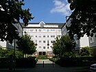
|
| Duisburger Strasse
( Location ) |
230 | Duisburg , city in North Rhine-Westphalia | Nov 30, 1910 | The street is a one-way street between Brandenburgischer Strasse and Konstanzer Strasse. As street 11 of the development plan, it was named Jülicher Straße before 1910 , before it was given its current name at the end of 1910. |

|
| Durlacher Strasse
( Location ) |
600 | Durlach , former margravial residence town | March 16, 1888 | Even before 1874, the Jungfernstrasse , which was named a few days after the death of Kaiser Wilhelm I , the commander-in-chief of the Army of Operations, was recorded here south of (today's) Volkspark . In Baden , the Baden Revolution was bloodily suppressed in 1849, with "a battle between the Prussian Landwehr and Baden insurgents" taking place near Durlach on June 25, 1849.
Initially, Durlacher Strasse ran between today's Bundesallee and Kuppenheimer Strasse, and the section to Kufsteiner Strasse, the district border with Schöneberg , was added on August 16, 1928. The quiet and central residential street with old and new buildings borders directly on the Wilmersdorf Volkspark in the north . The 20 arbors of the “KGA Durlach”, which is threatened as an existing residential building project, are located on the street. The artists Ernst Ludwig Kirchner , Max Pechstein , Gerhard Marcks , Richard Scheibe , worked and / or lived in the studio and residential building Zum Bieber (No. 15 / 15a; formerly No. 14/15) in the first half of the 20th century . Clara Siewert and Elisabeth Siewert . |

|
|
Eberbacher Strasse
( Location ) |
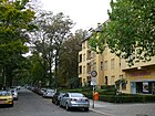
420 | Eberbach Monastery in Eltville on the Rhine | May 17, 1930 | The street in the Rheingauviertel lies between Rüdesheimer and Schlangenbader Straße . Before street 78 , the part between Schlangenbader and Johannisberger Straße was named first. On July 20, 1938, the eastern extension, the previous Neckarstrasse , was incorporated and at the same time a street name that existed several times during the formation of Greater Berlin was canceled. |
|
| Iron tooth road
( Location ) |
1200 | Friedrich II. (1413–1471), Brandenburg Elector, called "Eisenzahn" | Jan. 8, 1892 | It lies between Kurfürsten- and Hohenzollerndamm . This street was built around 1885 as Straße 22a and Straße 27 . On January 8, 1892 it was named north of Westfälische Strasse as Eisenzahnstrasse and south as Wohlauer Strasse . On June 18, 1911, Wohlauer Strasse was incorporated into Eisenzahnstrasse. The Annie Heuser School ( Waldorf School ), the Katharina Heinroth Elementary School, the Theaterkunst GmbH and the Deutsche Rentenversicherung are located in Eisenzahnstraße . |

|
|
Eislebener Strasse
( Location ) |
270 (in the district) |
Eisleben , city in Saxony-Anhalt | Feb. 14, 1895 | The street lies between Nürnberger and Rankestrasse, whereby the street and the northern side of the street belong to the district of Charlottenburg . Before the naming, which was based on the places of activity of Martin Luther, it was Street 31a, Section IV of the development plan. |

|
| Emser Platz
( Location ) |
100 (diameter) |
Relation to the adjacent street | Nov 14, 1901 | Emser Platz, created around 1885 as Platz B , was renamed to Platz E around 1890 and was named Hohenzollernplatz in 1892 . In 1901 it was given the current name after the Hohenzollern bathing resort , while the first name was intended for a more representative extension, today's Hohenzollernplatz. The square with lots 1, 2 (south) and 5–5f (north) is crossed by the Hohenzollerndamm and touched to the northeast by the Emser / Güntzelstrasse and southwest of Pommersche / Sigmaringer Strasse, although the Pomeranian traffic is further west via the Sächsische Strasse guided. The greening of the eastern end of Pommerschen Straße increases the character of the square again. |

|
| Emser Strasse
( Location ) |
830 | Bad Ems , town in Rhineland-Palatinate | Jan. 8, 1892 | Before naming a section of street 10a , it lies between Emser Platz and Lietzenburger Straße . From Lietzenburger Strasse, it is only permitted as an entry road into the 30 zone , but is not designated as a one-way street and therefore has a small turning hammer here . |

|
| Ermslebener way
( Location ) |
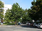
90 | Ermsleben , district of Falkenstein / Harz | May 17, 1930 | The street between Wallenberg and Rudolstädter Straße was listed in the development plan as Straße 32a around 1885 ; from 1912 it was part of Straße 39 . |
|
| Ettaler Strasse
( Location ) |
180 | Ettal , rural community in Bavaria | March 20, 1957 | The street leads from Geisbergstraße as a dead end , an exit to Lietzenburger Straße is not possible, but there is a turning area. As an extension of Bamberger Straße, the district boundary runs along the eastern edge of the road, the properties of which are in Schöneberg . From 1892 to 1957 Ettaler Strasse was the southern part of Passauer Strasse , which today belongs entirely to Schöneberg on the other side of Lietzenburger Strasse. |

|
|
Fasanenplatz
( Location ) |
100 × 60 | Relation to the adjacent street | Nov 14, 1901 | The Fasanenplatz is the northwest of four squares that form the corner points of the " Carstenn figure ". It is located in the course of Fasanenstraße to the east of the street and Schaperstraße and Meierottostraße join to the east, Ludwigkirchstraße from the west on the square. The inner-city tree-lined square is connected to the park-like area around the Berlin Festival and the Gerhart-Hauptmann-Anlage. There is a fountain and a fire alarm in the square. |

|
|
Fasanenstrasse
( Location ) |
1040 (in the district) |
Pheasantry established here by King Frederick II in 1755 . | 1901 | The street connects Müller-Breslau-Straße (near Straße des 17. Juni ) with Hohenzollerndamm . Only the southern edge of Lietzenburger Straße belongs to the district , the northern street is in Charlottenburg . The eponymous pheasantry had to give way to the zoological garden in 1841 and was relocated to Potsdam . In the city map of Berlin from 1857 the route is entered as an unmarked path. On a map published before 1874, Fasanenstraße (in Wilmersdorf the western boundary of the Carstenn figure ) ran in a straight line from Hardenbergstraße to (today's) Nikolsburger Platz, before 1876 only to Grunewaldstraße (today: Hohenzollerndamm). In 1890 the district boundary, Gravelotter Straße , was already registered for the Wilmersdorfer part between Nachodstraße and Lietzenburger Straße , but in 1896 again Fasanenstraße. The writer Heinrich Mann lived at Fasanenstrasse 61 . |

|
| Fechnerstrasse
( Location ) |
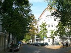
400 | Hanns Fechner (1860–1931), Wilmersdorf painter | July 31, 1947 | It is between Berliner Strasse and Sigmaringer Strasse (dead end). Around 1856 this was where the An der Trift path was located, and around 1890 it was named Lauenburger Straße . In 1937 it was named in Walter-Fischer-Straße and after the denazification in 1947 after a Wilmersdorfer personality. |
|
|
Fehrbelliner Platz
( Location ) |
100 (diameter) |
Battle of Fehrbellin | Jan. 8, 1892 | From 1885 onwards, according to the development plan , it was laid out as Place C and was named in 1892. The traffic routing of the square was designed to be an extended intersection of Brandenburgischer Straße ( underground line U7 ) and Hohenzollerndamm . In the southeast it is delimited by the semicircle of public buildings with the Senate Administration (No. 2), the Main Customs Office (No. 3) and the Charlottenburg-Wilmersdorf District Office (No. 4). At the northeast corner, Württembergische Straße joins the State Administration and Regulation Office (No. 1), opposite on the west side are the buildings of the German Pension Insurance (No. 5). From the south, Barstrasse joins Brandenburgische Strasse on the square, under whose lane the underground line U3 turns northeast into Hohenzollerndamm, on the square is the U-Bahn station pavilion . The north-west of the square is bordered by the Preußenpark (No. 7) with the “Parkcafé” (No. 8). House number 6 is not taken. |

|
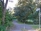
| Franz-Cornelsen-Weg
( Location ) |
220 | Franz Cornelsen (1908–1989), founder of Cornelsen Verlag | July 10, 1996 | The private road is between Dillenburger and Mecklenburgischer Strasse. |
|
|
Friedrich-Hollaender-Platz
( Location ) |
50 × 30 (triangular shape) (in the district) |
Friedrich Hollaender (1896–1976), revue and sound film composer, cabaret artist and music poet, who had to emigrate during the Nazi era | Jan. 18, 2012 | The square is located south of Lietzenburger Strasse , which closes the triangle in Charlottenburg , which is spanned in the district between Joachimsthaler Strasse (no. 24) and Rankestrasse (no. 17 and 18), the site at Rankestrasse 16a in the middle of the square is undeveloped. Bundesallee goes off from the south end of the square . No properties are assigned to the site itself. It was called Rankeplatz from 1901 to 2012 , was redesigned in 2011/2012 and then renamed. The new furniture is very concrete and does not encourage you to stay. The stele with biographical data shows a snapshot, mainly showing Marlene Dietrich and Friedrich Hollaender at the bottom. The “ceremonial inauguration” of the square took place on June 18, 2012 in the presence of Friedrich Hollaender's daughter, Melodie Hollaender. |

|
| Fuerth Street
( Location ) |
120 | Fürth , city in Bavaria | Dec 6, 1898 | The street lies between Geisbergstrasse and Lietzenburger Strasse , but does not go through to the latter. It was street L in the development plan from 1890 until it was named in 1898 . With the eastern extension of Lietzenburger Straße, the northern section of the road was omitted after 1960. |

|
|
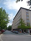
Gasteiner Strasse
( Location ) |
460 | Bad Gastein , health resort in Austria | March 16, 1888 | The street is between Nassauischer and Sigmaringer Strasse. Buchhofstrasse was located here around 1875 and renamed Kirchhofstrasse around 1880 . In 1888, Gasteiner Straße was created by merging Kirchhofstraße and Straße 19a (from 1885 between Nassauischer and Uhlandstraße) in the development plan. The Goethe-Gymnasium , the corner house No. 9-10 and the fire station Wilmersdorf are listed monuments. The street has horseshoe numbering, it starts with no. 1 on the northeast corner of Nassauische Strasse and leads west to Habermannplatz, where the playground is property 15. Plots 17–34 are on the south side of the street. The fire station is at number 19/20, 21/25 is the Goethe-Gymnasium (address: 23). The counting is not interrupted by the intersecting streets (Uhlandstrasse and Lauenburger Strasse) and continues with number 26. According to LOR, the street with lots 1–8 and 26–34 belongs to the prognosis area Volkspark Wilmersdorf , planning area Nikolsburger Platz (04 05 16 52). The western plots 9–23 are in the forecast area Barstraße, planning area Leon-Jessel-Platz (04 05 15 50). The postcode of the entire street is 10717. |
|
| Geisbergstrasse
( Location ) |
290 (in the district) |
Battle at Geisberg near Weissenburg in Alsace , 1870 | 1893 | The central quiet residential street with little business and worth seeing old buildings lies between Motzstrasse and Spichernstrasse, whereby it lies between Spichernstrasse and Bamberger Strasse in the district and continues eastwards to Schöneberg . The former street 50 of the development plan was named around 1875, the street section in Wilmersdorf was already marked Geisbergstraße in 1893. Until 1938 the street formed the border to the Charlottenburg district . The name comes from the storming of the Geisberg in the Franco-German War on August 4, 1870 by Prussian troops under the Crown Prince, who later became Emperor Friedrich III. back. The Kurfürstendamm and Tauentzienstrasse can be reached quickly on foot. |

|
| Geisenheimer Strasse
( Location ) |
640 | Geisenheim , town in Hesse | March 1, 1912 | The street is in the Rheingauviertel between Kreuznacher and Wiesbadener Straße . Whereby it meets an unnamed place at the southern end and there is no crossing to Laubacher Straße, at the opposite point the district borders on Friedenau and Steglitz . The properties at Geisenheimer Strasse 2-59 belong to the artists' colony |

|
| Gerhur Street
( Location ) |
90 | Gerdauen, German city in East Prussia , since 1945 Schelesnodoroschny (Kaliningrad) in Russia | 4th July 1929 | The street lies between Badensche Straße and Wilhelmsaue and has been renamed several times: First, Hessische Straße was created in 1890 by merging the Flensburger Straße and Hopfenbruchstraße, which had existed since 1874 . In 1895 it became Lieckstrasse and in 1901 Landhausstrasse . Gerdauener Strasse was separated from the southern section of Landhausstrasse in 1920 . Gerdauen (near Königsberg ) was the former godfather town of Wilmersdorf, which was largely destroyed in a battle on September 9, 1914 during the First World War . In 1929 it was finally given its current name, with a modified spelling. | |
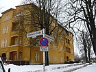
| Gerolsteiner Strasse
( Location ) |
100 | Gerolstein , town in Rhineland-Palatinate | March 3, 1919 | The street in the Rheingauviertel lies between Homburger and Eberbacher Straße, there is a footpath for access, a street sign is available. On the west side is the allotment garden complex Johannisberg to which the plots 1 and 2 belong, 3 and 4 are four-storey residential buildings. The east side is built on with the five four-storey houses 10-12a, which form a row of row houses with Homburger Straße 25, Rüdesheimer Straße 2-6 and Eberbacher Straße 2. This residential development is listed as a monument to the ensemble of the tenement complex "Gartenterrassenstadt Rheinisches Viertel". The postcode is 14197 and according to the LOR structure, the street belongs to the planning area Binger Straße in the forecast area Wiesbadener Straße (04041343). It was laid out as a private road in the 1920s between Wiesbadener and Homburger Strasse and crossed Neckarstrasse . Whereby the plots 4-6, 7-9 were only built on in the southeast corner house (Eberbacher Straße 3), the area also belongs to the KGA, the section was de-dedicated. The existing development took place in the city of Wilmersdorf until 1920. |
|
| Gieselerstrasse
( Location ) |
300 | Johann Gieseler, (1842–1891) Wilmersdorfer landowner | Aug 24, 1893 | It lies between Brandenburgischer Strasse and Hohenzollerndamm , when it was named it was between Hohenzollerndamm and Wegenerstrasse. On December 18, 1906, it was extended in the south to Brandenburgische Strasse. |

|
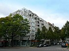
| Grainauer Strasse
( Location ) |
220 | Grainau , municipality in the Garmisch-Partenkirchen district | Jan. 28, 1959 | The street was part of the eastern boundary of the " Carstenn figure ". Located between Geisbergstrasse and Nachodstrasse, it was laid out as Prinzenstrasse around 1875 and was named Brandenburgische Strasse around 1885 . On March 16, 1888, it was renamed Prager Strasse because another Wilmersdorfer Strasse was named Brandenburgische Strasse on the same day . The northern section of Prager Strasse was detached from Prager Strasse on January 28, 1959 and named as Grainauer Strasse. |
|
|
Güntzelstrasse
( Location ) |
1240 | Bernhard Güntzel (1833–1892), Wilmersdorfer local politician | 1893 | Güntzelstraße is located between Emser Platz on Hohenzollerndamm and Aschaffenburger Straße, whereby the suburbs here deviate from the east side of Bamberger Straße and include the triangular unnamed square, which means that Güntzelstraße is in the district. In the street was Gartenstraße , which was proven before 1876 and which was merged with Straße 13a to form the newly named Hannoversche Straße around 1890 . This eastern part and the Königsberger Straße (to the west of it) laid out around 1872 were merged in 1893 under the street name that is still used today. |

|
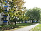
| Gustav-Rickelt-Weg
( Location ) |
65 | Gustav Rickelt (1862–1946), actor | 1999 | The road is a (semi-official) connecting path between the Südwestkorso and Kreuznacher Road, west of the piece back and east of Schildhornstraße. The route is signposted from the Südwestkorso, lots are not assigned. |
|
|
Habermannplatz
( Location ) |
40 × 40 | Ernst Habermann (1866–1958) Lord Mayor of Deutsch-Wilmersdorf from 1909 to 1920 | Feb 14, 1964 | The place is a vacant lot (Gasteiner Straße 15) on the northeast corner of the intersection of Sigmaringer and Gasteiner Straße. Centuries ago, the area of the square served as a burial place in the village of Wilmersdorf and was leveled around 1890 and therefore referred to in Berlin as a bone park , under the name of old burial place and between 1935 and 1964, place K was the name before 1964. |

|
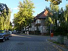
| Hanauer Strasse
( Location ) |
560 | Hanau , Hessian city | Jan. 8, 1892 | According to the development plan, laid out as Straße 45a around 1885 , it runs between Heidelberger Platz and Laubacher Straße. The street is located in the Rheingauviertel . |
|
| Hans-Rosenthal-Platz |
50 (diameter) |
Hans Rosenthal (1925–1987), entertainer and presenter | Apr 2, 1993 | From the south the Kufsteiner, from the southwest the Durlacher, from the southeast the Mettestrasse and from the northeast the Fritz-Elsas-Strasse flow onto the Hans-Rosenthal-Platz. The square and the road are in Wilmersdorf and the district border to Charlottenburg-Wilmersdorf is to the east of the square. This is in the squareGrade II listed and in 1941 inaugurated former RIAS building , which in 1994 became the seat of Germany radio was. To the north, the district boundary goes on Parkweg (Kufsteiner Straße) through the Volkspark. |

|
| Harlinger Strasse
( Location ) |
100 | Harlingen , region in East Frisia | Dec 15, 1930 | The street, laid out as street S5 according to the development plan , lies between Sylter and Borkumer Straße. |

|
| Heidelberger Platz
( Location ) |
150 × 110 × 110 | Heidelberg , Baden-Württemberg city | 1892 | Heidelberger Platz forms the northern end of the Rheingau district . Berlin Heidelberger Platz train station is located on the northeast side of the square . The triangular square lies between Mecklenburgischer and Aßmannshauser Strasse, in extension of Hanauer Strasse there are plots 1-4 on the south side, plot 5 is the greened area with the playground. |

|
| Helgolandstrasse
( Location ) |
280 | Helgoland , island in the North Sea | March 6, 1891 | The road lies between Dillenburger and Mecklenburgischer Strasse, but does not go through for traffic. It is originally the Steglitzer Weg leading from the village of Schmargendorf over the Wilmersdorfer Flur to Steglitz . In this settlement area, several streets were named after seaside resorts on the North and Baltic Sea coasts, so on March 6, 1891, the north-western section of the Steglitzer Weg was renamed. |

|
| Helmstedter Strasse
( Location ) |
510 | Helmstedt , city in Lower Saxony | Aug 4, 1906 | The first name was Straße 23 , it runs between Aschaffenburger and Berliner Straße. | |
|
Hildegardstrasse
( Location ) |
540 | Hildegard Schramm, daughter of the landowner Otto Schramm alternatively Hildegard von Bingen (1098–1179) |
Nov 2, 1895 | The street on the south bank of the former Wilmersdorfer See was named Seestrasse around 1872 before it was renamed in 1895. It is between Bundesallee and Blissestrasse. On house number 5, a relief of the former Wilmersdorf village church from 1797 is carved in stone. | |
| Hoffmann-von-Fallersleben-Platz
( Location ) |
60 × 15 | August Heinrich Hoffmann von Fallersleben (1798–1874), university professor and poet | Sep 1 1926 | The square with lots 1–3 is located south on Hohenzollerndamm , bounded to the east by the Konstanzer Straße exit of the city motorway from Steglitz , to the west is Warneckstraße and to the south is the “ KGA Hohenzollerndamm”. The Christ Resurrection Cathedral of the Russian Orthodox Church is located across the opening Berliner Straße . |

|
| Hohensteiner Strasse
( Location ) |
310 | Hohenstein , municipality in Hesse | Aug 19, 1909 | The street lies between Aßmannshauser and Hanauer Straße and belongs to the Rheingauviertel . |

|
|
Hohenzollerndamm
( Location ) |
2320 (in the district) |
Hohenzollern , family of the Prussian kings and German emperors | Aug 1, 1906 | The length of the Hohenzollerndamm lies between Bundesallee and Clayallee . The name of the Preußische Strasse in Hohenzollerndamm took place on August 1, 1906 between today's Clayallee and the Ringbahn . On July 25, 1908, part of Nachodstrasse between Hohenzollernplatz and Kaiserallee was included . The part between Bundesallee and Hohenzollernbrücke (over the city motorway ) and the railway line that still belongs to the district. The street continues to the southwest in Schmargendorf , where the name has been valid for longer than the street section in Wilmersdorf. In addition, the north-western side of the bridge with properties 47a and 48 belongs to Halensee and at the southern end the street and its western side from Rheinbabenallee (Roseneck) belongs to Grunewald . |

|
|
Hohenzollernplatz
( Location ) |
160 × 80 | Place to the adjacent street | Nov 14, 1901 | The square was laid out around 1910 on the central island of the Hohenzollerndamm . When the current Hohenzollernplatz was named, the previous square of that name was renamed Emser Platz . The square is located along the Hohenzollerndamm, with Düsseldorfer Straße opening to the north and Nikolsburger, Nassauische and Holsteinische Straße from the south. At the mouth of the latter is the Hohenzollernplatz underground station . The traffic routing of the busy street was changed in the 1960s and the square was moved to the southern edge. |

|
| Holstein Street
( Location ) |
640 | Holstein , southern part of Schleswig-Holstein | Jan. 8, 1892 | This street is located between Hohenzollerndamm (Hohenzollernplatz) and Gasteiner Straße, which was called Straße 8b in the development plan from 1890 until it was named in 1892. |

|
| Homburger Strasse
( Location ) |
800 | Bad Homburg vor der Höhe , town in the Hochtaunus district | 1902 | The street is between Laubacher and Schlangenbader Straße. Around 1902, when it was named, it ran between Sodener and Laubacher Strasse and in 1906 the section east of Rüdesheimer Platz was separated and became part of Taunusstrasse. On July 13, 1934, Mossestrasse was included as the western section and part of Taunusstrasse as the eastern section. On May 1, 1972, the section to the west of the city freeway was renamed from Homburger Strasse to Rudolf-Mosse-Strasse. |

|
|
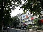
Jenaer Strasse
( Location ) |
400 | Jena , city in Thuringia | Aug 4, 1906 | The first name was Straße 48 of the development plan, before 1876 to around 1890 the Buschstraße was named in the street . In 1908 Rheinische Strasse was included as a southern extension. The Jenaer Straße, named in 1906, runs between Berliner and Güntzelstraße, further in the direction of Aschaffenburger Straße there is a dead end .
In front of the house in Jenaer Strasse 7, the lawyer and author Rainer Faupel had two stumbling blocks laid for Minna and Albert Neuburger. Faupel lives in this house and has extensively researched and publicized the fate of the couple. |
|
|
Joachimsthaler Strasse
( Location ) |
70 (in the district) |
the Joachimsthal High School | Sep 15 2014 | Only the section south of Lietzenburger Strasse on the west side of Friedrich-Hollaender-Platz belongs to the district. The road leads north to Charlottenburg . In Wilmersdorf the street S20 of the development plan was located (in Charlottenburg: street 20, section V / 1 ). At the time it was named on February 23, 1887, Joachimsthaler Strasse ran from Schaperstrasse in Wilmersdorf to Hardenbergstrasse , as shown on the map from 1890: In 1893, according to a city map, it ends on Kurfürstendamm . On February 14, 1958, the part between Hardenbergstraße and Hertzallee (forecourt of the Zoo station ) was detached and renamed Hardenbergplatz . The district office of Charlottenburg-Wilmersdorf decided in its meeting on May 20, 2014 to correct the spelling in Joachimsthaler Strasse, which was renamed on September 15, 2014. |

|
| Johannisberger Strasse
( Location ) |
1120 | Johannisberg, district of Geisenheim | Jan. 8, 1892 | It is located in the Rheingauviertel between Heidelberger Platz and Südwestkorso . From 1885 it was street 42a of the development plan. |

|
| Juister way
( Location ) |
90 | Juist , East Frisian island | 2010 | The road opens up a new development area on a horticultural site that previously belonged to the TU . Plots 1–15 (odd) and 2–16 (even) are assigned to it, these are located to the west of Sopot Street, the path can be reached via the Magnolienring from which it branches off on both sides. The name was chosen to match the surrounding streets after locations on the North and Baltic Seas. |

|
| Julius-Morgenroth-Platz
( Location ) |
30 × 30 | Julius Morgenroth (1871-1924), doctor | Sep 2 1996 | The previously unnamed square in front of the Wilmersdorf town hall between Hohenzollerndamm and Brienner Straße in front of the municipal gallery and the citizens' office / public order office was given its name in 1996. In 1938 a street named after Morgenroth in Schmargendorf was renamed Dünkelbergsteig because of its Jewish origins . A plaque on the square commemorates the namesake. |

|
|
Kahlstrasse
( Location ) |
250 | Wilhelm Kahl (1849–1932), lawyer and politician | Aug 9, 1929 | It lies between Wallenbergstrasse and Rudolstädter Strasse. The street was named on the occasion of Kahl's 80th birthday during his lifetime; from 1927 he was president of the criminal law reform commission of the Reichstag . According to the development plan, it was Street 38 from 1909 . |

|
| Kalischer Strasse
( Location ) |
410 | Kalisch , former German city, now in Poland | Jan. 8, 1892 | It is located between Berliner and Rudolstädter Strasse. Named as Straße 31 from 1885 and 1892, the northern section between Westfälischer and Berliner Straße ceased to exist around 1906. |

|
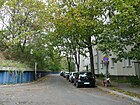
| Kalkhorster Strasse
( Location ) |
170 | Kalkhorst , municipality in Mecklenburg-Western Pomerania | May 17, 1930 | The street (lots 1–21, odd) goes off as a dead end west of Kalischer Straße and turns south before the Steglitz junction of the city freeway until it is named Straße 87 . The west side of the road at the end with a turning area is bounded directly by the high-lying motorway with sheet pile wall and bushy slope. |
|
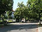
| Kaubstrasse
( Location ) |
160 | Kaub , city on the Rhine near St. Goarshausen | Jan. 8, 1892 | It is located between Brienner Straße and Hohenzollerndamm in the Rheingauviertel . |
|
| Kelheimer Strasse
( Location ) |
140 | Kelheim , city in Bavaria | March 20, 1957 | The street goes north from Geisbergstrasse as a dead end and runs to Lietzenburger Strasse , where there is a turning area. This part previously belonged to Würzburger Strasse and was removed and renamed when the local traffic areas were redesigned in 1957. |

|
| Koblenzer Strasse
( Location ) |
400 | Koblenz , city in Rhineland-Palatinate | May 14, 1926 | It lies between Hildegardstrasse and Detmolder Strasse, over the latter it goes as a dead end street to the turning area in front of the city motorway . The street was named Lauenburger Straße before 1874 with reference to Bismarck and was called Parallelstraße around 1888 . On January 8, 1892, it was named Coblenzer Straße with reference to the suppression of the Baden Revolution in 1849 when the Commander-in-Chief of the Army of Operations, Kaiser Wilhelm I, became the military governor of the city of Coblenz. In 1926 the street name was corrected to the newer spelling with "K". | |
| Konstanzer Strasse
( Location ) |
1230 | Constance , city on Lake Constance | Sep 12 1906 | It is located between Berliner Straße and Olivaer Platz / Xantener Straße in the district. The district boundary to Charlottenburg runs on the southern edge of Lietzenburger Straße, the stump in the extension of Konstanzer Straße does not belong to this street. The Kurfürstendamm , which was laid out in the 16th century, changed its course several times and the branches running in a different direction were given new names, so around 1850 the part between Xantener and Brandenburgische Strasse was renamed Priester Weg , which was omitted around 1885. The name that followed from 1895 was Kostnitzer Straße along Straße 18a and Straße 18b . The name was changed to Konstanzer Straße in 1906 because the name Kostnitz for Konstanz was now out of date. |

|
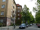
| Kreuznacher Strasse
( Location ) |
560 | Bad Kreuznach , town in Rhineland-Palatinate | 1903 | The street in the Rheingauviertel lies between the Steglitz motorway junction (Schildhornstraße junction) and Bornstraße, east of Laubacher Straße it belongs to Friedenau . It forms a border with the artist colony . The properties at Kreuznacher Strasse 10–36, 36a, 38–52 belong to the artists' colony. The street was initially intended as Kreuznacher Straße in a development plan for the Friedenau district from 1895 . In Wilmersdorf it was called Straße 12 according to the development plan . |
|
| Kufsteiner Strasse
( Location ) |
940 | Kufstein , city in Tyrol | June 15, 1906 | Kufsteiner Strasse runs between Wexstrasse and Berliner Strasse and is interrupted in traffic management by the Volkspark . The properties to the east are in the Schöneberg district . It was formed when the southern section of Bamberger Straße was detached; before this name was given, this part was called the extended Bamberger Straße . It is first shown as a laid-out street in the street directory from 1909. On April 2, 1993, plot No. 69 on Durlacher Strasse was detached and named Hans-Rosenthal-Platz . |

|
| Kulmbacher Strasse
( Location ) |
200 | Kulmbach , Franconian city | Feb. 1, 1901 | It lies between Regensburger and Geisbergstrasse. When the name was given in February 1901, it was called Culmbacher Straße after the town's name at the time . In 1929 the spelling was adapted to the modernization of the place name. In contrast to the neighboring north / south streets (Grainauer, Ansbacher, Bamberger Straße etc.) it only connects two east / west streets and therefore has no through traffic. |

|
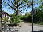
| Kuppenheimer Strasse
( Location ) |
90 | Kuppenheim , town in Baden-Württemberg | Jan. 8, 1892 | It lies between Durlacher and Wexstrasse. Darmstädter Strasse was established before 1874 and was named Grenzstrasse in 1876 . When it was named, the street ran with its northern part to today's Kufsteiner Straße. The name was given in memory of the battle at Kuppenheim on June 25, 1849, from Kuppenheim the siege of Rastatt was led by Prince Wilhelm (later Kaiser Wilhelm I ), with the bloody suppression of the Baden Revolution . On August 16, 1928, the northern section came to Durlacher Strasse. Since 1965, Kuppenheimer Straße has been a green area south of the Volkspark , keeping its name . |
|
|
Kurfürstendamm
( Location ) |
690 (in the district) |
Elector , title of the ruler of the Mark Brandenburg | around 1830 | The entire street runs between Rathenauplatz and Breitscheidplatz , of which the south side between Lehniner Platz and Olivaer Platz / Lietzenburger Straße belongs to the district. The sections from Lehniner Platz to the west are in Halensee and Charlottenburg . Initially named as Churfürsten Damm (a sand and bridle path), the spelling Kurfürstendamm was set on August 15, 1874. Originally created as a connection ( Knüppeldamm through the swampy terrain) for the Electors between the Berlin City Palace and the Grunewald Hunting Lodge , the Kurfürstendamm led from Grunewald via Auguste-Viktoria-Platz to Lützowufer and Corneliusbrücke in Tiergarten , Strasse 32 and Strasse 34, Abt IV of the development plan. When the (then) Budapester Strasse on Potsdamer Platz was named Friedrich-Ebert-Strasse (today: Ebertstrasse ) on April 22, 1925 , the section of Kurfürstendamm became Tiergarten and a small part of Charlottenburg (between Auguste-Viktoria-Platz and Lützowufer ) was renamed Budapester Straße . |

|
|
Landauer Strasse
( Location ) |
190 | Landau in der Pfalz , city in Rhineland-Palatinate | Aug 19, 1909 | The street in the Rheingauviertel lies between Laubacher and Ahrweilerstraße. |

|
| Landhausstrasse
( Location ) |
460 | Country house with restaurant on the corner of Berliner Straße | 1901 | Landhausstrasse connects Trautenaustrasse with Badenschen Strasse. In the historic village center of Wilmersdorf zum Hopfenbruch, the Hopfenbruchstrasse initially ran along this route. In 1890 it was named Hessische Straße , briefly (1895–1901) it was called Lieckstraße after the owner of the local property . In 1920, GerHAUS Strasse was detached from the street south of Badenschen Strasse. |

|
| Laubacher Strasse
( Location ) |
1160 (in the district) |
Laubach , city in Hesse | March 16, 1888 | The road lies in the course of the historic land route from Steglitz to Wilmersdorf. From 1856 it was first called Steglitzer Weg , and from around 1880 it was called Grüner Weg . Its southern part was named Laubacher Straße in 1888. The path formed the boundary between Friedenau and Wilmersdorf and was sometimes listed as a border road . The road forms the border between the districts of Friedenau and Wilmersdorf, to which the road area and the western side of the road belong. The street running in north-south direction lies between Kreuznacher and Varziner Straße and forms the eastern end of the Rheingauviertel . The plots at Laubacher Straße 46–56 belong to the artist colony . |

|
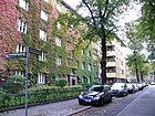
| Laubenheimer Strasse
( Location ) |
440 | Laubenheim , municipality in Rhineland-Palatinate | Aug 19, 1909 | The street forms a border to the artist colony . It is located between Kreuznacher and Rüdesheimer Straße. The properties in Laubenheimer Strasse 1–39 belong to the Gartenstadt artists' colony. |
|
| Lentzeallee
( Location ) |
690 (in the district) |
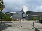
August Lentze (1860–1945), politician | Nov 26, 1917 | Lentzeallee is located between Platz am Wilden Eber and Dillenburger Straße, in the district the northern side of the street is east of Sopoter Straße. To the west, the street belongs to Schmargendorf and the entire southern side of the street is in Dahlem . |
|
|
Leon-Jessel-Platz
( Location ) |
30 × 30 | Leon Jessel (1871–1942), composer, victim of National Socialism | June 13, 1986 | The square is in the corner between Fechner Strasse and Sigmaringer Strasse, from the west the Wegener Strasse opens. The small town square was paved and redesigned in 1984, named in 1986 and planted by residents in 2002. |

|
|
Lietzenburger Strasse
( Location ) |
500 (in the district) |
Lietzenburg was the original name of the Charlottenburg Palace | 1890 | Lietzenburger Strasse connects Schlüterstrasse / Olivaer Platz with Martin-Luther-Strasse . The section in the district lies between Ettaler and Rankestrasse, as well as the south side to the west between Friedrich-Hollaender-Platz and Württembergischer Strasse with properties 22–46 (even) and 27–107 (odd). To the north, including the street, lies Charlottenburg and east of Rankestrasse Schöneberg . The Lietzenburger Straße is part of the former district boundary between Wilmersdorf and Charlottenburg, the current district boundary. The street of Dept. V / 1 of the development plan, which was built before 1885, was initially without a name, but was marked in a city map in 1890 between Kostnitzer and Rankestrasse. With the expansion of the south bypass, Achenbachstrasse was extended to Kleiststrasse on September 1, 1963 , and the section between Wielandstrasse and Schlüterstrasse was spun off to Olivaer Platz ; Lietzenburger Strasse was extended on that day (to the east) to the neighboring district of Schöneberg . |

|
| Livonian road
( Location ) |
280 | Livonia , historical landscape in the Baltic States | 1895 | When it was named, the street was located between Mainzer and Hildegardstraße, due to the extension in a northerly direction in 1930 it now runs between Mainzer Straße and Am Volkspark. |

|
| Lorcher Street
( Location ) |
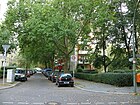
300 | Lorch am Rhein , city in Hesse | Aug 19, 1909 | It is located between Südwestkorso and Binger Strasse in the Rheingauviertel . The plots at Lorcher Strasse 6-10 belong to the artist colony . In 1936 it was extended to Schlangenbader Straße, today this part is built over. Plots 2–10 (even) and 1–5 (odd) with multi-family houses are located between Südwestkorso and Rüdesheimer Straße. Between Binger and Johannisberger Strasse there is a footpath marked with the street sign, between Johannisberger and Rüdesheimer Strasse a narrow footpath divides the (actual) street space with the plots 18–24 hours (straight) of the allotments . |
|
| Ludwig-Barnay-Platz
( Location ) |
140 × 60 | Ludwig Barnay (1842–1924), actor and theater director | Jan. 11, 1963 | The green and tree-lined square is between Laubenheimer Straße and Bonner Straße, in the artist colony . The plots Ludwig-Barnay-Platz 1–12 belong to the artists' estate. The square, named in 1909, was called Laubenheimer Platz until 1963 and was named after its co-founder Barnay on the occasion of the 80th anniversary of the founding of the German Theater. Plots 1–13 (consecutive) on the north and south sides of the square are assigned to this. |

|
|
Ludwigkirchplatz
( Location ) |
200 × 90 | enclosed Ludwigskirche | Nov 4, 1895 | Set up as Platz A according to the development plan from 1885 , it was laid out as Straßburger Platz around 1890 and renamed in 1895 a few months after the laying of the foundation stone for the Catholic Church of St. Ludwig on June 29, 1895. The square surrounded by trees to the east of the church and to the west by a base with paths and a roundabout is located in the square of Ludwigkirch-, Pfalzburger, Emser and Pariser Strasse. Plots 1–12 are (continuously) north and south of the square, plot 13 is the inner area of the square including the church. This interrupts the course of Pariser Straße on the southern edge of the square. | |
| Ludwigkirchstrasse
( Location ) |
280 | adjacent Ludwigskirche | Oct. 1, 1900 | The street lies between Pfalzburger (northeast corner of Ludwigkirchplatz ) and Fasanenstraße . From 1885 to 1890 it was named Carlstraße and then until it was finally renamed Hagenauer Straße after the local church, the foundation stone of which was laid in 1895. |

|
|
Magnolia ring
( Location ) |
Magnolias , a genus of plants from the magnolia family | 2010 | Together with Juister Weg, the street opens up a new building area on a horticultural site that previously belonged to the TU . The street lies between Sopoter Straße and Lentzeallee, with both only connected as an access road (from the south and west). To the west is the Juister Weg with its properties. The street has a central square around which three-story residential buildings are arranged, with lots 1–17, 18–29 and 30–49 (consecutive), some of which are background pieces in the second row on the north side, to the east the “ KGA Norderney ” closes " on. |

|
|
|
Mainzer Strasse
( Location ) |
410 | Mainz , city in Rhineland-Palatinate | 1890 | The street is between Bundesallee ( Bundesplatz ) and Koblenzer Straße. The street was laid out before 1874 as Baiernstraße and in 1876 it was merged with Lützowstraße to the east to form a new street and renamed. This name refers to the fact that Kaiser Wilhelm I was governor of Mainz fortress even before he became king in 1861 . |

|
| Mannheimer Strasse
( Location ) |
560 | Mannheim , city in Baden-Württemberg | 1890 | The street, originally street 36a , lies between Barstrasse and Brandenburgischer Strasse and as a footpath to Blissestrasse. It goes from Barstrasse north of Barbrücke to the east and then bends northwards parallel to Barstrasse. Their route first ran between Brandenburgischer and Mecklenburgischer Strasse. As a result of construction work on the Volkspark Wilmersdorf , it has ended north of the Volkspark (then Hindenburgpark ) since February 1, 1921 ; the section south of the Volkspark was named Brabanter Straße. On September 1, 1967, the part of the street Am Volkspark to Barstrasse was included. In front of the house at Mannheimer Straße 27 (formerly number 43) there is a memorial plaque for Rosa Luxemburg and Karl Liebknecht , who found their last refuge here with the Siegfried Marcusson family before their murder. |

|
| Mansfelder Strasse
( Location ) |
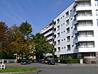
1040 | Mansfeld , city in Saxony-Anhalt | 1916 | The street is between Cicero and Mannheimer Straße. The part to the east of today's Bielefelder Straße (formerly Straße 3 ) appears in the Berlin address book from 1916, the western part (formerly Straße 50 ) was included in 1930. It is a one-way street from Barstrasse to Hohenzollerndamm . To the west of Eisenzahnstraße there is a piece of stairs that are not accessible. |
|
| Marbacher Strasse
( Location ) |
120 | Marbach , town in Baden-Württemberg | Aug 19, 1909 | The street is between Kreuznacher and Rauenthaler Straße. The properties at Marbacher Strasse 2–4, 6–18 belong to the artist colony . The naming took place on the occasion of the 150th birthday of Friedrich Schiller after his place of birth. The sculpture “Vegetative Plastic” is located on the corner of Kreuznacher Straße. |

|
| Markobrunner Strasse
( Location ) |
240 | Marcobrunn , vineyard near Erbach (Rheingau) in Hesse | Aug 19, 1909 | The street is between Laubenheimer and Ahrweiler Straße. The properties at Markobrunner Strasse 1–24 belong to the artists' colony . Around 1906 until the renaming in 1909, Rothenburger Straße was planned in this street. Rothenburger Strasse is not included in address books, Markobrunner Strasse was listed as undeveloped in 1912. |

|
| Maxdorfer Steig
( Location ) |
80 | Maxdorf , municipality in Rhineland-Palatinate | July 31, 1947 | The residential street connects Barstrasse and Mannheimer Strasse and was named Walter-Flex-Strasse in 1936 . |

|
| Mecklenburg Street
( Location ) |
1740 | Mecklenburg , region in Northern Germany | March 16, 1888 | The street forms the north-western end of the Rheingauviertel . The street is between Blisse and Breite Straße. Mecklenburgische Strasse was created in 1888 by merging road 31a between Blissestrasse and Schmargendorf S-Bahn station and road 31b between Schmargendorf S-Bahn station and Breite Straße. Previously, the Heideweg was designated in their route before 1856 and from 1856 until the plan roads were laid out in 1885, the Schmargendorfer Weg and Wilmersdorfer Weg . |

|
| Mehlitzstrasse
( Location ) |
90 | Daniel Ludwig Mehlitz (1826–1900) mayor of Wilmersdorf | March 16, 1888 | The street lies between Berliner Straße and Wilhelmsaue. Half of the road used to be an old field path, the other half led across a property belonging to the farmer Mehlitz. Before 1885 the street here was named Prinz-Heinrich-Straße and between 1890 and 1902 as Prinzenstraße . Daniel Ludwig Mehlitz became community leader of Wilmersdorf in 1875, the family had been based in Wilmersdorf since 1720. |

|
| Meierottostrasse
( Location ) |
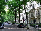
280 | Johann Heinrich Ludwig Meierotto (1742–1800), geographer and educator | March 16, 1888 | The street lies between Fasanenplatz and Bundesallee . The street was called Luisenstraße from 1876 to 1888 .
The namesake Meierotto worked at the Royal Joachimsthal High School , which was previously on this street, and was involved in the school reform in Prussia . In 1885 a house (owner: Markwald, banker) is noted on Luisenstrasse at the corner of Kaiserallee , which in the 1890 address book now belongs to the owner Schweder (1887 Markwald's heirs are named). In 1899 the street was marked “s. Berlin ”, on the east side stood (at that time) the Joachimsthalsche Gymnasium and next to the residential building there were construction sites on Schaperstraße and Kaiserallee . In front of the house with number 1, two stumbling blocks remind of the Loebell couple, who were deported to Riga ( Latvia ) in 1942 at the behest of the German government and murdered there. |
|
| Meinekestrasse
( Location ) |
100 (in the district) |
August Meineke (1790–1870), classical philologist | March 16, 1888 | Meinekestrasse is located between Schaperstrasse and Lietzenburger Strasse in the district and leads north to Kurfürstendamm in Charlottenburg . The street ended at the Joachimsthalschen Gymnasium which was located in the Karree Meierotto-, Schaperstraße and Kaiserallee . |

|
| Motzstrasse
( Location ) |
270 (in the district) |
Friedrich von Motz (1775–1830), Prussian statesman | Oct 21, 1901 | Motzstraße is located in the district between Prager Platz and Bamberger Straße, part of the street runs in the Schöneberg district . The section according to the Hobrecht Plan (number 8) located in Schöneberg was named after a cabinet order of June 11 , 1870 announced on July 6, 1870 . The Königshofer road (before 1874 to 1877: Westfälische road to 1877 1890 August Road to 1890 to 1901 Königshofer Street ) in Wilmersdorf was included in the Motzstraße on 21 October 1,901th A section of the street belonged to Charlottenburg until the district border reform in 1938 . |

|
|
Munster Street
( Location ) |
150 | Münster , city in North Rhine-Westphalia | 1892 | The street, laid out as street 11a according to the development plan , goes from Brandenburgische Straße to the west as a dead end into the Tempo 30 zone . |

|
|
Nachodstrasse
( Location ) |
400 | Nachod , site of a battle in the German War in Bohemia | 1890 | The street lies between Bundesallee and Bamberger Straße in the course of the Hohenzollerndamm and was already shown on a map in 1890. Since around 1875 the Grunewaldstrasse (to the west) and the Schöneberger Strasse (to the east) have run along this route . The section of Nachodstrasse to the west of Bundesallee was incorporated into Hohenzollerndamm in 1908. The street partially belongs to the street network of the " Carstenn figure ".
Until July 25, 1908, the street reached as far as Hohenzollernplatz. On this date, the section between Kaiserallee and Hohenzollernplatz was renamed Hohenzollerndamm . There is a historic school building on property number 26. |

|
| Nassau Street
( Location ) |
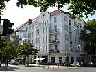
840 | Duchy of Nassau | 1886 | The street is between Hohenzollernplatz and Berliner Straße. In 1886 the Braunschweiger and Wilmersdorfer Strasse (from 1876) were merged. The Buschweg ran here as early as 1856 . The street is numbered in a horseshoe shape with 1 on the western corner house Hohenzollerndamm 203 starting to 37 on the corner of Berlin Badische Straße, back on the east side from 38 to 67. The church on Hohenzollernplatz (202/203) is on this northeast corner . Another church is on plot 18: Church of the Holy Cross . Cross streets are Güntzelstraße with the opening Trautenaustraße , 100 meters before Berliner Straße the Gasteiner Straße opens from the west . The war damage to the buildings on the street was minimal, so there are mainly five-story old buildings, most of which have been restored and renovated. The zip code is 10717, the street belongs to the planning area according to LOR 04051652: Nikolsburger Platz, forecast area Volkspark Wilmersdorf. Parallel streets are Holsteinische Straße to the west and Landhausstraße to the east , continued north of Nikolsburger Straße . |
|
| Nauheimer Strasse
( Location ) |
370 | Bad Nauheim , town in Hesse | Aug 19, 1909 | The street that was planned and laid out as street 35a lies between Aßmannshauser and Schlangenbader Straße . Nauheimer Strasse is in the Rheingauviertel . |

|
|
Nikolsburger Platz
( Location ) |
85 (diameter) |
Nikolsburg , town in Moravia , place of signing of the preliminary peace of Nikolsburg | March 16, 1888 | The round square with four road junctions and a paved carriageway with lots 1–3 and 5–7 is located on Trautenaustraße, Landhausstraße opens from the south and Nikolsburger Straße from the north. Between 1875 and 1888 it was called Magdeburger Platz and was the southwest of four squares that form the cornerstones of the " Carstenn figure ". The mirror image of Prager Platz , named on the same day, shows the main motivation behind the name: the “victorious peace between Prague and Nicolsburg”, as it was called in contemporary historiography. |
|
| Nikolsburger Strasse
( Location ) |
140 | Named for the adjoining square | 1890 | The street leading north was named together with Nikolsburger Platz . The short and quiet residential street goes as a dead end from Hohenzollerndamm southwards and ends at the green area of Nikolsburger Platz. Before the current name was given, Ringstrasse II had existed since 1876 and was named Oldenburger Strasse around 1885 . |

|
| Norderneyer Street
( Location ) |
210 | Norderney , East Frisian island | 1892 | The street lies in an area with streets named after North and Baltic seaside resorts. It runs from Helgolandstrasse south to Borkumer Strasse and beyond as a dead end. Only the western side is built on.
The street was originally much longer and reached in the north to Mecklenburgische Strasse, in the south to today's Lentzealle. At that time it was exactly on the village boundary between Wilmersdorf and Schmargendorf. It was originally called "Norderneystraße" and was marked on all city maps from 1893 onwards. The course of the street in the northern part is still clearly recognizable from Mecklenburgische Strasse to Wiesbadener Strasse , as Franz-Cornelsen-Weg runs here only as a narrow footpath, but the distance between the basic pieces is wide enough for a street so that one narrow green area was created. On the eastern edge is the property of the Mosse-Stift , which was built as early as 1893. To the south of Wiesbadener Strasse, however, nothing is visible any more: an allotment garden was built as early as 1920; according to an aerial photo from 1928, Norderneyer Strasse can at best still have existed as a beaten path along property boundaries. The Franz-Cornelsen-Weg was later re-routed here and is located a little further east between the remains of the allotment garden and an elongated meadow. The only part of the street that still exists today runs south of Helgolandstrasse. On the west side, which then belonged to Schmargendorf, the present-day development was built around 1928 and the name was changed to "Norderney er Straße". On the east side, back then partly meadow or field, there are now allotment gardens. The southernmost part was still a continuous street in 1928 up to today's Lentzeallee. Today there is only a narrow footpath on the western edge of the former street, allotment gardens have been laid out on the rest of the former street. The area to the west of it used to belong to Dahlem, there were trial areas for horticulture in the 21st century, terraced houses have been in the Magnolienring development area since 2010, but there is no public access from this direction. Around 1939 there was a correction of the district boundaries, since then the entire area has been in the district of Wilmersdorf. At the end of the 1960s, the northern and southern parts of Norderneyer Straße were abolished, and since then it has only had its current length. |

|
|
Nürnberger Platz
( Location ) |
50 × 50 | Nuremberg , city in Bavaria | Oct 21, 1901 | The green square is the corner point and the northeast square is the “ Carstenn figure ” from Wilmersdorf. It is located on Spichernstrasse, which is extended northwards from Nürnberger Strasse, Grainauer Strasse forms the east and Geisbergstrasse opens out at the northeast corner. Of the four places the Carstenn figure has, it is the least attractive; lots are not allocated. |

|
|
Nürnberger Strasse
( Location ) |
310 | Nuremberg , city in Bavaria | May 18, 1876 | The street is between Geisberg- / Schaperstraße and Kurfürstenstraße, leading across Lietzenburger and Tauentzienstrasse . In the district it is between Eislebener Straße and Nürnberger Platz. Between Eislebener and Kurfürstenstraße are the streets and the west side in Charlottenburg , the east side in Schöneberg . The name was given in connection with the neighboring (named on the same date) Burggrafenstraße and refers to the fact that the Hohenzollerns were burgraves of Nuremberg before their installation in the Mark Brandenburg . Before Straße 31, Section IV of the development plan, it was laid out in 1874 by the Tiergarten share building association. Initially, the name Kaiserwahl-Straße was planned. On March 16, 1888, the north-eastern section of Birkenwäldchenstrasse was also included in Nürnberger Strasse, and the part of Birkenwäldchenstrasse on the Wilmersdorfer area belonging to the “ Carstenn figure ” was named Spichernstrasse on the same day. Until 1938 Nürnberger Strasse ran in the districts of Tiergarten , Charlottenburg and Wilmersdorf , and from then on also in the Schöneberg district . The street was between Nürnberger Platz and Budapester Straße. Due to renovation work, a part of the street in the area of the Budapester / Kurfürstenstraße was de-designated on August 14, 1962 , and another part on December 7, 1962 (Tiergarten). |

|
|
Offenbacher Strasse
( Location ) |
310 (in the district) |
Offenbach , Hessian city | 1909 | The street with lots 6–24 (continuous) between Hohensteiner and Laubacher Straße is located in the district and continues eastwards to the southwest Corso in Friedenau with lots 1–5a and 25–31. Previously laid out as street 13 in the development plan of Wilmersdorf, the Friedenau part was called Am Friedhof from around 1890 onwards . |

|
|
Olivaer Platz
( Location ) |
250 × 70 | Oliva Monastery near Gdansk, the place where the Peace of Oliva was signed | 1892 | The square with lots 1–7 as well as 17, 18 (continuous) and 20 for the indoor part with playground and parking lot is located between Konstanzer and Württembergischer Straße in the district, with Bregenzer Straße ending as a one-way street to the south and Bayerische Straße starting as a one-way street. The north side of the square (plots 11–16, continuous) in the course of the former part of Lietzenburger Strasse belongs to Charlottenburg . The V / Place B, Div. 1 of the development plan was still unnamed, then marked on the map of 1890 in the map of Berlin from 1893 by name. On September 1, 1963, the section of Lietzenburger Strasse between Wielandstrasse and Schlüterstrasse was included in Olivaer Platz when the “Südtangente” was expanded. | |
|
Paderborner Strasse
( Location ) |
170 | Paderborn , city in North Rhine-Westphalia | Nov 4, 1915 | It lies between Brandenburgischer Strasse and Eisenzahnstrasse and was spun off from Düsseldorfer Strasse in 1915 as a section to the west of Brandenburgische Strasse. |

|
| Paretzer Strasse
( Location ) |
300 | Paretz , part of the town of Ketzin in the Havelland district | March 16, 1888 | It is located between Blissestrasse and Mecklenburgischer Strasse and was named Strasse 33a before it was named . On October 17, 1960, Kempenicher and Linnicher Strasse were incorporated into Paretzer Strasse. In Paretz was the country palace, which until 1806 was the temporary residence for Friedrich Wilhelm III. and Queen Luise was. |

|
| Paris street
( Location ) |
500 | Paris , capital of France | Nov 4, 1895 | The street lies between Württembergischer Straße and Bundesallee , but is interrupted by Ludwigskirchplatz and only leads through to the Bundesallee as a bicycle and footpath bridged with a transverse construction. The street in the train of Hopfenbruchstrasse (around 1880 – around 1885) led when it was named from Place Z to Wilmersdorf and was not shown in street directories in Schöneberg's plans. In 1902 the eastern section between today's Bundesallee and Grainauer Straße, which was still in Schöneberg, was removed and renamed Regensburger Straße. For this purpose, the previous Königsberger Strasse was added to Pariser Strasse as a western section . |

|
| Paulsborner Strasse
( Location ) |
500 (in the district) |
Paulsborn , farmstead laid out in 1800 and later forester's house on Grunewaldsee, owned by hunting gear attendant Johann Paul von Born. | March 16, 1888 | The Paulsborner Straße is with the plots 1-16 and 82-94 (continuous) between Westfälischer and Brandenburgischer Straße in the district. It continues to the southwest in Halensee , Schmargendorf and Grunewald . In 1888, Street 15, Street 34, Street S15 and Street G16 were combined into one street. |

|
| Pfalzburger Strasse
( Location ) |
405 | Pfalzburg , French commune in the southeast of the Moselle department | 1892 | In 1885 the street 8a was named after the fortress, which surrendered on December 12, 1870 in the Franco-German War and thus became part of the German Empire . The street runs from Lietzenburger over Ludwig-Kirchplatz and Hohenzollerndamm to Fechnerstraße. The Nelson Mandela International School is located here. |
|
| Pomeranian Street
( Location ) |
460 | Pomerania , historical region in Northern Germany | 1892 | From 1885, the road 13b of the development plan is planned here, which was named in 1892 after the Prussian province of Pomerania , in keeping with the surrounding streets after the federal states of the Empire . It is located between Sächsischer Strasse over the Württembergische leading and Bayerischer Strasse, from there a dead end with a connection over the footpath leads to Konstanzer Strasse. |

|
|
Prague square
( Location ) |
85 (diameter) |
adjacent street | March 16, 1888 | Prager Platz is the southeast of four squares that form the cornerstones of the " Carstenn figure ". Created before 1878 as Halberstädter Platz , it was named in 1888 together with Nicolsburger Platz , which is mirrored across Kaiserallee , with reference to the “victorious peace between Prague and Nicolsburg”. The square with the assigned properties 1-6 and 8 is located between Trautenau- ( confluence to the west), Motz- ( confluence to the east) and Prinzregentenstrasse, which flows from the south. The Prager (from the north) and Aschaffenburger Straße (from the southeast) end for vehicles as a dead end with a turning hammer in front of the square. |

|
| Prague street
( Location ) |
200 | Prague , capital of the Czech Republic, place where the Peace of Prague was signed | March 16, 1888 | The street is located between Nachodstraße and Prager Platz ; it does not go through to the latter as a dead end for traffic. Like Nikolsburger Strasse, which is analogously laid across Kaiserallee, it forms the boundary of the “ Carstenn figure ”. The names of the two streets and the associated squares are based on the “victorious peace of Prague and Nikolsburg”. In 1888, Ringstrasse II, established before 1876, and Brandenburger Strasse were merged and named as Prager Strasse. On January 28, 1959, the northern section, the former Brandenburger Strasse , was detached and renamed Grainauer Strasse. |

|
| Prinzregentenstrasse
( Location ) |
1670 | Prinzregent , representative of a prince incapable of government , here designed for the Prussian Prince Regent (named seven days after the death of Kaiser Wilhelm I ) | March 16, 1888 | The street lies between Prager Platz and the district boundary on the northern edge of the city motorway on Varziner Straße. It is marked as a bicycle road between Güntzel and Berliner Strasse ; Further south it leads as a two-lane road with parking bays as a traffic-calmed area through the Volkspark Wilmersdorf . The 30 km / h zone ends at Wexstrasse and merges into Handjerystrasse, which is also traffic-calmed . The design of the street as a bicycle route is intended to pull traffic away from the parallel federal avenue . The previous names of the street on Prinzregentenstrasse are Elberfelder Strasse , which was renamed Oberfeldstrasse before 1876 and was combined in 1888 with Promenade I , designated by Johann Anton Wilhelm von Carstenn , if it was located on Wilmersdorfer Flur. Other parts of Promenade I and Promenade II went into Handjerystraße.
The synagogue , which opened in 1930 , was located in Prinzregentenstrasse, house number 69/70, was destroyed during the Reichskristallnacht and later demolished. A memorial plaque reminds of this.
|

|
|
Rankestrasse
( Location ) |
80 (in the district) |
Leopold von Ranke (1795–1886), historian | March 16, 1888 | The street with the lots 16-23a (continuous) lies with the street area on the southeast side of Friedrich-Hollaender-Platz and between Lietzenburger and Eislebener Straße with the east side in the district and continues in Charlottenburg to Breitscheidplatz . Before it was renamed in 1888, it was part of Kaiserstraße , which Carstenn laid out in Friedenau beginning in 1872 to connect his Wilmersdorfer and Lichterfeld estates and extended to Charlottenburg territory (up to today's Breitscheidplatz) until 1876. When it was renamed Kaiserallee (1888), the northern part was separated as Rankestrasse. At Friedrich-Hollaender-Platz, the street that is shown here as a parking lot also has an exit to Joachimsthaler Straße . |

|
| Rauenthaler Strasse
( Location ) |
280 | Rauenthal , part of Eltville am Rhein in Hesse | Aug 19, 1909 | The street lies between Ludwig-Barnay-Platz and Laubacher Straße in the Rheingauviertel . The properties at Rauenthaler Straße 1–26 belong to the artists' colony |
|
| Ravensberger Strasse
( Location ) |
210 | Grafschaft Ravensberg , historical territory in East Westphalia | 1892 | Road 9a , which had been planned since 1885, was named in 1892 . It lies between Brandenburgischer and Eisenzahnstrasse. |

|
| Regensburger Strasse
( Location ) |
360 (in the district) |
Regensburg , city in Bavaria | 1902 | Historically, the Hopfenbruchstrasse to a forest and pasture land in Wilmersdorfer and Charlottenburg was located here , in 1885 this path was paved for Schöneberg and named Pariser Strasse , before the road between Kaiserallee and Viktoria-Luise-Platz was named Regensburger Strasse in 1902 which, however, initially belonged to Berlin. It is located between Bundesallee and Bamberger Straße in the district and continues eastwards in Schöneberg . |

|
|
Rüdesheimer Platz
( Location ) |
200 × 90 | adjacent street | Aug 19, 1909 | The square is located between Ahrweiler and Rüdesheimer Strasse, the north side (no. 1–6) and south side (no. 7–11) are assigned to the square, the inner area of which is numbered 12 as plot. The block square with six road junctions was named in 1909 and is the central square of the Rheingauviertel . The Schmuckplatz is the center of the "garden terrace city" in the Rheingauviertel. A reconstructed Café Achteck was opened on the square in 2006 , which on the outside corresponds to the historic Berlin urinals from 1900, but inside has a modern public toilet system from Wall AG . The subway station Rüdesheimer Platz is on the west side of the square . In the summer months, the Rheingau wine fountain takes place, where winegrowers from the Rheingau sell their wine. |
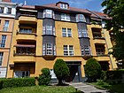
|
|
Rudesheimer Strasse
( Location ) |
480 | Rüdesheim am Rhein , town in the Rheingau-Taunus district | Aug 19, 1909 | The street is in the Rheingauviertel between Homburger and Johannisberger Straße. On April 14, 1936, Niederwaldstrasse (Rüdesheim is located on the Niederwald ) was included as the southern section of Rüdesheimer Strasse. The street lies in an area in which they were given the names of municipalities in the Rheingau . The properties at Rüdesheimer Strasse 15–29 and 33–37 belong to the artists' colony . |

|
| Rudolf-Mosse-Platz
( Location ) |
80 × 70 (triangular shape) |
Rudolf Mosse (1843–1920), publisher | Dec 15, 1958 | The former place H was named Homburger Platz in 1934 because the Lindenkirche was built on the previous place of that name. In 1958 it was renamed after the Jewish publisher Mosse, one of the most important Berlin newspaper publishers. The triangular square lies with the northwest side along the Mecklenburgische Straße, on the other side of the street the district boundary runs. To the south is Rudolf-Mosse-Strasse with its properties 9 and 11 (the square is numbered 6) and to the east is the (closed) Sodener Strasse (no. 57). |

|
| Rudolf-Mosse-Strasse
( Location ) |
180 | Rudolf Mosse (1843–1920), publisher | May 1, 1972 | Mossestrasse , named after the Jewish newspaper publisher, was named Homburger Strasse in 1934 . During the construction of the city motorway feeder , the Homburger Strasse was separated in the "Tunnel Schlangenbader Strasse" area and in 1972 the western section of the street was given the historically established name as Rudolf-Mosse-Strasse, it lies between Mecklenburgische Strasse (Rudolf-Mosse-Platz) and over the Sodener Straße as a dead end street to the turning area in front of the Autobahn overhang Schlangenbader Straße . This is where the interdenominational orphanage Mosse-Stift is located . |

|
| Rudolstädter Strasse
( Location ) |
1060 | Rudolstadt , Thuringian city | Dec 22, 1911 | Rudolstädter Strasse is located between Hohenzollerndamm and Mecklenburgischer Strasse to the northeast, parallel to the city motorway . The western edge of the Volkspark Wilmersdorf with the Fennsee ends at it, it also forms the southwest border of the " KGA Am Hohenzollerndamm". The one-sided development results from the plot numbers 2–126 (even) and 77–127 (uneven). |

|
| Ruhrstrasse
( Location ) |
400 | Ruhr , right tributary of the Rhine | July 26, 1923 | The naming of the street 5 took place shortly after the occupation of the Ruhr area by French and Belgian troops from January 11, 1923 because of the delayed reparation payments by Germany. The headquarters of the German Pension Insurance and the Protestant New Church are located on the street . The street lies between Hohenzollerndamm and Bielefelder Straße. |

|
|
Saxon Street
( Location ) |
1110 | Kingdom of Saxony , federal state of the German Empire | 1892 | The quiet inner-city residential street with dense development lies between Lietzenburger and Brandenburgischer Strasse. It was laid out in 1885 as road 12a . |

|
| Schaperstrasse
( Location ) |
540 | Karl Julius Heinrich Schaper (1828–1886), teacher and director of the Joachimsthal Gymnasium | March 16, 1888 | From 1876 to 1888 before it was called Ring Road I . The central and quiet inner-city residential street forms the northern arch of the " Carstenn figure ". It runs from Spichernstrasse to Fasanenplatz. The residential buildings are well-preserved and restored old buildings, post-war buildings and new buildings. The " Haus der Berliner Festspiele ", formerly the " Freie Volksbühne ", stands on the street . The street borders on the former Joachimsthal grammar school . In 1966 René Block founded his "Edition Block" here. At the western end is the “ bar of all reason ”. |

|
|
Schlangenbader Strasse
( Location ) |
1030 | Schlangenbad , town in Hesse | 1895 | The parallel motorway overhang is named after this street . The street is located between Mecklenburgischer and Dillenburger Strasse; from 1885 it was named Strasse 44a in the development plan . |

|
|
Schrammstrasse
( Location ) |
80 | Beer garden formerly located here : Tanzpalast Schramm , Franz Otto Schramm (1845–1902), Wilmersdorfer farmer and innkeeper | 1902 | The street between Am Volkspark and Hildegardstraße was laid out as Straße 8 according to the development plan . With the changes to the Volkspark Wilmersdorf , part of the Schrammstrasse came to today's street Am Volkspark. |

|
| Siegburger Strasse
( Location ) |
160 | Siegburg , town in the Rhein-Sieg district | Aug 19, 1909 | Siegburger Strasse is located in the Rheingauviertel between Aßmannshauser and Hanauer Strasse. |

|
| Sigmaringer Strasse
( Location ) |
415 | Hohenzollern-Sigmaringen is the Swabian line of Hohenzollern that has remained Catholic | June 30, 1908 | The street lies between Brandenburgische Strasse and Hohenzollerndamm (Emser Platz). The previous name had been Kurz Trift since 1856 , before the name was given in 1888 with the extension of street 10a of the development plan, initially as Sigmaringener Straße and, after the spelling reform from 1908, in today's spelling. |

|
| Sodener Strasse
( Location ) |
470 | Bad Soden am Taunus , town in Hesse | 1902 | Sodener Strasse is located between Dillenburger and Rudolf-Mosse-Strasse. After 1885 the street 46a was named Ehrenfeldstraße and in 1902 it was included in the Sodener Straße. During later construction work, various sections were removed again. |

|
| Spessartstrasse
( Location ) |
365 | Spessart , low mountain range in Hesse and Bavaria | Aug 19, 1909 | Spessartstrasse is located in the Rheingauviertel between Hanauer and Aßmannshauser Strasse. |

|
| Spichernstrasse
( Location ) |
385 | Spicheren , site of the Battle of Spichern in the Franco-German War in Lorraine near the Spicherer Heights, a ridge south of Saarbrücken , the storming of which by German troops on August 6, 1870 cleared the way to Metz . | March 16, 1888 | It lies between Schaperstraße (Nürnberger Platz) and Bundesallee and forms a street of the " Carstenn figure ". 1874 was the route still without name, but the map of 1876 as Birkenwäldchen road between the Wilmersdorf Kaiserstraße drawn and the start of the Nuremberg street corner was later named Augsburger Strasse, on the ring road I time. On March 16, 1888, the Charlottenburg section to Nürnberger Strasse was included. The part belonging to the “Carstenn figure” in the Wilmersdorfer area was named Spichernstrasse on the same day. |
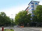
|
| Steinrückweg
( Location ) |
130 | Albert Steinrück (1872–1929), actor and director | Feb 21, 1940 | The street lies between Kreuznacher Straße and Südwestkorso . The street, initially a ring road, was named Rastatter Straße in 1906 and was drawn in piece by piece by 1909. The remaining part in the present area was named Barneyweg in 1932 , the namesake of which was replaced by Steinrück in 1940 during the Nazi era . The street forms a border with the artists 'colony and the lots at Steinrückweg 1–9 belong to the artists' colony. This housing estate, built in 1929, belongs to the German Stage Members' Cooperative, which was founded by Barnay in Weimar in 1871 . |
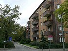
|
| Street at Schoelerpark
( Location ) |
430 | adjoining park (after the physician Heinrich Schoeler, see also Schoeler-Schlösschen ) | Sep 1 1967 | The street runs on the northern edge of Volkspark Wilmersdorf westward from Uhlandstraße as a dead end to the level of Schoelerpark (southern edge). The street, renamed in 1967, belongs to the street Am Seepark, which was expanded in 1912 . The road layout was also changed due to construction work on the park. The part laid out in 1922 was named Hindenburgstraße (the Seepark as Hindenburgpark ) and in 1955 the street was named Am Volkspark . |
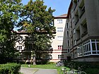
|
|
Southwest Corso
( Location ) |
860 (in the district) |
Direction of the street, seen from Berlin | March 27, 1909 | The south-west parade lies between Breitenbachplatz and Bundesallee , the district includes the south-western part up to Laubacher Strasse , the further course to Bundesallee leads through Friedenau . The street (to the quarter provided here) was decided with a majority of one vote by the Friedenau municipal council. It was intended as the main connection from Kaiserallee to the then newly developed Dahlem domain , and at the request of Kaiser Wilhelm II , the former bridle path was laid out in the middle of the street. In 1907, the directory publishers began to prefix the text parts with maps of the street; In 1910 the south-west corso between Rastatter Platz and Hanauer Platz (Varziner / Laubacher Strasse) is drawn across Rüdesheimer Platz ; in the text part of the street directory, the south-west corso is still entered as the Black Forest road .
The south-west parade forms the southern end of the Rheingauviertel and a border to the artists' colony . The previous name was Schwarzwaldstraße . The street was laid out by the Berlinische Boden-Gesellschaft under Georg Haberland in 1906–1908. |
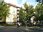
|
| Sylter Strasse
( Location ) |
270 | Sylt , North Frisian island | 1891 | It is located between Norderneyer and Zoppoter Straße, in the settlement area in which several streets are named after seaside resorts on the North and Baltic Sea coasts. |

|
|
Tharandter Street
( Location ) |
120 | Tharandt , city in Saxony | Feb. 19, 1911 | The street 70 was laid out and named in 1911. It lies between Prinzregentenstrasse and Bundesallee , but does not lead to the latter as a dead end . |

|
| Trautenaustrasse
( Location ) |
400 | Trautenau , city in East Bohemia, site of a battle in the German War | Aug 3, 1908 | The street lies between Nassauische and Prager Platz in the eastern section, it is the southern boundary of the " Carstenn figure ". The Rosberitzer road between Nikolsburger and Prague square was with the 1908 Lipaer street named as Trautenaustraße. |

|
| Triberger Strasse
( Location ) |
75 | Triberg , city in the Black Forest | Aug 19, 1909 | The street is between Aßmannshauser and Hanauer Straße, the closest to the parallel streets to Heidelberger Platz. |

|
|
Tuebinger Strasse
( Location ) |
140 | Tübingen , Baden-Wuerttemberg university town | Aug 19, 1909 | Created as Straße 17 from 1885 , it runs between Bundesplatz and Durlacher Straße and ends here in front of the Volkspark . |

|
|
Uhlandstrasse
( Location ) |
1960 (in the district) |
Ludwig Uhland (1787–1862), poet | Oct 28, 1893 | Uhlandstrasse is located between Blissestrasse and in front of Lietzenburger Strasse in the district; the section leading north to Hardenbergstrasse ( Steinplatz ) is in Charlottenburg . This Charlottenburger Strasse, which is part of Section V / 1 of the development plan, was named Uhlandstrasse on April 25, 1885. Schleswigsche Strasse and Valerienstrasse were included in this in the Wilmersdorf area in 1893 . On April 15, 1965, the Uhlandstrasse in the south was extended to Blissestrasse when changes were made to the Volkspark . With the connection to the city motorway, Uhlandstrasse has become one of the main roads into the center on Kurfürstendamm . |
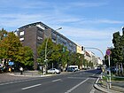
|
|
Waghäuseler Strasse
( Location ) |
350 | Waghäusel , town in Baden-Württemberg , especially the battle near Waghäusel in 1849 | 1892 | The street is between Bundesallee and Kufsteiner Straße. In 1892, on the route planned as Straße 21a in the development plan of 1885, the street was named after the slaughter where the Crown Prince and later Emperor Wilhelm I decided to put down the Baden Revolution in 1849. |

|
| Wallenbergstrasse
( Location ) |
360 | Raoul Wallenberg (1912–1947 [missing]), Swedish diplomat | Sep 1 1967 | On the route of Wallenbergstrasse, the street 29a planned in the development plan of 1885 was named Strelitzsche Strasse around 1902 . With the changes to the park, this came to Am Seepark around 1912 . Both together were named Hindenburgstrasse in 1922 . In 1955 this name was replaced by Am Volkspark. In 1967 the western section of the street Am Volkspark was renamed Wallenbergstraße in connection with the planning of street sizes for the construction of the city motorway . The street lies between Ermslebener Weg and Mecklenburgischer Straße along the southern edge of the Volkspark. |

Ermslebener Weg to Mecklenburgische Strasse and Paretzer Strasse |
| Warneckstrasse
( Location ) |
120 | Gustav Warneck (1834–1910), Protestant theologian | May 13, 1929 | The road 15c according to the development plan from 1885 was in 1903 Rudorfstraße named and renamed the 1929th The street is between Hoffmann-von-Fallersleben-Platz and Rudolstädter Straße. |

|
| Wegenerstrasse
( Location ) |
180 | Robert Wegener (1829–1895), head of the district and community of Wilmersdorf from 1877 to 1886 | Aug 24, 1893 | The road 17a of the development plan of 1885 to 1890 as a Holsteiner street set up before 1893 it acquired its current name. It lies between Sigmaringer and Sächsische (r) Strasse. |

|
| Weimar Street
( Location ) |
410 | Weimar , city in Thuringia , the wife of Kaiser Wilhelm I came from the House of Saxe-Weimar | Apr 7, 1908 | The street lies between Hildegardstrasse and Detmolder Strasse, over the latter it still goes as a dead end to the city motorway . Before 1874, in the Wilmersdorfer and Friedenau area, it was named Nassauer Straße and moved to Promenade VI in 1876 . The Wilmersdorfer Teil was designated as Straße 28 from 1892 and was named Weimarsche Straße before 1897, and then Weimar Straße from 1908. |

|
| Westfälische Strasse
( Location ) |
800 (in the district) |
Westphalia , Prussian Province | 1905 | The street lies between Henriettenplatz ( Kurfürstendamm ) and Brandenburgische Straße ( Fehrbelliner Platz ). The eastern part from the crossing Paulsborner Straße to Brandenburgische Straße is in the district, to the west it continues in Halensee . The street lies on the route of the street Die Kuhtrift , which existed before 1876 , which was initially renamed in 1888 with the spelling Westphälische Straße (with "ph") with the increasing urbanization of the area , whereby street 14 and street 35 were included. The Cicerostraße depot is located between Cicerostraße and Eisenzahnstraße and buildings belonging to the Deutsche Rentenversicherung are to the east of Konstanzer Straße . |
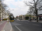
|
| Wetzlarer Strasse
( Location ) |
280 | Wetzlar , city in Hesse | Aug 19, 1909 | The street lies between Laubenheimer and Ahrweiler Straße in the Rheingauviertel . The properties at Wetzlarer Straße 1, 3–30 belong to the artists' colony . |

|
| Wexstrasse
( Location ) |
220 (in the district) |
Eduard Wex (1827–1902), civil engineer, President of the Berlin Railway Directorate | Dec 22, 1911 | The Wexstraße is located between Bundesplatz and Prinzregentenstraße in the district, it continues eastwards in Schöneberg and is with the junction of the city motorway in Friedenau . Margarethenstrasse , which was here before 1874, was incorporated into the Ringbahnstrasse in 1888 . In 1911 this was divided into the Rudolstädter and Seesener, located in Halenseer area, as well as on the Kaiserallee in the western Detmolder and the eastern Wexstraße. |

|
|
Wiesbadener Strasse
( Location ) |
1480 (in the district) |
Wiesbaden , Hessian state capital | before 1893 | The street lies between Mecklenburgischer and Laubacher Straße in the district and continues eastward in the Friedenau district to Friedrich-Wilhelm-Platz on Bundesallee . The properties in Wiesbadener Strasse 69-76 belong to the artist colony . |

|
|
Wilhelmsaue
( Location ) |
1000 | Wilhelm I , German Emperor | March 16, 1888 | The street lies between Mannheimer Strasse and Bundesallee (west-east), the old location between Blissestrasse and Mehlitzstrasse was historically called Dorfaue according to the type of settlement , until the rural name was replaced by Wilhelmstrasse in 1875 . In 1888 the extended Wilhelmstrasse was given a green area in the middle and the name Wilhelmsaue, in 1895 a bust of Kaiser Wilhelm I was erected. The first village church of Wilmersdorf was located here, which was later replaced by today's Auenkirche . In addition, at the beginning of the 20th century there was the Herzsprungscher Dorfkrug (number 113) restaurant and nearby the Wilmersdorfer See, which was built up from 1915 . The Fennsee lies near the road . The Schoeler-Schlösschen , which still exists, is the oldest building in Wilmersdorf. |

|
| Wittelsbacherstrasse
( Location ) |
600 | House of Wittelsbach , German noble family | Nov 30, 1910 | The street lies between Sächsische and Brandenburgische Strasse and was laid out in 1901 in the route of Strasse 9 and Strasse 67 of the development plan. |

|
| Württembergische Strasse
( Location ) |
940 | Kingdom of Württemberg , federal state of the German Empire | 1892 | The street runs in a north-south direction between Hohenzollerndamm (north side of Fehrbelliner Platz ) and Olivaer Platz (corner of Pariser Straße). According to the development plan, it was initially called Straße 14a from 1880 ; In 1890 it was named Wartenbergische Strasse . Just two years later, like other streets in the area, it was renamed after kingdoms and states of the German Empire proclaimed in 1871 .
The 'Württemberg' allotment garden that existed here until 2009 had to be abandoned in favor of new residential buildings. The new building complex comprises Württembergische Strasse 41-49 and is located between Pariser Strasse and Düsseldorfer Strasse. Together with the open spaces on the courtyard side, it was given the name 'rose gardens' and will be completed in summer 2013. The eleven seven-story buildings are being built by the Bauwert Investment Group with a quota of 95 million euros. According to the name, a total of 41 varieties of roses are planted on the farm. There is also a parking garage and a fountain is also being built. |

|
| Wurzburger Strasse
( Location ) |
80 | Würzburg , Franconian city | before 1897 | Around 1900 this street was laid out and named on the route from street 30b of the development plan. It is located in the north of the district between Lietzenburger and Augsburger Strasse. In 1893 and 1895 the street parallel to Nürnberger and Passauer Straße was still unnamed and lies between Augsburger and Geisbergstraße. On the map from 1897 it is named as Würzburger Straße. |

|
|
Xantener Strasse
( Location ) |
300 | Xanten , city on the Lower Rhine | 1892 | From 1885 it was planned as street 5c and in 1892 it was named. It is located between Brandenburgischer Strasse and Konstanzer Strasse ( Olivaer Platz ). |

|
|
Zähringerstrasse
( Location ) |
610 | Zähringer , south German noble family | Nov 30, 1910 | In the streets of Straße 9a and Straße 66 of the development plan, the street was named in 1910, it is between Sächsische and Brandenburgischer Straße. |
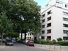
|
| Sopot Street
( Location ) |
450 | Sopot , former German city near Gdansk | 1891 | The street between Wiesbadener Straße and Lentzeallee, along with the street area and the east side, belongs to the district, the western properties belong to the district of Schmargendorf . The southern extension of Zoppoter Straße to Lentzeallee took place around 1906. |
|
Former and not built roads
In Wilmersdorf, then German Wilmersdorf , the existing roads were expanded between 1880 and 1910 and the streets laid out from the development plans from 1880/1885; according to information in the Berlin address books (as far as they are already listed), these were often left undeveloped for a long time . After the (initial) naming, new names were often assigned after a short time, sometimes after two years, which were due to the events of the time. Often the local road network of Charlottenburg , Schöneberg and Friedenau or the initial affiliation from Halensee was extended or otherwise influenced. The changes on and around the Wilmersdorfer See , then set up as Seepark (later Volkspark ) or the change in traffic flows and traffic planning as a result of the construction of the motorway ring road or the expansion of Lietzenburger Straße to the southern bypass influenced the road system in the district. Only previous street names are included in the following list, insofar as they are applicable to Wilmersdorf. Changes in the street name due to the adjustment of the spelling after 1906, such as "K" instead of "C" at Nicolsburger Platz or "f" instead of "ph" at Westphälischestraße , as well as differences in separate or combined spelling or in the local form such as Gerdauener Straße (Gerfamilie Straße ) are only listed separately if relevant. On the other hand, the consecutive assignments due to changes in the development documents cannot always be precisely defined if the course of the routes has changed. There are differences in the early and later documents in the Rheingauviertel . Several names initially assigned to streets or squares were changed (preferably between 1870 and 1910) and reassigned again elsewhere, obviously because the Wilmersdorfer municipal council considered the name or the historical reference to be significant. Again, names for the same street course coexisted at the same time (at least temporarily).
| Formerly | from | to | renamed to | Notes, origin of name |
|---|---|---|---|---|
| Achenbachstrasse | before 1890 | Sep 1 1963 | → Lietzenburger Strasse | After Heinrich von Achenbach (1829–1899), lawyer and politician, the street was named after Section IV of the development plan between Ranke- and Nürnberger Straße on the border with the Schöneberg district. |
| Old burial place | around 1856 | around 1935 | Place K | Until the 19th century the burial ground of the village was located here , which was leveled around 1890 and popularly referred to as the Bone Park , according to the development plan as Platz K , the area has been called Habermannplatz since 1964 . |
| At the Seepark | around 1912 | 1922 | → Hindenburgstrasse | The Wilmersdorfer See was gradually filled in and replaced by a park in an east-west direction. The dynamism of the construction work around today's Volkspark from 1912 resulted in renaming and changes in the course of the street. |
| At the Trift | around 1856 | around 1890 | → Lauenburger Strasse | The old dirt road from Wilmersdorf across the corridor to Charlottenburg served as a cattle drive . Fechnerstrasse has been running here since 1947 |
| Augustastrasse | March 16, 1888 | May 20, 1937 | → Stenzelstrasse | Augusta von Sachsen-Weimar-Eisenach (1811–1890), the wife of Kaiser Wilhelm I , gave her name to the northern part of the Green Path (located in Wilmersdorf) together with Steglitzer Strasse . The current name is Blissestraße . |
| Auguststrasse | around 1877 | around 1890 | → Königshofer Strasse | The origin of the name August cannot be exactly assigned. Motzstraße was laid out in Schöneberg as early as 1870 . The section of road in Wilmersdorf, named Königshofer Strasse , was incorporated into Motzstrasse on October 21, 1901 . |
| Baiernstrasse | before 1874 | before 1876 | → Lützowstrasse | The spelling Baiern was officially repealed by King Ludwig I (1825–1848) by ordinance, according to which the country name must always be written with "y". In 1890 it was named as the eastern section of Mainzer Straße . |
| Barnayweg | December 17, 1932 | Feb 21, 1940 | → Steinrückweg | The actor and artistic director Ludwig Barnay (1842–1924) was the founder of the German Stage Members ' Cooperative in Weimar in 1871 , which in 1929 created the housing estate of the artists' colony here. |
| Berlin Square | Jan. 8, 1892 | July 25, 1908 | → Hohenzollerndamm | The Berliner Platz , in the development plan Straße 28 , lay on the border with Schmargendorf and sat down from there in the already established Hohenzollerndamm northeast of the circle line on Wilmersdorfer territory continued. The Brieger , Wohlauer and Osnabrücker Strasse converged on this area from the north , the Ringbahnstrasse bordered in the southwest and Kostnitzer Strasse in the east . In the east of Wilmersdorf the Berliner and Preussische Strasse merged . The latter was included along with the square in the Hohenzollerndamm, which was extended to Wilmersdorf to the Kaiserallee of the Carstenn figure . |
| Berlin way | after 1691 | March 16, 1888 | → Berliner Strasse | The Berliner Weg led from today's Nassauische Strasse in the direction of Berlin , which was northeast of Wilmersdorf. It was the second street after the village meadow that was laid out in the municipality and named after the paving in street . |
| Birch Grove Road | before 1876 | March 16, 1888 | → Spichernstrasse | The “birch grove” in the Schöneberg district gave it its name. In 1874 the route was not yet marked. In 1876, between Wilmersdorfer Kaiserstraße and Ringstraße I, a path under this name was drawn at the beginning of Nürnberger / Augsburger Straße. In 1888, the section in the Nürnberger Straße in Charlottenburg was included. The part belonging to the Carstenn figure in the Wilmersdorfer area was named Spichernstrasse on the same day. In the Berlin address book 1887 it is assigned to Berlin. |
| Brandenburger Strasse | around 1885 | March 16, 1888 | → Prager Strasse | The street named after Brandenburg (historical landscape of Prussia) lay between Nachod and Geisbergstraße. As the street of the Carstenn figure (as its eastern boundary), it was renamed in 1888 because another street in Wilmersdorf was named Brandenburgische Strasse on the same day . |
| Braunschweiger Strasse | around 1870 | 1886 | → Nassauische Strasse | When the empire was founded in 1871, the Duchy of Braunschweig became a federal state of the German Empire. The Brunswick Street (between Güntzel- and Berliner Strasse) in 1886 together with the Wilmersdorferstraße (Güntzelstraße the road north) renamed in 1886 in Nassau Street. |
| Brieger Strasse | Jan. 8, 1892 | June 18, 1911 | → Albrecht-Achilles-Strasse | The street named after Brieg in the province of Silesia (today: Brzeg , Opole Voivodeship in Poland ) formed the southern extension of Albrecht-Achilles-Strasse and ran from Westfälische Strasse to Hohenzollerndamm. In 1911 it was merged with Albrecht-Achilles-Strasse. The section was drawn in between 1928 and 1930 for the planned expansion of the Halensee tram depot ; the Cicerostraße bus depot has been on the site since 1958 . |
| Briloner Strasse | June 14, 1910 | Feb. 19, 1911 | → Ballenstedter Strasse | After the Congress of Vienna in 1816, Brilon became part of the Westphalia province of the Kingdom of Prussia and in 1818 it became a district town. In 1910 this street was given its name due to its location parallel to Münsterschen Straße , the capital of Westphalia, but was renamed in 1911. |
| Buchhofstrasse | around 1875 | around 1880 | → Kirchhofstrasse | The Buchhof was probably the name of a property north of the locality (north of the → Berliner Weg ). The route has been part of Gasteiner Strasse since 1888 . |
| Bush road | before 1876 | around 1890 | Street 50 | The name is derived from a forest here, the Hopfenbruch is mentioned as early as 1774 between Charlottenburg and Wilmersdorf. The route of the path was taken into account in the development plan around 1890 and was given the number 50 , then named in 1906 in Jenaer Straße . |
| Bush path | around 1856 | around 1870 | → Braunschweiger Strasse | The term Busch was used for the Hopfenbruch, an area between Charlottenburg and Wilmersdorf that was mentioned as early as 1774. The bush path ran from the eastern end of the village to the north in the direction of Charlottenburg into the wooded area and pasture land. Today Nassauische Strasse is in the route . |
| Carlstrasse | around 1885 | around 1890 | → Hagenauer Strasse | The street was established with the development plan from 1885, the reason for the naming could not yet be determined. The renaming to Hagenauer Straße probably took place together with the (new) naming of the neighboring Straßburger Platz. With the construction of the church of the Catholic parish of St. Ludwig, consecrated in 1897, it received its current name Ludwigkirchstraße . |
| Charlottenburg Way | around 1856 | around 1885 | → Westendstrasse | The path led from the village northwest to the neighboring town of Charlottenburg . The division took place around the beginning of the 1880s, with the section south of Westfälische Strasse being named Westendstrasse and part of it being incorporated into Brandenburgische Strasse . |
| Danziger Strasse | before 1874 | before 1876 | → Ringstrasse II | The street was named after Danzig (today Gdańsk), the then capital of the Prussian province of West Prussia . The course of the street between today's Prager and Nikolsburger Platz entered Trautenaustraße as an eastern section . |
| Darmstädter Strasse | before 1874 | 1876 | → border road | The street was named after Darmstadt , whereby part of the Grand Duchy of Hesse had come to Prussia as a result of the German War in 1966 . The street ran near the boundary to Friedenau and has been called Kuppenheimer Strasse since 1892 . |
| The high way | around 1830 | around 1885 | → Berliner Strasse | The high road led west over a hill out of the village and was probably also called the back road . The way led to the "Villa Colony Grundewald". |
| The cow drift | around 1856 | March 16, 1888 | Westfälische Strasse | The Kuhtrift led in the 19th century as Viehtrift from Wilmersdorf toward inn Halensee to pastures that were on the southwest Hopfenbruch. The renaming was related to the naming of parts of the empire. |
| The short run | around 1856 | March 16, 1888 | Sigmaringener Strasse | It led as a dirt road from Brandenburgische Strasse in a northerly direction to the pastures in the Hopfenbruch, the Trift being the path on which the cattle are driven to water and pasture. |
| Ehrenfeldstrasse | after 1885 | 1902 | Sodener Strasse | The road 46a according to the development plan was named after the "Ehrenfeld Castle" in the municipality of Zwiefalten in what is now the Reutlingen district (Baden-Württemberg). |
| Elberfelder Strasse (1) | before 1874 | before 1876 | → Promenade I | After the transition to Prussia in 1815, Elberfeld became the seat of a district that arose from the mayorships of Elberfeld and Barmen. When the promenades through Carstenn were planned , this street race lost its name. |
| Elberfelder Strasse (2) | around 1885 | Jan. 8, 1892 | → Babelsberger Strasse | The name of the street after the city of Elberfeld , which became available in 1876 through changes along the Carstennschen Promenade , was reassigned to this Hannöverschen Strasse , which was planned according to the development plan . |
| Erfurter Strasse | around 1890 | around 1912 | → At the Seepark | Street 23a, which has existed since 1885 on the southern edge of the area around the Fenngraben, was named after Erfurt , a town in Thuringia. In 1802 Erfurt became part of Prussia and remained so until 1945. (Only 1806–1814 was the Principality of Erfurt directly under French rule.) |
| Falkensteiner Strasse | The planned street between Mecklenburgische Strasse and Dillenburger Strasse. It would have been laid out parallel to Sodener and Schlagenbader Strasse in the space between these two. Today the western edge of the Schlangenbader Strasse motorway overhaul runs at this point . | |||
| Flensburger Strasse | before 1874 | 1890 | → Hessische Strasse | After the German-Danish War (1864), the city of Flensburg came from Denmark to Prussia . The road was planned in 1874 between Schleswiger and Kaiserstraße . In 1890 Magdeburger Strasse was also included as Hopfenbruchstrasse and Hessische Strasse was formed, before it was given its current name as Landhausstrasse after the restaurant "Landhaus" on the corner of Berliner Strasse . |
| gardenstreet | before 1876 | around 1890 | → Hannoversche Strasse | The Königsbergerstraße was probably around 1876 as garden road out, it is marked on the map with this name in 1876 and is located on the southern edge of the hop break, a forest and meadow area to Charlottenburg way, so the name is explained. In 1890 it was named Hannoversche Straße with street 13a before it became the eastern section of Güntzelstraße . |
| Georgstrasse | 1875 | before 1893 | → Geisbergstrasse | One of the Brandenburg margraves Georg Wilhelm is likely to be used for the name, although a Georg Wilhelmstrasse with two houses on the Ringbahnstrasse is already listed. Geisbergstraße is shown in this street on the map from 1893. |
| Gravelotter road | before 1890 | before 1896 | → Fasanenstrasse | The street between Nachodstrasse and Lietzenburger Strasse is named after the municipality of Gravelotte in Lorraine. It was here, west of Metz, on August 18, 1870, that the battle with the greatest losses in the Franco-Prussian War took place, which led to the withdrawal and enclosure of the French Northern Army under Marshal Bazaine in the fortress of Metz. The route leading through from the north, known as Fasanenstrasse, was incorporated into → Ringstrasse II as the western boundary of the Carstenn figure and then named Gravelotter Strasse . |
| Border road | 1876 | Jan. 8, 1892 | → Kuppenheimer Strasse | The name referred to the course of the street in the direction of the local border between Wilmersdorf and Friedenau. |
| Green way | around 1880 | March 16, 1888 | → Laubacher Strasse → Augustastrasse |
The path led from the village of Wilmersdorf in a southerly direction "into the green" and formed the boundary between Friedenau and Wilmersdorf, sometimes or partially as the Steglitzer Weg , sometimes listed as a border road. In 1888, the section south of the Ringbahn on the boundary between Wilmersdorf and Friedenau became Laubacher Straße. The section of the Ringbahn that belongs to Wilmersdorf was named Augustastraße together with Steglitzer Straße . |
| Grunewaldstrasse | around 1875 | around 1890 | → Nachodstrasse | The street led to the villa colony Grunewald and with its expansion from 1889 the Kurfürstendamm and probably also the street west of the Kaiserallee became the later Hohenzollerndamm . The street name still exists today in the neighboring district to the east. |
| Hagenauer Strasse | around 1890 | Oct. 1, 1900 | → Ludwigkirchstrasse | The street is named after Hagenau , the French city in Lower Alsace. At the time it was named, as a result of the Franco-Prussian War of 1870/71 from 1871 to 1919, it belonged to the German realm of Alsace-Lorraine . It was renamed when the Catholic Ludwig Church was built. |
| Halberstädter Platz | before 1877 | March 16, 1888 | → Prager Platz | Halberstadt , city in Saxony-Anhalt . In 1807 the city became part of the Kingdom of Westphalia created by Napoleon and the capital of the Saale department. The Halberstädter Platz was renamed in 1888 as the southeast corner of the Carstenn figure . |
| Hamburger Street | before 1880 | March 16, 1888 | → Lipaer Strasse | The Mecklenburg road was before 1880 by Hamburg named, thus matching the east continued leading Danziger Strasse . Hamburg became a member of the North German Confederation initiated by Otto von Bismarck in 1867 and remained a member of the German Empire in 1871 . |
| Hannoversche Strasse | around 1890 | Aug 24, 1893 | Güntzelstrasse | In 1866 Hanover was annexed to the Kingdom of Hanover by Prussia during the German War and received provincial self-government , and the royal seat of Hanover became a Prussian provincial capital. Around 1890 Gartenstrasse was merged with Strasse 13a to form the newly named Hannoversche Strasse . The Hannoversche Straße , in the development plan from 1885 Street 17a , was between Hohenzollern (today Emser Platz) and Schöneberg, today it forms the eastern section of Güntzelstraße. |
| Hann ö different street | around 1875 | around 1885 | → Elberfelder Strasse (2) | The street name refers (according to the spelling) to the province of Hanover , which was formed from the annexed Kingdom of Hanover as a result of the German War in 1866 . It was close to the border with Schöneberg in a north-south direction along what is now Babelsberger Strasse . |
| Heidelberger Strasse | Oct 6, 1905 | March 1, 1912 | → Assmannshauser Strasse | Heidelberger Strasse was located between Heidelberger and Aachener Platz (corner of Kreuznacher and Laubacher Strasse) across Rüdesheimer Platz . In 1908 the Rüdesheimer Platz was redesigned and the southern section was (in the meantime) called the Black Forest Road. Its route changed as a result, in 1912 the remaining northern section was renamed Aßmannshauser Strasse. |
| Hessische Strasse | 1890 | 1895 | → Landhausstrasse | The street name refers to the Prussian province of Hesse-Nassau , with Nassauische Strasse running parallel to the west. Hessische Strasse was located between Nicolsburger Platz and Wilhelmsaue in 1893 and was created in 1890 by merging Flensburger and Hopfenbruchstrasse. |
| Hindenburgstrasse | Dec 6, 1917 | Nov 18, 1955 | → At the Volkspark | The street was named in 1917 after Paul von Hindenburg (1847–1934), Field Marshal General and Reich President, and in 1922 Am Seepark was included. The street thus included the Seepark named in Hindenburgpark on the north and south edges between Rudolstädter Straße (Ringbahn) and the border to Schöneberg. |
| Hohenzollernplatz (1) | Jan. 8, 1892 | Nov 14, 1901 | → Emser Platz | It was named after the German ruling family of the Hohenzollern , who also provided the Prussian kings and the emperor . 1885 was the place the name b space and 1890 square E . After it was named Hohenzollernplatz in 1892 , it was renamed Emser Platz in 1901 because another square on Hohenzollerndamm was named Hohenzollernplatz on the same day. |
|
Holsteiner Strasse (east-west direction) today: Berliner Strasse |
before 1874 | March 16, 1888 | → Berliner Strasse | The street was on the eastern edge of the municipality, northeast of Wilmersdorfer Strasse in Schöneberg, while Schleswiger Strasse runs south-east . In April 1864, Denmark joined Schleswig and Holstein after losing to the Düppeler Schanzen and these parts of the country were annexed by Prussia in 1867 as the province of Schleswig-Holstein . |
| Holsteiner Strasse (2) | around 1890 | Aug 24, 1893 | → Wegenerstrasse | The street name after Holstein as part of the Prussian province of Schleswig-Holstein was reassigned after 1888 for the street between Brandenburgische / Sächsische Strasse and Sigmaringenstrasse. |
| Homburg Square (1) | around 1900 | July 13, 1934 | → canceled | The square of this name, initially set up as Homburger Platz in the Rheingauviertel , was north of Homburger Strasse between Binger and Johannesberger Strasse. It no longer exists because the Lindenkirche was built on it in 1936 . This name is related to Hessen-Homburg , which existed as a Landgraviate until 1866, before it was ceded to Prussia in the peace treaty of September 3, 1866 after the war of 1866 and incorporated into the province of Hessen-Nassau as the Homburg office . Alternatively, the nearby H square was given the name Homburger Platz in 1934. |
| Homburg Square (2) | July 13, 1934 | Dec 15, 1958 | → Rudolf-Mosse-Platz | After the name of the so-called square in the Rheingauviertel was canceled , it was transferred to the nearby square H on Mecklenburgische Strasse in 1934 . In 1934, the naming was probably more based on Bad Homburg vor der Höhe , although the Landgraviate of Homburg in the Prussian province of Hessen-Nassau is based on the surrounding names. |
| Hopfenbruchstrasse | 1876 | 1890 | → Landhausstrasse | The Hopfenbruch is forest area and pastureland between Charlottenburg and Wilmersdorf, towards which the road ran. The Hopfenbruchstrasse, probably also Hopfenbruchweg, led from the village center of Wilmersdorf into the area of the Hopfenbruch and follows an older route. In addition to the northward part, there was also a section south of the Hopfenbruch to the west (in the route of Pariser Strasse) and the naming was influenced by various planning stages. |
| Jülicher Strasse | after 1906 | Nov 30, 1910 | → Duisburger Strasse | The street 11 was named after Jülich , which had belonged to Prussia and especially the Rhine Province since the Congress of Vienna in 1915 . The naming did not last long, because in 1910 there was no street between Düsseldorfer and Xantener Straße on the city map. It also seems to have been undeveloped, as there is no Jülicher Strasse in the 1912 address book. but Xantener Strasse is likely. |
| Jungfernstrasse | before 1874 | March 16, 1888 | Durlacher Strasse | The reference for the name of this street, which was named in 1874, could not be determined. It was on the southern edge of the "Großer Fenn" east of the Kaiserallee. |
| Kaiserallee | March 16, 1888 | July 18, 1950 | Bundesallee | After the death of Kaiser Wilhelm I , the Kaiserstraße , which was built on behalf of Carstenn , was upgraded to “Allee” by renaming it. |
| Kaiserplatz | March 16, 1888 | July 18, 1950 | Bundesplatz | A week after the death of Kaiser Wilhelm I (1797-1888) was, together with the naming of the Emperor road to the imperial avenue of the Strasbourg court renamed. |
| Kaiserstrasse | 1874 | March 16, 1888 | → Kaiserallee | The street named after Kaiser Wilhelm I (today: Bundesallee ) was laid out by Carstenn from 1872 to 1874 to develop and connect his Wilmersdorfer and Lichterfeld estates. In Wilmersdorf it is the central (north-south) axis of the " Carstenn figure " and continued south to Friedenau . In 1888 the northern part in Charlottenburg was named Rankestrasse . |
| Kirchhofstrasse | around 1880 | March 16, 1888 | → Gasteiner Strasse | At the place of today's Habermannplatz there was formerly the cemetery of the community Wilmersdorf, the so named street led past it. |
| Koenigsberger Strasse | around 1872 | around 1876 | → Gartenstrasse | Königsberg (today: Kaliningrad) became the capital of the " Province of Prussia " in 1829 , but lost this status as a result of a law of March 19, 1877. Gartenstrasse was already marked on the map from 1876 . The road lay between the Schöneberg district boundary and the southern edge of the Hopfenbruch, although it is only a project to the west of Schleswigschen Strasse (today Uhlandstrasse). |
| Koenigshofer Strasse | around 1890 | Oct 21, 1901 | → Motzstrasse | The street was located between Prager Platz northeast and Straße 51 at Platz 1 and was included in the existing Motzstraße in Schöneberg after planning changes had taken place in the area of the borders between the suburbs compared to the current street system. |
| Kostnitzer Strasse | 1895 | May 19, 1908 | → Konstanzer Strasse | The street between Kurfürstendamm and Berliner Straße was initially named after Kostnitz . The connection of this place with the history of the Hohenzollern was the reason for the naming, but this name was erroneously used by Konstanz , the "supposed" old city name was widespread in the North and East German literature of the 15th century. The street was formed according to the development plan from street 18a and street 18b in the route of the Priesterweg . The renaming to Konstanzer Straße was based on the realization that this supposedly older name was a mistake. |
| Laubenheimer Platz | Aug 19, 1909 | Nov 1, 1963 | → Ludwig-Barnay-Platz | Laubenheim is a wine-growing village south of Bingen is left close (close Kreuznach) and came after the Congress of Vienna in 1815 for the province of Rheinhessen . The square on Laubenheimer Strasse was then associated with the name of Barnay in 1963 , who in July 1871 was the founder and later honorary president of the German Stage Members 'Cooperative , the first interest group for actors and from which the artists' colony was established. Barnay had lost the local honor in 1940 when the Barnayweg was abolished . |
|
Lauenburger Strasse (1) today: Koblenzer Strasse |
before 1874 | around 1888 | Parallel street | The road lay south of Wilmersdorf lake, a planning area with street names, the reference to Bismarck had, was considered the merit of the German war the Lauenburg as provincial came to Prussia. When carrying out the planning, the focus was placed on the extension into the Friedenau district and the street name became free. |
|
Lauenburger Strasse (2) today: Fechnerstrasse |
around 1890 | May 20, 1937 | → Walter-Fischer-Strasse | The Saxe-Lauenburg was named after the Danish German war condominium of Austria and Prussia, and in 1865 the Duke title was the Prussian King Wilhelm I transferred. In 1890, in another settlement area south of Hohenzollerndamm with reference to Prussian provinces, the name Lauenburger Strasse was given again |
| Lieckstrasse | 1895 | before 1901 | → Landhausstrasse | On the map from 1893, the Hessische Strasse is marked between Nicolsburger Platz and the eastern Wilhelmsaue, which then derived its name from the landowner Lieck over his property. |
| Lipa Street | March 16, 1888 | Aug 3, 1908 | Trautenaustrasse | Lipa is a village on the road from Sadowa via Chlum to Königgrätz. The battle of Königgrätz on July 3, 1866 brought the decision in the Austro- Prussian war through the victory of the Prussian troops over the Austro-Saxon army . The street was between Nikolsburger Platz and Nassauische Strasse. The (more easterly) Rosberitzer Strasse was renamed together with Lipaer Strasse in 1908 in Trautenaustrasse. |
| Liegnitzer Strasse | Jan. 8, 1892 | March 2, 1911 | → Cicerostrasse | The street 28b was named in 1892 parallel to the Schlesische Straße after Liegnitz the city and the Prussian government district in the province of Lower Silesia. It ran from Hochmeisterplatz to Ringbahnstraße and was annexed to Cicerostraße in 1911 as a southern extension. |
| Lützowstrasse | before 1876 | 1890 | → Mainzer Strasse | The street named after Baron Ludwig Adolf Wilhelm von Lützow (1782–1834), Prussian general of the Lützow Freikorps , is noted in its location in 1888, but not, for example, on the section between Coblenzer and Weimarscher Strasse. |
| Magdeburg Square | 1876 | March 16, 1888 | → Nikolsburger Platz | At the time the street was named, Magdeburg was temporarily the capital of the Prussian province of Saxony . The Magdeburger Platz was the southwest of four places of the Carstenn figure at the north end of the Magdeburger Straße . |
| Magdeburger Strasse | before 1874 | 1876 | → Hessische Strasse | In Prussian history, Magdeburg was the capital of the Elbe Department of the Province of Westphalia and later the capital of the Province of Saxony . The street was parallel to Kaiserstraße to the west between Magdeburger Platz and the eastern end of the Wilhelmsaue. |
| Margarethenstrasse | before 1874 | March 16, 1888 | → Detmolder Strasse | Margarethe is a female given name, the origin of which could not be determined exactly, but here it can be assigned to the wife of the former property owner who built the street. Margarethenstrasse, already marked on the map from 1874, was included in the Ringbahnstrasse in 1888 . |
| Mecklenburger Strasse | before 1874 | before 1880 | → Hamburger Strasse | Mecklenburg is the historical area on the Baltic Sea between Pomerania, Brandenburg and Schleswig-Holstein. Despite the state independence under the knighthood, both grand duchies were members of the North German Confederation and later of the German Empire . The street name was changed around 1880 before today's Trautenaustrasse was formed in 1908 . |
| Mossestrasse | Jan. 8, 1892 | July 17, 1934 | → Homburger Straße (as western section) | Rudolf Mosse (1843–1920) was a Berlin publisher, company founder and businessman, who was honored as the founder of the orphanage "Mosse-Stifts" built in 1893–1895 with the adjacent street. During the Nazi era , this street was incorporated into Homburger Straße in 1934. This deletion from the Wilmersdorfer street directory was removed again in 1972 when the Homburger Straße was separated into two sections due to the construction of the city motorway. |
| Mühlenweg | before 1874 | around 1875 | canceled | The Mühlenweg led to the former mill in Paretzer Strasse. The name refers to the course of the road to the former mill, which was located in Paretzer Strasse opposite today's hospital. The Mühlenweg ran from Mecklenburgische (Blissestraße) to Paretzer Straße. The road no longer exists. |
| Nassauer Strasse | before 1874 | before 1876 | → Ringstrasse | The road between Seestraße in Wilmersdorf and Wilhelmstraße (later Görresstraße) in Friedenau, which was already drawn here as Nassauer Straße after the Duchy of Nassau on a map from 1874, was included in the plan of Carstennschen Ringstraße, but was then expanded to Weimarschen Straße . The street section in Friedenau is now called Stubenrauchstrasse. |
| Neckarstrasse | Aug 19, 1909 | July 20, 1938 | → Eberbacher Strasse | The street included in the development of the Rheingauviertel, named after the Neckar , tributary of the Rhine, was incorporated into Eberbacher Straße in 1938 as an eastern extension. |
| Niederwaldstrasse | before 1900 | Apr 14, 1936 | → Rüdesheimer Strasse | The street, initially projected in the grid of the Rheingauviertel west and parallel to Rüdesheimer Straße, was named after the Niederwald near Rüdesheim , a south-western foothill of the Taunus . Due to the changes in construction, the street was included as the southern section in Rüdesheimer Straße in 1936. |
| Oberfeldstrasse | before 1876 | March 16, 1888 | → Prinzregentenstrasse | The Oberfeld is a part of the area south of Wilmersdorf that belonged to the Wilmersdorf manor in the 19th century. The road ran towards this area. |
| Oldenburger Strasse | around 1885 | March 16, 1888 | → Nikolsburger Strasse | Since the Ringstrasse II was not expanded in this way, the street of today's Landhausstrasse was named after Oldenburg for a long time . |
| Osnabrücker Strasse | 1895 | Jan. 22, 1958 | → Bielefelder Strasse | Osnabrück came to Prussia with the Kingdom of Hanover in 1866 and that's how the street between Hohenzollernplatz and Westfälischer Straße got its name. |
| Parallel street | around 1888 | Jan. 8, 1892 | → Coblenzer Strasse | The street Lauenburger Strasse (here under 1) ran from Hildegardstrasse in Wilmersdorf in the direction of Steglitz parallel to the Grüner Weg . The previous street name was withdrawn and reassigned in 1888 when the planning was changed, plus → Lauenburger Straße (2). |
| Preussische Strasse (1) | around 1875 | before 1876 | → Victoriastraße | Streets named after Prussia. Since 1886 as Aschaffenburger Strasse, this street had only been named after Prussia for a short time; Victoriastrasse was already shown on the map from 1876 . |
| Prussian Street (2) | Jan. 8, 1892 | July 25, 1908 | → Hohenzollerndamm | Preussische Strasse, which was previously called Strasse 15a and Strasse 15b , was located between Nikolsburger Strasse and Konstanzer Strasse. In 1908 it was incorporated into the Hohenzollerndamm, which had existed since 1900. |
| Priest way | around 1850 | around 1885 | no longer available today at Konstanzer Strasse |
The Wilmersdorfer priests took this route to get to the church of their branch village Lietzen. The Kurfürstendamm, laid out in the 16th century, changed its course several times. Parts that originally ran in a different direction were given new names. Around 1850 the part between Xantener and Brandenburgische Strasse was renamed Priester Weg. Around 1885 the name Priester Weg was dropped. |
|
Prinzenstrasse (1) today: Grainauer Strasse |
around 1875 | around 1885 | → Brandenburger Strasse | Prince is the name for all non-ruling and befitting descendants of sovereign royal houses. In this case, the street name refers to the Hohenzollern house in general. It is a street of the Carstenn figure between what is now Nachodstrasse and Geisbergstrasse. |
|
Prinzenstrasse (2) today: Mehlitzstrasse |
1890 | 1902 | → Mehlitzstrasse | Prince is the name for all non-ruling and befitting descendants of sovereign royal houses. Half of the road was an old dirt road, the other half led over a property belonging to the farmer Mehlitz. The street was initially named Prinz-Heinrich-Straße . As the eastern cross street of the Wilhelmsaue, it was later noted on maps without a name. |
| Prinz-Heinrich-Strasse | before 1885 | 1890 | → Prinzenstrasse | Half of the road on the eastern edge of the Dorfaue was an old field path, the other half led across a property belonging to the farmer Mehlitz. and was named after Prince Heinrich of Prussia (1862–1929) . The somewhat village-like street may be the reason that it was renamed as Prinzenstraße in 1890, before the farmer who owned the land took its name in 1902. |
| Promenade I | before 1876 | March 16, 1888 | → Prinzregentenstrasse | The hiking I to VI formed a ring Straßenzug in Friedenau and Wilmersdorf that of Carstenn was planned. The Promenade I led peace Auer area from today Perelsplatz the circle line, part of the promenade was one of Wilmersdorf and ran north of the ring road to today's Durlacher Street. The Wilmersdorfer part was named Prinzregentenstrasse in 1888. |
| Promenade IV | before 1876 | June 24, 1892 | → Weimarsche Strasse | The hiking I to VI made of a Carstenn planned ring Straßenzug in Friedenau (here in the route of the Stubenrauchstraße) and Wilmersdorf. The part of Promenade IV that belonged to Wilmersdorf between the Ringbahn and Seestraße (on Wilmersdorfer See ) was run as Straße 28 from 1892 , before 1897 it was named Weimarsche Straße (since 1908: Weimarian Straße). |
| Promenade path | 1904 | 1910 | canceled | The promenade path on the southern bank of the Wilmersdorfer See, which was later filled in, is one of the planned projects around the Seepark (today: Volkspark). |
| Putbuser Platz | 1891 | after 1926 | canceled | Putbus is the youngest town on the island of Rügen and the oldest seaside resort on the island. Putbuser Platz was on the outskirts of Wilmersdorf zu Schmargendorf at the intersection of Heiligendammer and Zoppoter Strasse, and in 1932 it is no longer included in the city maps. In later years, with the development of the square, it was closed. |
| Rank place | Nov 14, 1901 | Jan. 17, 2012 | → Friedrich-Hollaender-Platz | The square was named after the historian Leopold von Ranke (1795–1886). |
| Rastatter Platz | Jan. 8, 1892 | Aug 26, 1913 | → Breitenbachplatz | Rastatt is a baroque and residential city in Baden-Württemberg. Historically known through the Peace of Rastatt in 1714, which ended the War of the Spanish Succession and the Rastatt Congress that met in 1797–1799 . Significant for Prussian history when it was the center of the Baden Revolution in 1849 and, after its defeat, the scene of martial law shootings by Prussian firing squads. Rastatter Platz was abandoned because Rastatter Straße was not designed as a ring road as planned. The square was renamed in 1913 on the occasion of the opening of the underground line to Dahlem, in the construction of which the Prussian Minister Paul von Breitenbach played a major role. |
| Rastatter Strasse | around 1906 | December 17, 1932 | → Barnayweg | Rastatt was the center of the Baden Revolution in 1849 and, after its defeat, the scene of martial law shootings by Prussian execution squads. The street was parallel to Bonner Straße between Südwestkorso and Kreuznacher Straße, at the time it was named it was planned to be a ring road that connected Dillenburger, Schlangenbader, Binger and Johannisberger Straße as well as the Südwestkorso with Kreuznacher Straße north of Breitenbachplatz . From August 19, 1909, it consisted only of its southern section between Südwestkorso and Kreuznacher Straße, the remaining part had been drawn in. |
| Ringstrasse I. | before 1876 | March 16, 1888 | → Schaperstrasse | Ringstrasse I ran in the form of a half-ring from the then not yet named Fasanenplatz to the also not yet named Nürnberger Platz. It formed the northern boundary of the Carstenn figure . |
| Ringstrasse II | before 1876 | March 16, 1888 | → Nikolsburger Strasse → Rosberitzer Strasse → Prager Strasse |
The Ringstrasse II connected the four at that time not yet named decorative places of the Carstenn figure in the form of a half ring and thus formed their southern boundary. The northern boundary of the "Carstenn figure" was the ring road I . The Ring Road II was on the route of pheasant down and Danziger Strasse. |
| Rosberitzer Strasse | March 16, 1888 | Aug 3, 1908 | → Trautenaustrasse | Rosberitz is a village on the road from Sadowa via Lipa and Chlum to Königgrätz . The battle of Königgrätz on July 3, 1866 brought the decision in the Austro- Prussian war through the victory of the Prussian troops over the Austro-Saxon army . The street was between Nikolsburger and Prager Platz. The Rosberitzer Strasse was renamed together with the (south-western) Lipaer Strasse in 1908 in Trautenaustrasse. |
| Rothenburger Strasse | around 1906 | Aug 19, 1909 | → Markobrunner Strasse | Rothenburg ob der Tauber , a small town in Central Franconia |
| Rudorffstrasse | 1903 | May 13, 1929 | → Warneckstrasse | The street named after Ernst Rudorff (1840-1916), musician, art teacher and nature conservationist, was laid out in 1885 as street 15c . |
| Sadowastrasse | March 16, 1888 | Aug 20, 1906 | → Aschaffenburger Strasse | The street was named after the village of Sadowa , west of which the Battle of Königgrätz in the German War between Prussian and Austrian troops took place on July 3, 1866 . The former rights of Austria in Schleswig-Holstein passed to Prussia. In accordance with this reference, the street is located southeast of Prager Platz and was included in the Aschaffenburger Straße, which had existed in Schöneberg since 1886, when the building area was changed (compare the illustration from 1893). |
| Schleswiger Strasse | around 1875 | March 16, 1888 | → Badensche Strasse | The street, named after part of the Prussian province of Schleswig-Holstein , was renamed Wilmersdorf in 1888 and then in 1912 also in Schöneberg. The tensions after the Congress of Vienna in 1815 over the unity and affiliation of Schleswig-Holstein culminated in the German-Danish Wars of 1848–1850 and 1864. Denmark had to renounce the duchies in 1864, Schleswig came under Prussian administration. After the Austro-Prussian War in 1866, Schleswig and Holstein and Lauenburg became Prussian provinces. |
| Schleswigsche Strasse | Apr 25, 1885 | Oct 28, 1893 | → Uhlandstrasse | Named after the northern part of the Prussian province of Schleswig-Holstein, which in 1864 after the German-Danish War was initially under Prussian administration as a part of the country and in 1866 after the German war with Holstein and Lauenburg became the province of Schleswig-Holstein. Before Straße 6a was added to Uhlandstraße in 1893 with Valerienstraße . |
| Schmargendorfer way | around 1856 | around 1885 | → Mecklenburgische Strasse | The route previously called Heideweg led from Wilmersdorf in a south-westerly direction to the neighboring village of Schmargendorf . In 1888 the street 31a and street 31b on this route on the zoning plan were named along the edge of the district boundary and thus the connection to the Schmargendorf station of the ring railway was established, which was opened in 1883. |
| Schöneberger Strasse | before 1878 | around 1890 | → Nachodstrasse | The middle street of the Carstenn figure east of the Kaiserallee was named after Schöneberg . Before the name changed to Nachodstraße. |
| Schöneberger Weg | before 1856 | around 1875 | → Schleswiger Strasse | The Schöneberger Weg was the old local connection route from the eastern end of the village Wilmersdorf to Schöneberg . Also called Mühlenweg because of the direction to Mühlberg, at least it continued under this name in Schöneberg until the street name Badensche Straße was established, in Wilmersdorf in 1888 and in Schöneberg in 1912. |
| Black Forest Road | Oct. 24, 1908 | Oct. 24, 1912 | → Geisenheimer Strasse | The Schwarzwaldstraße was created in 1908 during the expansion of the Rheingauviertel from the detached southern section of Heidelberger Straße. The Black Forest is Germany's highest and largest contiguous low mountain range and is located in the southwest of Baden-Württemberg on the right bank of the Rhine. |
| Seestrasse | around 1872 | Nov 2, 1895 | → Hildegardstrasse | The street got its name after the Wilmersdorfer See, which was later filled in, on the south side of which it ran. |
| Solsdorf way | Dec 15, 1930 | Apr 1, 1971 | moved in | The road 88 of the development plan between Rudolstädter and Kalischer Strasse was named in 1930 after Solsdorf, today a district of Rottenbach near Rudolstadt (Thuringia). In 1971 the road was de-dedicated for the construction of the city motorway. On the map 1: 5000 of the district land surveying offices (as of 2013), an undeveloped remnant of this path is indicated as leading through a green area not officially. |
| Spandauer Weg | around 1856 | March 16, 1888 | → Berliner Strasse | The Spandauer Weg led from the rural community of Wilmersdorf to the west in the direction of Spandau. The founding of the empire in 1971 was the occasion for the Wilmersdorfer to create a Berlin street with further extensive renaming in March 1888, whereby this street was combined with other existing streets and renamed. |
| Steglitzer Strasse | around 1880 | March 16, 1888 | → Augustastrasse | Steglitz is the southern neighbor of Wilmersdorf. The Steglitzer Strasse ran along the route of the historic route that led from Wilmersdorf in a southerly direction to Steglitz. In 1888, Steglitzer Strasse was merged with part of Grüner Weg and renamed Augustastrasse . |
|
Steglitzer Weg Laubacher Strasse |
around 1856 | around 1880 | → Laubacher Strasse | Steglitz is the southern neighbor. The old country road led from Wilmersdorf to Steglitz and was also called Steglitzer Weg in Wilmersdorf. After the creation of Friedenau , its southern part formed the boundary between Wilmersdorf and Friedenau and was also shown on maps as a public route. From around 1880 it was also known as Grüner Weg and finally named Laubacher Straße in 1888. |
|
Steglitzer Weg Helgolandstrasse |
around 1856 | January 8, 1892 | → Helgolandstrasse → Dillenburger Strasse |
The old country route from Schmargendorf to Steglitz led through the Wilmersdorf district. With the expansion of the local area since 1883 through the connection of Schmargendorf to the Ringbahn , this route was renamed in 1891 with reference to the street names for seaside resorts in Helgolandstrasse and in 1892 the remaining southeastern part was renamed Dillenburger Strasse. |
| Stenzelstrasse | May 20, 1937 | July 31, 1947 | → Blissestrasse | Stenzel was a supporter of the Nazi movement and suffered fatal injuries in physical confrontations between the SA and anti-fascist workers on January 5, 1933 on the corner of Detmolder and Augustastraße . The street name was replaced when the streets were first renamed in Berlin after the Second World War. |
|
Strasbourg Square (1) Bundesplatz |
1875 | March 16, 1888 | → Kaiserplatz | The square, Bundesplatz since 1950 , was named after the Alsatian city of Strasbourg , which at that time was the capital of the realm of Alsace-Lorraine when the Kaiserstraße was built. The square is north of the Wilmersdorf-Friedenau train station on the Ringbahn . |
|
Straßburger Platz (2) today: Ludwigskirchplatz |
around 1890 | Nov 4, 1895 | → Ludwigkirchplatz | The naming of a square after Strasbourg in Alsace became vacant in 1888 after the death of the emperor, when the previous square of that name was renamed Kaiserplatz . The name was then transferred to place A of the development plan from 1885. |
| Strelitz Street | around 1902 | around 1912 | → At the Seepark | Strelitz was a line and a (partial) duchy of the Mecklenburg state as a whole without its own legislature and since 1871 a federal member of the German Empire . The Strelitzsche Straße, laid out as Straße 29a from 1885 , was an undeveloped square-like extension in the area between the Ringbahnstraße and Mecklenburgischer Straße. |
| Valerienstrasse | Apr 25, 1885 | Oct 28, 1893 | → Uhlandstrasse | Valerie is a female given name and, in the present case, is probably the first name of the wife of the former landowner who had the street built. First it was called Straße 6a and in 1893 it was incorporated with Schleswigschen Straße to Uhlandstraße, which was already named on April 25, 1885. |
| Victoriastrasse | before 1876 | March 16, 1888 | → Aschaffenburger Strasse | The Preußenstraße on the southeastern edge of the Carstenn figure was soon named after the Empress Victoria. The British Princess Victoria of Great Britain and Ireland (1840-1901) was the wife of Frederick III. German Empress. After his death in 1888, she took the widow's name Kaiserin Friedrich and retired to Schloss Friedrichshof in the Taunus. |
| Walter-Fischer-Strasse | May 20, 1937 | July 31, 1947 | → Fechnerstrasse | The Lauenburger road in 1937 after the locksmith and SA man named Walter Fischer (1910-1929), who was fatally injured in the Wegenerstraße in armed conflicts. In the anti-fascist renaming order in Berlin in 1947, it was renamed Fechnerstrasse. |
| Walter-Flex-Strasse | around 1936 | July 31, 1947 | → Maxdorfer Steig | The street was named after the writer Walter Flex (1887–1917), whose work was used for propaganda purposes by the National Socialists. Accordingly, when street names were denazified in 1947, they were changed to Maxdorfer Steig. |
| Wartenbergische Strasse | 1890 | 1892 | → Württembergische Strasse | The street named after Wartenberg Castle in the Donaueschingen district (Baden-Württemberg) was laid out as street 14a in the development plan from 1880 . |
| Wilmersdorfer Chaussee | around 1885 | March 16, 1888 | → Brandenburgische Strasse | Wilmersdorf and Charlottenburg were connected by a road in the 1880s , whereby the Charlottenburger Weg became the directional road from Charlottenburg to Wilmersdorf. The location is shown on the map from 1888, it leads from Wilmersdorf to the northwest in the direction of the Berlin-Charlottenburg train station . |
| Wilmersdorfer Strasse | 1876 | 1886 | → Nassauische Strasse | The road connected Deutsch-Wilmersdorf with Charlottenburg directly to the north through the Hopfenbruch. The street was probably merged with Braunschweiger Straße , which led from the village meadow to the Carstenn figure , when the plan was carried out in 1886. |
| Wilmersdorfer Weg | around 1856 | around 1885 | → Mecklenburgische Strasse | The route from Schmargendorf northeast to Wilmersdorf probably had its name before the road was expanded. |
| Westendstrasse | before 1874 | March 16, 1888 | → Brandenburgische Strasse | Westend was laid out as a villa colony in the west of Charlottenburg. It is already available on maps from the western end of Wilmersdorf at the corner of Berliner / Steglitzer Strasse to the northwest in 1874. Until it was named, it was the southern part of the Charlottenburger Weg. |
|
Westphälische Strasse (1) today: Blissestrasse |
before 1874 | around 1877 | → Auguststrasse | The street is named after the Prussian province of Westphalia , with which, as a result of the Congress of Vienna from 1816 to 1946, a large part of the Westphalian territories was part of a political unit for the first time. The provincial capital and seat of the chief president was Münster. The street was north-east between today's Prager Platz and the Schöneberg district. With the renaming (around 1877) the street name became free and was reassigned elsewhere → (2) Westphälische Straße . |
|
Westphälische Strasse (2) today: Westfälische Strasse |
March 16, 1888 | 1905 | → Westfälische Strasse | Westphalia had been the Prussian province of Westphalia since 1816 with the capital Münster . The Westphälische road (initially with "ph") in 1888 by renaming the road the Kuhtrift and incorporating said in the development plan road 14 and road 35 is formed. |
| Wilhelmstrasse | before 1874 | March 16, 1888 | Wilhelmsaue | The historic Dorfstrasse was named after the German Kaiser Wilhelm I before 1875 ( after the founding of the Empire in 1871 ) . A week after his death, several streets were renamed and renamed in Wilmersdorf, with Wilhelmstrasse also being renamed Wilhelmsaue. |
| Wohlauer Strasse | Jan. 8, 1892 | June 18, 1911 | → Eisenzahnstrasse | The road 27 was named in 1892 and was parallel to the Legnica and Brieger road between Berliner Platz / Ringbahnstraße and Westphalian road. In 1911 Wohlauer Strasse was incorporated into Eisenzahnstrasse. Wohlau is a district town in Lower Silesia. It was a residence of the Silesian Piasts from Liegnitz-Brieg-Wohlau and after the First Silesian War fell with almost all of Silesia to Prussia. |
| Wolfenbütteler Strasse | around 1885 | Jan. 8, 1892 | → Fasanenstrasse | Wolfenbüttel , today the district town of the district of the same name on the Oker in Lower Saxony. The name of the street, like the neighboring Braunschweiger Strasse , was named after the wife of Friedrich II. And Queen of Prussia Elisabeth Christine von Braunschweig-Wolfenbüttel-Bevern (1715–1797). |
Further locations in Wilmersdorf
Allotment gardens (colonies)
In the district there are only a few allotment gardens (KGA) compared to other districts.
- KGA, Am Fenn '(Wallenbergstrasse 8, Am Fenn 1 → Lage , Am Fenn 2 → Lage ), a fictitious permanent allotment garden, which is, however, intended as an optional area of the property fund, with 30 parcels on 6,626 m² of state-owned leased land.
- KGA, Am Stadtpark I '(Waghäuseler Straße 13 → Lage ), a fictitious permanent allotment garden with 103 plots on 22,971 m² of state-owned leased land, which is, however, intended as an optional area of the property fund, and 4,850 m² of private land.
- KGA, Binger Loch '(Rudolf-Mosse-Straße 2 → Lage ), an allotment garden with 20 plots on 7,342 m² of leased land.
- KGA, Bundesallee '(Straße am Schoelerpark 20 → Lage ), a fictitious permanent allotment garden, which is intended as an optional area of the property fund, with 21 plots on 6,323 m² of state-owned leased land.
- KGA, Durlach '(Durlacher Straße 10/14 → Lage ), allotments with only limited security, which is intended as an option area for the property fund, with 21 plots on 6,323 m² of state-owned leased land.
- KGA, Am Hohenzollerndamm '(Warneckstraße 1 / Berliner Straße 80 → Lage ), an allotment garden with 115 plots on 37,527 m² of state-owned leased land that is only partially secured.
- KGA, Johannisberg '(Johannisberger Straße 40 / 40a → Lage ), permanent allotment gardens with 227 plots on 63,847 m² of state-owned leased land. Another four parcels on 1,336 m² of land are planned as priority areas for the Comenius School.
- KGA, Norderney '(Lentzeallee 88 → Lage ), a secured permanent allotment garden with 19 plots on 7,450 m² of land.
- KGA, Wiesbaden '( Wiesbadener Straße 56 → Lage ), allotments with 13 plots on 4,156 m² provided as optional space for the property fund and 13 plots on 8,621 m² of state-owned leased land.
- Railway farms are managed in category Ib according to the Senate Administration's allotment garden development plan.
- ELW sub-district Wilmersdorf Group Heidelberger Platz, which are also named KGA, Laubacher Straße 'and KGA, Mecklenburgische Straße' along the railway line (Laubacher Straße 30, Lage ), permanent allotment gardens with 19 plots on 5,852 m² of railway area. On April 16, 1987, the colony ELW Gruppe Heidelberger Platz was renamed ELW sub-district Wilmersdorf Gruppe Heidelberger Platz, the number according to the Berlin street directory was changed from 06280 to 16227.
- ELW sub-district Wilmersdorf Group Ahrweihler Strasse: The ELW Group Ahrweiler Strasse colony (06285) was renamed on April 16, 1987 and named 16226 in the street register.
Parks and cemetery
- Preußenpark ( location )
- Schoelerpark ( location )
- Volkspark Wilmersdorf ( location )
- Wilmersdorf cemetery ( location )
See also
literature
- Dagmar Girra, Sylvia Lais: The Berlin street names: Charlottenburg-Wilmersdorf . Stapp Verlag, Berlin 2001, ISBN 3-87776-360-X .
- Udo Christoffel (Ed.): Berlin-Wilmersdorf. A district book . Berlin 1982, DNB 209418842 .
Web links
- Map of Berlin 1: 5000 with district boundaries. Senate Department for Urban Development Berlin, 2012, accessed on November 25, 2012 .
- Street directory Wilmersdorf. kaupert media gmbh, accessed on October 30, 2012 .
- Berlin-Brandenburg Statistics Office: Directory of streets and squares in the Charlottenburg-Wilmersdorf district (as of February 2015); pdf
- Lexicon: Charlottenburg-Wilmersdorf from A to Z - streets
Individual evidence
- ^ Working group on the history of Wilmersdorf
- ↑ a b c d e f Wilmersdorfer Blätter, Volume IX (1906), No. 4, p. 133.
- ↑ a b c d e f g h i j k l m n o p q Garden city on the south-west parade with an artist colony
- ^ History of Albrecht-Achilles-Strasse near Kaupert / Luise-Berlin ; Retrieved March 29, 2010.
- ↑ a b c d e Pharus Plan Berlin 1906. Pharus Verlag GmbH / Berlin SW 68 / Linden-Strasse 3 ( page no longer available , search in web archives ) Info: The link was automatically marked as defective. Please check the link according to the instructions and then remove this notice.
- ↑ a b suburbs> Dt. Wilmersdorf> Strelitzsche Str. In: Berliner Adreßbuch , 1913, Part V, p. 534 (Erfurter Strasse, page 507 (6146)).
- ↑ Friedrich-Ebert-Schule - Gymnasium : It was not until 1917 that the school was named "Oberrealschule an Seepark", which was changed to "Oberrealschule am Hindenburgpark" a year later
- ^ Suburbs> Berlin-Wilmersdorf> Seepark, Am . In: Berliner Adreßbuch , 1914, Part V, p. 550.
- ^ Suburbs> Berlin-Wilmersdorf> Am Seepark . In: Berliner Adreßbuch , 1918, Part V, p. 522.
- ↑ Aßmannshauser Straße in the Berlin address book 1914 , 1916 and 1938
- ↑ Johannisberg garden colony at www.qiez.de
- ^ History of Badenschen Strasse near Kaupert / Luise-Berlin ; Retrieved February 23, 2010.
- ↑ a b c Wilmersdorfer Blätter, XIII. Volume (1910/1911), No. 4, p. 133.
- ^ History of Barstrasse near Kaupert / Luise-Berlin ; Retrieved February 23, 2010.
- ↑ Area map of the train station (PDF) (49 kB)
- ↑ a b c d e Berlin-Wilmersdorf on berliner-stadtplan.com
- ^ Lexicon: Charlottenburg-Wilmersdorf from A to Z
- ↑ a b c d e f g h i j k l m Clarification of the situation using the map of Berlin 1: 5000 (K5 color edition), produced by the district surveying offices
- ↑ Berlin Chronicle, online version, ed. from the Berlin State Archives. (Events of May 7, 1945) ; Retrieved November 22, 2014.
- ↑ Wilmersdorfer Blätter, XI. Year (1908), No. 5, p. 121 and p. 151.
- ↑ Wilmersdorfer Blätter , Volume X (1907/1908), No. 12, p. 269.
- ↑ Georg-Kolbe-Museum : “I can paint very beautiful but very difficult.” The black acrobat Sam inspires Ernst Ludwig Kirchner, Gerhard Marcks and Richard Scheibe. (PDF; 33 kB) Section 5 of the exhibition Magic of the nude model ( Memento of the original from February 28, 2013 in the Internet Archive ) Info: The archive link has been inserted automatically and has not yet been checked. Please check the original and archive link according to the instructions and then remove this notice. 2012/2013.
- ^ Roman Zieglgänsberger (editor): Clara Siewert. Between dream and reality. With contributions by Renate Berger, Michael Kotterer and Roman Zieglgänsberger. Ed .: Kunstforum Ostdeutsche Galerie Regensburg, Regensburg 2008, ISBN 978-3-89188-116-3 , pp. 22, 25, 35 (note 48).
- ^ History of Emser Strasse near Kaupert / Luise-Berlin ; Retrieved November 23, 2012.
- ↑ Charlottenburg-Wilmersdorf from A to Z: Friedrich-Holländer-Platz, former Rankeplatz
- ^ Streets> Geisbergstr. (Berlin) . In: Berliner Adreßbuch , 1905, Part III, p. 226.
- ^ Map of Berlin 1: 5000 (K5 - color edition): Gerolsteiner Straße
- ^ Georg-Wilhelm-Strasse - Güntzelstrasse . In: Berliner Adreßbuch , 1918, V., p. 496. “Georg-Wilhelm-Strasse 24b follows Gieselerstrasse 1-7. Also for Neckarstrasse it is not noted as cross street (← Rüdesheimer Strasse → ← Hochheimer Strasse → ← Johannisberger Strasse →). ”(Also in the address book part V Deutsch-Wilmersdorf 1910, 1911, 1912, from 1913 as Berlin-Wilmersdorf, also for In 1915, 1916 Gerolsteiner Strasse is not included, Neckarstrasse is undeveloped and as a cross street with Johannisberger Strasse.).
- ↑ built 1910-1914, design by the architects Paul Jatzow, Carl Horst, Willibald Kübler; Client "Berlinische Boden-Gesellschaft & Berlin-Südwest"
- ^ Gerolsteiner Strasse . In: Berliner Adreßbuch , 1920, V. (Wilmersdorf), p. 510. “← Homburger Strasse → 1, 2: Construction sites, 3 go to Neckarstrasse 2, ← Neckarstrasse → 4-9 does not exist, 10 go to z. Neckarstrasse 1, 11 s. a. Rüdesheimer Straße 2: E (owner) Archirekt Schneidereit, 14 tenants; 12: go to Homurger Strasse 27 ← Homburger Strasse → “.
- ↑ fragments. Wilmersdorf. published by the Wilmersdorf History Working Group , 1998, ISBN 3-933175-55-0 , p. 10.
- ↑ a b c Wilmersdorfer Blätter, XI. Volume (1908), No. 6, p. 174.
- ↑ Julia Haak: Searching for clues in your own house. In: Berliner Zeitung . October 24, 2013.
- ↑ New development area on Lentzeallee
- ^ BA Charlottenburg-Wilmersdorf: Julius-Morgenroth-Platz
- ↑ fragments. Wilmersdorf. published by the Wilmersdorf History Working Group , 1998, ISBN 3-933175-55-0 , p. 118.
- ^ Suburbs> Wilmersdorf> Mansfelder Str. In: Berliner Adreßbuch , 1916, Part V, p. 520.
- ↑ According to Kauperts / Luise, the street was only given its name on May 17, 1930. That is probably the date of the inclusion of further sections.
- ^ Kauperts: Mansfelder Strasse
- ↑ charlottenburg-wilmersdorf / district / culture / vegetative_plastik
- ↑ a b District Office Charlottenburg-Wilmersdorf: Joachimsthaler Gymnasium.html
- ↑ (suburbs)> Wilmersdorf . In: Berliner Adreßbuch , 1883, Appendix, p. 101.
- ^ Surroundings of Berlin> Wilmersdorf> Meierottostr. In: Berliner Adreßbuch , 1890, Appendix, p. 151.
- ^ Suburbs> Wilmersdorf with Halensee> Meierottostr. In: Address book for Berlin and its suburbs , 1899, Vororte, p. 249.
- ↑ fragments. Wilmersdorf. published by the Wilmersdorf History Working Group , 1998, ISBN 3-933175-55-0 , p. 123.
- ^ Map of Berlin 1: 5000 (K5 - color edition): Nassauische Strasse
- ↑ Damage to buildings 1945: Nassauische Strasse
- ↑ District Office Charlottenburg-Wilmersdorf: Nikolsburger Platz.html
- ↑ Suburbs> Dt. Wilmersdorf> Norderneystr. In: Berliner Adreßbuch , 1910, Part V, p. 674 (spelling in one word).
- ↑ a b aerial photo from 1928 Senate Department for Urban Development and the Environment, Berlin
- ↑ District Office Charlottenburg-Wilmersdorf: Nürnberger Platz.html
- ↑ UNESCO Project School Nelson Mandela School ( Memento of the original from July 16, 2015 in the Internet Archive ) Info: The archive link was inserted automatically and has not yet been checked. Please check the original and archive link according to the instructions and then remove this notice.
- ^ Lexicon Charlottenburg-Wilmersdorf from A to Z: Prager Platz with picture gallery
- ↑ Traffic survey bike counter for Berlin: How many cyclists are there? Retrieved February 5, 2019 .
- ^ Suburbs> Wilmersdorf with Halensee> Regensburger Str. In: Berliner Adreßbuch , 1903, V, p. 329.
- ^ Lexicon: Charlottenburg-Wilmersdorf from A to Z Rüdesheimer Platz, garden monument
- ^ Lexicon: Charlottenburg-Wilmersdorf from A to Z: Rudolf-Mosse-Platz
- ↑ On the person of Heinrich Schoeler
- ↑ a b Suburbs> Friedenau (street map) . In: Berliner Adreßbuch , 1907, Part V, p. 155.
- ↑ Birgitt Etzel: 41 types of roses in the garden (print edition) / Expensive apartments are booming in City-West , Berliner Zeitung , January 3, 2013, p. 18.
- ↑ Supplement to the Berlin address book 1893. Julius Straube Publishing House ( page no longer available , search in web archives ) Info: The link was automatically marked as defective. Please check the link according to the instructions and then remove this notice.
- ↑ Berlin Jan. 1897. Verlag FA Brockhaus' Geogr.-artist. Establishment, Leipzig ( page no longer available , search in web archives ) Info: The link was automatically marked as defective. Please check the link according to the instructions and then remove this notice.
- ^ Map of the country initially Berlin . In the publishing house d. Königl.Preuss.Landes -aufnahme (1869), taken by Königl.-Preuß. General Staff 1867, individual additions from 1899 ( Memento of the original from December 18, 2015 in the Internet Archive ) Info: The archive link was inserted automatically and has not yet been checked. Please check the original and archive link according to the instructions and then remove this notice.
- ↑ a b c d e f g h i j k l m n o p q Near Wilmersdorf, supplement to the address book from 1893 ( page no longer available , search in web archives ) Info: The link was automatically marked as defective. Please check the link according to the instructions and then remove this notice.
- ↑ Berliner Platz on Pharus Plan Berlin 1906. Pharus Verlag GmbH / Berlin SW 68 / Linden-Straße 3 ( page no longer available , search in web archives ) Info: The link was automatically marked as defective. Please check the link according to the instructions and then remove this notice.
- ↑ Architekturmuseum TU Berlin: Map of Berlin around 1860
- ^ Suburbs> Wilmersdorf> Birkenwäldchenstr. In: Berliner Adreßbuch , 1887, Appendix, p. 112.
- ^ Brieger Strasse in Wilmersdorf. In: Edition Luisenstadt. 2008, accessed January 16, 2016 .
- ↑ a b c d e f g h i 1874, Latest plan of Berlin: with the Königl. Preuss. Class and administrative district superintendent and parish boundaries / edit. and ed. by Julius Straube. (Digitized version) 1: 17.777. Berlin: Straube, 1874. 1 map, multicolored. ( Page no longer available , search in web archives ) Info: The link was automatically marked as defective. Please check the link according to the instructions and then remove this notice. , Wilmersdorf at the bottom left on the map
- ↑ Digitized from: Plan from Berlin and the surrounding area to Charlottenburg: overview map of the development plan for the surrounding area of Berlin. Keller, Berlin 1862 ( page no longer available , search in web archives ) Info: The link was automatically marked as defective. Please check the link according to the instructions and then remove this notice.
- ^ Surroundings of Berlin> Wilmersdorf> Georg Wilhelmstr. In: Berliner Adreßbuch , 1893, Appendix, p. 194.
- ↑ Gravelotter Straße on plan Berlin 1895. Publisher: FA Brockhaus' Geogr.-artist. Anstalt, Leipzig ( Memento of the original dated December 7, 2015 in the Internet Archive ) Info: The archive link was inserted automatically and has not yet been checked. Please check the original and archive link according to the instructions and then remove this notice.
- ^ Already as Fasanenstrasse in the plan Berlin 1897. Publisher: FA Brockhaus' Geogr.-artist. Anstalt, Leipzig ( Memento of the original from January 30, 2016 in the Internet Archive ) Info: The archive link was inserted automatically and has not yet been checked. Please check the original and archive link according to the instructions and then remove this notice.
- ↑ To the Schwarzwaldstraße
- ↑ Silva overview plan of the city of Berlin and its 20 administrative districts - based on the law of April 27, 1920 / edit. and ed. by Willy Holz ( page no longer available , search in web archives ) Info: The link was automatically marked as defective. Please check the link according to the instructions and then remove this notice.
- ↑ to Berlingeschichte.de
- ↑ Pharus Plan Berlin 1921 (large edition with suburbs) Pharus Verlag GmbH / Berlin SW 68 / Linden-Strasse 3 ( page no longer available , search in web archives ) Info: The link was automatically marked as defective. Please check the link according to the instructions and then remove this notice.
- ^ Lexicon Charlottenburg_Wilmersdorf: Rudolf-Mosse-Platz
- ^ A b c d Digitized by: Maraun, Wilhelm, Grosser Verkehrs-Plan von Berlin with its suburbs: [map] / Designed by Maraun. 1: 13,500. Berlin: Liebel, 1900. 1 ct .: multicolored. - With suffix. ( Page no longer available , search in web archives ) Info: The link was automatically marked as defective. Please check the link according to the instructions and then remove this notice.
- ↑ Suburbs> Dt. Wilmersdorf . In: Berliner Adreßbuch , 1912, Part V, p. 762 (Accessed the alphabetical list of streets and places: between “H” and “M” no Jülicher Str.).
- ↑ a b c 1888, plan of Berlin: with details of the military buildings, offices and places; [City map] / edit. in the Kartogr. Division of the Kgl. Land record ( page no longer available , search in web archives ) Info: The link was automatically marked as defective. Please check the link according to the instructions and then remove this notice.
- ^ Lexicon: Charlottenburg-Wilmersdorf from A to Z: Ludwig-Barnay-Platz
- ^ Supplement to the Berlin address book 1893 . Publisher: Julius Straube (Rheingauviertel area) ( Page no longer available , search in web archives ) Info: The link was automatically marked as defective. Please check the link according to the instructions and then remove this notice.
- ↑ Prinzenstraße on supplement to the Berlin address book 1893 ( page no longer available , search in web archives ) Info: The link was automatically marked as defective. Please check the link according to the instructions and then remove this notice.
- ^ Map of Berlin and the immediate vicinity with the court division that came into force on June 1, 1906 / revised. and ed. by Jul. Straube ( page no longer available , search in web archives ) Info: The link was automatically marked as defective. Please check the link according to the instructions and then remove this notice.
- ↑ Sanwald Plan Berlin 1926. Publisher: Karl Sanwald / Pasing vor München ( page no longer available , search in web archives ) Info: The link was automatically marked as defective. Please check the link according to the instructions and then remove this notice.
- ↑ Westermanns Plan von Berlin 1932 Verlag: Georg Westermann / Berlin W 40 / Braunschweig ( page no longer available , search in web archives ) Info: The link was automatically marked as defective. Please check the link according to the instructions and then remove this notice.
- ↑ Pharus-Plan Berlin 1943. Pharus-Verlag, Berlin N 54, Schwedter Straße 263 ( Memento of the original from December 29, 2015 in the Internet Archive ) Info: The archive link was inserted automatically and has not yet been checked. Please check the original and archive link according to the instructions and then remove this notice.
- ↑ Wohlauer Strasse on the supplement to the Berlin address book 1893. Publisher: Julius Straube ( page no longer available , search in web archives ) Info: The link was automatically marked as defective. Please check the link according to the instructions and then remove this notice.
- ↑ Allotment garden development plan of the Senate Department for Urban Development (pdf; 465 kB) ( Memento of the original from March 19, 2013 in the Internet Archive ) Info: The archive link was inserted automatically and has not yet been checked. Please check the original and archive link according to the instructions and then remove this notice.
- ↑ a b c d e f Fictional permanent allotment gardens which, according to the FNP, are to be used for another purpose. This can also include allotment garden areas below three hectares for which development plans have already been introduced to secure them as permanent allotment gardens, as they can be developed from the representations of the FNP. Once the B plans have been established, the allotment gardens are permanent and classified in security level Va - permanent allotment gardens.
- ↑ a b Allotment gardens on private areas which, according to the FNP, are intended for another use.
- ↑ Fictitious permanent allotment gardens according to §§ 16 and 20a BKleingG, which are additionally protected by being shown in the FNP as green areas - allotments.
- ↑ Fictitious permanent allotment gardens, the areas of which are intended for transport, social or technical projects that are implemented at short notice. Furthermore, the systems that are to be converted into residential areas at your own request are recorded here.
- ↑ Allotment garden areas that are defined as permanent allotment gardens by the B-Plan.
- ↑ Allotment gardens on land owned by Deutsche Bahn AG leased to railway agriculture. These are smaller groups of gardens that are close to railway tracks.
