Bundesstrasse 265
| Bundesstrasse 265 in Germany | |

|
|
| map | |
| Basic data | |
| Operator: |
|
| Overall length: | 120 km |
|
State : |
|
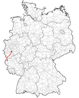
The federal highway 265 (abbreviation: B 265 ) runs through North Rhine-Westphalia and Rhineland-Palatinate . It leads from the Kölner Ringen over the Luxemburger Straße in a south-westerly to south-westerly direction through the Eifel to Prüm .
course
The federal highway 265 begins at the Barbarossaplatz in Cologne and leads as Luxemburger Straße in a south-westerly direction out of town. It crosses the military ring road on the outskirts and shortly afterwards the A 4 ( junction Cologne-Klettenberg ). It continues through Hürth under the same name to the southwest. On November 10, 2015, construction began on a bypass road (B 265n) around the Hermülheim district . Around the Erftstadt districts of Liblar , Lechenich and Erp , the road runs past as a four-lane bypass road to the north and south. After Liblar, the B 265 crosses the route shared by the A 1 and A 61 in this area . In the Zülpich city area, it leads through hamlets in the plane , here a bypass is being planned east of the place, and then crosses federal highways 56 and 477 . The B 56n in the direction of Euskirchen has been developed as a feeder road to the A 1.
In the further course it climbs slowly up to the Eifel , the B 266 and the B 258 are crossed in the area of the town Schleiden . It continues through Hellenthal . In the wide area of this municipality, the B 265 soon rises noticeably towards the height of the Schnee Eifel , running along the German- Belgian border. When Hellenthaler district Losheim the branches B 421 to the east towards. From here the B 265 leads south.
Only at the state border between North Rhine-Westphalia and Rhineland-Palatinate does the road separate from the German-Belgian state border. The main road now overcomes one last incline on the edge of the Schneifelrücken and then drops over the last ten kilometers to the town of Prüm .
Traffic management from Prüm
In Prüm, the B 265 meets the B 51 , which runs from Cologne via Euskirchen and Prüm through the Eifel. This leads the traffic together with the new A 60 via Bitburg to Trier and Saarbrücken . The B 410 leads from Prüm to northern Luxembourg . It is she who allows the B 265 to be called Luxemburger Strasse.
history
In the first section Cologne-Zülpich, the road follows the almost 2000-year-old route of the Roman road from Trier to Cologne, the old Colonia Claudia Ara Agrippinensium , which has been called Agrippa-Straße Cologne-Trier since the Regionale 2010 project .
The Roman road can be recognized by its mostly straight course. The current route deviates due to bypasses, road relocations as part of lignite mining in the southern Rhenish lignite area in the Ville area and connections to important places such as (Erftstadt) - Lechenich . Until the time of Prussia , this section was mostly called Zülpicher Straße, often also in sections Trier Straße.
The Department road was to be expanded as early as the French era . But only after a royal Prussian decree of February 4, 1850, the road from Cologne (with a detour via Lechenich) via Zülpich to Vianden was declared a Cologne-Luxembourg district road and the expansion was financed from government funds. The work was carried out from 1852 to 1856 , the opening was on May 28, 1856 with the Cologne Secret Government and Building Councilor Ernst Friedrich Zwirner .
The section between Losheimergraben and Prüm was originally named as the B 411 . Today the B 411 marks a section of road near Koblenz .
Web links
Individual evidence
- ↑ B265: Start of construction on bypass near Hürth. State Office for Road Construction North Rhine-Westphalia, November 10, 2015, accessed on November 12, 2015 .
- ↑ Citizens' information of the city of Hürth from June 26, 2018 with a comprehensive description of the planning and construction status (also very informative aerial photos) (pdf)
- ↑ Presentation of the State Office for Road Construction North Rhine-Westphalia on December 10, 2019 on the status of expansion and planning (PDF file) on the city of Hürth's website (accessed: April 29, 2020)
- ↑ Kölner Stadt-Anzeiger: Osttangente is preferred. December 9, 2010, accessed December 4, 2017 .
- ↑ Peter Simons: Development of the traffic system in the Euskirchen area in our home , supplement to the Euskirchener Volksblatt 7th year 1930
