Bundesstrasse 57
| Bundesstrasse 57 in Germany | |||||||||||||||||||||||||||||||||||||||||||||||||||||||||||||||||||||||||||||||||||||||||||||||||||||||||||||||||||||||||||||||||||||||||||||||||||||||

|
|||||||||||||||||||||||||||||||||||||||||||||||||||||||||||||||||||||||||||||||||||||||||||||||||||||||||||||||||||||||||||||||||||||||||||||||||||||||
| map | |||||||||||||||||||||||||||||||||||||||||||||||||||||||||||||||||||||||||||||||||||||||||||||||||||||||||||||||||||||||||||||||||||||||||||||||||||||||
| Basic data | |||||||||||||||||||||||||||||||||||||||||||||||||||||||||||||||||||||||||||||||||||||||||||||||||||||||||||||||||||||||||||||||||||||||||||||||||||||||
| Operator: |
|
||||||||||||||||||||||||||||||||||||||||||||||||||||||||||||||||||||||||||||||||||||||||||||||||||||||||||||||||||||||||||||||||||||||||||||||||||||||
| Start of the street: |
Kleve ( 51 ° 47 ′ N , 6 ° 9 ′ E ) |
||||||||||||||||||||||||||||||||||||||||||||||||||||||||||||||||||||||||||||||||||||||||||||||||||||||||||||||||||||||||||||||||||||||||||||||||||||||
| End of street: |
Aachen ( 50 ° 43 ′ N , 6 ° 5 ′ E ) |
||||||||||||||||||||||||||||||||||||||||||||||||||||||||||||||||||||||||||||||||||||||||||||||||||||||||||||||||||||||||||||||||||||||||||||||||||||||
|
State : |
|||||||||||||||||||||||||||||||||||||||||||||||||||||||||||||||||||||||||||||||||||||||||||||||||||||||||||||||||||||||||||||||||||||||||||||||||||||||
| Development condition: | two-lane | ||||||||||||||||||||||||||||||||||||||||||||||||||||||||||||||||||||||||||||||||||||||||||||||||||||||||||||||||||||||||||||||||||||||||||||||||||||||
|
Course of the road
|
|||||||||||||||||||||||||||||||||||||||||||||||||||||||||||||||||||||||||||||||||||||||||||||||||||||||||||||||||||||||||||||||||||||||||||||||||||||||
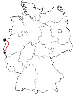
The federal highway 57 (abbreviation: B 57 ) is a federal highway in Germany . It runs in three sections from Kleve to Rheinberg , within Krefeld and from Mönchengladbach through Aachen to the Belgian border at Köpfchen .
history
The origin of the federal highway goes back to the French rule in the Napoleonic period. In 1795, construction of the straight Route d'Aix la Chapelle á Crefeld began in sections and was completed in 1812. It represented the direct connection between the departmental capital Aachen and Krefeld .
In 1839 today's B 57 was laid out by the Prussian administration as Aachen-Krefelder Landstrasse. In 1932 this road between Aachen and Moers was elevated to Fernverkehrsstraße 57 (FVS 57), renamed Reichsstraße 57 in 1934. This Reichsstraße was extended in 1937 north via Xanten to Kleve and in 1940 after the German occupation of Belgium south via Eupen , Malmedy , Luxemburg and Metz to Héming .
Originally the line ran from Kleve via Krefeld and Mönchengladbach to Aachen. The section from Rheinberg to Krefeld was replaced by the A 57 , while the Krefeld – Mönchengladbach section is now part of the A 44 in the same area .
In 1937/1938 a bypass road was built around Erkelenz (today's Krefelder Strasse between the intersection of Aachener Strasse / Antwerpener Strasse / Goswinstrasse and the Ziegelweiher) to relieve the city center. Due to the growth of the city, however, the bypass road was back in the city center a few years after the Second World War, so that in 1975 a new (second) bypass road was built around Erkelenz, which is now run as the B 57.
Until the construction of the Kurt-Koblitz-Ring in 1990, the main road crossed the city center of Alsdorf along the Anna mine .
On September 19, 1995, the bypass road was inaugurated as the B 57n around the Mönchengladbach district of Rheindahlen .
In autumn 2011 the first section of the B 57n bypass was opened for Baesweiler , which was necessary in particular for the improved connection of the steadily growing industrial areas in Baesweiler and Übach-Palenberg-Holthausen; The work was completed in February 2014 with the approval of the southern section of the bypass.
Until a bypass was built (December 21, 2008), the road cut through the open-air museum LVR-Archaeological Park Xanten .
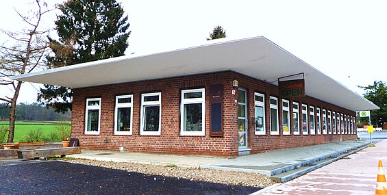
In the northern urban area of Aachen, Krefelder Strasse leads past the former Sandkaulsteinweg past the Soers sports park with the Tivoli and the riding stadium .
The B 57 ends today as Eupener Straße on the border with Belgium at the Aachen-Köpfchen crossing .
Waters crossed
- the Hohe Ley , a river between Kalkar and Xanten
- the Niers , at the end of the A 44 in Mönchengladbach OT Neuwerk
- the Rur and the Teichbach near Linnich
- the Malefinkbach near Körrenzig
- the Baal Bach in Baal
- the Broichbach in Alsdorf
- the worm in Aachen
B57, CHIO bridge and Tivoli
See also
Web links
Individual evidence
- ↑ Four lanes in the city of Krefeld, Alsdorf and Aachen
- ↑ Hans Vogt: A hike through the Jülich country . Krefeld 1990, p. 40 f .
- ↑ History Alsdorf in data
- ↑ B57n: New bypass of Baesweiler officially opened to traffic. State Office for Road Construction North Rhine-Westphalia, February 25, 2014, accessed on February 25, 2014 .
- ↑ The key to everything


