
Bundesstrasse 2
| Bundesstrasse 2 in Germany | |||||||||||||||||||||||||||||||||||||||||||||||||||||||||||||||||||||||||||||||||||||||||||||||||||||||||||||||||||||||||||||||||||||||||||||||||||||||||||||||||||||||||||||||||||||||||||||||||||||||||||||||||||||||||||||||||||||||||||||||||||||||||||||||||||||||||||||||||||||||||||||||||||||||||||||||||||||||||||||||||||||||||||||||||||||||||||||||||||||||||||||||||||||||||||||||||||||||||||||||||||||||||||||||||||||||||||||||||||||||||||||||||||||||||||||||||||||||||||||||||||||||||||||||||||||||||||||||||||||||||||||||||||||||||||||||||||||||||||||||||||||||||||||||||||||||||||||||||||||||||||||||||||||||||||||||||||||||||||||||||||||||||||||||||||||||||||||||||||||||||||||||||||||||||||||||||||||||||||||||||||||||||||||||||||||||||||||||||||||||||||||||||||||||||||||||||||||||||||||||||||||||||||||||||||||||||||||||||||||||||||||||||||||||||||||||||||||||||||||||||||||||||||||||||||||||||||||||||||||||||||||||||||||||||||||||||||||||||||||||||||||||||||||||||||||||||||||||||||||||

|
|||||||||||||||||||||||||||||||||||||||||||||||||||||||||||||||||||||||||||||||||||||||||||||||||||||||||||||||||||||||||||||||||||||||||||||||||||||||||||||||||||||||||||||||||||||||||||||||||||||||||||||||||||||||||||||||||||||||||||||||||||||||||||||||||||||||||||||||||||||||||||||||||||||||||||||||||||||||||||||||||||||||||||||||||||||||||||||||||||||||||||||||||||||||||||||||||||||||||||||||||||||||||||||||||||||||||||||||||||||||||||||||||||||||||||||||||||||||||||||||||||||||||||||||||||||||||||||||||||||||||||||||||||||||||||||||||||||||||||||||||||||||||||||||||||||||||||||||||||||||||||||||||||||||||||||||||||||||||||||||||||||||||||||||||||||||||||||||||||||||||||||||||||||||||||||||||||||||||||||||||||||||||||||||||||||||||||||||||||||||||||||||||||||||||||||||||||||||||||||||||||||||||||||||||||||||||||||||||||||||||||||||||||||||||||||||||||||||||||||||||||||||||||||||||||||||||||||||||||||||||||||||||||||||||||||||||||||||||||||||||||||||||||||||||||||||||||||||||||||||
| |
|||||||||||||||||||||||||||||||||||||||||||||||||||||||||||||||||||||||||||||||||||||||||||||||||||||||||||||||||||||||||||||||||||||||||||||||||||||||||||||||||||||||||||||||||||||||||||||||||||||||||||||||||||||||||||||||||||||||||||||||||||||||||||||||||||||||||||||||||||||||||||||||||||||||||||||||||||||||||||||||||||||||||||||||||||||||||||||||||||||||||||||||||||||||||||||||||||||||||||||||||||||||||||||||||||||||||||||||||||||||||||||||||||||||||||||||||||||||||||||||||||||||||||||||||||||||||||||||||||||||||||||||||||||||||||||||||||||||||||||||||||||||||||||||||||||||||||||||||||||||||||||||||||||||||||||||||||||||||||||||||||||||||||||||||||||||||||||||||||||||||||||||||||||||||||||||||||||||||||||||||||||||||||||||||||||||||||||||||||||||||||||||||||||||||||||||||||||||||||||||||||||||||||||||||||||||||||||||||||||||||||||||||||||||||||||||||||||||||||||||||||||||||||||||||||||||||||||||||||||||||||||||||||||||||||||||||||||||||||||||||||||||||||||||||||||||||||||||||||||||
| map | |||||||||||||||||||||||||||||||||||||||||||||||||||||||||||||||||||||||||||||||||||||||||||||||||||||||||||||||||||||||||||||||||||||||||||||||||||||||||||||||||||||||||||||||||||||||||||||||||||||||||||||||||||||||||||||||||||||||||||||||||||||||||||||||||||||||||||||||||||||||||||||||||||||||||||||||||||||||||||||||||||||||||||||||||||||||||||||||||||||||||||||||||||||||||||||||||||||||||||||||||||||||||||||||||||||||||||||||||||||||||||||||||||||||||||||||||||||||||||||||||||||||||||||||||||||||||||||||||||||||||||||||||||||||||||||||||||||||||||||||||||||||||||||||||||||||||||||||||||||||||||||||||||||||||||||||||||||||||||||||||||||||||||||||||||||||||||||||||||||||||||||||||||||||||||||||||||||||||||||||||||||||||||||||||||||||||||||||||||||||||||||||||||||||||||||||||||||||||||||||||||||||||||||||||||||||||||||||||||||||||||||||||||||||||||||||||||||||||||||||||||||||||||||||||||||||||||||||||||||||||||||||||||||||||||||||||||||||||||||||||||||||||||||||||||||||||||||||||||||||
 |
|||||||||||||||||||||||||||||||||||||||||||||||||||||||||||||||||||||||||||||||||||||||||||||||||||||||||||||||||||||||||||||||||||||||||||||||||||||||||||||||||||||||||||||||||||||||||||||||||||||||||||||||||||||||||||||||||||||||||||||||||||||||||||||||||||||||||||||||||||||||||||||||||||||||||||||||||||||||||||||||||||||||||||||||||||||||||||||||||||||||||||||||||||||||||||||||||||||||||||||||||||||||||||||||||||||||||||||||||||||||||||||||||||||||||||||||||||||||||||||||||||||||||||||||||||||||||||||||||||||||||||||||||||||||||||||||||||||||||||||||||||||||||||||||||||||||||||||||||||||||||||||||||||||||||||||||||||||||||||||||||||||||||||||||||||||||||||||||||||||||||||||||||||||||||||||||||||||||||||||||||||||||||||||||||||||||||||||||||||||||||||||||||||||||||||||||||||||||||||||||||||||||||||||||||||||||||||||||||||||||||||||||||||||||||||||||||||||||||||||||||||||||||||||||||||||||||||||||||||||||||||||||||||||||||||||||||||||||||||||||||||||||||||||||||||||||||||||||||||||||
| Basic data | |||||||||||||||||||||||||||||||||||||||||||||||||||||||||||||||||||||||||||||||||||||||||||||||||||||||||||||||||||||||||||||||||||||||||||||||||||||||||||||||||||||||||||||||||||||||||||||||||||||||||||||||||||||||||||||||||||||||||||||||||||||||||||||||||||||||||||||||||||||||||||||||||||||||||||||||||||||||||||||||||||||||||||||||||||||||||||||||||||||||||||||||||||||||||||||||||||||||||||||||||||||||||||||||||||||||||||||||||||||||||||||||||||||||||||||||||||||||||||||||||||||||||||||||||||||||||||||||||||||||||||||||||||||||||||||||||||||||||||||||||||||||||||||||||||||||||||||||||||||||||||||||||||||||||||||||||||||||||||||||||||||||||||||||||||||||||||||||||||||||||||||||||||||||||||||||||||||||||||||||||||||||||||||||||||||||||||||||||||||||||||||||||||||||||||||||||||||||||||||||||||||||||||||||||||||||||||||||||||||||||||||||||||||||||||||||||||||||||||||||||||||||||||||||||||||||||||||||||||||||||||||||||||||||||||||||||||||||||||||||||||||||||||||||||||||||||||||||||||||||
| Operator: |
|
||||||||||||||||||||||||||||||||||||||||||||||||||||||||||||||||||||||||||||||||||||||||||||||||||||||||||||||||||||||||||||||||||||||||||||||||||||||||||||||||||||||||||||||||||||||||||||||||||||||||||||||||||||||||||||||||||||||||||||||||||||||||||||||||||||||||||||||||||||||||||||||||||||||||||||||||||||||||||||||||||||||||||||||||||||||||||||||||||||||||||||||||||||||||||||||||||||||||||||||||||||||||||||||||||||||||||||||||||||||||||||||||||||||||||||||||||||||||||||||||||||||||||||||||||||||||||||||||||||||||||||||||||||||||||||||||||||||||||||||||||||||||||||||||||||||||||||||||||||||||||||||||||||||||||||||||||||||||||||||||||||||||||||||||||||||||||||||||||||||||||||||||||||||||||||||||||||||||||||||||||||||||||||||||||||||||||||||||||||||||||||||||||||||||||||||||||||||||||||||||||||||||||||||||||||||||||||||||||||||||||||||||||||||||||||||||||||||||||||||||||||||||||||||||||||||||||||||||||||||||||||||||||||||||||||||||||||||||||||||||||||||||||||||||||||||||||||||||||||||
| Start of the street: |
Mescherin ( 53 ° 18 ′ N , 14 ° 25 ′ E ) |
||||||||||||||||||||||||||||||||||||||||||||||||||||||||||||||||||||||||||||||||||||||||||||||||||||||||||||||||||||||||||||||||||||||||||||||||||||||||||||||||||||||||||||||||||||||||||||||||||||||||||||||||||||||||||||||||||||||||||||||||||||||||||||||||||||||||||||||||||||||||||||||||||||||||||||||||||||||||||||||||||||||||||||||||||||||||||||||||||||||||||||||||||||||||||||||||||||||||||||||||||||||||||||||||||||||||||||||||||||||||||||||||||||||||||||||||||||||||||||||||||||||||||||||||||||||||||||||||||||||||||||||||||||||||||||||||||||||||||||||||||||||||||||||||||||||||||||||||||||||||||||||||||||||||||||||||||||||||||||||||||||||||||||||||||||||||||||||||||||||||||||||||||||||||||||||||||||||||||||||||||||||||||||||||||||||||||||||||||||||||||||||||||||||||||||||||||||||||||||||||||||||||||||||||||||||||||||||||||||||||||||||||||||||||||||||||||||||||||||||||||||||||||||||||||||||||||||||||||||||||||||||||||||||||||||||||||||||||||||||||||||||||||||||||||||||||||||||||||||||
| End of street: |
Mittenwald ( 47 ° 24 ′ N , 11 ° 16 ′ E ) |
||||||||||||||||||||||||||||||||||||||||||||||||||||||||||||||||||||||||||||||||||||||||||||||||||||||||||||||||||||||||||||||||||||||||||||||||||||||||||||||||||||||||||||||||||||||||||||||||||||||||||||||||||||||||||||||||||||||||||||||||||||||||||||||||||||||||||||||||||||||||||||||||||||||||||||||||||||||||||||||||||||||||||||||||||||||||||||||||||||||||||||||||||||||||||||||||||||||||||||||||||||||||||||||||||||||||||||||||||||||||||||||||||||||||||||||||||||||||||||||||||||||||||||||||||||||||||||||||||||||||||||||||||||||||||||||||||||||||||||||||||||||||||||||||||||||||||||||||||||||||||||||||||||||||||||||||||||||||||||||||||||||||||||||||||||||||||||||||||||||||||||||||||||||||||||||||||||||||||||||||||||||||||||||||||||||||||||||||||||||||||||||||||||||||||||||||||||||||||||||||||||||||||||||||||||||||||||||||||||||||||||||||||||||||||||||||||||||||||||||||||||||||||||||||||||||||||||||||||||||||||||||||||||||||||||||||||||||||||||||||||||||||||||||||||||||||||||||||||||||
| Overall length: | 845 km | ||||||||||||||||||||||||||||||||||||||||||||||||||||||||||||||||||||||||||||||||||||||||||||||||||||||||||||||||||||||||||||||||||||||||||||||||||||||||||||||||||||||||||||||||||||||||||||||||||||||||||||||||||||||||||||||||||||||||||||||||||||||||||||||||||||||||||||||||||||||||||||||||||||||||||||||||||||||||||||||||||||||||||||||||||||||||||||||||||||||||||||||||||||||||||||||||||||||||||||||||||||||||||||||||||||||||||||||||||||||||||||||||||||||||||||||||||||||||||||||||||||||||||||||||||||||||||||||||||||||||||||||||||||||||||||||||||||||||||||||||||||||||||||||||||||||||||||||||||||||||||||||||||||||||||||||||||||||||||||||||||||||||||||||||||||||||||||||||||||||||||||||||||||||||||||||||||||||||||||||||||||||||||||||||||||||||||||||||||||||||||||||||||||||||||||||||||||||||||||||||||||||||||||||||||||||||||||||||||||||||||||||||||||||||||||||||||||||||||||||||||||||||||||||||||||||||||||||||||||||||||||||||||||||||||||||||||||||||||||||||||||||||||||||||||||||||||||||||||||||
|
State : |
|||||||||||||||||||||||||||||||||||||||||||||||||||||||||||||||||||||||||||||||||||||||||||||||||||||||||||||||||||||||||||||||||||||||||||||||||||||||||||||||||||||||||||||||||||||||||||||||||||||||||||||||||||||||||||||||||||||||||||||||||||||||||||||||||||||||||||||||||||||||||||||||||||||||||||||||||||||||||||||||||||||||||||||||||||||||||||||||||||||||||||||||||||||||||||||||||||||||||||||||||||||||||||||||||||||||||||||||||||||||||||||||||||||||||||||||||||||||||||||||||||||||||||||||||||||||||||||||||||||||||||||||||||||||||||||||||||||||||||||||||||||||||||||||||||||||||||||||||||||||||||||||||||||||||||||||||||||||||||||||||||||||||||||||||||||||||||||||||||||||||||||||||||||||||||||||||||||||||||||||||||||||||||||||||||||||||||||||||||||||||||||||||||||||||||||||||||||||||||||||||||||||||||||||||||||||||||||||||||||||||||||||||||||||||||||||||||||||||||||||||||||||||||||||||||||||||||||||||||||||||||||||||||||||||||||||||||||||||||||||||||||||||||||||||||||||||||||||||||||||
| Development condition: | differently | ||||||||||||||||||||||||||||||||||||||||||||||||||||||||||||||||||||||||||||||||||||||||||||||||||||||||||||||||||||||||||||||||||||||||||||||||||||||||||||||||||||||||||||||||||||||||||||||||||||||||||||||||||||||||||||||||||||||||||||||||||||||||||||||||||||||||||||||||||||||||||||||||||||||||||||||||||||||||||||||||||||||||||||||||||||||||||||||||||||||||||||||||||||||||||||||||||||||||||||||||||||||||||||||||||||||||||||||||||||||||||||||||||||||||||||||||||||||||||||||||||||||||||||||||||||||||||||||||||||||||||||||||||||||||||||||||||||||||||||||||||||||||||||||||||||||||||||||||||||||||||||||||||||||||||||||||||||||||||||||||||||||||||||||||||||||||||||||||||||||||||||||||||||||||||||||||||||||||||||||||||||||||||||||||||||||||||||||||||||||||||||||||||||||||||||||||||||||||||||||||||||||||||||||||||||||||||||||||||||||||||||||||||||||||||||||||||||||||||||||||||||||||||||||||||||||||||||||||||||||||||||||||||||||||||||||||||||||||||||||||||||||||||||||||||||||||||||||||||||||
 |
|||||||||||||||||||||||||||||||||||||||||||||||||||||||||||||||||||||||||||||||||||||||||||||||||||||||||||||||||||||||||||||||||||||||||||||||||||||||||||||||||||||||||||||||||||||||||||||||||||||||||||||||||||||||||||||||||||||||||||||||||||||||||||||||||||||||||||||||||||||||||||||||||||||||||||||||||||||||||||||||||||||||||||||||||||||||||||||||||||||||||||||||||||||||||||||||||||||||||||||||||||||||||||||||||||||||||||||||||||||||||||||||||||||||||||||||||||||||||||||||||||||||||||||||||||||||||||||||||||||||||||||||||||||||||||||||||||||||||||||||||||||||||||||||||||||||||||||||||||||||||||||||||||||||||||||||||||||||||||||||||||||||||||||||||||||||||||||||||||||||||||||||||||||||||||||||||||||||||||||||||||||||||||||||||||||||||||||||||||||||||||||||||||||||||||||||||||||||||||||||||||||||||||||||||||||||||||||||||||||||||||||||||||||||||||||||||||||||||||||||||||||||||||||||||||||||||||||||||||||||||||||||||||||||||||||||||||||||||||||||||||||||||||||||||||||||||||||||||||||||
| Bundesstrasse 2 in Berlin ( Strasse des 17. Juni ) | |||||||||||||||||||||||||||||||||||||||||||||||||||||||||||||||||||||||||||||||||||||||||||||||||||||||||||||||||||||||||||||||||||||||||||||||||||||||||||||||||||||||||||||||||||||||||||||||||||||||||||||||||||||||||||||||||||||||||||||||||||||||||||||||||||||||||||||||||||||||||||||||||||||||||||||||||||||||||||||||||||||||||||||||||||||||||||||||||||||||||||||||||||||||||||||||||||||||||||||||||||||||||||||||||||||||||||||||||||||||||||||||||||||||||||||||||||||||||||||||||||||||||||||||||||||||||||||||||||||||||||||||||||||||||||||||||||||||||||||||||||||||||||||||||||||||||||||||||||||||||||||||||||||||||||||||||||||||||||||||||||||||||||||||||||||||||||||||||||||||||||||||||||||||||||||||||||||||||||||||||||||||||||||||||||||||||||||||||||||||||||||||||||||||||||||||||||||||||||||||||||||||||||||||||||||||||||||||||||||||||||||||||||||||||||||||||||||||||||||||||||||||||||||||||||||||||||||||||||||||||||||||||||||||||||||||||||||||||||||||||||||||||||||||||||||||||||||||||||||||
|
Course of the road
|
|||||||||||||||||||||||||||||||||||||||||||||||||||||||||||||||||||||||||||||||||||||||||||||||||||||||||||||||||||||||||||||||||||||||||||||||||||||||||||||||||||||||||||||||||||||||||||||||||||||||||||||||||||||||||||||||||||||||||||||||||||||||||||||||||||||||||||||||||||||||||||||||||||||||||||||||||||||||||||||||||||||||||||||||||||||||||||||||||||||||||||||||||||||||||||||||||||||||||||||||||||||||||||||||||||||||||||||||||||||||||||||||||||||||||||||||||||||||||||||||||||||||||||||||||||||||||||||||||||||||||||||||||||||||||||||||||||||||||||||||||||||||||||||||||||||||||||||||||||||||||||||||||||||||||||||||||||||||||||||||||||||||||||||||||||||||||||||||||||||||||||||||||||||||||||||||||||||||||||||||||||||||||||||||||||||||||||||||||||||||||||||||||||||||||||||||||||||||||||||||||||||||||||||||||||||||||||||||||||||||||||||||||||||||||||||||||||||||||||||||||||||||||||||||||||||||||||||||||||||||||||||||||||||||||||||||||||||||||||||||||||||||||||||||||||||||||||||||||||||||
The national road 2 (abbreviation: B 2 ) is approximately 845 kilometers, the longest and one of the oldest highways Germany . It crosses Germany in a north-south direction from the German- Polish border at Gartz (Oder) to the German- Austrian border at Mittenwald . Its historical forerunner is the medieval Via Imperii .
history
The federal highway 2 runs - beginning in northeast Germany - through the federal states of Brandenburg , Berlin , Saxony-Anhalt , Saxony , Thuringia and Bavaria . It roughly corresponds to the course of the historic Reichsstraße Via Imperii , except for the sections between Leipzig and Hof (there B 93 and B 173 ) and between Augsburg and Oberau (there B 17 and B 23 ). Between Berlin and Nuremberg , it essentially runs almost parallel to federal motorway 9 .
Origins
In 1816 the road Potsdam - Wittenberg was built, in 1828 the road Berlin - Schwedt - Stettin was built.

All-mile obelisk on the B 2 near Loitzschütz
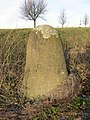
Half milestone on the B 2 near Loitzschütz

Quarter milestone on the B 2 near Bergisdorf


Previous routes and names
- State road No. 12: Augsburg - Donauwörth - Nuremberg
- State road No. 37: (Gibbach -) Hof - Schleiz
- State road No. 86: Munich - Weilheim - Partenkirchen
- State road No. 100: Nuremberg - Hof - Plauen
The B 2 takes its course in today's German territory largely from the long-distance traffic route established in 1932 , later: Reichsstraße 2 , which until 1945 ran from today's German-Polish border via Stettin , Köslin , through the Polish corridor and Danzig to the Vistula from 1918 at Dirschau (today: Tczew ) . There it led into the former Reichsstrasse 1 ( Aachen - Berlin - Königsberg ). This now Polish part has no continuous street numbering. Deviating from the original route, the road has been running between Leipzig and Hof via Gera since the mid-1930s, while the route previously went via Altenburg , Zwickau and Plauen .
After successfully in 1938 annexation of Austria to the German Reich were Seefeld road and Brennerstraße ( Scharnitz - Zirl - Innsbruck - Brenner ) until 1945 also as a Reichsstrasse two out. With its course through Swabia , southern Bavaria and Tyrol, it partly corresponded to the former Via Raetia .
In the 1970s, the former F 2 had to be relocated south of Leipzig because of the Zwenkau open-cast lignite mine . Since then, it has led south of Zwenkau over the former overburden area to the east, where the B 95, which has also been laid, joins in Großdeuben . From here it runs in four lanes into Leipzig city center.
Route (detailed)
The sights on the edge of the route that can be reached from the B 2 are also described below.
Brandenburg - Berlin - Brandenburg
The B 2 begins at the Polish border as a continuation of the national road 13 coming from Stettin about one kilometer east of the village of Rosow and crosses the federal state of Brandenburg from northeast to southwest. After Schmargendorf near Angermünde to the Autobahn triangle Kreuz Barnim on the Berliner Ring A 10 , the B 2 is interrupted, traffic is routed via the B 198 and the A 11 motorway .
Rosow - Schwedt / Oder
Until 1945, today's Bundesstraße 2 began as Reichsstraße 2 in Gdansk . As a result of the Second World War , it began in 1945 at the border town of Rosow a few kilometers south of the A 11 motorway border crossing . Through the town of Gartz and the Schwedt district of Vierraden , it leads through tobacco plantations to Schwedt , a town with a petroleum and cellulose processing industry, where a road crossing branches off into Chojna in Poland (Königsberg in the Neumark) .
Schwedt / Oder - Berlin
In Schwedt , the B 2 is a generous bypass that simultaneously connects the PCK refinery and the B 166 (as an extension of the A 20 ). To the south of it, the main road to Pinnow is expanded with 2 + 1 lanes.

The Marienkirche in the former district town of Angermünde is visible from afar , leaving the street behind to the northwest through a bypass built in the 1960s. Here it crosses the Angermünde – Bad Freienwalde (now closed), Berlin - Angermünde - Szczecin and Angermünde - Schwedt railway lines without crossing. The B 2 is interrupted between the Angermünder district of Herzsprung and the Autobahn triangle Kreuz Barnim .
The old course by Chorin with former Cistercian - Kloster and the course about Eberswalde and Bernau was downgraded to L 200 of 2003. Bundesstraße 2 starts again at the Barnim motorway triangle , passes Lindenberg and after about 3.5 kilometers reaches the north-eastern Berlin city limits. The division of federal roads when passing through towns may have been due to the responsibility for maintaining and repairing the busy traffic route: Now the state of Brandenburg has to take over the financing in Orten.
Berlin

The federal highway runs through Berlin in a south-westerly direction. The urban area begins in the Malchow suburb of the Pankow district . The official street name up to the confluence of the Blankenburger Pflasterweg is Bundesstraße 2 (with street sign ), a name was necessary for the georeferenceable addressing of the adjacent properties . For example, “Bundesstrasse 2 No. 20” is the adjacent Malchow substation, which is located to the east in the neighboring Lichtenberg district of Wartenberg . After 2.2 kilometers in Berlin, the street name in the Malchow district changes to Dorfstraße , the route continues on Malchower Chaussee and changes to Weißensee . The further course leads over the Berliner Allee to Prenzlauer Berg along the Greifswalder Strasse and Otto-Braun-Strasse to the historic center of Berlin . The B 1 , B 2 and B 5 meet at Alexanderplatz . From here the B 2 forms a joint route with the B 5 . This leads past Alexanderplatz via Alexanderstraße and Karl-Liebknecht-Straße . Then the B 2 leads in an east-west direction on the Museum Island over the Spree and runs on the boulevard Unter den Linden to Pariser Platz . Originally the B2 crossed the Brandenburg Gate here . After Pariser Platz has been redesigned into a pedestrian zone , the square must be bypassed to the north via Wilhelmstraße , Dorotheenstraße and Ebertstraße . However, the roads designated for bypass were not upgraded to federal roads. At Platz des 18. März , the B 2 continues its historical course in the Tiergarten district and is called Straße des 17. Juni from here on . Past the Victory Column and Ernst-Reuter-Platz , the street leads over Theodor-Heuss-Platz and Heerstraße through the Charlottenburg-Wilmersdorf district . Crossing the Havelniederung over the Stößensee and Frey bridges , it reaches the Spandau district . At the junction with Wilhelmstrasse, the B 2 bends in a south-westerly direction (this is where the same route as the B 5 ends), crosses the Groß-Glienicker and Gatower Heide as Potsdamer Chaussee and leaves Berlin on the south-western city limits.
Potsdam - Lutherstadt Wittenberg

Again, the state of Brandenburg is reached by the federal highway 2 in the urban area of Potsdam , district Groß Glienicke . The further course leads in an arc around the Krampnitzsee , passes the remarkable Russian colony Alexandrowka via the Potsdam districts Fahrland and Neu Fahrland and the crossing of the Sacrow-Paretz Canal . Via the Nedlitzer Strasse , Am Schragen , Jägerallee and Hegelallee , the junction of the federal road 273 is reached at their western end . The B 2 continues on Schopenhauerstrasse , Luisenplatz , Zeppelinstrasse , Breite Strasse , which it partly uses parallel to Bundesstrasse 1 , crosses the Havel over the Lange Brücke and passes Potsdam Central Station . In the further course it has two parallel tours over a length of around one kilometer, one as Leipziger Strasse and Michendorfer Chaussee and the other as Brauhausberg , the road runs past Telegrafenberg in a southerly direction and leaves Potsdam by crossing the Berlin outer ring of the railway. Michendorf is bypassed on a bypass to the east. There is a connection to the A 10 (Berliner Ring) south of Michendorf . Between Michendorf and Beelitz , the road crosses the Seddiner lakes on a dam built in 1804 . Until the dam was built, the Potsdam - Beelitz connection ran on a post road east around the lake via Kähnsdorf and Saarmund . The city of Beelitz, which is located in a well-known asparagus growing area, is also bypassed via a bypass road running east of the city. The road reaches Treuenbrietzen , then the Fläming is crossed: Here is the watershed between the Havel and Elbe. The Treuenbrietzen district of Marzahna is the last place on the B 2 in the state of Brandenburg.
Saxony-Anhalt
From the state border of Brandenburg, the B 2 runs through the federal state of Saxony-Anhalt , crosses Saxony , then runs again for a relatively short stretch through Saxony-Anhalt and then reaches Thuringia .
Lutherstadt Wittenberg
After crossing the state border, Kropstädt is the first district of Lutherstadt Wittenberg . The closed settlement area of the city begins with the Berliner Chaussee, a sloping avenue with old trees. The transition from the Fläming to the Elbaue provides a first glimpse of the old town and the world-famous sites of the Reformation . In the area of the old town, Berliner Straße follows the former city fortifications in order to then reach the district court crossing complex - the castle church can be seen from there . The Wittenberg southern bypass is reached via the harbor bridge (via the Węgliniec – Roßlau railway ) - the B 2 becomes four-lane and merges with the B 187 . The two federal highways separate again at the Elbbrücke traffic lights. The B 2 crosses the Elbe over the four-lane Elbe bridge opened in 2000 .
Lutherstadt Wittenberg - Bad Düben

After crossing the Elbe bridge, several flood bridges are passed as far as the Pratau district : the diked area of the Elbe is two kilometers wide here. When the Elbe floods in 2002 , the Elbe bridge was closed to traffic as far as Pratau. Before Eutzsch , the main road becomes two-lane again. The traffic flow that was bundled over the Elbe is unbundled here: In Eutzsch the B 100 begins to Bitterfeld and 1.5 kilometers southeast of the town the B 182 to Torgau . A redesign (bypass) is part of the priority requirement of the federal transport route plan.
At Kemberg , the B 2 leaves the Elbe and reaches the Dübener Heide - a scenic and game-rich section. There is a monument of historical importance on the route, the Lutherstein . Up to this point Martin Luther is said to have been accompanied by Wittenberg students in 1519 when he left for a dispute in Leipzig for a disputation with Johannes Eck . Then Eisenhammer is reached, a small settlement in complete forest location - cut through by the main road. This is where the last producing charcoal burning plant on Dübener Heide is located (as of 2013). The last place before the state border with Saxony is Tornau . From here you can Söllichau and the NVA - Bunker Museum Kossa reach.
Saxony
Bad Düben - Leipzig
In Saxony you first pass the spa town of Bad Düben . The main road initially follows a new route, but then runs through the town again: The bridge over the Mulde follows . In Krensitz you cross the Halle – Cottbus railway line . On the further course of the B 2 you drive through Krostitz , where you can see the old buildings of the former malt factory on the right side, threatened with decay. The “ Ur-Krostitzer ” beer is brewed in a new facility in the local area .
Leipzig

Several business parks are passed in front of Leipzig . After the confluence of the B 184 , the B 2 becomes four-lane and takes on the character of an urban motorway. This is followed by the cross with the A 14 ( Leipzig-Mitte junction ), which also has distribution functions to the Leipzig trade fair and to Leipzig / Halle Airport .
The B 2 crosses the districts of Wiederitzsch , Eutritzsch , Zentrum-Ost, Reudnitz-Thonberg , Stötteritz and then represents the border between the districts of Connewitz and Südvorstadt . On the southern edge of the city, the B 2 crosses parts of the Leipzig riparian forest and leaves the city on the east splices -Ufer. The section between the Schleußiger Weg junction and the Leipzig-Süd motorway junction (with the A 38 ) should be expanded as part of the A 72 by 2020 , but this is rejected by Leipzig's city council. On February 20, 2013, it was therefore decided not to extend the A 72 to Leipzig. In future it will end at the Leipzig Süd intersection. The listed agra-Park will be crossed on a bridge that will be replaced by a tunnel by 2030 at the earliest.
Leipzig - Zeitz
The B2 leaves the Free State of Saxony near Pegau .
Saxony-Anhalt
The federal road leads via Zeitz to Giebelroth again through Saxony-Anhalt.
Thuringia
Zeitz - Gera
The federal state of Thuringia is crossed by the B 2 in a southerly direction from the state border with Saxony-Anhalt.
Gera
The B 2 reaches the urban area of Gera directly at the state border . It leads past the districts of Hermsdorf and Cretzschwitz and since the completion of the city ring for the Federal Garden Show 2007 in an arc across the previously green field corridor to the new junction at Kreuz Gera ( federal motorway 4 ) and on to Ostkreuz. It ends there for the time being - only the B 92 leads over the east bypass past Zschippern and Pforten to the level of the Gera-Süd thermal power station. The old route of the B 2 led from the Seligenstädt junction in a south-westerly direction through the Schoßbachtal to Langenberg , where it met the B 7 - which has now also been downgraded - and continued with it into the city center.
The route begins again as L 3002 at the Gera Heinrichsbrücke and leaves the city southwest via the Weißig district .
Gera - yard
In Großebersdorf, the dedication of the B 2 begins again for a short section that connects the ending federal highway 281 with the federal highway 175 . The rest of the route from Mittelpöllnitz to Schleiz has again been downgraded to L 3002.
Between 1951 and 1966, transit traffic through the GDR was diverted from the Schleiz junction of today's A 9 via today's B 2 (then: F 2) and the Töpen / Juchhöh border crossing to the Hof-Nord junction on today's A 72 , because the Saale bridge had been destroyed on the A 9 since 1945 and was only released again in 1966.
In Schleiz, the L 3002 becomes the B 2 again and continues for a short distance along the federal highway 94 that ends here to the federal highway 282 south of the city, where it again merges into the L 3002 and leads to Gefell . In Gefell, the federal road 90 changes into the B 2, which leads south parallel to the A 9 over the Bavarian border to Hof.
Bavaria
As the last federal state, the B 2 runs through from Thuringia to the Austrian border with Bavaria .
Hof - Bayreuth
In Hof, the B 2 meets the B 173 at the cemetery . The two federal highways B 2 and B 173 cross the Saale together and then separate again. The B 2 finally leads out of the city as Ernst-Reuter-Straße in the form of a four-lane city motorway after it has also crossed the innermost city center for historical reasons. An optimization of the route on the same route as the B 173 from Lessingstrasse via Schützenweg and Kulmbacher Strasse to Ernst-Reuter-Strasse fails because the city of Hof prefers to have as many kilometers of road as possible designated as a federal road for reasons of road cost maintenance. In this way, however, heavy-duty vehicles with navigation systems are guided through the city center with narrow intersection radii and narrow one-way streets.
-
Course of the road in Hof
- Schleizer Strasse
- Lessingstrasse
- Konrad-Adenauer-Platz
- Poststraße (only in the south direction)
- Kreuzsteinstraße (only in the south direction)
- Marienstraße (section between Kreuzsteinstraße and Konrad-Adenauer-Platz only in the north direction)
- Luitpoldstrasse
- Jahnstrasse
- Berlin Square
- Ernst-Reuter-Strasse
It continues south to Konradsreuth . From there the route leads via Münchberg and to Gefrees .
In the section between Hof and Münchberg it was downgraded to state road 2461, further down to the southern border of the district of Hof to district road HO 44.

From the border of the Bayreuth district , the B 2 was downgraded in 2015 to the Bayreuth-Nord junction of the federal motorway 9 . North of Gefrees it is now the district road BT 48, up to the western outskirts of Gefrees in the district Böseneck it is now part of the state road 2180, further to Bad Berneck the district road BT 48.
The section of the B 2 north of Gefrees through the Lübnitz valley is known for subsidence and curves that often led to accidents. This can be seen most clearly at the bridge that leads over the Lübnitz. Heavy-load accidents in particular occurred at this point. A planned new construction of the B 2 in this area, which provided for a new bridge and a straightened road course, was rejected by the road construction authority. In view of the steadily increasing traffic (currently around 2600 vehicles per day including heavy goods vehicle traffic), the Lübnitztalbrücke was closed for about ten years. During this time, the B 2 ran over a temporary bridge right next to the Lübnitztal bridge. In 2012 the Lübnitztalbrücke was reopened to traffic after a general renovation. A new reinforced concrete frame was incorporated into the bridge behind the preserved sandstone facade.
From Gefrees the route led past the Stein Castle Chapel through the old town of Bad Berneck and ran from there to Bayreuth until the end of 2015 . Between the junction with the B 303 in Bad Berneck and the Bayreuth-Nord junction of the A 9 , it was downgraded to State Road 2460.
On the way to Bayreuth, the B 2 reached the Bindlacher Berg shortly after Benk and crossed Bindlach . The Bindlacher Berg was the military base of the US armed forces until the early 1990s . From Bindlach, the road passed the former military barracks in the Laineck district of Bayreuth before reaching the traffic circle at the Bayreuth-Nord motorway junction.
Bayreuth - Nuremberg

Bayreuth and the Wolfsbach district are traversed to the south, before the B 2 leads through the medieval Creußen . Further south, Schnabelwaid and Pegnitz are reached. Between Bayreuth (Josephsplatz) and Pegnitz-Neudorf, the road is identical to the B 85 , south of Neudorf it is about two kilometers long with the B 470 .
From Pegnitz the B 2 runs along the eastern edge of the Franconian Switzerland in a course, partly very winding and at a relatively high level (400–550 m above sea level) . Here it runs u. a. through Leupoldstein , the Hiltpoltstein market with its narrow and steep town through and Hiltpoltstein Castle and past the town of Graefenberg with its historic old town. From Weißenohe (former Benedictine monastery , brewery) the B 2 leaves the Alb plateau of Franconian Switzerland and the road becomes more spacious again. In the area of the Eckental market , it initially leads through the district of Forth, where a bypass is to be built in the medium term. It has bypassed the district of Eschenau since the end of 2008 and climbs in two stripes to the "Geschaidter Berg", where it intersects the district of Großgeschaidt near Kleingeschaidt in order to reach the city limits of Nuremberg via the Heroldsberg bypass through the Nuremberg Reichswald .
Nuremberg - Schwabach - Roth


In urban Nürnberg the B 2 opens into the inner city ring, B 4 R . In the south of the city in the area of the telecommunications tower , it leaves the ring together with the B 14 as Schweinauer Hauptstrasse in a south-westerly direction. At the end of this, south of the Südwesttangente and the Main-Danube Canal , the two federal highways separate again and the B 2 runs in two lanes as Weißenburger Straße towards Schwabach . In this section of the route it is partly designed with three stripes; there is a separate bus lane to the center, and a lorry crawl lane on the slope to Schwabach. After crossing the city of Schwabach, the B 2 runs a short distance together with the Autobahn 6 , and finally continues as a motorway-like road between the cities of Schwabach and Roth .
The expansion of the B 2 from Nuremberg- Reichelsdorf to the unfinished Schwabach-Roth motorway junction of the A 6 has been planned since the mid-1980s . This is highly controversial among the population, as the planned route leads through the Rednitz lowlands and, in the opinion of the BUND , would destroy unique grasslands. With the implementation of the expansion plan, a (usable) bypass of the city of Schwabach would result, which would result in a considerable relief of the inner-city traffic. The route would then lead as B 2a over the motorway junction to Schwabach- Limbach , Nürnberg- Katzwang and Nürnberg-Reichelsdorf on the Frankenschnellweg already planned for this connection , from there via the motorway junction Nürnberg-Hafen onto the A 73 . This route was initially planned as the A 77 , but its implementation was postponed in favor of the existing version.
Roth - Donauwörth
In the section between the junctions Roth A 6 and Donauwörth , the A 77 was intended as a four-lane replacement to the old B 2. Contrary to the plans, the construction of the motorway was postponed and an expansion of the existing B 2 was prioritized.
From the end of the four-lane B 2n (after the Roth-Kiliansdorf junction and before Wernsbach) to Donauwörth, further construction work is taking place in the direction of a three-lane expansion. The three-lane section of the Pleinfeld- South to Ellingen- North section has already been completed. The fourth lane has been completed between Ellingen-Mitte and Weißenburg -Nord, shortly after the Dietfurt-Treuchtlingen intersection to the southern border of the Weißenburg-Gunzenhausen district to Langenaltheim , the three-lane roadway is also ready. After two years of construction, the Röttenbach bypass in the Roth district was completed in 2007 .
The 3.5 kilometer long four-lane bypass of Untersteinbach (district of Roth) was completed and approved in December 2014. The construction of the bypass of Dettenheim (Weißenburg-Gunzenhausen district) was realized from December 2014 to July 2017.
In the Federal Transport Infrastructure Plan 2030 which will bypass of Dietfurt as dreistreifiger new construction as well as the bypass of Wernsbach classified as four-lane construction in the "priority needs". The construction of the Wernsbach bypass officially began on December 9, 2016. On April 15, 2020, the new bypass road was finally released with the transfer of traffic to the east lane. The complete completion of the construction project at Wernsbach is expected in July 2020.
For the bypass of Dietfurt, preliminary planning and route selection began in 2017. After selecting the preferred variant, the plan approval procedure can then be initiated. The completion of the local bypass is expected in 2027 at the earliest, more likely in 2030.
The section between Kaisheim and Donauwörth has been part of the Romantic Road since September 2012 .
Donauwörth - Augsburg
The Donauwörther bypass from Berger Kreuz (Schellenberg) is developed as a motorway-like road (closed for pedestrians and cyclists ) descending to the Danube into the Lech Valley . Between Donauwörth-Süd and Kreuz Augsburg-West , the B 2 has four lanes as a motor vehicle (but there is a hard shoulder on both sides only from the Langweid -Nord exit , otherwise only emergency bays or continuous acceleration lanes). Here it runs on or parallel to the old Roman road Via Claudia Augusta . As a part of this, it represents the replacement of the originally planned A 91 from Füssen to Feuchtwangen .
Augsburg - Munich
The route is interrupted between the Augsburg-West and Augsburg-Ost junction of the A 8 . It then leads through the districts of Hammerschmiede , Lechhausen , city center , Herrenbach and Hochzoll in the city of Augsburg . The long-term plan is to build a four-lane Augsburg Osttangente from the A 8 junction Friedberg (Bavaria) via Friedberg-West, Kissing , Mering and Königsbrunn to the B 17 . The final route and a schedule for implementation have not yet been determined. In the Federal Highway Expansion Act, which was amended at the end of 2016, the sections at Friedberg and Kissing are classified as urgent, the section further to Oberottmarshausen (B 17) as subject to planning rights. The bypasses Althegnenberg, Hattenhofen and Mammendorf are urgent needs. A similar connection was already planned with the construction of the A 90 , but its implementation was rejected.
The federal road continues via Kissing, Mering, Merching ( Aichach-Friedberg district ), Althegnenberg , Hattenhofen , Mammendorf , Fürstenfeldbruck , Puchheim , Germering (Fürstenfeldbruck district) to Munich . The road is developed as a two-lane road in the entire section and is sometimes quite curvy. Some parts of the forest are also passed. In München- Pasing , the B 2 continues on Landsberger Straße to the Mittlerer Ring ( B 2 R ).
Munich - Starnberg


This part of the B 2 is also known as "Olympiastraße". It was completed in two sections in 1936 on the occasion of the Olympic Winter Games in Garmisch-Partenkirchen . On shorter sections north of Murnau and on the Hirschberg it is three-lined. Between Munich and Starnberg it was replaced by the A 95 and A 952 federal motorways .
In Starnberg, a tunnel has been planned for a long time to relieve the pressure, which is known as the "B 2 tunnel", "Office tunnel" or "relief tunnel". This tunnel is intended to relieve the city of through traffic and, together with the partial bypass from the B 2 to the St 2069, enables the graduation of the B 2 above ground, as well as the St 2069 and the St 2070, whereby a better control of the destination and source traffic in the city becomes possible. In the Starnberg population, action groups were formed , which campaign against or for the "B 2 tunnel" (pros and cons of a B 2 bypass). After carefully weighing all the advantages and disadvantages, the city council unanimously decided in November 2008 in favor of the B 2 relief tunnel and the western bypass. In February 2017 this decision was confirmed with 19 votes to 12. Since the end of 2016, the tunnel has been classified as having planning rights in accordance with the Federal Highway Code.
Starnberg - Mittenwald
The B 2 continues via Weilheim and Murnau and roughly follows the course of the Roman road Via Raetia to Garmisch-Partenkirchen and Mittenwald to the border crossing in Scharnitz (Austria).
Between Traubing and Weilheim , a three-lane (2 + 1) expansion is planned at Pähl with traffic, otherwise and also in sections south of Weilheim. The Weilheim bypass has been classified as an urgent need since 2016. The bypass in the northern Murnau urban area is classified as an urgent requirement and is also planned with a tunnel.
South of Eschenlohe , the federal motorway 95 coming from the north ends at the B 2, which affects the volume of traffic on the B 2. The Auerberg tunnel south of Eschenlohe is only classified as a further requirement with planning rights , but could still be realized in the 2020s. The adjoining Oberau tunnel has been under construction since 2015 and is intended to bypass Oberau. From here the federal road 23 runs together with the B 2. Farchant has been bypassed by the Farchant tunnel since 2000 . For Garmisch-Partenkirchen, a bypass by means of a Wanktunnel is included in the urgent need of the trunk road expansion law that was amended at the end of 2016. After the implementation of the above-mentioned bypasses and tunnels, the B 2 between Eschenlohe and Garmisch-Partenkirchen would have four lanes and two lanes. In Garmisch-Partenkirchen, the B 23 separates to the west and is to be routed through the Kramer tunnel , thus dividing the through traffic there. On the Austrian side, the B 2 is continued by the B 177 .
Others
The filmmaker Franz Xaver Gernstl dedicated his own film series to Bundesstrasse 2 from 2000 to 2002 and portrayed people and cities along the route in eight one- and two-hour films .
See also
- List of European roads
- List of federal highways in Germany
- List of streets in Saxony
- List of motorway-like roads
Web links
- Geoportal.sachsen.de: Course of the B 2 in Saxony
- Detailed route description of the section Roth - Donauwörth, which was previously planned as federal motorway 77
- Detailed route description of the section Donauwörth - Augsburg, which was previously planned as Federal Motorway 91
Individual evidence
- ↑ cf. the road map from 1501 by Erhard Etzlaub , Liechtenstein Map Collection (Houghton Library), Harvard University Library
- ↑ Network node map of the Barnim district (PDF; 5.3 MB)
- ↑ Landesstraße L 200 in Bernau near Berlin is ready at www.bernau bei-berlin / Bürgerportal; accessed on May 28, 2018.
- ↑ Announcement of February 21, 1991 on the determination of through-traffic in accordance with Section 5, Paragraph 4 of the Federal Highway Act, published in the Official Journal for Berlin, Volume 41 No. 15 of March 22, 1991 and information from the Senate Department for Urban Development and Environment (Berlin) Section X - Civil engineering, road construction; accessed November 30, 2016.
- ↑ Bundesverkehrswegeplan, Anlage Sachsen-Anhalt ( page no longer available , search in web archives ) Info: The link was automatically marked as defective. Please check the link according to the instructions and then remove this notice. (PDF; 87 kB)
- ↑ Andreas Tappert: Agra tunnel takes on contours. In: Leipziger Volkszeitung. September 4, 2018, accessed October 23, 2018 .
- ↑ a b c d Romy fall: network node maps and road map. Thuringian State Office for Building and Transport, May 20, 2016, accessed on April 22, 2017 .
- ^ Roland Bollmann: Image of a station sign along the route. (JPEG image format) (No longer available online.) In: göttengrün.de. Formerly in the original ; Retrieved December 9, 2011 . ( Page no longer available , search in web archives ) Info: The link was automatically marked as defective. Please check the link according to the instructions and then remove this notice.
- ↑ Long-distance transport: a curse or a blessing? In: Nordbayerischer Kurier , March 10, 2016, p. 19
- ↑ Bridge construction is progressing. In: Frankenpost , April 26, 2012
- ↑ Bindlach loses status symbol . In: Nordbayerischer Kurier , March 15, 2016, p. 17
- ↑ S_Projekte_WUG. In: www.stbaan.bayern.de. Archived from the original ; accessed on January 31, 2016 .
- ↑ Wernsbach: Official start of construction of the long-awaited bypass of Wernsbach Completion planned for the end of 2019 . In: donaukurier.de . ( donaukurier.de [accessed on May 7, 2017]).
- ↑ Historic day for Wernsbach . In: donaukurier.de . April 14, 2020 ( donaukurier.de [accessed June 11, 2020]).
- ↑ Patrick Shaw: B2 bypass: "Dietfurt can come". (PDF) In: Treuchtlinger Kurier. Archived from the original ; accessed on May 7, 2017 .
- ↑ A rough schedule is in place. (PDF) In: Weißenburger Tagblatt. March 16, 2017, archived from the original ; accessed on May 7, 2017 .
- ↑ Margret Sturm: B2: Emergency bays replace the missing hard shoulder. Retrieved August 23, 2020 .
- ↑ a b c Federal Law Gazette. (PDF) Retrieved May 8, 2017 .
- ↑ Dossier. Retrieved May 8, 2017 .
- ↑ Birgit Grundner and Julia Binder, Bayerischer Rundfunk: After 40 years of dispute: Starnberg City Council opts for tunnel | BR.de . February 21, 2017 ( archive.org [accessed June 5, 2017]).
- ↑ B 2, Starnberg relief tunnel. (No longer available online.) Archived from the original on June 28, 2017 ; accessed on May 8, 2017 .
- ^ Bundesstrasse 2, expansion north of Weilheim. (No longer available online.) Archived from the original on March 22, 2016 ; accessed on May 8, 2017 .
- ^ B 2, expansion south of Weilheim. (No longer available online.) Archived from the original on March 26, 2016 ; accessed on May 8, 2017 .
- ^ B2, OU Weilheim. (No longer available online.) Formerly in the original ; accessed on May 8, 2017 . ( Page no longer available , search in web archives ) Info: The link was automatically marked as defective. Please check the link according to the instructions and then remove this notice.
- ↑ Dossier. Retrieved May 8, 2017 .
- ↑ Suddenly good chances for Auerberg tunnel . In: https://www.merkur.de/ . April 29, 2017 ( merkur.de [accessed May 8, 2017]).
- ^ B 2, Garmisch-Partenkirchen bypass with Wanktunnel. (No longer available online.) Archived from the original on May 20, 2016 ; accessed on May 8, 2017 .
- ↑ Dossier. Retrieved May 8, 2017 .